
December 21, 2023 Remutaka Rail Trail (Day 85)
This morning was grey and misty, but we had plans to escape over the Remutaka* range to the east where it was predicted to be sunny and warm! We drove today, our destination the terminus of the Remutaka Rail Trail, a hiking and cycling trail that follows the 1878 Remutaka rail line that connected the eastern Wairarapa region to the markets of Wellington. The Wairarapa region is named from Lake Wairarapa (in Maori mythology it is the eye of the fish that is the north island that the demi-god Maui fished up from the sea). It is a very rural area raising beef and dairy cattle, and sheep. In the 1980’s a viticulture industry began and the area is now known for its wineries and olive groves. The spine of mountains dividing the eastern area from the wetter western side creates a rain shadow and the Wairarapa tends to be warmer and sunnier than Wellington, but colder in the winter!
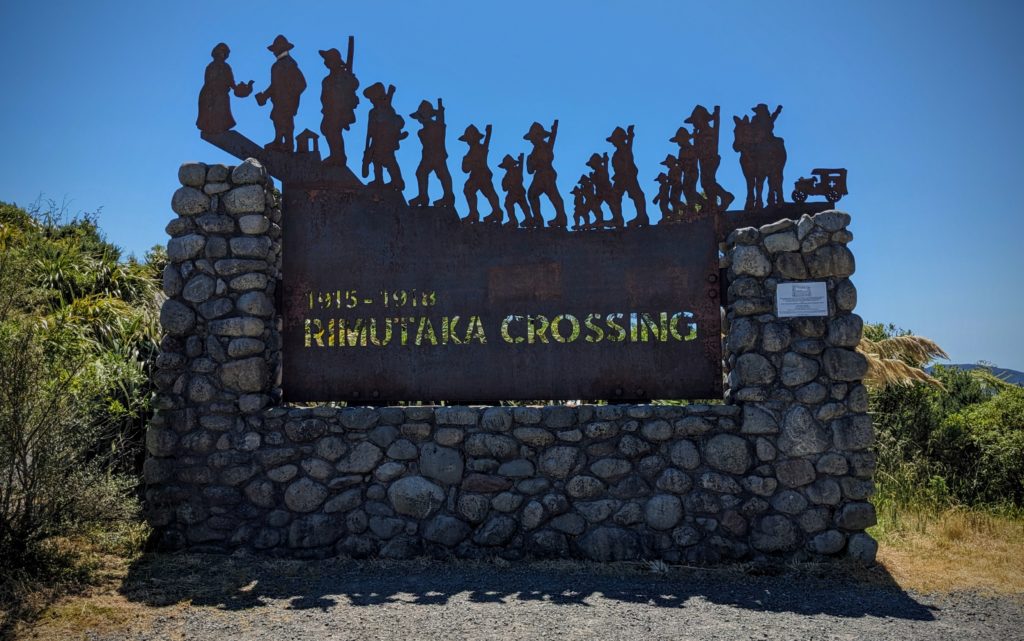
As we left the mist behind and crossed the summit of the road we stopped at the ‘Rimutaka Crossing’ view point.
This commemorative structure memorializes “the thousands of infantry soldiers who marched over the Rimutaka Hill (from 1915 to 1918) prior to their departure to the Western Front as part of the New Zealand Division in WW1.” It was a 27 mile, 3 day march for the soldiers, mostly from the Wairarapa region and further northeast, on their way to the infamous warfare trenches of Europe.
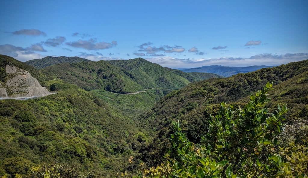
Looking back past the hills towards the mist engulfing the Wellington area.
We descended from the summit into the tiny town of Featherston and turned right onto the road to the Rail Trail. We arrived to brisk winds flowing up from Palliser Bay on Cook Strait, winds coming up the valley of Lake Wairarapa all the way from the east side of the south island! We hoisted our day packs, tightened our hats on our heads and headed up the trail. We started out through a regenerating forest, with shade and kawakawa bushes, along a stream. Then we came out into the open to the actual rail bed at Cross Creek camp. It was a small community of railroad workers at the end of the steep downhill run of the railway, before it followed the valley up to Masterton, the largest town of the Wairarapa region. Very little of the town is visible, but plaques with history and pictures tell the story. The Railway was operational from 1878 to 1955, 77 years!

Soon we headed up ‘The Long Straight’ as this 299 yard section was known, the longest section of straight track on the whole line, only 274 meters!
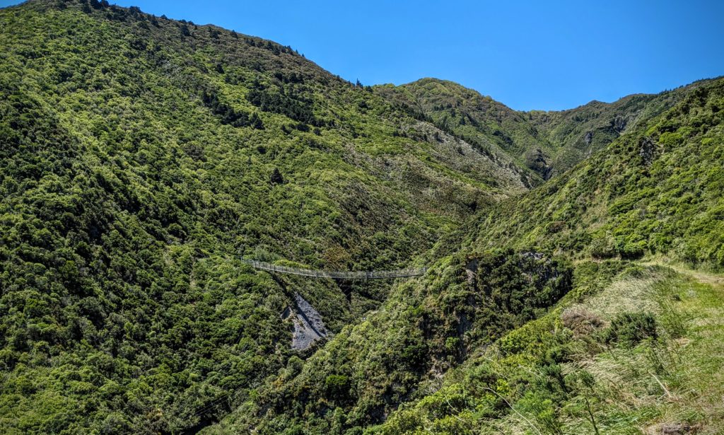
Three and a half miles into our hike we spotted our goal – The Siberia Suspension Bridge!

As we approached the bridge the wind was whipping even stronger and we read this information!

The bridge is about a football field in length and was visibly swinging in strong gusts of wind! But we braved it and headed across!
We made it across the bridge! Then went through the Siberia tunnel at the other end and turned around to retrace our steps back over the bridge and back down to Cross Creek where we ate our picnic lunch. We had one more destination on our list, another suspension bridge in Kaitoke Regional Park, on our drive back towards Wellington!
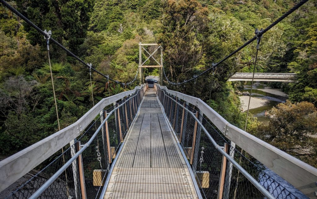
This was an easy one to get to! See our car at the end of the bridge?
We were glad for the quick and easy access to this bridge, the 7 mile hike in the sun and wind really wore us out! We got home in an hour and a half, and grilled some lamb burgers for dinner!
*Remutaka; all things Remutaka (range, forest park, rail trail, etc.) used to be spelled Rimutaka. I don’t know when the spelling change occurred but the NZ Travellers Road Atlas we bought 3 years ago has the Ri spelling!