February 23 Over Arthur’s Pass (Day 149)
After an early breakfast we packed the remainder of our gear and headed out by 8am for the long drive over Arthur’s Pass to the northwest coast of the South Island. We took some of the longest straight roads we’ve been on since we got to NZ! The Canterbury Plains are famous for that I think! The Plains are comprised of the fields left behind by the glaciers that carved the mountain valleys to flow to the sea. The Rangitata River to the south, the Rakaia River in the center and the Waimakariri River to the north all flow into the Canterbury Bight of the Pacific Ocean. The flow of these rivers provides irrigation for the most productive farmland in the country. The fields were bright green with grass, dotted with sheep and dairy cows and divided by the huge well manicured tree-hedges we’ve seen all over the country.
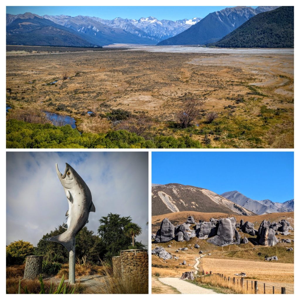 At the mouth of the wide, braided Rakaia River we stopped at the rest area before crossing the longest bridge in NZ. We admired the huge salmon statue (bottom left picture) that the town is so proud of. Chinook salmon eggs from the McCloud River in California were introduced into the NZ river in the early 1900’s for sport fishing. Past that river obstacle we proceeded over Porters Pass to Castle Hill (bottom right picture). These rock outcrops are sacred to the Maori of the area, they have been used as backdrops to Lord of the Rings and Narnia movies, and they are popular spots for climbers to freeclimb and ‘boulder’. A great story with some history is HERE. Finally we entered the Waimakariri River Valley on our way up to Arthur’s Pass (top panorama picture).
We stopped at the small Arthur’s Pass Village, a store, a restaurant, a train whistle stop and a few other buildings house the 48 or so permanent residents. There a lots of tramping tracks radiating out from the Village though, this being an accessible spot in the midst of the Southern Alps! We had lunch at the restaurant and perused the gift shop, watching diners being pestered by several Kea parrots, then proceeded down the other side of the pass through the Otira River Gorge with 16 percent grade!
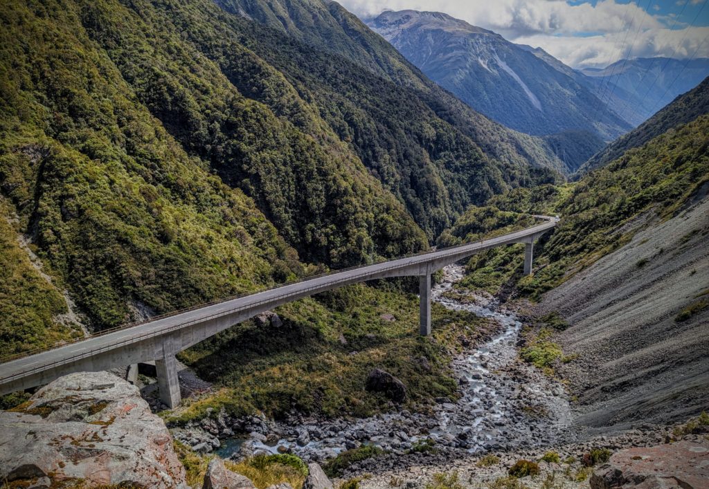
The viaduct (bridge) opened in 1999 improved what is known as Deaths Corner!

Deaths Corner was named for a rock landslide that occurred about 2000 years ago that dammed the river. The river finally cut through it creating the gorge.
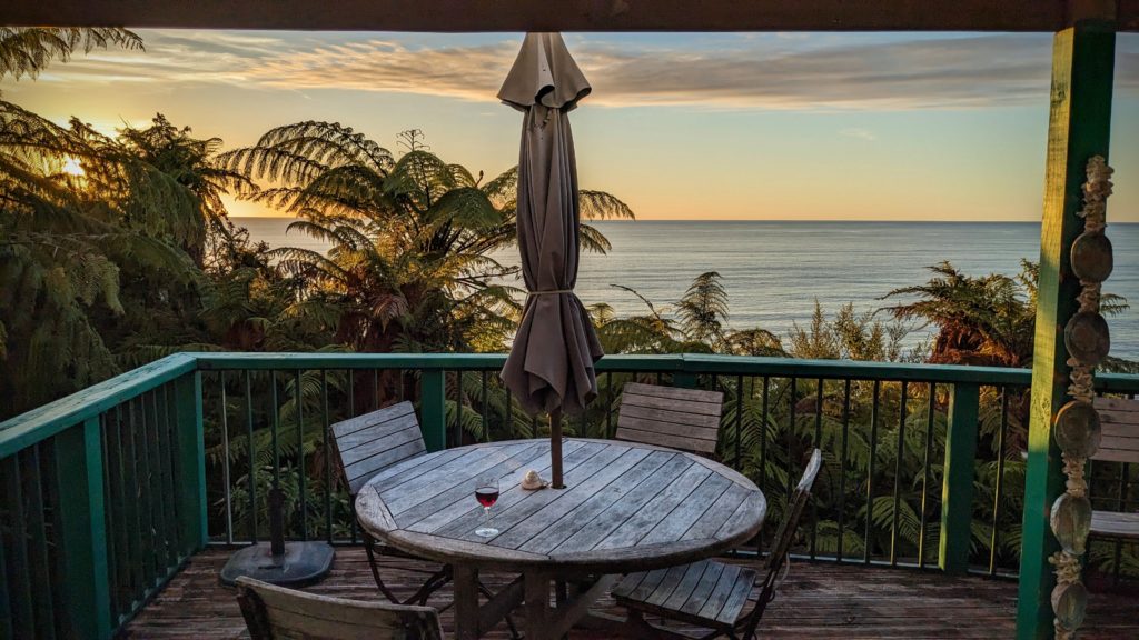
We still had an hours drive to Greymouth to do our grocery shopping, then another hour to the Airbnb. But it was worth it! A warm ocean breeze, a clear sky for a fabulous sunset. I’ll let the pictures tell the story!