
Nov 17, 2025 Mt. Taranacki to…
These satellite images show where we are on the North Island. The right image is the North Island, the red square on the upper area is Auckland, the pink outline on the lower left is the Taranaki region. The image on the left is a closeup of Taranaki, the pink dot is approximately where we’re staying. The colors are accurate. The dark circle is Te Papa-Kura-o-Taranaki, formerly known as Egmont National Park, established in 1900. It is covered with native forest surrounding the almost symmetrical cone of 8,261 ft. high Mt. Taranaki. The surrounding volcanic plains have been developed into mostly dairy farms. In January, 2025 Mt. Taranaki became the only mountain in the world granted legal personhood, affording it the same rights, powers, duties and responsibilities as a person under the law, joining the Whanganui River as the only river granted personhood. Imagine 85% of the North Island was covered in forest before Europeans arrived! Since today was forecast to be partly cloudy we decided to take a road trip. We headed up toward the mountain.
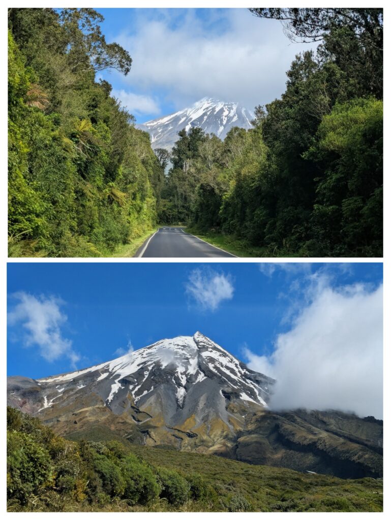
The mountain top faded in and out of the clouds as we drove up the southern flank. At one point the clouds retreated enough that we had a clear view of the peak.
From the gravel parking lot at the end of the road we walked the half mile up to the Manganui Gorge bridge, constructed just a year and a half ago.
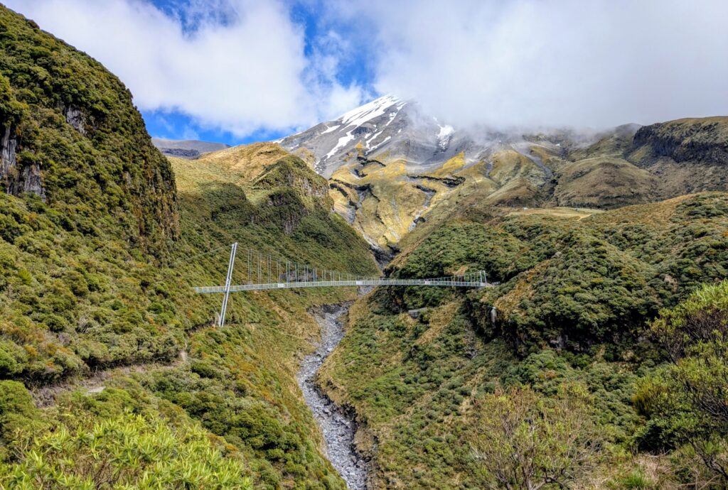
An impressive swing bridge built to make the passage over the Manganui Gorge more safe. Especially since the trail leads to the only ski area on the mountain!
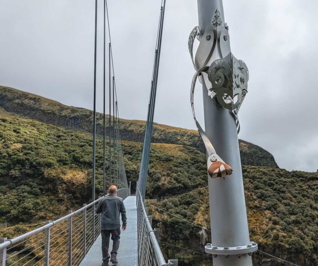
The bridge is guarded by Rakahore, the personification of rock. He is one of the protectors of Mother Earth (Papa) against the attacks of Ocean Maid (Hine-moana). He holds a touchstone that visitors can touch to connect the past with the future.
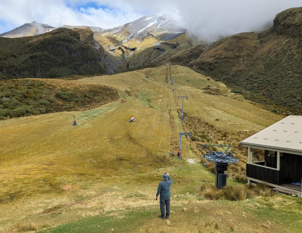
The Manganui Ski slope, 3 tow lifts after a 30 minute hike from the parking area. At least there is a ‘flying fox’, a basket strung across the gorge on cables, to transport your gear to the small ski lodge / mountain hut.