Lee’s Ferry -March 27
On a chilly, blustery day we continued our journey across Glen Canyon Dam into Page, Arizona where we re-supplied. From there we ascended Echo cliffs, then descended the other side to sunshine and warmth at Lee’s Ferry on the Colorado river. From 1870 to 1929 Lee’s Ferry was the only relatively safe place to cross the Colorado river for 600 miles! Now it’s part of Glen Canyon National Recreation Area and the launch point for raft trips on the Colorado river through the Grand Canyon.
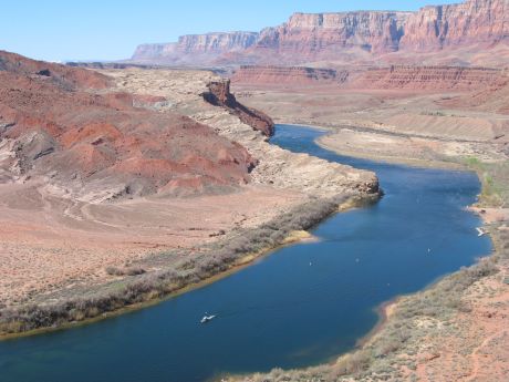
Looking down on the Colorado River from a steep trail. There were 3 different sites for the ferry, since they were flooded and washed away periodically.
 Looking left, or upstream, you can see the wagon road descending to the river at the site of 1 of the 3 ferry crossings.
Looking across the Colorado from just below the campground. The milky colored water in the foreground is the silty Paria river flowing into the clear water of the Colorado. Glen Canyon Dam completely changed the quality of the Colorado river water, filtering out the massive amount of red silt collected from the huge watershed.
Sunset on “Lee’s Backbone”. Pioneers built an amazing wagon road on the face of the cliff to get to Lee’s Ferry.


