Jan. 17 – Around Camp
Little hikes around camp reveal interesting venues and characters.
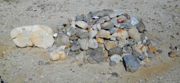
A rock sculpture of a tortoise.
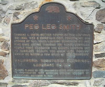
A monument to an infamous local character.
Peg Leg Smith’s storied career as a mountain man, fur trapper, prospector, horse thief and even Indian children kidnapper, could be an elaborate and convoluted lie!
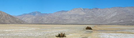
Jan. 14 – Clark Lake
We took a hike from the camper up Rockhouse Canyon Road to Clark Lake. It is a dry lake bed or playa as we know them in Oregon. We started to cross the lake bed which still had a little moisture here and there from rains in December.
Bushes grow along a straight path of disturbance on the playa surface.
We veered east on the playa towards a distant structure we couldn’t make out, even with binoculars. On the way we spotted several small artifacts that gave us a clue what the structure might be.
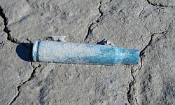
The now familiar .50 caliber bullet casing, circa 1942. We found two.
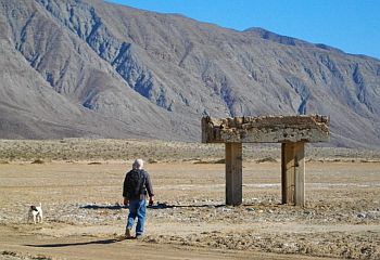
Robert & Mav approach the concrete bombing/strafing target. Another target structure was further to the north.
I found little information on the internet about the use of this area for WWII pilot & gunnery training, but the Abandoned & Little-Known Airfields site had interesting maps and info. On the San Diego Reader site Desert Maneuvers there is more info. and a description of the ‘bombing targets’.
Jan. 13 – Fonts Point
We set up camp along Rockhouse Canyon Road along with other scattered snowbird boondockers. We’re at about 600 feet above sea level and we sat out the southern California cold snap in sun and a cool breeze. Robert braved the wind chill and the loose sand and rode his motorcycle up nearby Fonts Point to get a view over the badlands down to Borrego sink.

Looking down at Borrego sink from the top of Fonts Point.

The corrugated nature of the badlands is visible on the slope of Fonts Point.
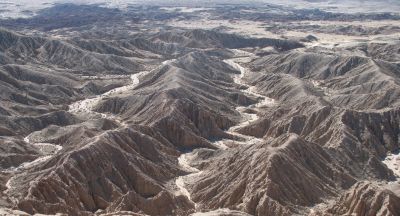
The result of the constant wind and intermittent water erosion flows down the washes from the heights.
Jan. 12 – The Borrego Valley
We spent one night in Ocotillo Wells State Vehicular Recreation Area (OWSVRA). A great campsite with showers, a Discovery Center and lots of rangers patrolling the area. We took a short walk in the morning to Blowsand Hill and watched the motorcycles and ATVs climb up the hill and zoom around. We continued our trip into Anza Borrego Desert State Park and headed to the Visitor Center at the edge of the tiny town of Borrego Springs. As we drove into Borrego Valley we passed through Galleta Meadows, a desert vista with strange creatures frozen in time and space!
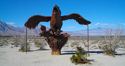
Huge metal birds appear about to take off from the desert floor.

Detail of the gaping beaks of these mythical birds.
Elsewhere in the desert prehistoric sabre-toothed cats stalk the prehistoric horses.
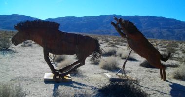
Apparently there is paleontological evidence here of these creatures, as well as mammoths.
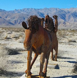
The sculptor captured the open mouthed fear the horse may have felt!
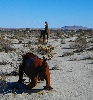
The sabre-toothed cat stalks the alert horse (who is missing an ear).
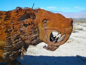
Detail of the sabre-toothed cat. They became extinct about 10,000 years ago.
Jan. 11 – Imperial Sand Dunes
We decided to take the ‘northern’ route through Glamis, the OHV recreation mecca. We stopped at a turnoff high in the dunes with a wonderful overlook. You can imagine why this area is used for many movie sets.
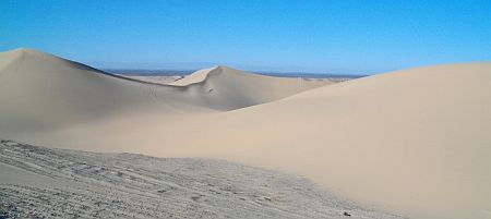
Looking west towards the Imperial valley.

Looking east towards the Cargo Muchacho mountains where we have camped in the past.

A sand rail enjoying a run through the dunes.
