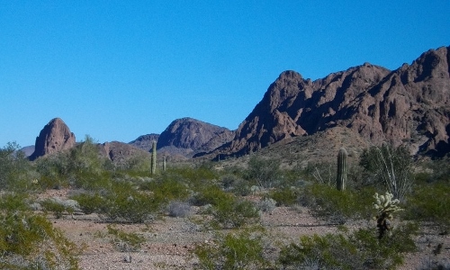
Today we decided to stick closer to camp. On the simple map you can pick up at any of the 3 entrance kiosks into the wildlife refuge, the roads and water sources are marked with little accuracy. There is a symbol for ‘Hidden Valley Tank’ within walking distance of our campsite, but looking out at the mountains, how could we find it?
It’s like looking for a needle in a haystack, a water source in the arid mountains of Arizona!
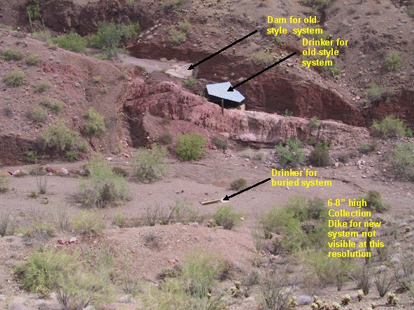
I started with an internet search for GPS coordinates for water sources in Kofa Wildlife Refuge. Maybe the Fish & Wildlife Service doesn’t want to make it that easy! I couldn’t find any information pinpointing water sources here. Next I checked Google Earth and found what looked like a corrugated metal roof in a nearby narrow canyon. The ‘old style’ of water source enhancements usually consists of a dam holding water in a natural depression with a roof over it to minimize evaporation.
From the Kofa Nat’l. Wildlife Refuge website.
This must be it! Now I had to find the latitude and longitude to pinpoint the spot so we could walk right to it with our handheld GPS. I used a website; http://www.latlong.net/ ,which I use to pinpoint our location for the map “Where are Robert and Mary Jo now?” on our website. I found the telltale roof on the map and scrolled over the spot to get the coordinates. I put those into our handheld GPS hoping they are correct because sometimes the coordinates I get for our website puts us many miles away, sometimes into Mexico! Off we headed to the northeast, walking cross country.
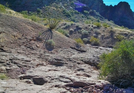
We reached a wash we believed to be the outflow of Hidden Valley and followed it up.
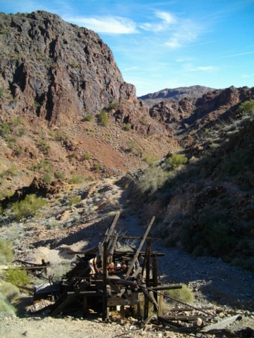
There it is! The valley is more narrow and steeper than we imagined!
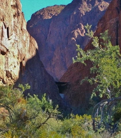
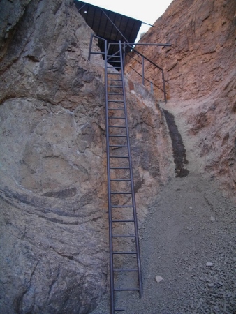
We found a path through the wash to the base of the tank.
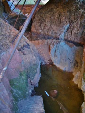
A climb up the ladder afforded us a view of the tank itself, rather empty now.
Mission accomplished. We were wondering how they got all the equipment, metal, cement, etc. to the site and when they did the enhancements?
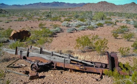
As we hiked out we found the chassis of an old truck, maybe it had been used for the tank construction.
Hiking further out we found evidence of an old road leading to Hidden Valley. It wasn’t going our way so we hiked cross country back to our campsite.
Posted on January 21st, 2014 at 8:44 am | 2 Comments »
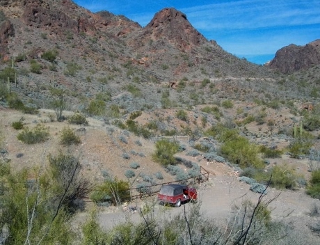
We finally made it to the parking area for the Big Eye Mine. We had some hiking to do now!
The road was closed, but you might see the faint line of it in the upper right.
As we hiked up the road some old buildings came into view.
It’s the Big Eye Mine Cabin.
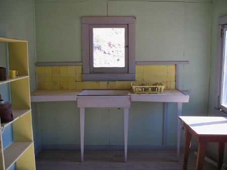
The cabin has been restored somewhat and is available to stay in if you would like.
The interior is clean and has a few amenities, a guest book to sign, 2 bed frames, two red chairs and assorted artifacts.
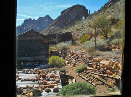
Looking out the back door window you can see what we figured was the bath house, a clothes line, wash basin and various household tools.
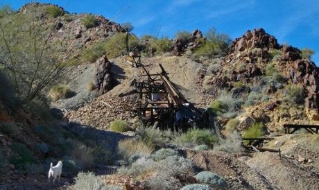
We had to continue hiking up to the actual site of the mine. It was a lot smaller than we anticipated, but then it only operated for a few years in the early 1900’s.
This we assume is where the ore was loaded onto trucks at the bottom of the scaffolding, to be hauled to a railroad and shipped to a smelter.
We climbed above this point to the mine tunnel. All caves and tunnels are closed to protect wildlife.
We peeked inside, but didn’t venture in!
We had to conclude our exploration to head back to the Jeepster for the 15 miles of dirt road, 10 miles of gravel road and 22 miles of pavement back to our campsite!
Posted on January 19th, 2014 at 6:01 pm | No Comments »
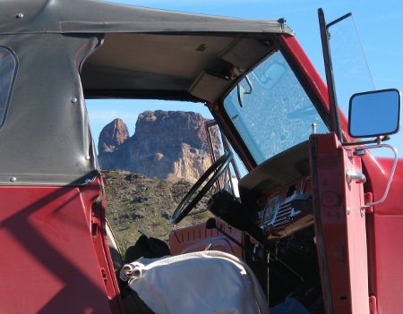
This morning we got an early start, we had a long trip planned! We turned the Jeepster south on the pavement and east onto the gravel Castle Dome Road. We were headed to the Big Eye Mine on a 15 mile one-way dirt road meandering around mountains, saguaro forests, in and out of washes and finally into a canyon where the mine is located.
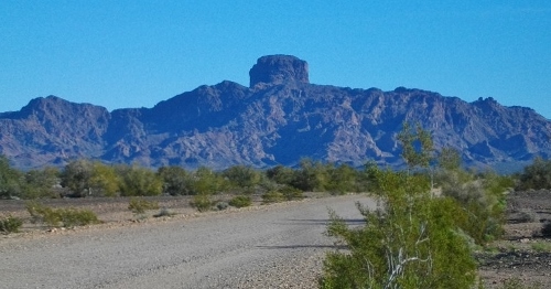
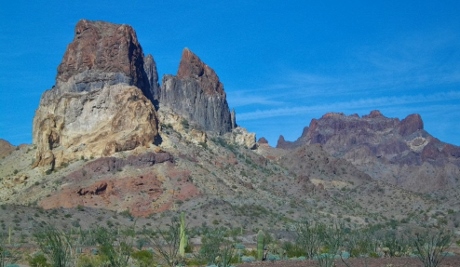
Castle Dome Peak dominates the skyline as you drive up the road.
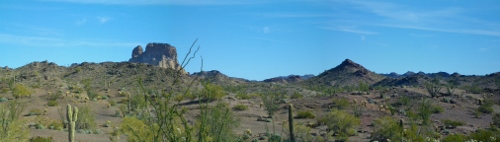
When we turned onto the Big Eye Mine Road, Thumb Butte eventually dominates the horizon.
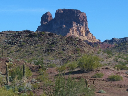
The road continues up to Thumb Butte.
We took a break to stretch our legs.
We continued all the way around Thumb Butte, no discernible ‘thumb’ from this angle!
Posted on January 18th, 2014 at 5:37 pm | 2 Comments »
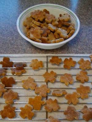
We took a day off from exploring and concentrated on domestic chores. I did some baking, including biscotti and a new recipe; doggie biscuits for Mavrik!
It was a package mix a friend gave me that included a tiny little shamrock shaped cookie cutter. I made LOTS of cookies, good thing Mavrik likes them!
Posted on January 18th, 2014 at 5:32 pm | 1 Comment »
Today is the full moon! Before we saw the sun rise we had a beautiful view of the moon setting!
The moon setting in the west, behind the mountains flanking the Colorado River on the Yuma Proving Grounds.
After a good breakfast we headed north to the Palm Canyon Road and took a spur off of that into the Kofa Queen Canyon. Basically we were following a wash into this fantastic canyon . We bounced slowly along the road until we reached the end, the “Road Closed to Motor Vehicles to Protect Wilderness Values” sign. We continued on foot up a deeply rutted wash, apparently the road had continued on in the far distant past. We reached a hillside where the faint jeep tracks ran up, we followed them and looked down at the end of another road, the “Road Closed…” sign with its back to us!
The view from the top of the hill.
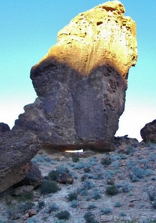
On our way out of the canyon we stopped at the ‘arch’ along the wash.
The ‘arch’ looks pretty small, but the boulder is huge! We had to hike up to it, and had great views through the gap.
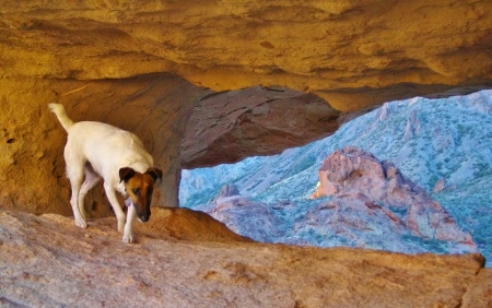
Mavrik in the arch.
Posted on January 17th, 2014 at 4:56 pm | No Comments »