November 12, 2023 Road Trip Part 2
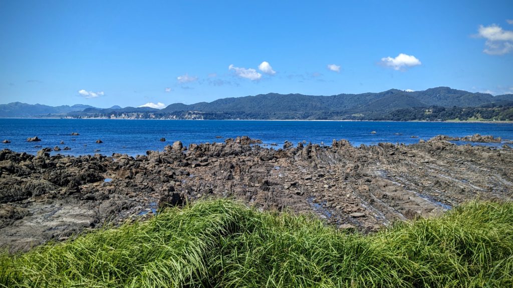
- After lunch at the little park in Waihau Bay we continued along the coast then inland a little bit until we saw a sign for Lottin Point. Well, a point must mean a view, so of course we turned off onto the single lane road past bucolic pastures with sheep and cattle, down around curves onto a gravel road.

What a view! Is that Lottin Point? We never found out!
At a fork in the road there is a sign “toilets” to the right, motel to the left. We started towards the toilets but decided the gravel road was a little too much for the rental car and turned back towards the motel.
-

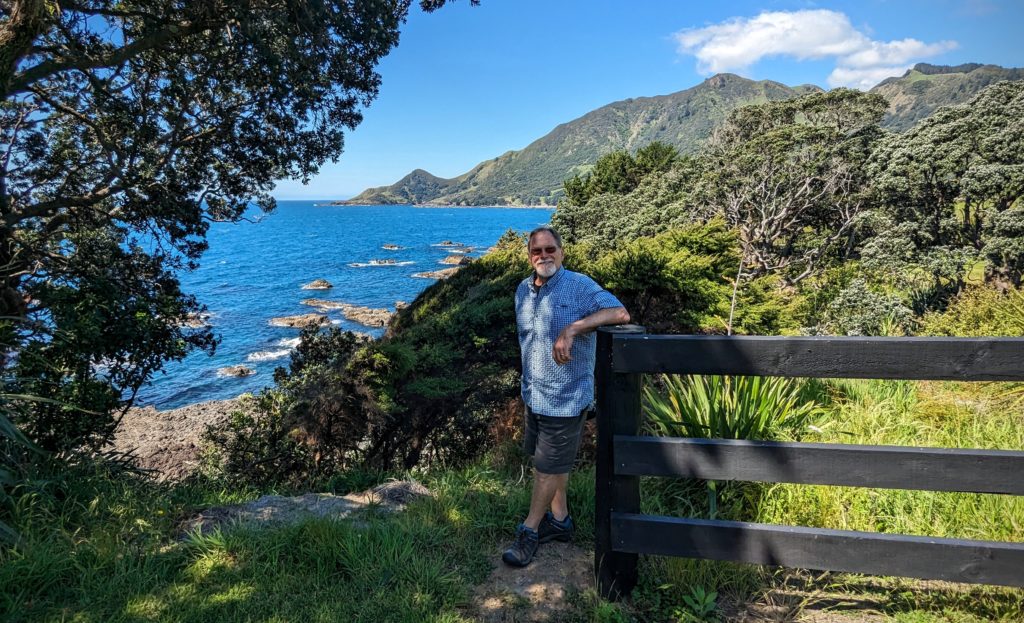
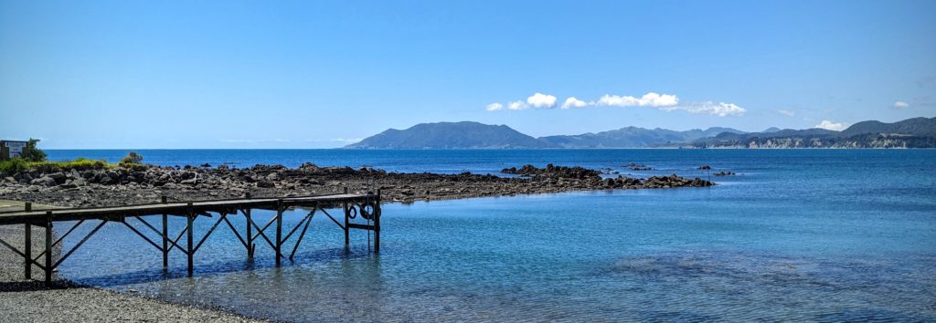
From the top of the hill before descending down the driveway.
The motel seemed so out of the way we needed to learn more about it. We drove into the driveway, parked and walked to the reception door which was locked. Just then a man who was painting a part of the building called out ‘Can I help you?’. It turned out to be the owner of the Lottin Point Motel and we had a great conversation with him, culminating in him offering to take us to the beach down the sketchy gravel road in his truck. When we returned up the hill he offered us beers, of course we couldn’t refuse, and we spent more time talking at a table on the patio, looking out at the fabulous view. He eventually admitted that painting was done for the day! He introduced us to the Japanese philosophy of Ikigai-‘a reason for being’, a concept referring to something that gives a person a sense of purpose, a reason for living. A wonderful hour we spent at the motel with the proprietor!
The view from the lawn, by the picnic table.

The little things in life that give us pleasure!
- We reluctantly left the sunny patio and continued to Te Araroa to find the largest Pohutukawa tree in the world! We were not disappointed!

In a field on the grounds of a school near a beach is this impressive tree!
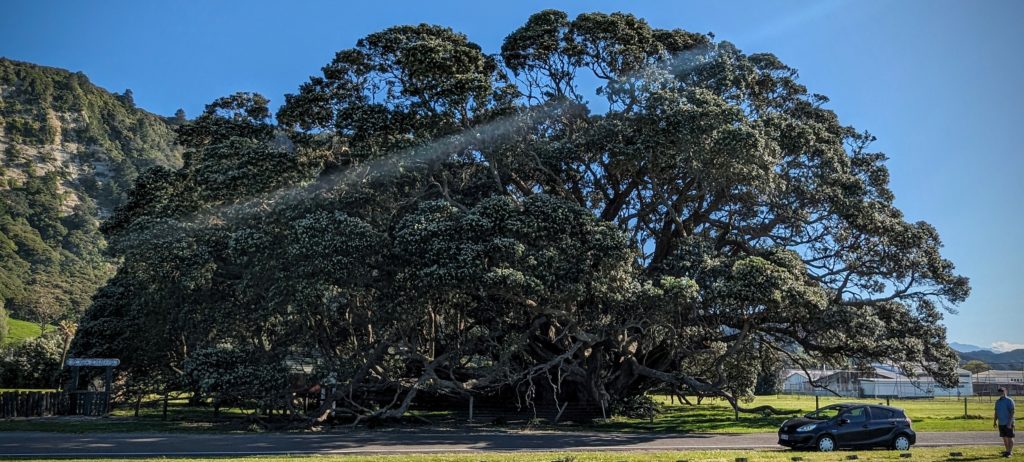
You have to back way up to get it all in! Imagine when all the white buds open into crimson flowers for Christmas!
We still had over an hours drive to our night’s destination so we hurried along towards Tokomaru Bay. We arrived with a few hours of daylight still to go. Our accommodation was the old Post Office building, built in 1906.
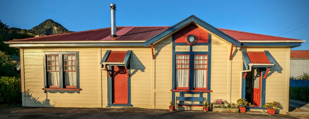
It has been restored and serves as a Bed and Breakfast. A wonderful, quiet, comfortable place.
We took a short walk to the beach past interesting older buildings that should be restored!
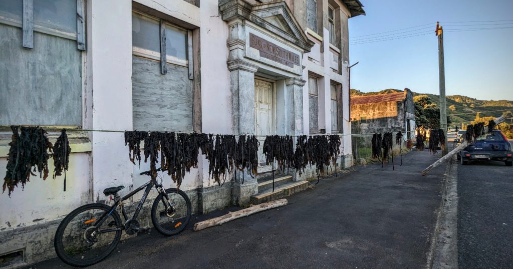
The old New South Wales Bank building. Someone is drying seaweed in front of the building!
The beach is beautiful, but like many beaches in the region it has been badly impacted by the cyclone Gabrielle that hit the region in February 2023, 9 months ago! In fact Tokomaru Bay was cut off from the rest of the country for 6 weeks because the storm caused so much forestry slash to sweep down from the mountains from the rain that it destroyed a bridge linking the area to Gisborne, the largest city.
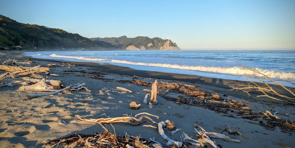
The beach was calm in the evening light, but it was littered with driftwood.
We returned to the B&B and had a wonderful grilled lamb burger dinner and retired for the night after sitting out on the bench in front looking at the stars which were bright and numerous!

Good night!
November 12, 2023 Road Trip Part 1 (Day 46)
We started out early (for us) at 7:30ish for a long day of driving along part of the East Cape of the North Island. Our first stop was in Whakatane (pronounced fah-kah-tah-neh) for some bacon and egg pies and coffees. As we drove out of town we noticed a lot of walkers and runners on the road with numbers on their shirts. We took a side road up to a viewpoint (we try to stop at every one we see!) and asked a volunteer what was the function. It is an annual fundraising challenging walk/run called Toi’s Challenge, an 18km (11 mile) route that takes the runners up over the viewpoint and back into town. We were happy to drive up!
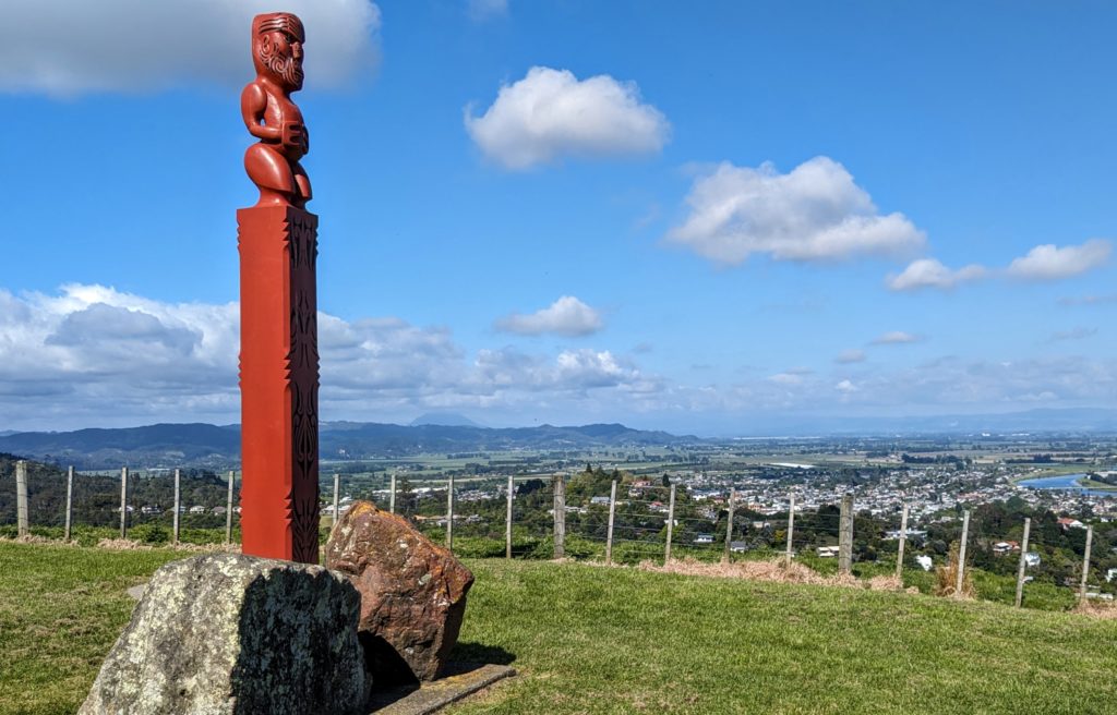
I think the statue is of Toi, an early chief of the Maori in the Whakatane area about 800 years ago. It is positioned on the site of a prominent Pa (fortified village) overlooking modern Whakatane.
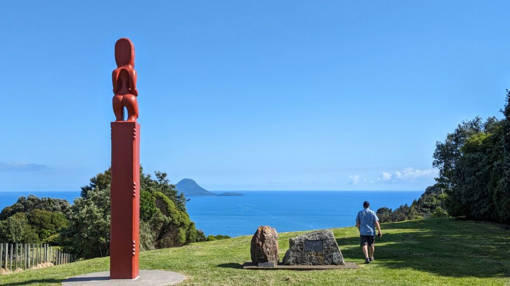
The statue looks out to sea, somewhere out there is White Island where 21 people died (some after being in hospital) after an eruption in December 2019.
We continued along the coast past Opotiki where Highway 2 cuts across the cape to Gisborne. After that there are virtually no roads into the interior! About a 40 minute drive further we crossed the Motu river. It looks almost like the braided rivers that flow out of glaciated valleys, but there are no glaciers here! I think that storms just scour out the steep valleys in torrents once in awhile!

The mountains start to get more rugged and steep, with less obvious human impact!
Somewhere up in the interior mountains is Mount Hikurangi, a sacred place to the local Maori. It is the highest non-volcanic mountain on the north island and purportedly “the first land in the world to catch the rays of the new day’s sun”, open to interpretation!…According to Wikipedia. Further past the Motu river we came to a wide open stretch of beach and a lonely old building.
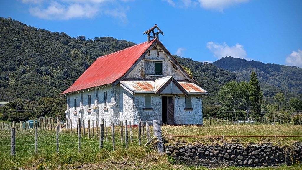
I thought church at first, but maybe a schoolhouse?
Just down the road is a much newer complex of buildings, the Otuwhare Marae at Omaio. A marae (pronounced mar-i) is explained here.
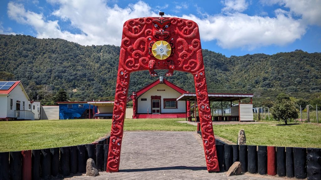
This Marae is prominent in that it’s right along the road and has this intricately carved gateway.
Both the old schoolhouse and newer Marae face out to the expansive sea on Omaio Bay.
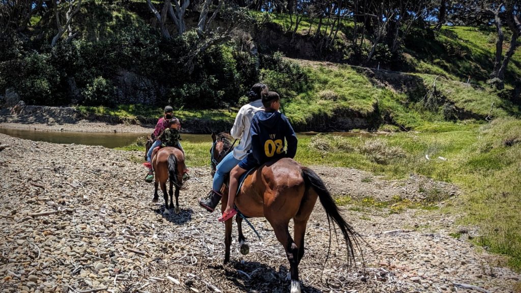
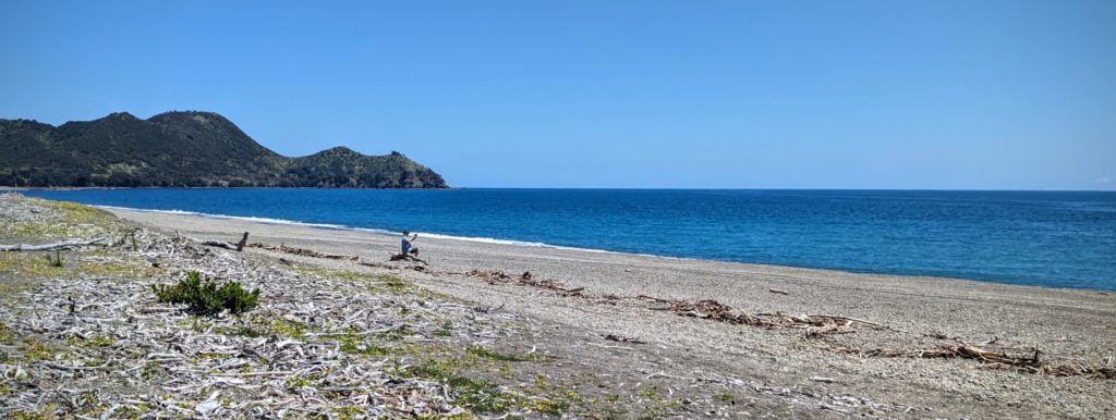
We stopped at a shady spot to have some lunch and saw these locals enjoying a Sunday ride along the ocean. It was too windy for lunch so we moved on.

We reached Waihau Bay just in time for our next coffees!
The landscape was a little different here with interesting vertical rock formations going out into the bay. Volcanic maybe?
We enjoyed our lunch at a small park next to the Waihau Bay Lodge watching 2 snorkelers in the bay and a fishing boat driving up onto a trailer and being hauled ashore by a tractor!
November 11, 2023 Random (Day 45)
This is a planning and preparation day for a 3 day road trip starting tomorrw. We’re going to venture to a remote area of the north island, the east cape. It boasts the most easterly point of New Zealand, the East Cape Lighthouse. Unfortunately we can’t get there, the road crosses private land and they have closed it indefinitely, probably due to the terrific storm Gabrielle that hit the area Feb. 13-14, 2023. But there will be plenty to see on this 800km loop trip!
We started this morning with a loop walk to town and up the Gully back to the B&B.

The spikey plants in the front are what they call Harakeke flax here. It’s actually a type of lily and was the go-to plant for all things Maori! They identified many types and cultivated it for the fiber, for basket weaving, rope making and even for weaving cloth!
Some random colorful pictures of things we’ve seen;

Wild iris from South Africa just started blooming in the garden!

A beautiful mural on the Waterfront in Tauranga.

A colorful bathroom at a fishing spot on Lake Rotoiti.
Another bathroom at Okere Falls. The public bathrooms are usually clean and well stocked!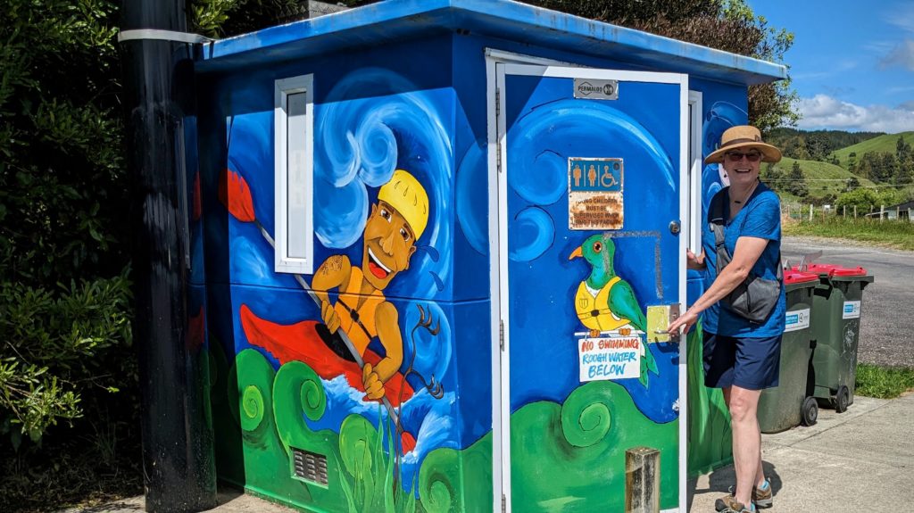
November 10, 2023 The Gully to Pukahina (Day 44)
We started our day with a local walk from our B&B down the hill into Maketu then up the hill through Kotukutuku Gully and back to the B&B, about 2 and a half miles total. A nice easy walk with shade in the gully! Informative markers and faded plaques gave information and identification of native species.
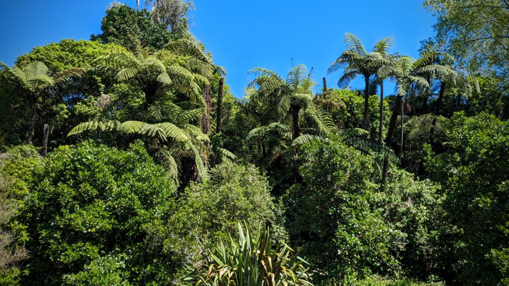
The gully was an easier walk than the roadway. It is being restored with native vegetation, there are even 2 young kauri trees growing. A creek runs along the bottom and tree ferns grow up the sides.
Later in the afternoon we went for a drive to Pukahina beach, east down the coast from Maketu. As the crow flies it’s about 2.5 km and an estuary inlet away from our B&B, but we had to drive 25km round about and through a construction zone to get there!
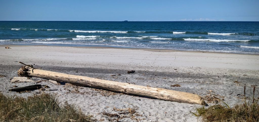
It was a deserted beach for the most part. The road to the beach had lots of holiday (summer) homes lining it, with park and beach access interspersed along the route.

These pastel cabins were on the sand dune above the beach and look quintessentially beachy!
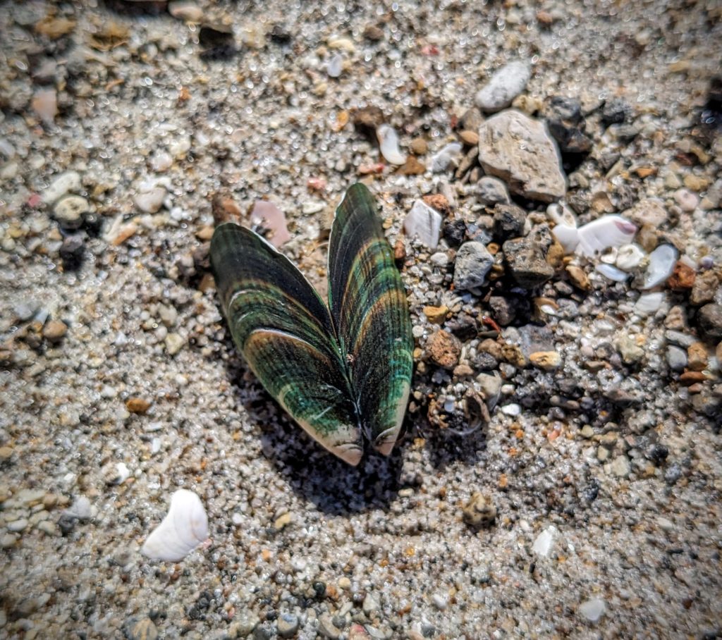
The beach has sections covered with shells, some worn to interesting patterns, and some very colorful!

We found some beach glass too besides shells!
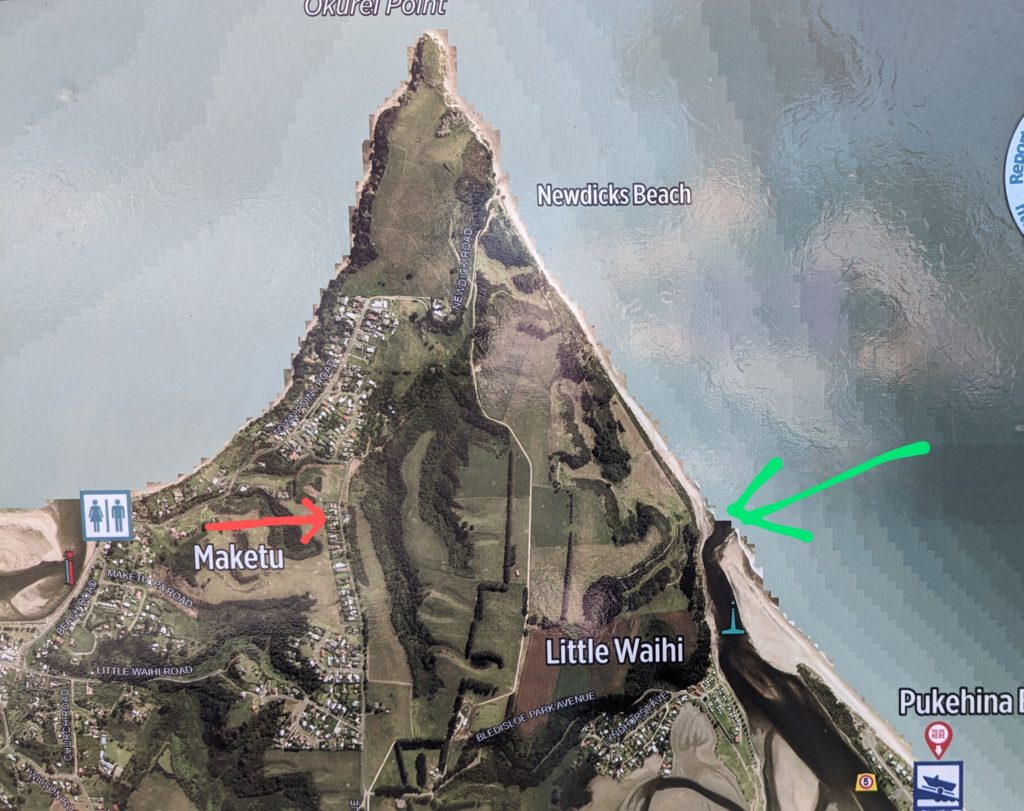
The red arrow points to our B&B, the green arrow is the estuary inlet, the top end of Pukahina beach. It looks like we could walk there! But it’s private property and has steep gullies and lots of cows!
November 9, 2023 Who Let the Cows Out? (Day 43)
Who Let the Cows Out?… Moo…Moo,Moo..Moo,Moo! Hahaha, that’s funny! We came back from our adventure today to see lots of cows in the field behind us! We were wondering yesterday who mows the field, now we know! There is a dairy across the road and they own the paddock behind us. They move the cows from paddock to paddock to rotate the grazing so as to not overgraze any area.
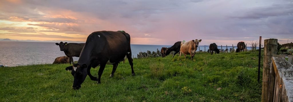
It looked like Switzerland at the seaside! No cow bells tho, too bad, it would really add to the ambiance!
As to our adventure…we headed back to Tauranga for an appointment. When we were there 2 days ago, on Tues, Nov. 7, we passed by a shop and stopped in to enquire about what I have wanted for quite awhile. I wanted a wedding ring tattoo on my ring finger. I don’t like to wear a ring because it’s uncomfortable to me, so I thought a tattoo would substitute. The tattoo artists actually convinced me it’s not the best place to do a tattoo, too much wear and tear causes fading and blurring. We said thanks, took a card and went on our way. We thought about it and Robert googled some designs and found one we both liked and we made another enquiry to them and ended up making an appointment!
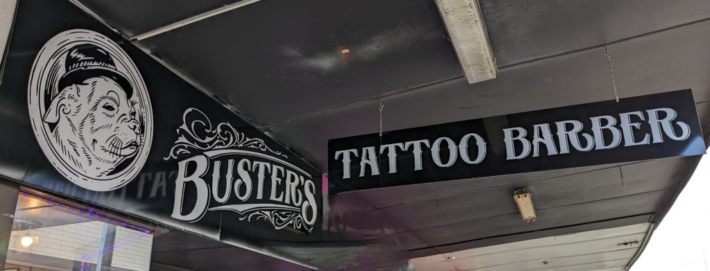
When we saw the sign, we knew we had to go in, even if just out of curiosity!

We met Buster himself! Everyone was so relaxed and straightforward, actually dissuading me from a finger tattoo!
We got there in the morning and Robert elected to go first!
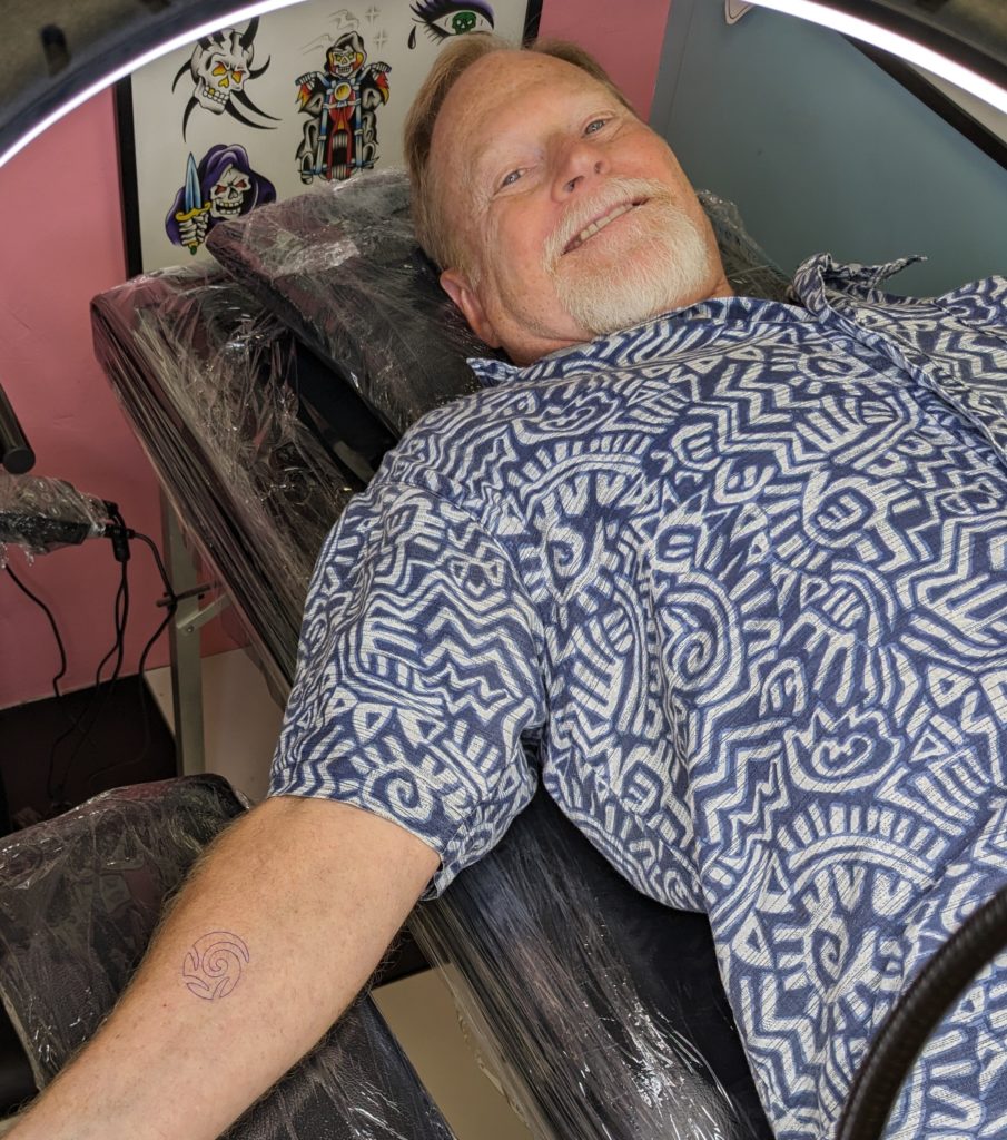
Ready for the art!

We are so happy with our choice!
The koru “is a spiral shape based on the appearance of a new unfurling silver fern frond.[2] It is an integral symbol in Māori art, carving and tattooing, where it symbolises new life, growth, strength and peace.[3] Its shape “conveys the idea of perpetual movement,” while the inner coil “suggests returning to the point of origin”… from Wikipedia.

We concluded our evening with grilled lamb burgers spiced with kawakawa herbs and another beautiful sunset!