December 10, 2023 Bits and Pieces (Day 74)
A day of rest since it was forecast that it would be a rainy, windy day, and it was! So here’s some bits and pieces of our last few days.

Artwork even on manhole covers in Miramar!

The Kaka parrot painted on the Karori water tower.

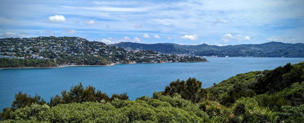
A view from the hills overlooking the suburb of Karori. Cook Strait is in the distance on the right and a bit of Wellington Harbour can be seen in the upper left.

In the Wellington Museum Attic, between two mundane exhibits.

The explanation of the sculpture. Archibald Baxter was one of several conscientious objectors during WW1, who was jailed, beaten, starved, sent to the front, and bound to a post in freezing conditions for 4 hours a day for his beliefs that war is ultimately futile.
The last paragraph if you can’t read it is;
“War will always draw both support and opposition. Supporters emphasize the bravery and sacrifice of those who fight, but it also takes courage and sacrifice to oppose war. In a time of WW1 remembrance, the Baxter sculpture highlights a lesser-known history.”
Quite a juxtaposition between this small sculpture in one museum, and the huge Gallipoli exhibit in the other museum. Makes one think.
More about Archibald Baxter HERE.
December 9, 2023 Museum Day (Day 73)
It was windy today, VERY windy, but that’s common in Wellington we’ve heard. No hiking on ridges for us today, instead we rode the bus into Wellington city centre to visit some of the free museums available. Almost immediately after we got off the bus we passed an historic building that wasn’t even on our list, the Old Government Buildings. Signage beckoned us through the open doors and a gentleman met us and gave us a quick explanation of the building and a leaflet guide and we set off to see the building.
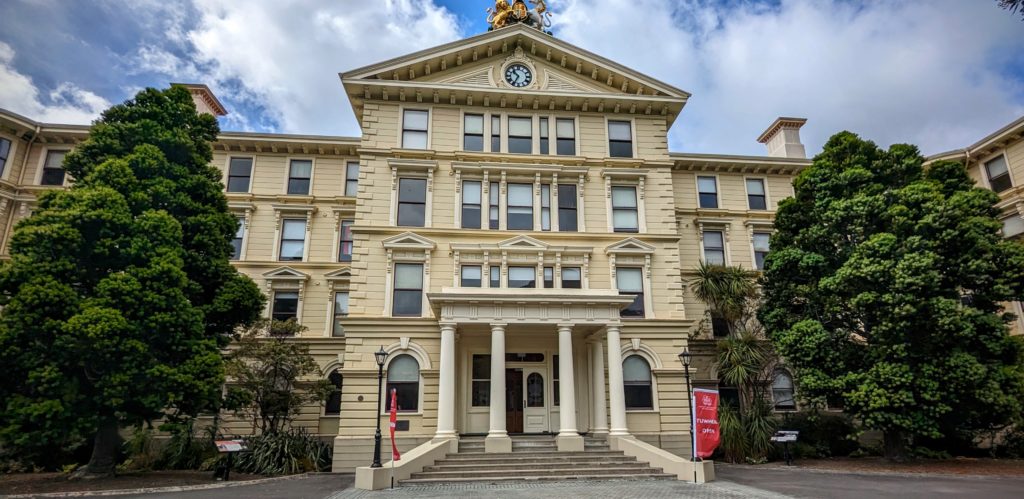
The facade of the Old Government Buildings. It looks like stone but is built entirely of wood!

The foyer is aglow with the rich unblemished by knots, honey tones of kauri wood. Dressed for the Christmas season.
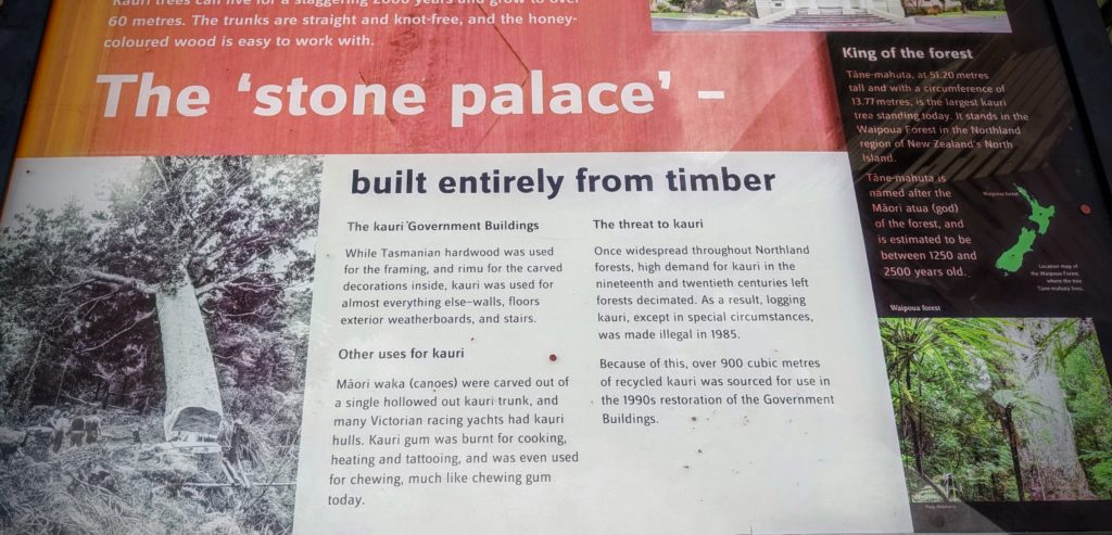
This sign outside describes more of the uniqueness of this building.
We moved on up the road to our original destination, another wood building from the 1860’s. This one a church built of wood due to the 1855 earthquake that shook Wellington so bad that stone buildings were deemed unsafe! Old St. Paul’s (because a new cathedral was built in the 1960’s that the church moved to) was empty from 1964 to 1967 when the government finally bought it and it was restored by the NZ Historic Places Trust. A beautiful building using native timbers.

Kauri wood was used for the roof (not the beams), the walls and the pews.
Heading south towards the waterfront we passed the ‘Beehive’ and the Parliament Buildings. They allow tours but you need to book in advance.

The old and the new. The Beehive houses the Executive Wing of the NZ Parliament. It’s construction began in 1969 and was completed in 1981. The Parliament building was built around 1922.
We next headed to an art museum. The NZ Portrait Gallery, in one of the ‘sheds’ of the waterfront, repurposed when the waterfront was reclaimed from an industrial wasteland and turned into a hub of cultural, social and artistic activity. We moved on to the Wellington Museum, housed in another old building on the waterfront, the Bond Store that in it’s day held incoming cargo until the duties were duly paid on the goods! This museum was much more eclectic and interactive!
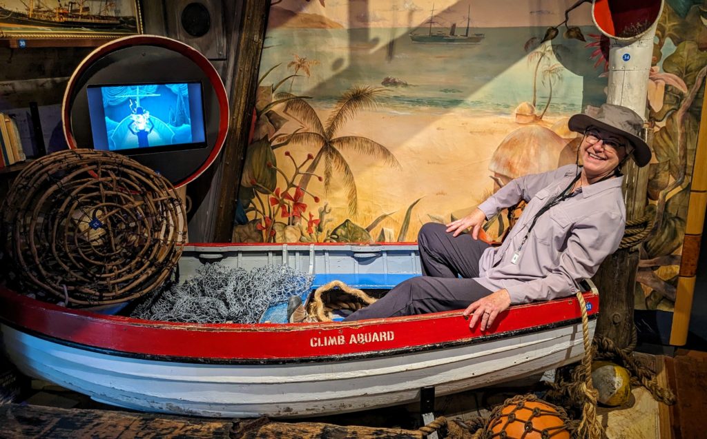
Having fun in the Maritime heritage exhibit!

And more fun in ‘the Attic’!
After another art museum, the City Gallery, we ended up back at Te Papa, nickname for ‘The Museum of New Zealand Te Papa Tongarewa’ to see some of the exhibits we missed last visit. We finished up going through “The Scale of Our War” an exhibit about New Zealanders in the battle of Gallipoli in WW1. It was sobering and totally mesmerizing. Especially the visuals on the damage various munitions; bullets, shrapnel, shells and grenades, can inflict on a body. We were so engrossed that we ended up being ushered out at closing time again!
December 8, 2023 Skyline Walkway (Day 72)
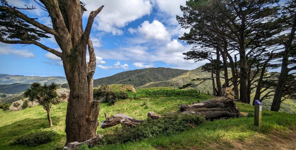
We woke to the prospect of another beautiful day, a day for hiking we thought! We finished our breakfast and drove out to the the Skyline Walkway trailhead, a scant 8.5 km (about 5 miles) from the B&B. We started through the forest and soon broke out into full sunshine. There are some ups and downs on the trail, but a lot of it is on the ridge tops above the suburbs of Wellington. At one point the trail approaches the edge of a Karori subdivision near the Montgomery Ave. playground and the local water tower. We were awestruck as we turned the corner of a switchback to this view:
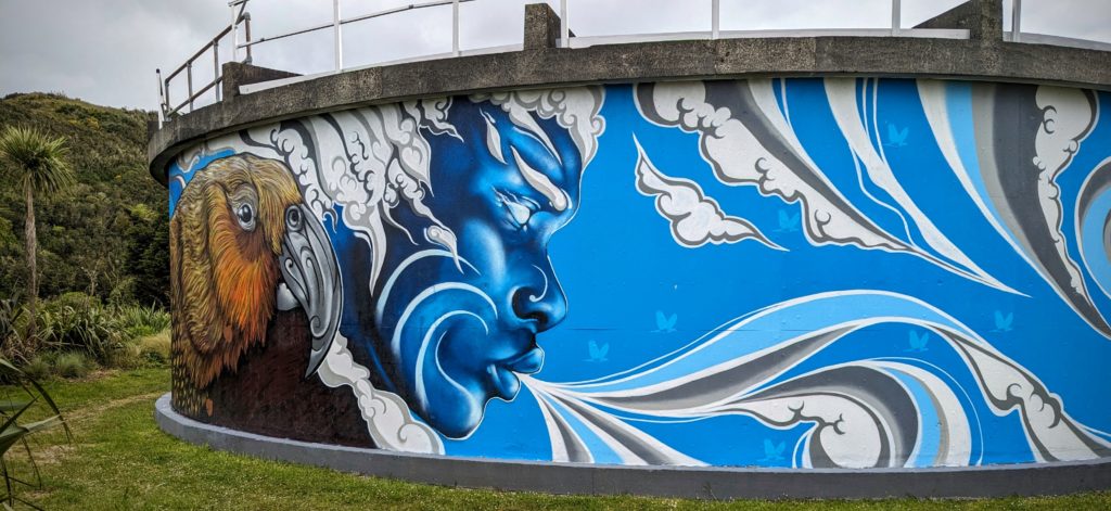
The water tower is beautifully decorated!
We walked around the structure to admire the artwork.
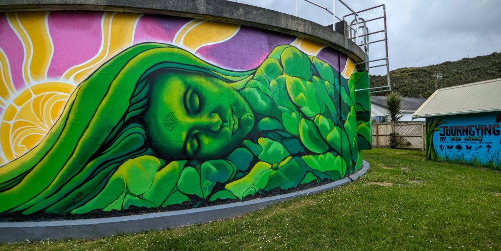
The breath from the blue figure blew onto the sleeping green beauty.
I realized that this depicts the primal couple, Ranginui (Rangi-Sky Father) and Papatuanuku (Papa-Earth Mother) of Maori creation mythology! And there was no graffiti marring it!

Other paintings depict the Pohutukawa tree and the Kawakawa bush.
We continued on the trail in the full sunshine, enjoying the long views over the suburbs and glimpses of Wellington harbour far below us. As we hiked we noticed that rabbits started appearing everywhere! Most were the typical brown cottontail bunny color and size, then we noticed some huge brown rabbits and and even a few black and a small blond rabbit! There were signs posted warning of poison for rats and possums (introduced in 1837 to establish a fur trade, then again in 1857. They are now a serious invasive pest threatening the natural environment!) but we guess that they have given up on controlling the rabbit populations, here anyway!

How many rabbits are in this picture? Over a dozen! Some are hidden under the bushes, but you can see a few pairs of rabbit ears in the open!
After 3 miles we found shade in a grove of Monterey pines (an imported specie to reforest the hills with marketable timber in plantations) and laid out our picnic lunch.
There were tons of rabbits here as well, but they disappeared into their rabbit holes when we arrived.
After lunch we discovered this old fireplace and wondered at the structure it must have been a part of.

Looking out over the hills towards the ocean, past the windmills, the view that the house must have had!
A six mile hike was pretty good for us, and we headed home for a relaxing evening.
December 7, 2023 Petone (Day 71)
As just about every name here, it’s pronounced differently than I thought! Petone, pronounced pe-tone-eh. It’s a town at the northern shore of Wellington Harbour, where the Hutt river flows into the harbour. Now it is considered a suburb of the town of Lower Hutt, not to be confused with Upper Hutt, which is upstream on the Hutt river. We went there on a mission, to purchase a flag, particularly the United Tribes flag of New Zealand. The first flag, chosen by a slim majority of 25 Maori chieftains in 1834, to represent the ‘new’ nation of New Zealand. It was necessary to enable the Maori to legally trade with Australia under British law.

The first recognized flag of the nation of New Zealand.
Anyway, we found our way to the flag shop and after our purchase we had a great conversation with the woman who helped us. She gave us recommendations for short walks in the Petone area and we set out to explore. A short bus ride took us to the edge of Petone where the river valley ascended into the hills. We found the Percy Scenic Reserve as she described it and found picnic tables to have lunch. The Reserve is the culmination of the lifetime works of the 3 Percy brothers whose grandfather purchased the land from a Maori chieftain around 1840 and set up a flour mill on the creek flowing from the hills. When the mill ceased operation the 3 brothers, unmarried with no families, continued living on the land and created gardens of native and exotic vegetation. Eventually the last brother opened the gardens to the public and in 1939 it was passed to the local government, who administer the reserve now. After our lunch we set out to explore the trails.
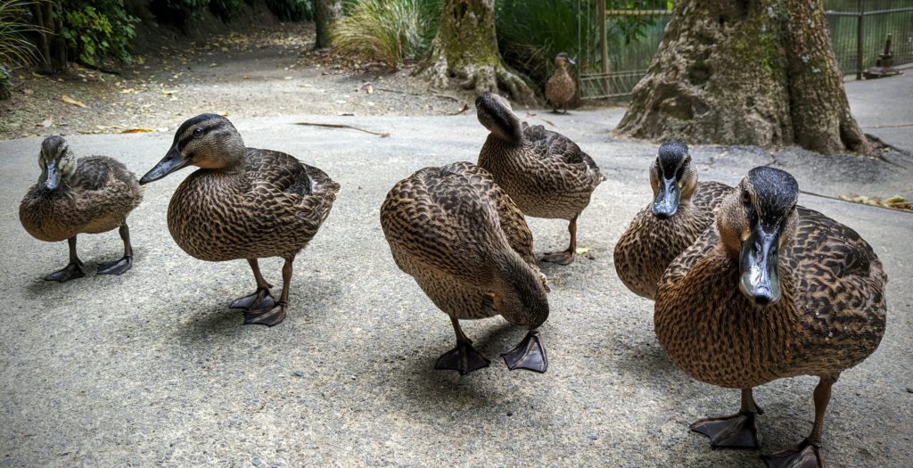
As we passed the pond, created to run the waterwheel to turn the millstone for the flour mill, this family of ducks followed us!
The ducks abandoned us as we offered no treats and we headed further on the trail towards the waterfall.

We followed the gurgling creek uphill.

The waterfall was more impressive than we expected from the tiny creek we followed!
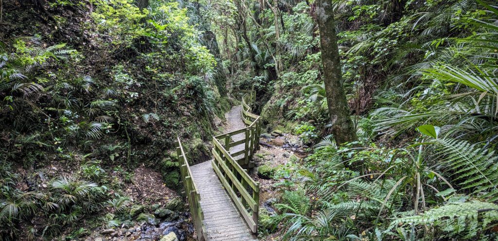
The trail was well laid out, with wooden walkways along the narrow creek bed.
We headed up a connecting trail to a higher point, but didn’t get any great long distant views so we returned down the same beautiful trail. We finally found the replica waterwheel from the Percy mill. Our return to catch the bus involved traveling on a walkway next to a highway for a short distance, but we emerged at the train/bus hub and discovered we could take a train back into Wellington town centre.

Our first public transport train in NZ, and it was air-conditioned! A relief on a hot day after hiking!
The train terminus is at Wellington Central Station. It was completed and opened in 1937 so it incorporates the architecture of the era, grand “neo-Georgian” style.
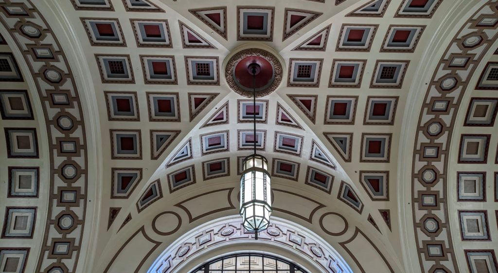
The roof in the grand foyer.

The grand entrance, where we exited, to catch the #2 bus back to the car park!
December 6, 2023 The Backside of Wellington (Day 70)
The title could also be “159 Steps” or “What Happens When You Catch the Wrong Bus”! We were heading to Seatoun, just to see the town, a suburb of Wellington on the east side of the Miramar peninsula that sticks out into Wellington Harbour. We ended up in Miramar, in the center of the peninsula. We decided to head to a green area on the map, hoping for some views over the water. We ended up climbing 159 steps to a walkway overlooking Evans Bay where we could see the backside of Wellington!
Looking out over Evans Bay towards the suburb of Oriental Bay. Wellington town centre is over the hill.
Abandoning our quest to see Seatoun we walked down from the heights on residential roads to catch a bus to Moa Point at the south end of the peninsula, hoping for a view out over Cook Strait and a quiet place on the water to have our picnic lunch. The bus stopped above Moa Point and we had a trail to follow down the hill. As we emerged from the overgrown woods we discovered we were overlooking the end of the Wellington Airport runway and the Wellington Wastewater Treatment plant!

The airport takes up the isthmus that connects Miramar peninsula to the mainland. Evans Bay is on the right (circled in red) and Lyall Bay is on the left (circled in green).
We continued down to sea level and walked on the road around to Moa Point and were not disappointed! We had a great view over Lyall Bay out to Cook Strait, with the mountains of the south island in the distance, one even snowcapped!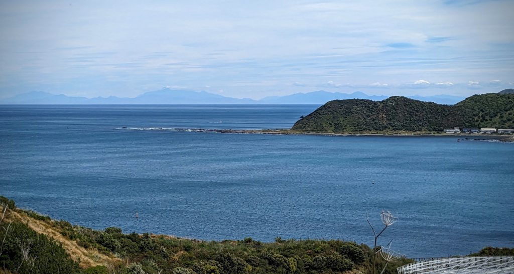 There is a little park at the point, but rather unkempt and weedy.
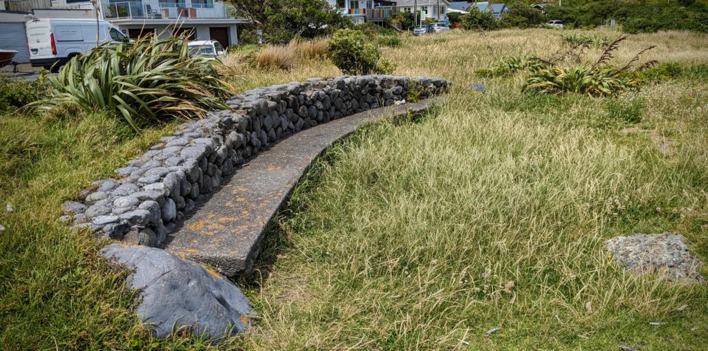
This stone bench however, made a great table for our picnic lunch!
As we ate our lunch, holding everything down because it was pretty windy, we watched several planes land, and a few take off, and a ferry passing the entrance to Lyall Bay on their way across Cook Strait. We also spotted a pod of dolphins porpoising through the water of the bay! After lunch we had to walk about 2 km on the road between the airport and a golf course to our return bus stop. We decided to pop into the airport to check it out.

Overhanging the holiday decor and Christmas tree displays was this enormous golden eagle and rider. A reference to Lord of the Rings, filmed in places in NZ. Although I don’t remember any giant eagles in the books!
We also took advantage of the free chocolate samples at a kiosk in the airport! We managed to get the correct bus back to the car park, and got home safely! Not a bad adventure for a day that started out with an accidental bus ride!
