January 22, 2024 MacKenzie District (Day 117)
Fairlie is known as ‘The Gateway to the MacKenzie” and is on the edge of the MacKenzie District, just about center of the South Island, and a part of the Canterbury Region which is the largest region of the country by area. It includes the highest mountain and the largest intermountain basin in the country. 

How it came to be known as “MacKenzie Country” is an interesting story! The area was only intermittently inhabited by Maori before European colonization, mostly as a hunting area. In the early 1850’s a Scottish immigrant, James MacKenzie, came to New Zealand via Australia where he had emigrated to in 1849, not transported as a convict (convict transport eventually ceased in Australia in 1868)! In New Zealand he found work as a sheep drover as he awaited results of his land application which required that he stock the land with sheep. In March of 1855 he was found in an inland basin, previously unexplored by Europeans, with 1,000 sheep supposedly rustled from a wealthy sheep station owner on the east coast! He claimed innocence and managed to escape only to be arrested in Lyttleton near Christchurch, some 100 miles away. In April he was convicted and sentenced to 5 years hard labour for sheep-stealing. He managed to escape several more times, even being shot in one instance. Eventually his case was investigated by a new magistrate who “…found that the police inquiry and the trial had been seriously flawed, and with the support of…a Superintendent, secured a free pardon for Mackenzie in January 1856.” After only 9 months of imprisonment MacKenzie was free, he made a quick getaway back to Australia it is assumed, but nothing is known of his later life. His legacy grew with the telling of his story and the significance of the inland pass and basin he was the first to utilize was quickly appreciated! “Small would-be farmers wanting their own land or resenting the power of large wealthy landowners could identify with him, as could those who did not fit the mould of genteel Canterbury society.” Remember, New Zealand was colonized by willing immigrants, no one was forced through slavery, penal conviction or indentured servitude to come to these shores! In fact many British immigrants were wealthy speculators or retiring military career pensioners, and they wanted hard-working peasant laborers! Eventually the high alpine basin was named in honor of the rebellious folk hero, and even his shepherd dog (probably a border collie) gained notoriety!

A statue has been erected in Fairlie in honor of James MacKenzie and his dog!
January 21, 2024 Aoraki/Mount Cook (Day 116)
A glorious day for a road trip, in fact the best day of the week for our destination; Aoraki/Mount Cook, the highest mountain in NZ at 12,218 feet. It is a 2 hour drive from our accommodation so we got up around 4am to have breakfast and pack our day packs to leave by 6am!

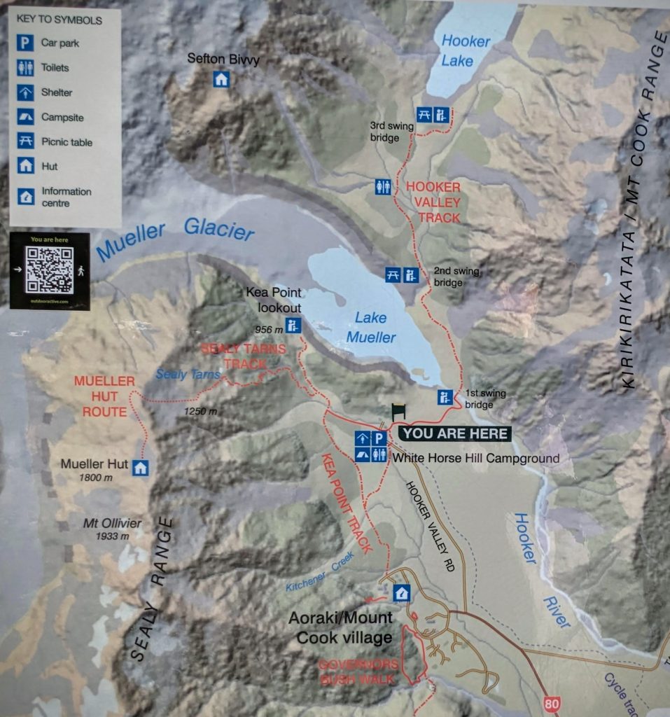
Our planned route from Fairlie to Aoraki/Mt. Cook.

On the road, we saw the alpenglow on the hills as the sun rose through the clouds.
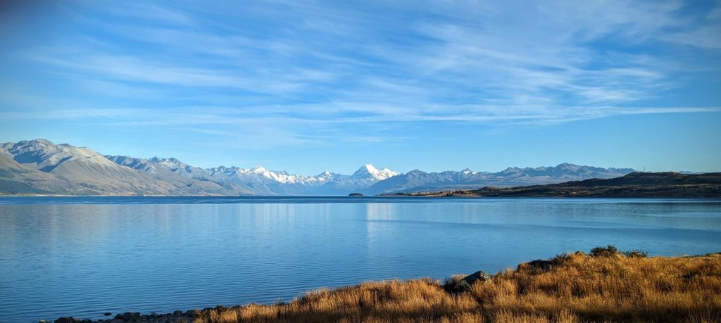
As we rounded the bottom of Lake Tekapo we stopped at a viewpoint of the mountain overlooking the lake.

Continuing on we rounded Lake Pukaki and drove north up the west side of the lake. We saw great big rows of slash and distant stands of burnt pine forest. At a rest area we found out that “…wilding conifers have spread from erosion plantings, farm shelterbelts and plantation forests into the surrounding countryside. If not managed these trees quickly form impenetrable forests of no economic value. They make farms unusable, take over native ecosystems, use scarce water and alter iconic landscape”. These forests are being controlled with herbicide and chainsaws. The land is then restored to productive farmland (more like rangeland), and encouraged to regrow in native plants.

As we approached closer the flat-bottomed glacial valley spread out beside us.

Finally we reached the parking lot at Hooker Valley which was quickly filling with early morning hikers!
The Hooker Valley Track is one of the most popular walks in New Zealand, probably because it’s a pretty easy walk, especially on such a beautiful day as today!

Near the start of the trail is the first of 3 suspension bridges. Apparently they are closed overnight because a crowd was starting to form waiting for the gate to be unlocked at 9am!

The second bridge was still in the morning shade cast by the mountains on the east side of the Tasman river.

The final bridge has fantastic views of Aoraki/Mt. Cook!

We finally reached Hooker Lake, with Aoraki/Mt. Cook in all it’s glory! The reality of the crowds reaching this point, with many more to come!

The ‘Instagram’ view sans crowds!

After our 3+ hour hike we went to the Hermitage Hotel cafe for coffees and visited the exhibits about Sir Edmund Hilary, the New Zealander who was the first to summit Mt. Everest with Tenzig Norgay, a Nepalese Sherpa. Aoraki/Mt. Cook and the southern Alps were Hilary’s training ground!

As we left Hooker Valley and Aoraki/Mt. Cook Village we got this great panorama of this small piece of the Southern Alps.
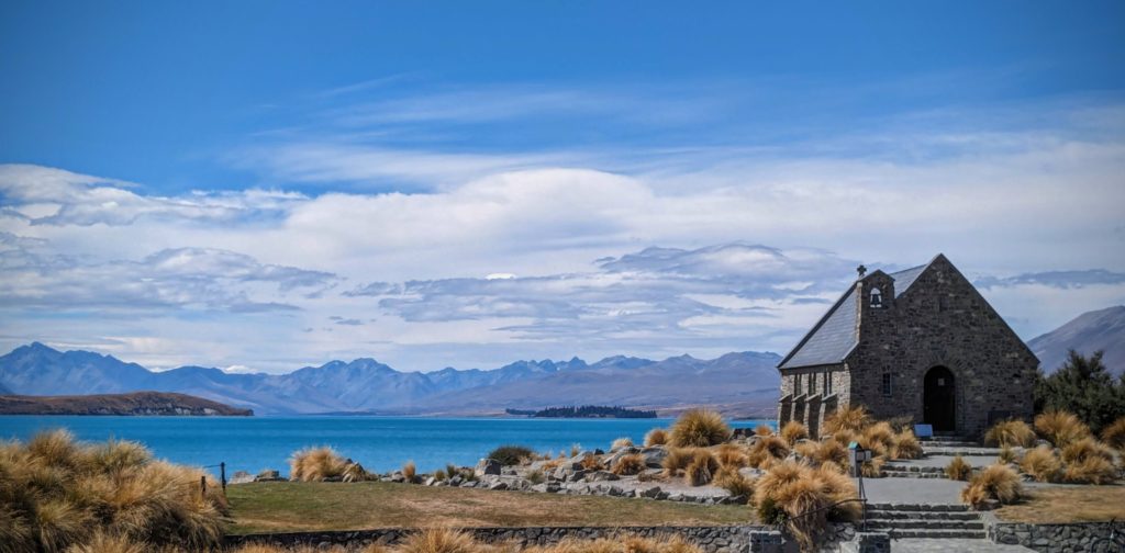
And on our way back to Fairlie we took a detour into the town of Lake Tekapo to get the iconic photo of the Church of the Good Shepherd overlooking the lake towards the Southern Alps!
January 20, 2024 Kakahu Track (Day 115)
Another beautiful, hot day forecast for today. We got a slightly earlier start and drove a half hour east to the Kakahu Bush Track trailhead. You know you made it to the trailhead when you see the lime kiln. Built around 1876 and used intermittently until about 1900, it was used to burn limestone to produce burnt lime that was used for agriculture and the building industry. 
The Kakahu Track begins on the ridge behind the kiln and follows a beautiful creek through forest that progressively changes from non-native pines (looking like Ponderosa Pines!) and big oaks/maples to native Podocarp/Broadleaf forest. This section of forest is the last large remnant of the native lowland Podocarp hardwood forest in the Canterbury region. New Zealand has 2 main types of native forest, the Beech forest that we hiked through in the Nelson Lakes Nat’l. Park and the Kahurangi Nat’l. Park in the north end of the South Island, and the Podocarp/broadleaf forest found mainly on the North Island and in pockets of low lying areas of the South Island. On the more tropical North Island the Podocarp forest also harbors the prehistoric looking tree ferns. A third forest type was introduced in the mid 1800’s as a commercial crop, the true conifers that are usually planted in plantations.
We hiked up through the forest that was deafening with insect buzzes and static sounds. The clicking and crackling sounds were almost like live electricity lines running along the ground!

We emerged at the top near the ‘Pinnacles’ a limestone outcrop that we hiked around.
 After hiking around the pinnacles we hiked up to another outcrop viewpoint and could look east to the South Pacific Ocean! Hiking through sheep paddocks we re-entered the native forest, the large trees that emerge from the canopy are the native Podocarps, like this Kahikatea tree, which have cones and fruits.
We resumed hearing the deafening songs of the Cicadas, of which NZ has over 40 species! At one point they were so thick they were on the trunks of all the trees around us. I realized then that the ‘dust’ blowing and falling through the trees was not just leaf litter, but frass, bug poop! The light, papery specks covered the forest floor and blew all around us, a necessary component of a healthy forest! I just made a note to make sure I wash my hair thoroughly when we get home! The junction at the Balancing Rock closes the loop section of the trail and we began our downhill hike back to the kiln. We finished our hike, soaked in sweat, and had our picnic lunch before we headed back home for well deserved showers and a relaxing evening!
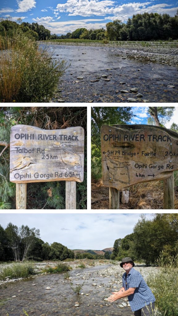
January 19, 2024 Opihi Gorge Trail (Day 114)
An early morning rainbow portended a beautiful day!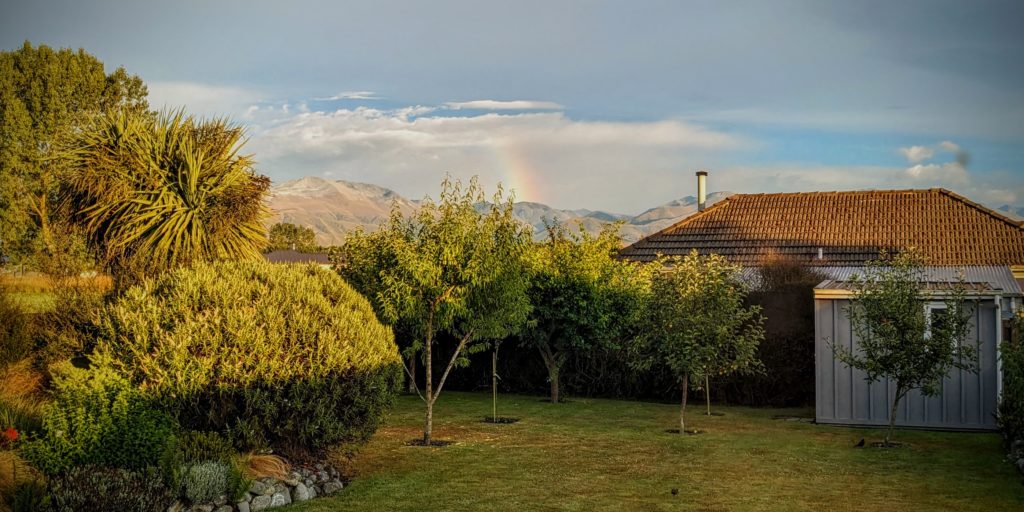 We headed out after a late breakfast to explore the opposite end of the Opihi River trail where the river enters a gorge and offers a more challenging hike through the gorge with ladders, bridges and rocky scrambles. We reached the end of the road for us, because of a water crossing, too deep for our little car. We took off our shoes and hobbled over the cobble rocks to the other side, then found we needed to cross a much wider section of the river! We decided we’re too tenderfooted to attempt that crossing and as we donned our shoes back on solid ground a 4 wheel drive cruised past, through the ford and on to we assume the Gorge trailhead! Oh well, we still had a 2.5 mile section of trail along the river to explore.

The ford over a small section of the river that stopped us! At the beginning (or end) of the River Trail the native plantings are doing great! Yesterday we saw 2 volunteers (we assumed) with a small pickup truck, a water tank and a pump, watering the plantings along the trail! About one third of the River Trail is in shady forest.
We were grateful for the shade, as the temperature soared into the high 20’sC, that’s over 80F! We were glad to finish the 5 mile out and back hike and sit in the shade eating our picnic lunch! A short drive to our VRBO, a good wash of our sweat drenched clothes, hang them on the line and relax! After dinner we had a delightful dessert of ice cream, fresh raspberries and chocolate!
January 18, 2024 Opihi River Track (Day 113)
A cloudy morning that cleared up to a wonderful day. I took a short walk this morning towards town center and the small grocery store and did a little sightseeing on the way.
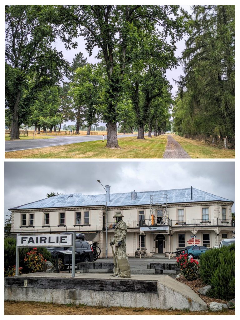
Hwy 79 T’s into Hwy 8 that runs through Fairlie. Hwy 8 is lined with trees planted in 1918 to commemorate “Peace from the Great War” and renamed Peace Avenue. This statue of a WW1 soldier is on Hwy 8 at the site of the railroad station from which the local boys boarded the train to their boot camps for the war. Some came home.
As the afternoon weather improved we decided to find and hike the easy Opihi River Trail that follows the river running parallel with Hwy 8.
The trail is being restored with native plantings in clearings. Along most of the length of the trail the river is obscured by trees and brush. The river had been stocked with Chinook salmon and brown trout in the 1900’s and is supposed to be good for fishing, although this summer it looks pretty low! We made it a round trip of 5 miles!
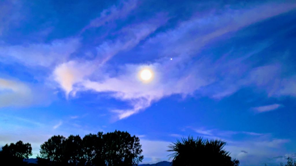
A relaxing evening, grilled lamb and veggies for dinner and a wonderful moon, looking full (but it’s not).