February 21 Heron Lake (Day 147)
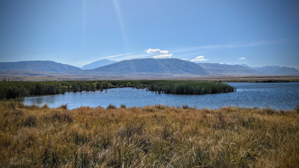
Another beautiful, bright sunny day, tempered by a cool south wind to relieve your exposed skin of the heat from the sun! We planned to go for a short 5 mile flatand hike until we looked at the map at the trailhead and saw we could drive to several high lakes! We hit the road, which quickly turned to gravel and turned into a high country valley that is mesmerizing! We had no idea! Called the Ashburton Lakes, the high country of Central Canterbury district in the South Island is reminiscent of Nevada; stark, dry, surrounded by mountains, seemingly empty. We crossed a rocky braided river bed and drove past one or two farms (what we consider ranches) to the largest of the lakes, Lake Heron.

Lake Heron at 2277 ft. elevation, with the Southern Alps as a backdrop!
I imagine the landscape was more brushy before European settlers, but the only trees seem to be non-native plantation pines or huge windbreak pine hedges. Maori were never permanent residents here, only seasonal migrants to collect food, fibre or mineral resources. There are trails across the land here that the Maori used to cross the Southern Alps to access the best sources of the coveted pounamu or greenstone, a type of jade that is very hard and carved for tools, weapons and jewelry. It is considered a valuable taonga, a treasured possession of cultural significance. So valuable that the Maori name for the South Island is “Te Wai Pounamu (‘The [land of] Greenstone Water’) or Te Wahi Pounamu (‘The Place of Greenstone’).” “Pounamu is found only in the South Island of New Zealand”.
A series of smaller and more reedy lakes called Maori Lakes had more bird life.
The flat, grassy tussocked land must have seemed ideal for lifestock to the Europeans who arrived in the 1860’s when gold was discovered in the area. The Gold rush was short lived and the miners turned to farming.
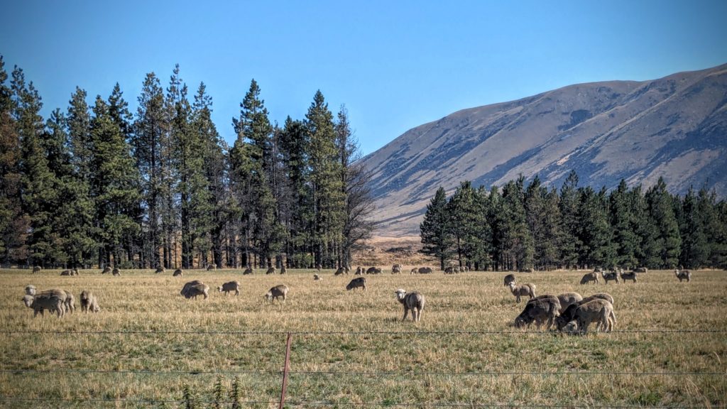
It turns out that the Merino sheep breed is best suited to the high dry country. They are the only sheep farmers that are making a living now. Meat and lower grade wool sheep breeds have virtually no value now.
As we returned to the paved road we stopped at the Hakatere Station, a restored ‘ranch’ that was one of the first to be started in the Ashburton Lakes region in the 1860’s.
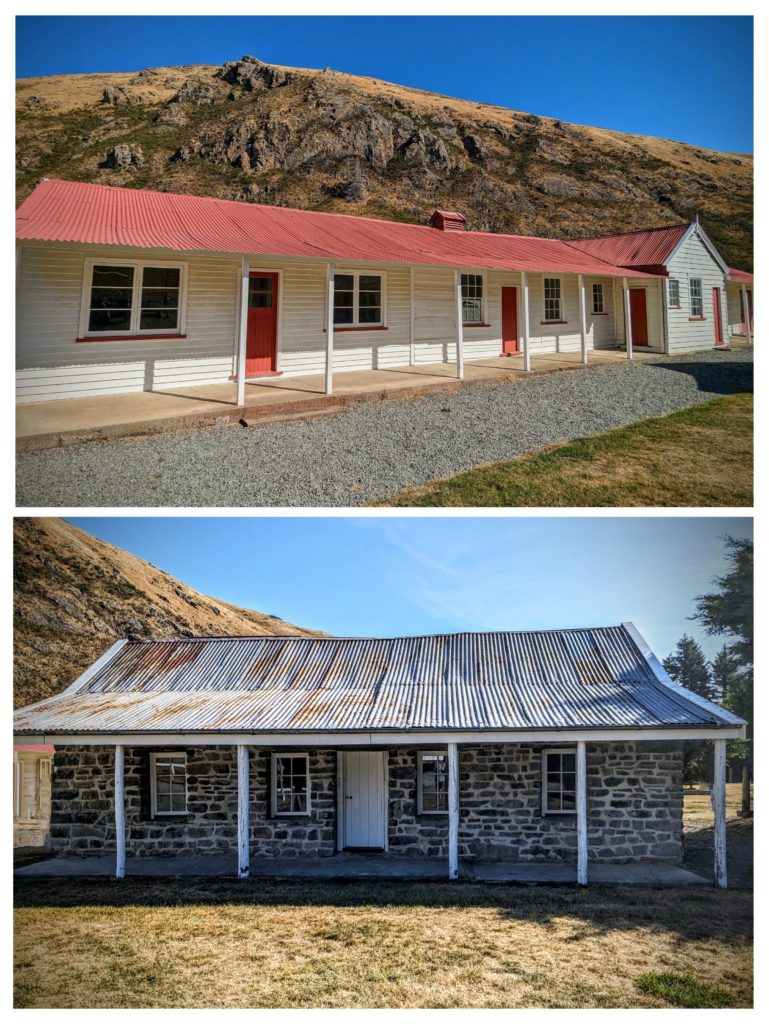
The top building was the shearers/single men’s bunkhouse. The bottom stone building was the original ranch house.
Amidst all the natural and cultural history to read at the Station is the admonishing to take care of the environment!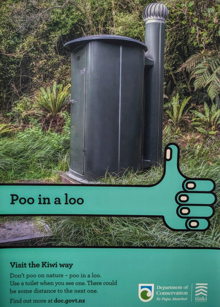
February 20 Woolshed Creek Hut (Day 146)
Today is our first day staying at our new Airbnb in Mt. Somers, a small village in the foothills of the Southern Alps. The nearby Mt. Somers, the actual mountain that is, is volcanic in origin, different rock forms than the nearby Southern Alps which are the result of the eastern Pacific tectonic plate sliding past the western Australian tectonic plate, causing a rise of the alps about 10mm per year, about .394 of an inch! There’s great hiking around the area, established and supported by the Mt. Somers Walkways Society, but now managed by the Department of Conservation. We hiked part of the eastern Mt. Somers Track to Sharplin Falls back on Day 111, Jan. 16. Today we are closer to the western side of the track and drove the 15 minutes to the Woolshed Creek carpark. Immediately when we got out of the car we were enveloped by the sweet, slightly-burnt caramel and rosewater scent of the scale insect infested beech forest covered with black sooty mold. We first encountered this on Dec. 27 Day 91! The hairlike anal tube structures of the insects protrude from the tree trunks and exude drops of sweet nectar that attracts lots of native bees and invasive wasps! We had to be careful as we walked to not smack a bee or wasp! We started on an easy track along Woolshed Creek, walking through the sweet smelling shady forest, then started heading uphill and reached the tangled wreckage of an old ore cart from a coal mining operation further uphill. A steep track continued up to the old mine site which was worked off and on from the late 1800’s to 1968!

Views around the old mine which is now boarded up.
We continued past the mine and emerged from the forest above the treeline to the grass tussock environment in full sun, but thankfully with a cool southern breeze (straight from Antarctica!)

Looking over the ridge down on the Stour River Valley and out towards the Southern Alps with patches of snow visible!
Checking our google maps route and a hiking app map we discovered we were only about a half mile from the Woolshed Creek Hut! We now had a goal! Over another short ridge we spotted the hut down in the valley with the creek flowing in front of it.

The track continued across the creek then divided, going northish and southish.
We saw that the southish track went into a gorge, and was that a suspension bridge down there? (not visible in the picture)

By golly it is! and the narrowest one we’ve encountered yet! Looking up stream you can see Emerald Pool, kind of small because it’s been a pretty dry summer here!
We decided to follow our trail back to the carpark rather than chance the very steep looking loop route! It was mostly downhill back to the car and we were happy to get back into the woods for half of the trip!

Robert pointed out our trail, almost 7 miles round trip!
February 19 Moving Day (Day 145)
Last night was magical. The water was calm and reflected the lights of the small settlement across the harbour as well as the lights of Highcliff road on the spine of the Otago peninsula.
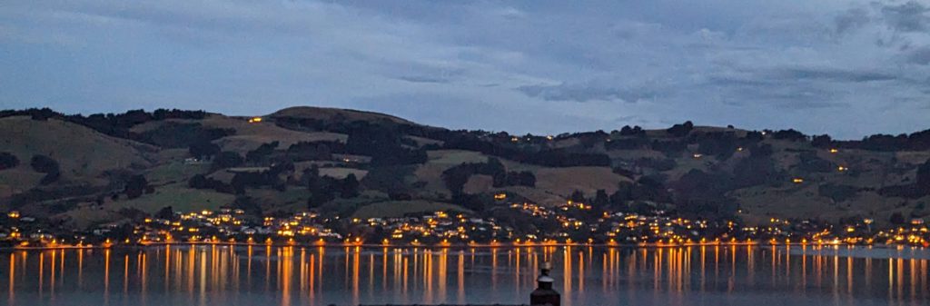
Our last night near Dunedin.
We packed up the last of our gear this morning and headed north to Mt. Somers, a 4 day stop before our final month stay on the west coast. On the way we drove along the east coast stopping at several viewpoints to see sealions or beautiful beaches. One stop was to see the famous Moeraki Boulders, huge spheres on a beach, some partially covered by sand and some just emerging from the sandy banks. There are several theories of their origin, but I like to think of them as ‘marbles of the gods’!
February 18 Dunedin CBD Museums (Day 144)
A beautiful sunrise for our last full day in Dunedin.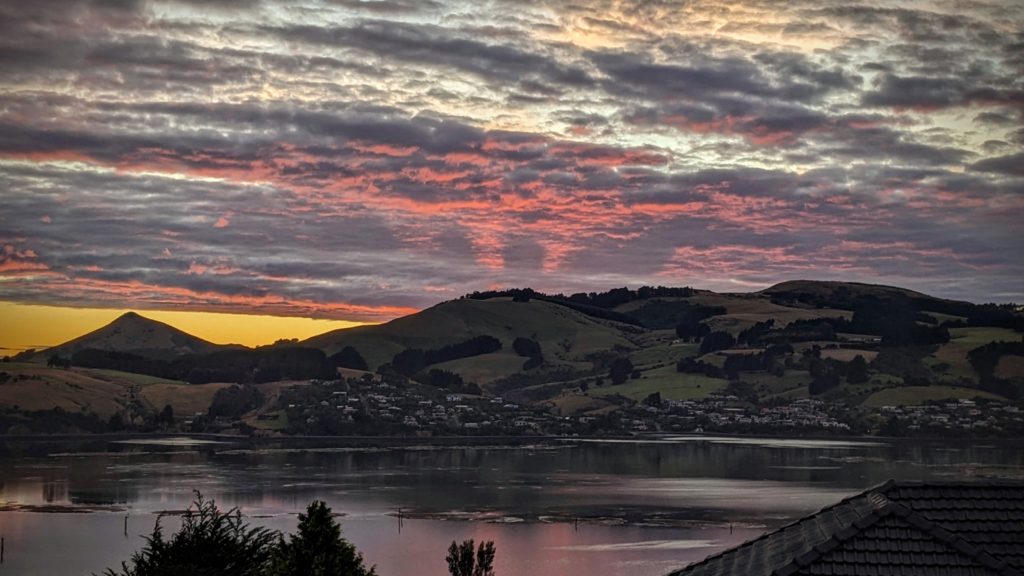
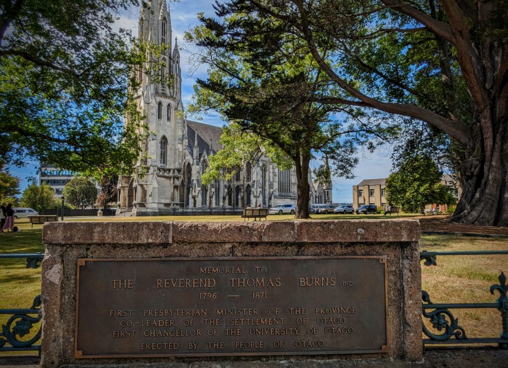
We decided to go into the city and do some sightseeing. There are several museums, gardens and architectural sights to see. We parked the car near the railway station and went into the nearby museum “Toitu Otago Settlers Museum” and got a cup of coffee. We couldn’t take the coffee into the museum so we headed to the center of town, the Octagon.
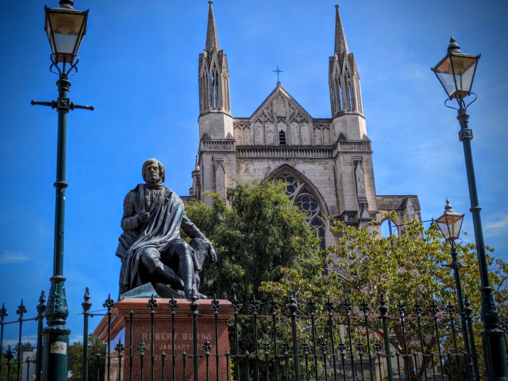
A sculpture in the Octagon, of Robert Burns, famed Scottish poet. Dunedin being founded by Scots, and the first Presbyterian Minister Thomas Burns being a nephew of Robert Burns it seems fitting that Burns the poet would be memorialized in New Zealand.
We walked back to the museum and perused the many exhibits of cultural history of the area.
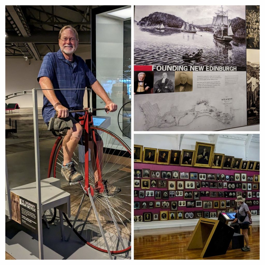
Lots of history of the “founders” of Dunedin – the Scots.
Just outside the museum is the Chinese Garden of Dunedin, “built to take you on a journey to a greater understanding of history, culture, heritage and tradition. Its origins come from a desire to celebrate the city’s Chinese heritage and its valuable sister city relationship with Shanghai.”

It is truly relaxing and beautiful.
After the museum, the garden and the walking, we returned to the Octagon for lunch and a walk further around the center to see the spires that rise above the other buildings.
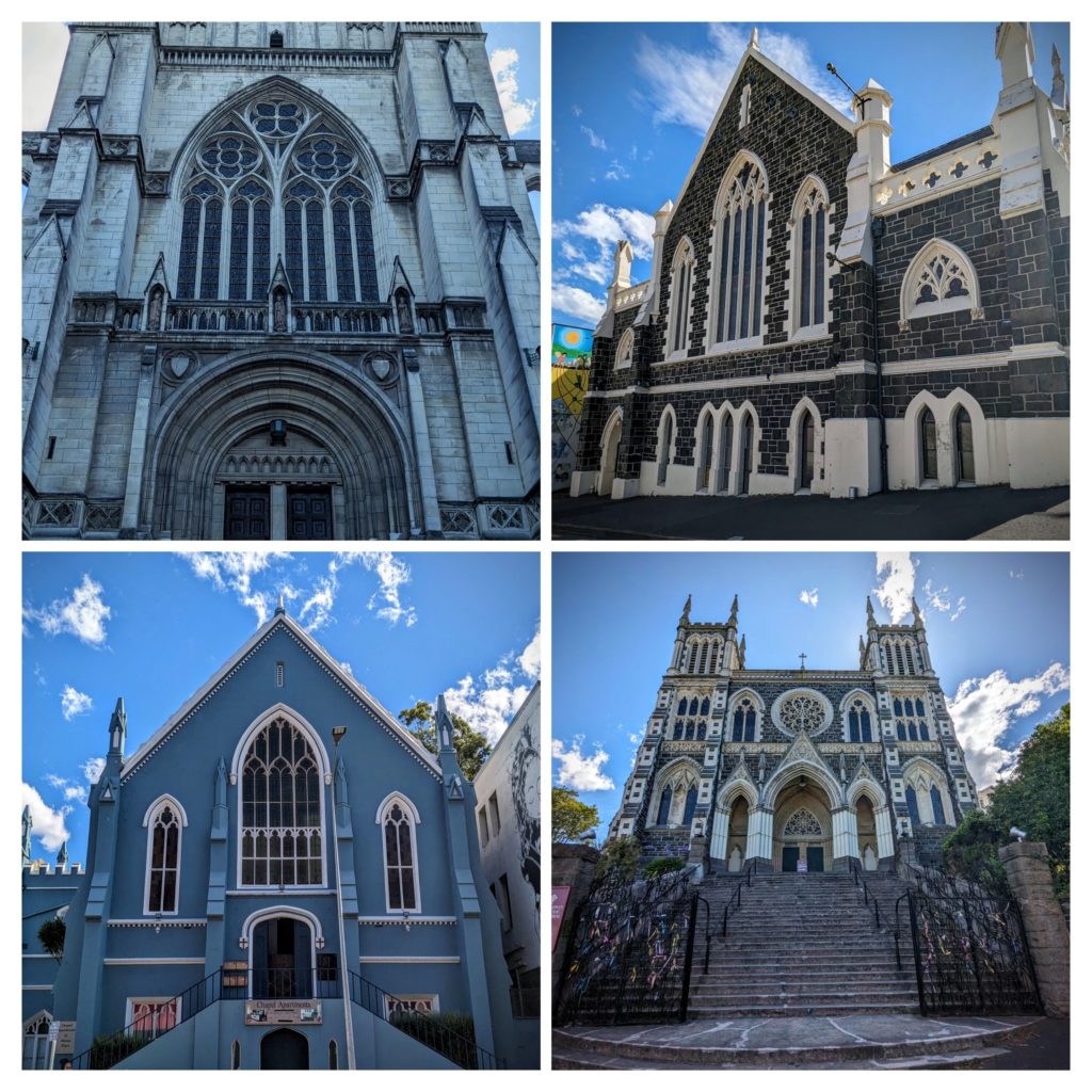
We found 5 huge churches within a few blocks of the Octagon! Two of them are no longer churches, one is an art center, the other a vacation rental!
The grand daddy church, aka First Church, because the minister was one of the founders of Dunedin!
Along our walking path we came across a few pubs too!
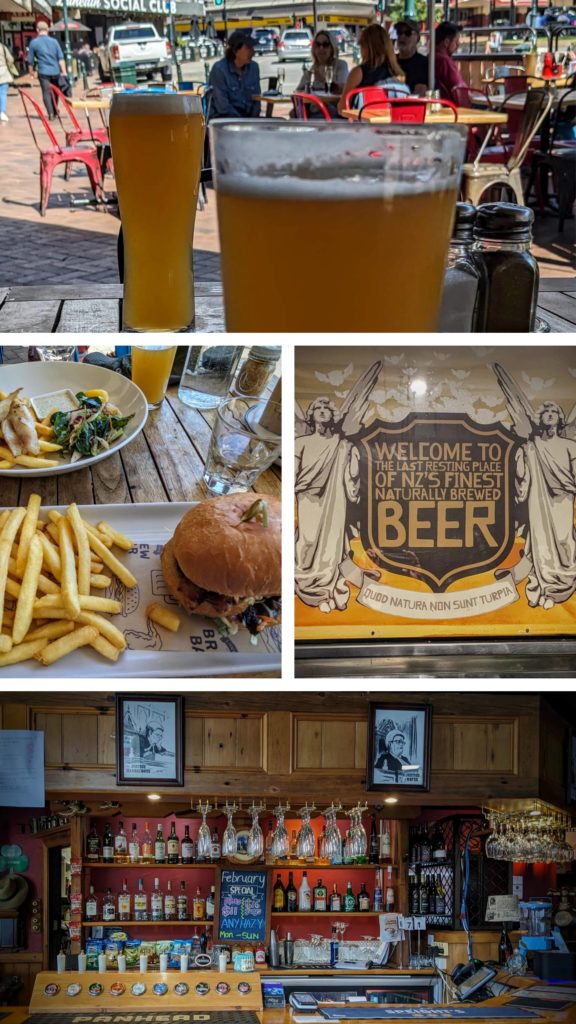
Gee, there are angels in pubs too!
After visiting all those pubs! (Just kidding!)
February 17 Aramoana Spit (Day 143)
Today our explorations take us up the opposite side of Otago Harbour from yesterday, the mainland side, to the Aramoana Spit, the other side of the harbour entrance from the lighthouse. ‘Aramoana’ in Maori means ‘pathway to the sea’. From the 1880’s the site was used as a pilot station for navigation around the mouth of Otago Harbour and eventually a long sea wall was built out towards the sea to inhibit the spread of tidal sands that would block the harbour mouth.
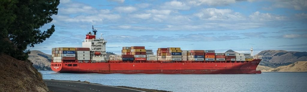
As we drove along the harbour edge we saw this container ship navigating in towards Port Chalmers, the main port. It looks so close to land! The navigable waterway is narrow and well marked in the wide harbour!
We reached the end of the road in Aramoana, a small beach resort village with no services, but lots of small holiday houses, and parked the car at the end of the ‘mole’ or seawall.
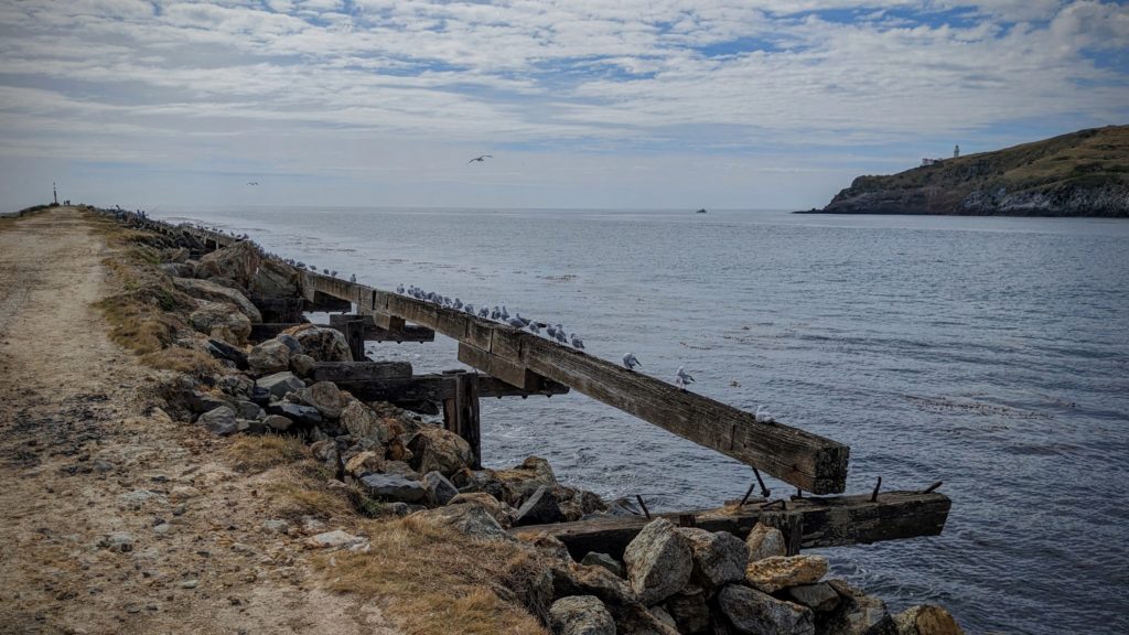
We walked out onto the ‘mole’ amongst the gulls and terns (“The Birds” vibes again!) and occasional sea lions.
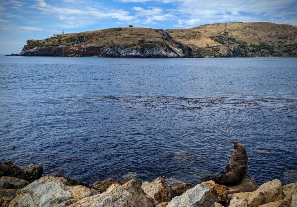
This sealion had a view of the lighthouse, the Royal Albatross Centre (the square building at the top of the hill) and the blue penguin beach across the harbour mouth.
From the mole the Aramoana Spit Beach extends north and we ended up driving to a spot to access the north end of the beach to avoid walking the length of the beach in the sun!
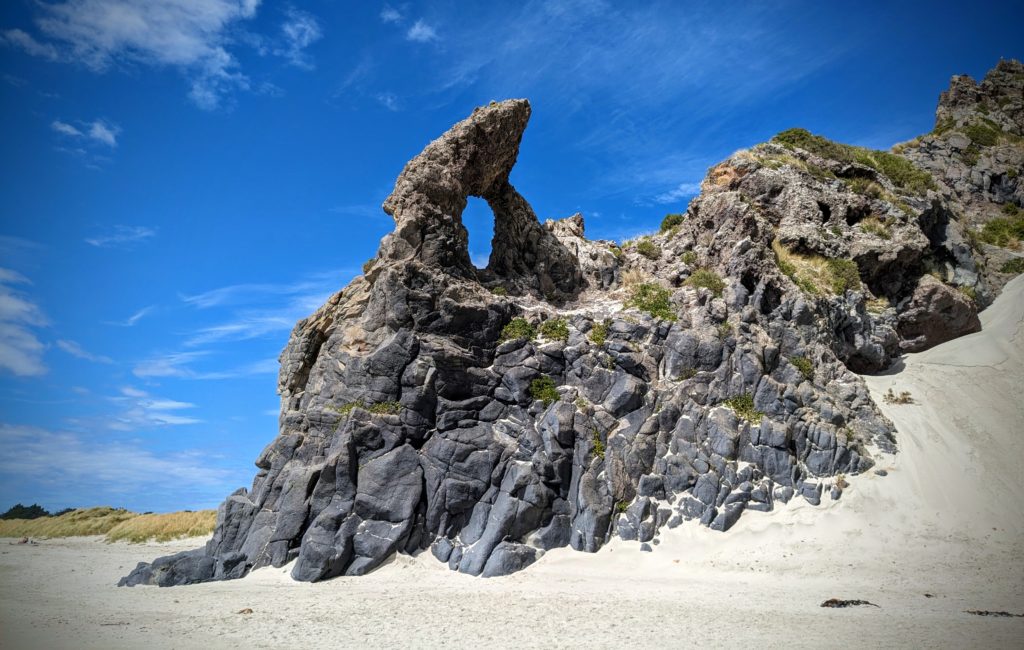
A landmark of this beach is the ‘keyhole’ rock formation.
Past the keyhole the beach was covered with small seashells, tons of them!

In some places they were several inches deep!
Our next stop was further north at Long Beach where there are some sea caves. A short walk through a forest and along a cliff face brought us to the beach where there were a few beachgoers and some sealions. We walked along the dunes close to the rockwalls and saw some rock climbers, then heard someone up in the rocks yell a profanity as a sealion barked, apparently upset that the rock climber stumbled upon it resting in the dunes! We found the sea caves and did a little exploring.
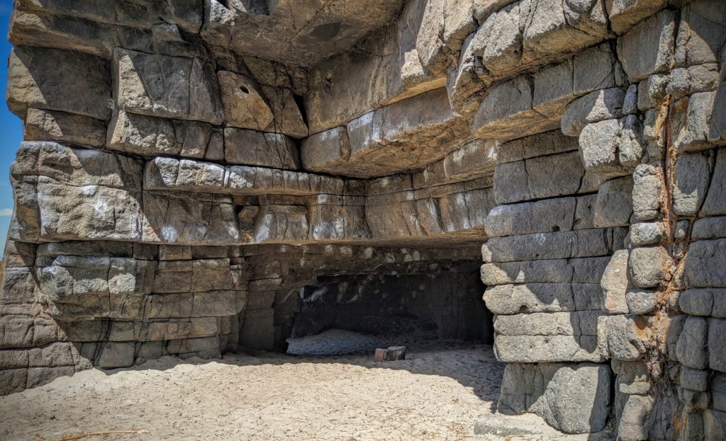
The first cave looks almost fake, like a set from an Indiana Jones movie, the rocks looking like hewn boulders carefully fitted together like something from Machu Picchu.
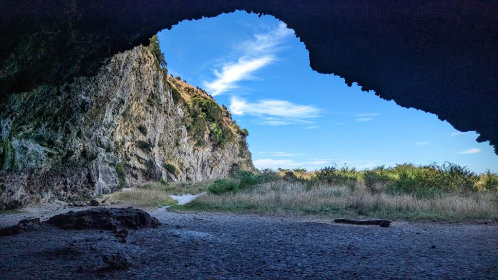
The much larger ‘Ballroom Cave” extended further back into the darkness, but we had no flashlights. The little blue penguins also use this beach to haul out of the water at sundown, and even nest and rear young in the back recesses of the caves. We saw lots of bird footprints in the sand and assume they are of penguins leaving and returning to their nest sites!

We finished our day of exploration with a walk in the surf as we watched a cruise ship out at sea turning to make a run into the harbour.
