February 16 Otago Peninsula (Day 142)
We explored the peninsula that separates Otago Harbour from the Pacific ocean today. A beautiful sunny, slightly breezy day. We drove from the B&B on the northwest side of the harbour along the edge of Dunedin and then along the harbour edge all the way to the tip of the peninsula at the entrance to Otago Harbour!

The lighthouse at Taiaroa Head. The Royal Albatross Centre is located at the tip of the peninsula. This is the world’s only mainland albatross colony in the world! Most breed on remote islands far from human civilization! The albatross is the world’s largest seabirds. The young birds that hatch at this colony will take 8 months of care from the parents until they fledge. They will then go to sea for 3 to 8 years before they return to the same site to find a mate and breed. They can live up to 40 years! The main threat to the albatross worldwide it plastic pollution!
We didn’t see any albatross that we could identify, but there are lots of birds along the peninsula, some places even reminding us of the Alfred Hitchcock movie “The Birds”! Just the other side of the tip of the peninsula from the viewing deck over the Pacific, on the protected harbour side, is the site of another bird colony, the little blue penguin colony. The penguins are out at sea during the day feeding and come into the nesting site after sunset, perhaps to avoid the sea lions that were lying around waiting! The viewing platform at this beach closes an hour before sunset, then opens for tours to view the returning penguins. We didn’t stick around all day for that, but click HERE for a great description with photos!
We backtracked to about mid-peninsula and crossed a narrow to Papanui Inlet, driving through rural areas on gravel roads to reach Okia Flat where we had our picnic lunch. We then hiked between Big Pyramid and Little Pyramid to reach Victory Beach on the Pacific side of the peninsula.

The trail started as a farm road until the pyramids, then became a hiking track through sand dunes to the beach.

The Beach! Awesome, and we were the only people there! A few sealions and birds were our only neighbors!
A walk on the beach, then the hike back to the car, passing a few people hiking in, and we moved on to the next beach, driving around Papnui inlet onto Cape Saunders and down to Allans Beach.
There were a few more people at this beach, being more accessible with less of a hike! There were a few sealions here too!
We then drove around Hoopers Inlet to reach Sandymount Recreation Reserve.

A boathouse on Hoopers Inlet. These shallow inlets must be great for fishing and bird watching!
Lots of hiking in Sandymount and we took the track that lead us to the viewpoint overlooking Allans Beach where we just came from!

The beach looks so much bigger than when we were standing on it, we were, however, at the far end of it!
We continued on the track to the viewpoint at the summit after passing through a small forest with a resident all black fantail bird that serenaded us with a song. The view was great, if you climbed on top of the monument marker, the vegetation having grown up a lot it seems!

Looking south towards Sandfly Bay.
It was a great drive home from there, along the spine of the peninsula, Highcliff Road, looking down either to the Pacific Ocean on the left, or down to Otago Harbour on the right!
February 15 Portside (Day 141)
A gray rainy day in Dunedin today, so we did laundry and took it to the closest laundromat to use a dryer, it being too rainy to hang laundry on the clothesline! The closest laundry is in Port Chalmers, and there happens to be a great pub across the street! The Portsider!

A beer and a great cured salmon plate with fresh made ciabatta bread and creme fraiche-mustard spread!
February 14 Valentine’s Lunch (Day 140)
Yesterday on our train ride through the Taieri Gorge at the stop at Hindon Station we noticed a gravel road across the Taieri river and wondered how to get there. It looked so peaceful along the river, a great place to have a picnic lunch. So today we figured out how to get there! There is no route through the gorge, but there are lots of rural gravel roads up in the hills around the gorge, leading to all the stations (farms, or what we would call ranches) scattered across the landscape. The main road is paved, but narrow and winding, up and down the hills.

The lowest point on the road is a stream crossing, probably a ford when it’s raining. Very lush along the stream, but the hills are brown and dry.
About 60km (37 miles) from our Airbnb we reached the Hindon Station site, coming down a steep hill past several buildings that are private residences now, but were town institutions like the school and railroad employee housing back in the day (1870’s to 1890’s)
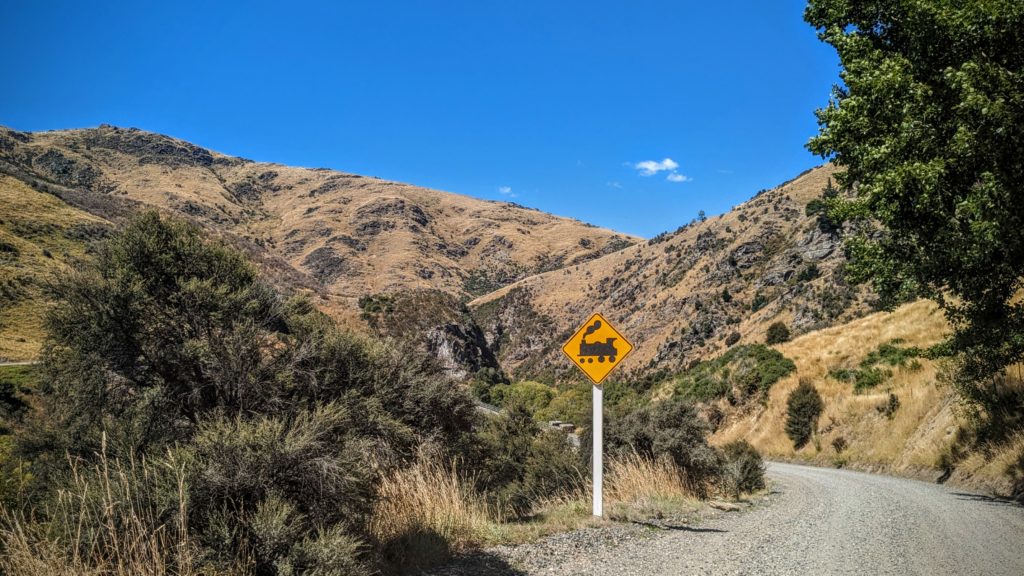
There is an interesting railroad crossing here, a shared railroad bridge and road.
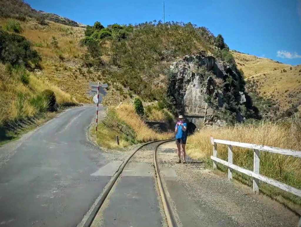
As Robert drove the car over the bridge, I took some pictures. The road turns to the left while the train tracks turn right and enter a tunnel behind me
We pulled into the only shade available on the flood plain along the river and set up the grill to cook some sausages for lunch!
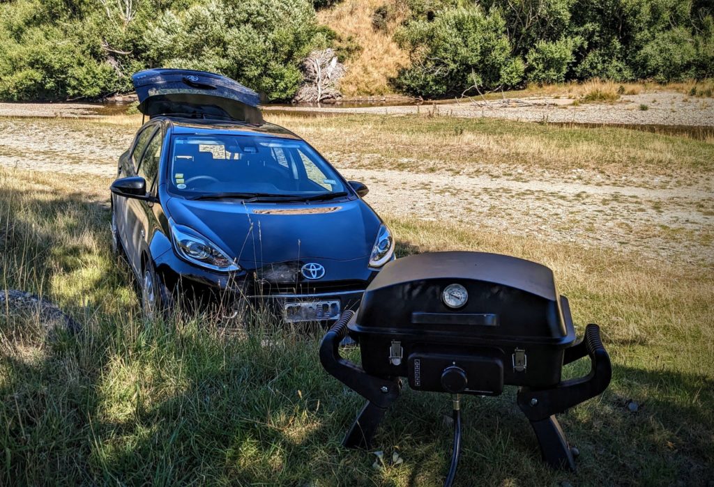
A little berm was a great spot to set up the grill. We got our lawn chairs out, but had to be careful because there was a strong wind blowing through the gorge.
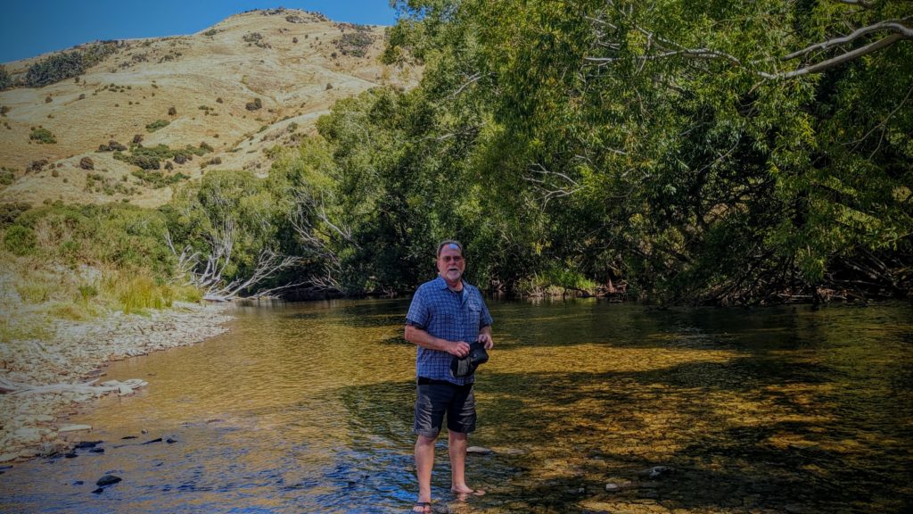
After lunch we took a stroll and cooled our feet off in the shallows of the river.
We packed our picnic supplies up and drove back up into the hills out of the gorge. We continued north on a main road through Central Otago towards the town of Middlemarch. The scenic train used to travel to Middlemarch, but was discontinued in 2019. According to the Dunedin Railway CEO; “The key factors influencing that decision for us is the extra demand around cruise ships – we’ve had to increase the number of cruise ship trains. In addition, we’ve got greater demand for passengers wanting shorter trips. And the challenger for us is the length of the Middlemarch trip – six and a half hours plus – and most tourists don’t have that amount of time to spend when they’re in Dunedin.”
It was evident to us that this decision has had an adverse effect on the Middlemarch railway station and the environs around it. However, it is where the Central Otago Rail Trail begins (or ends), the original Great Ride of NZ! The Strath Taieri Hotel across the street from the station has probably lost some business, but it’s 2 sentinel statues indicate the real value in the community!
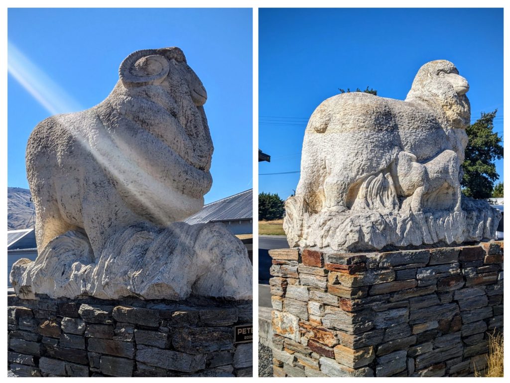
The Ram and the Ewe with Lamb are what’s really important in this rural area that is very reminiscent of the Columbia Plateau back in Oregon!
February 13 Inland Train Journey (Day 139)
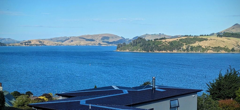
Our first full day in Dunedi. Actually, we are staying about 8km outside of Dunedin, in St. Leonard, a tiny community of houses on the road skirting the north side of Otago Harbour towards Port Chalmers. Port Chalmers sits about half way into Otago (oh-tah-go) Harbour and is a major port in NZ. It was the site where the first load of frozen meat (lamb & mutton I assume) left for London in a refrigerated ship, in 1882! This started the main export trade of meat which now includes exporting raw logs, and also now includes berths for huge cruise ships! Dunedin city proper sits at the inland end of the harbour. Our adventure today however takes us further inland, into the rural areas where the meat and timber is raised, on the farms of the Central Otago District. The Inlander Scenic Train trip is a sporadically scheduled trip on the old Central Otago Rail line that was built in the late 1800’s. Reaching deep into the rural ‘wop-wops’ (backcountry/middle of nowhere), it was a vital link for the farmers to get their stock to market. Departure was scheduled for 10am, but we arrived just after 9am to view the amazing Dunedin Railway Station!

Claiming to be the second most photographed building in the southern hemisphere! Surpassed only by the Sydney, Australia Opera House!
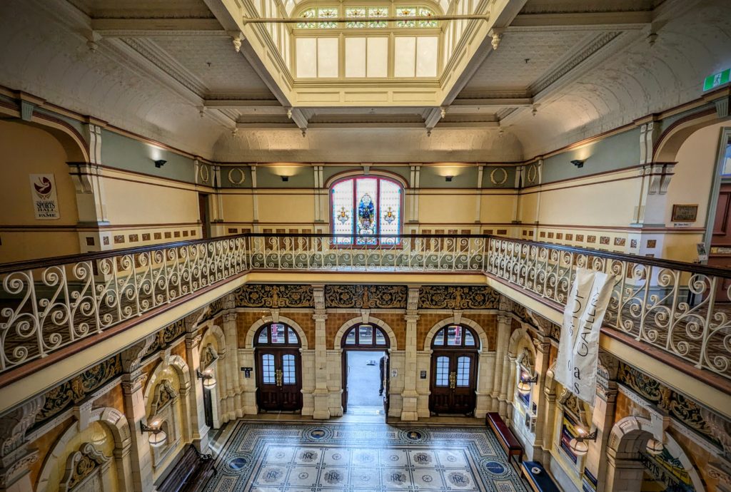
The Victorian era was coming to a close when the station was opened in 1906 and it is filled with impressive tileworks, fabulous mosaics, some stained glass and wrought iron decoration!
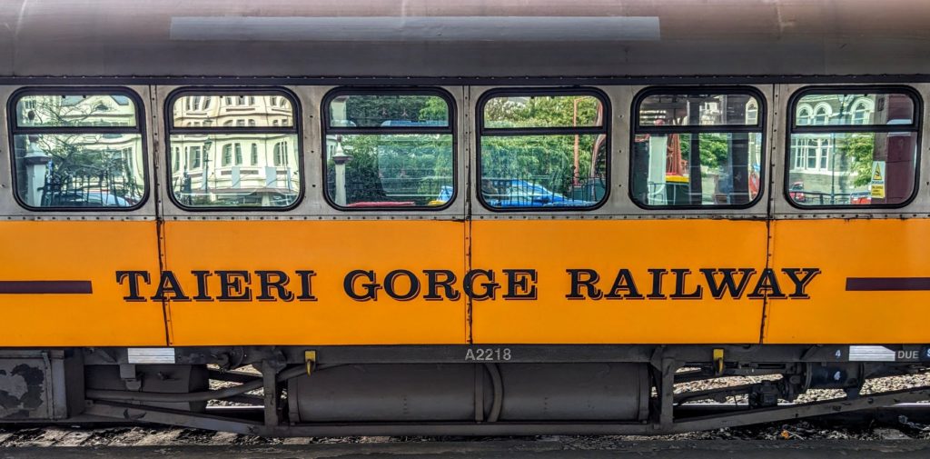
As the rail era ended with the prominence of automobiles and highways, in 1990 the railway moved into private hands as The Taieri Gorge Railway, then the Dunedin Railway, operating as a scenic route. Maintenance costs further reduced the line to one-third of it’s original length, with the other two-thirds either submerged under a man-made lake or removed to become the Otago Central Rail Trail.
The Inlander now travels from the Dunedin Railway Station through the Taieri gorge, carved by the Taieri river, to the tiny stop at Hindon, site of an old gold mining town of the 1860’s. Parts of the gorge are inaccessible by any other means except bush-whacking, there aren’t even trails through it! Before Covid the railway would take fishermen into the gorge, let them off the train to hike and fish stretches of the river, then pick them up at a later date at a specified stop!
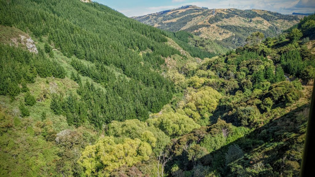
The shadow of the train crossing a bridge over the Taieri river. Native bush on the right and along the river bed. Introduced pine on the hill on the left. Clear cut pine plantations in the background.
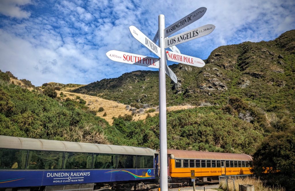
The stop at Hindon is surrounded by rimrock and soaring harrier hawks. We had time to walk around, read some history of the area and get a glass of wine before we headed back towards Dunedin.
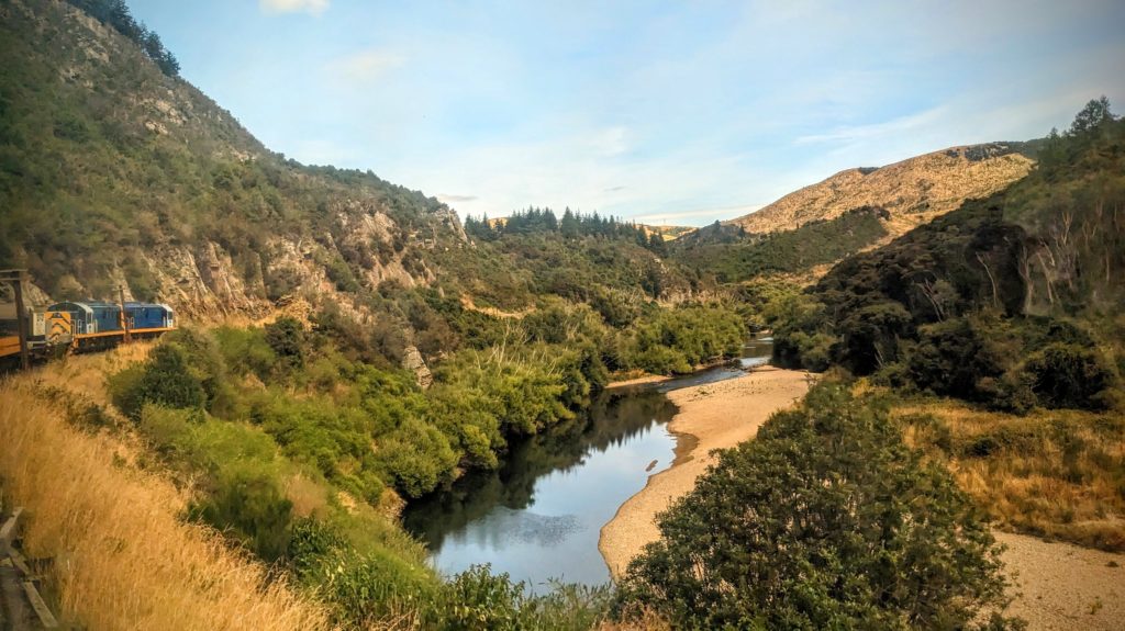
The river is low this summer, but the commentary spoke of several past floods that filled the gorge up to the tracks!

We passed the old stop at Parera that is now a private residence, accessed only by walking through a railway tunnel!
It was a fun ride through interesting terrain, crossing many bridges (‘viaducts’ here in NZ) including the Wingatui Viaduct, “the largest wrought iron structure in New Zealand since it was built in 1887” (per wikipedia), and through many tunnels which were dug by hand in the late 1880’s!
February 12 To Dunedin (Day 138)
After breakfast this morning we met John & Martha at their hotel and went back to the Kiwi Park for a 10am “Kiwi Encounter“. The half hour presentation takes place in the darkened Kiwi House where the day/night cycle is switched so that the kiwi are awake and active during our daytime. That makes it hard to see the kiwi until your eyes adjust, which takes about half an hour! It was amazing, we never realized that kiwi are that active and that they are that big! The females are about the size of a small chicken, the males smaller. Photography is not allowed, so no pictures. After our encounter we crossed the road to the Gondola and took a ride up Bob’s Peak for spectacular views!
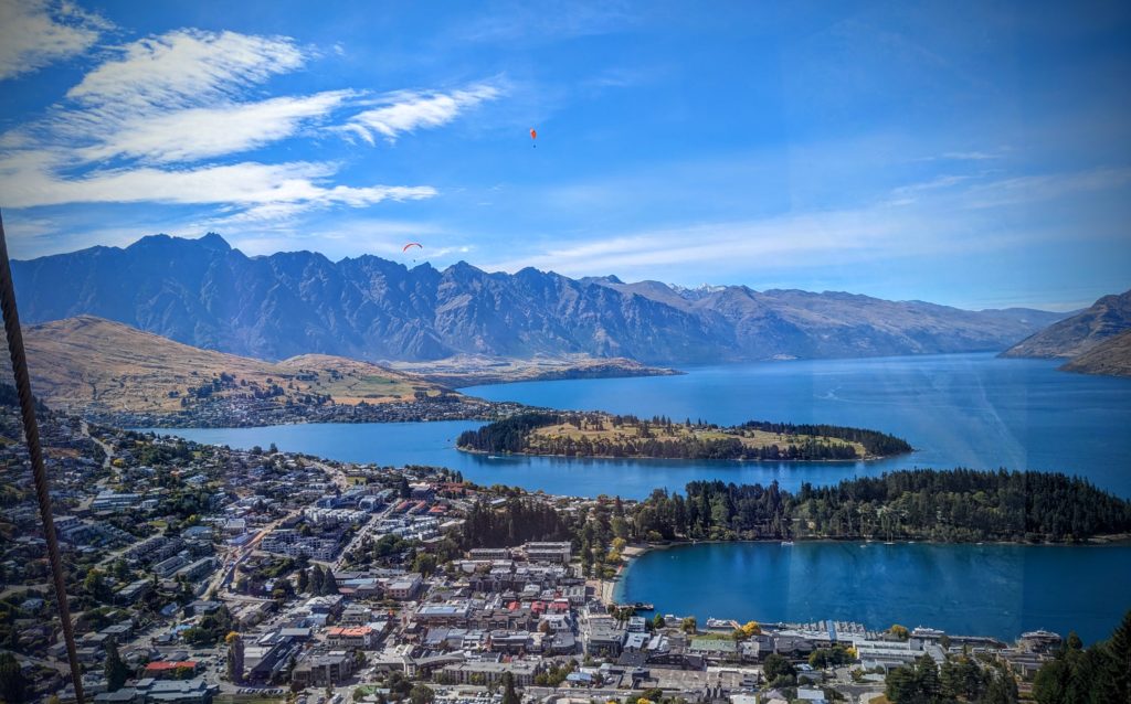
As we rose up the steepest cable car lift in the Southern Hemisphere the jagged Remarkables mountain range came into view in the distance. A few paragliders float over town and the waterfront beach is visible. The closest peninsula is the Queenstown Gardens, while the further one has a golf course.
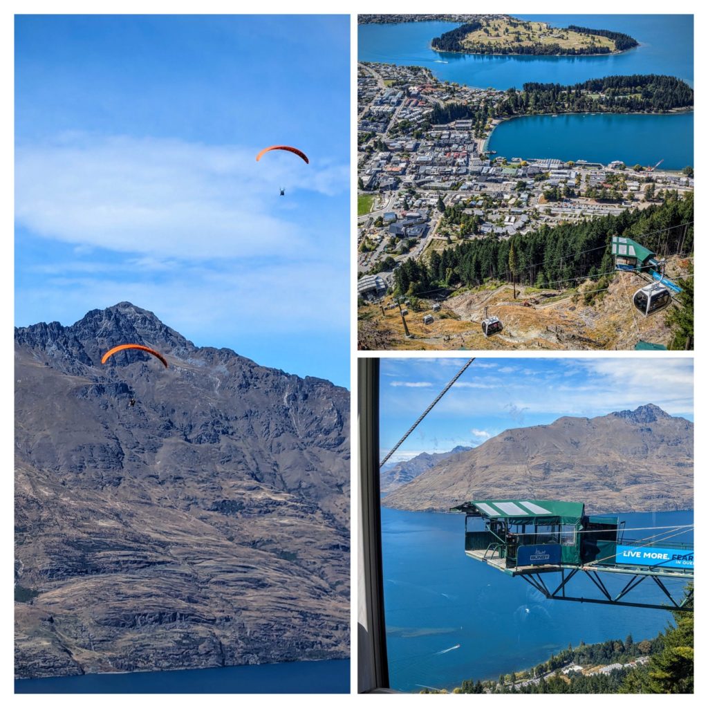
A montage of views; paragliders, town and cable car view, and a bungy jumping platform, not in use because of construction in the area.
After a short walk around town we eventually said our goodbyes, to meet again in Bend, and we took our leave, heading to our next stop in Dunedin while John and Martha are heading to Milford Sound tomorrow. A short way out of Queenstown we stopped at the Kawarau Gorge Suspension Bridge to get a coffee. It turns out that this is the birthplace of Bungy jumping! We stuck around to watch one jumper, then watched on the big screen in the visitors center to see another would-be jumper back away!
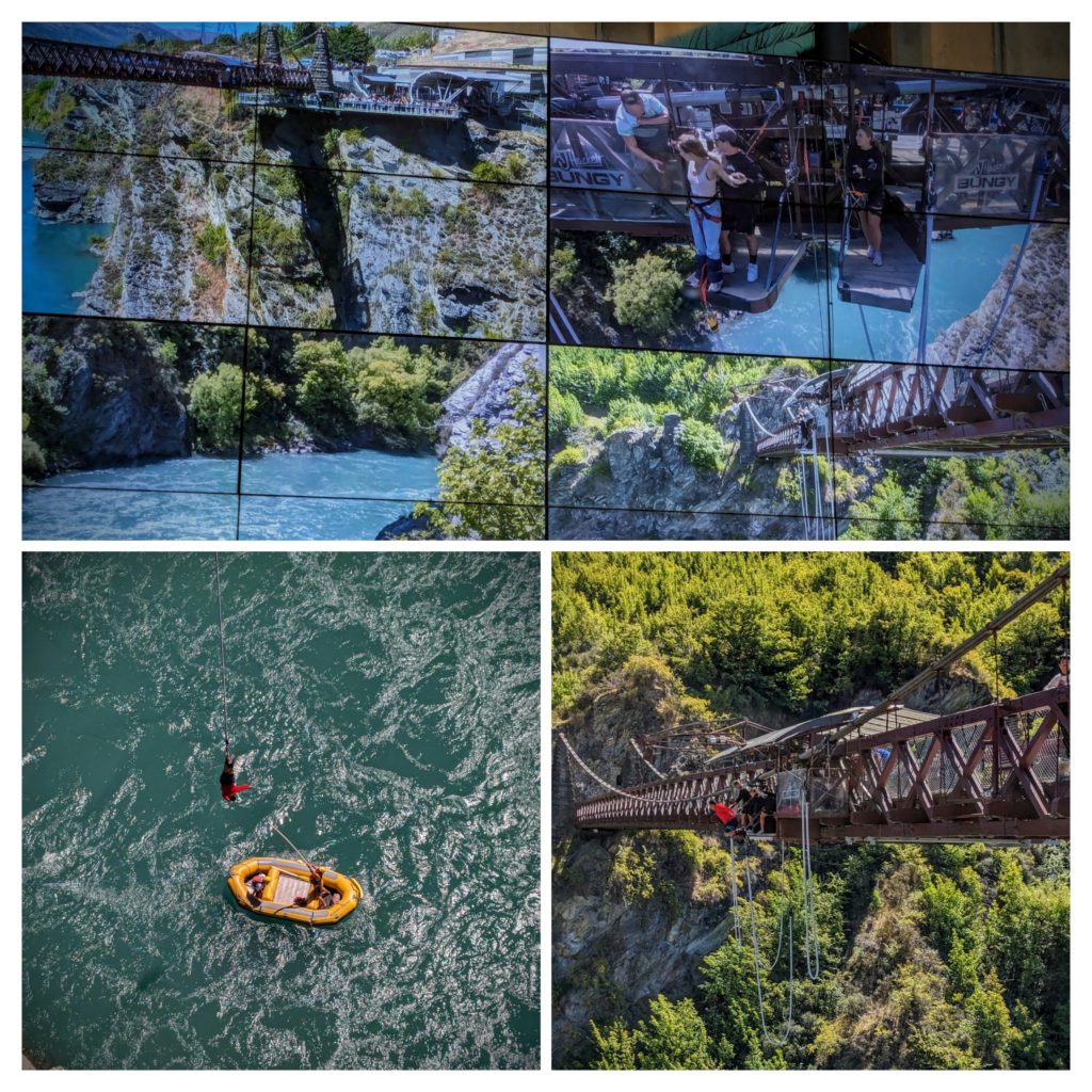
The man in the red t-shirt jumped, or rather stepped (maybe pushed) off the platform. He hung for a few minutes until the boat came for him to grab the pole to be pulled down into the boat and then had to climb a steep staircase to get back to the top! The young lady in the upper right picture decided it was too risky and stepped back from the edge!
We continued on through landscape that reminded us of eastern Oregon and stopped at a park along the Clutha river for a quick nap. Before reaching our Airbnb near Dunedin, above the shore of Otago Harbour.