February 29 Westport Shopping (Day 155)
Shopping Day! We need fresh fruit & veggies so we headed to the closest store which is in Westport, about 26 miles north. We’re also looking for new shoes, 6 months of hiking all around NZ has worn our walking shoes out! Luckily for us the one shoe store in town has Keens & Merrells (my favorite walking shoes) which were on sale! In fact, everything was on sale because this store, and several more stores we noticed, is going out of business. Westport started in 1861 to supply goldminers that flocked to the area in the west coast gold rush. Eventually it transitioned to coal mining and dairy farming when the easy gold pickings played out. The coal mining is mechanizing and downsizing so the town is transitioning once again, to tourism, with mountain biking and tramping as well as surfing being highlighted. Westport is the northern most town for supplies on the west coast. Another 69 miles north is the end of the road, and the beginning (or end) of the Heaphy Track, one of the 10 Great Walks of NZ.
New shoes in hand (we both found a pair!) we headed to a pub for lunch.
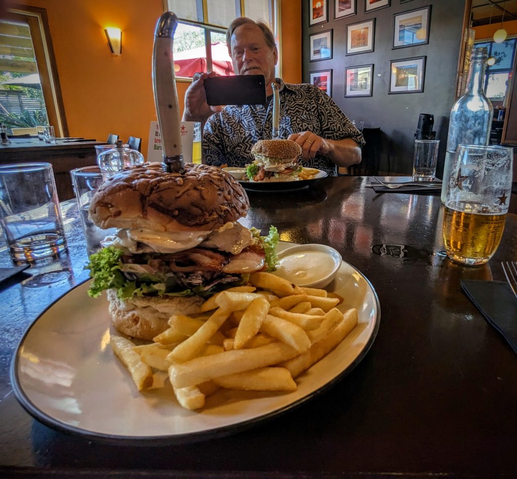
Huge chicken/bacon burgers and a beer!
We then headed for a pint at the local brewery, the small revitalized Shortjaw Brewery, housed in the old Miner’s Brewery that operated from the 1950’s, supplying the coal miners with a cold pint after a long shift in the mine.

They had a tasty Hazy on tap!
We finally got to the grocery store for our victuals!

Amongst the variety of ‘crisps’ as they call potato chips here, we found the 2 middle flavors; pizza and cheese bread, we didn’t find the spaghetti bolognese or the mac n’cheese flavors that Bill & Perla asked us about! We opted for the Garden Medley of vegetable crisps!
February 28 Day of the Weka (Day 154)
Today’s adventure started with a 20 minute drive south to the Punakaiki River, past the visitors center for Paparoa National Park and the entrance to Pancake Rocks and Blowholes Track. We parked in the new visitors carpark that accesses the Paparoa Track, a tramping and mountain biking trail that goes up into the Paparoa range of mountains. We were taking a small section of the trail, mostly because it starts with a swing bridge and ends at another swing bridge!

The first swing bridge, over the Punakaiki River, heading north.

The entrance to the trail shortly after crossing the river has a waharoa, an entranceway, carved to look like the ruru (morepork) owl of NZ.
The trail took us up, up, up over a small summit and then down, down, down to the next river north, through lush mixed forest with tree ferns, palms, tall native podocarps, and lush ferny undergrowth. All overlaid on limestone karst rock with streams cutting through it. We encountered some fellow hikers, and some wildlife, particularly several Weka!
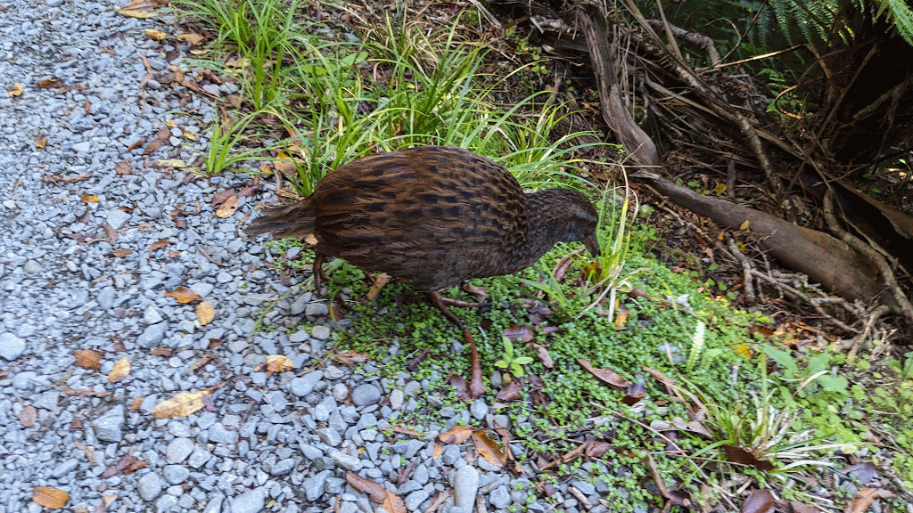
The first of many Weka we saw, bold, curious birds who mostly ignored us!

We thought we heard bleating in the bush, and then saw this little feral goat who quickly disappeared deeper into the forest. We heard several more bleats later on the trail too.
We reached the junction in the trail that took us the few minutes to the 2nd swing bridge.

This bridge crosses the Pororari River.
At the junction we encountered more Weka!
We had to decide, do we backtrack on the trail over the summit to the carpark, or do we take the trail that follows the Pororari River to the ocean? It was getting hot out and the river trail seemed so much easier!

We were so glad we did. This trail was very different, with great views of the river and more palm trees, but also more people!

Another waharoa at the entrance/exit of this trail.
We now had to walk through Punakaiki along the road to make a loop back to the car!

Even walking along the road is scenic, with the cliffs and lots of palm trees!
This walk took us past the previously mentioned Paparoa National Park Visitors Center, which is open but a new larger center is under construction next to it. The Pancake Rocks and Blowholes Track is across the street. It being high tide when we reached the entrance, it was prime time to visit, so we took the half hour walk and enjoyed the dramatic sights and sounds of waves crashing against the bizarrely eroded rocks, surge pools pulsating with rushing seawater, a blowhole spurting what looked like steam and hearing the booming sounds of underwater caverns filling and emptying of ocean waves!

You can see the ‘pancake’ shape of the rocks, caused by alternating layers of siltstone and limestone eroded over eons.

One of the dramatic surge pools!
After all that drama it was an uneventful walk the rest of the way back to the car, a loop of 8 miles total!
February 27 Walk in the Woods (Day 153)
We headed inland from the beach along the Fox River today, on the Inland Pack Track, into the woods. The woods here being a native forest of podocarps, broadleaved trees and tree ferns sprinkled with palm trees, very similar to the forests we encountered on the North Island! We even found kawakawa, our favorite munching leaves, growing into trees here! Prehistoric and tropical looking, the forest is well watered with frequent rain and the air tempered with warm ocean humidity. The Paparoa Range rises up from the beach and is the first in a series of ranges that culminates in the Southern Alps, the backbone of the South Island. The wet weather arrives from the Tasman Sea, rises up to coat the Alps with snow in the winter, creating a rainshadow desert on the east side (the drier Ashburton Lakes area), and several river valleys carved down the west side to empty their waters back to the Tasman Sea, the Fox River being one of them.

The beginning of the track was promising, with what looked like rock pavers!
We tramped through the woods on a wide track until it curved closer to the river where the bank has slipped and slid and crumbled. We picked our way over wet gullies, stepped on and over gnarled roots, climbed down and up slippery, muddy banks and emerged on a sandy, cobbley beach.

Looking across the river at the tall podocarp old-growth trees towering over the smaller trees, palms and tree ferns.
Back into the woods on a better track we reached a water crossing that was quite impassable for us so we turned back.

The orange triangle in the lower left across the river is the track, you can only get there by wading in the water!
We had only hiked 2.8 miles round trip and we had more to do! We drove south a little bit to Bullocks Creek Road and drove up the 6km (3.7 miles) gravel road to about midway point on the Inland Pack Track.

This is where the prehistoric feeling about the forest really got strong! We expected pterodactyl birds to fly overhead, brontosaurus to amble by, munching the treetops, or King Kong to emerge on a clifftop!

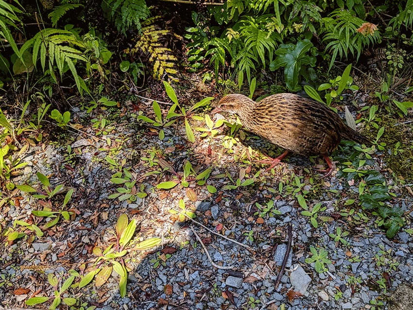
Instead we got a curious local flightless Weka bird come to check out our shoes, even poking it’s head into them when we took a break for lunch! Note; most birds don’t have a sense of smell!
We had driven up the road along Bullocks Creek which was totally obscured by vegetation. When we started on the trail we still couldn’t find the creek!
It turns out that the creek goes underground, leaving this sandy riverbed that is filled by flash floods when it rains heavily!
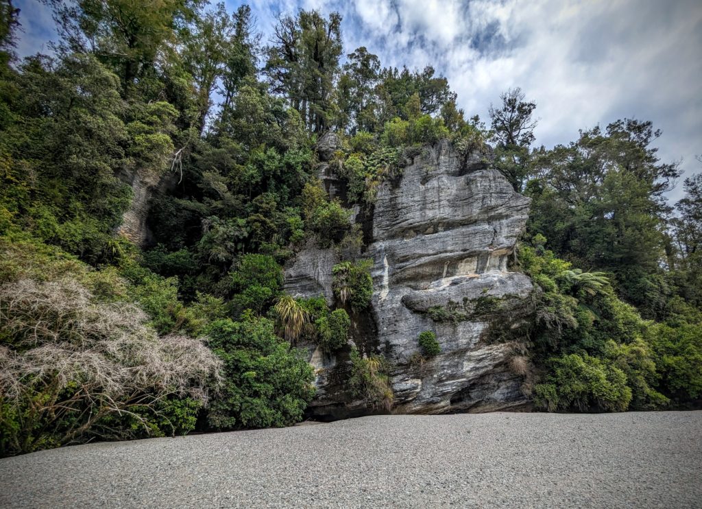
The ground underneath us is limestone, ancient seabed, that has been tunneled, caved and eroded by water over eons. Many signs along the trail warn you not to leave the track as there are sinkholes, caverns and thin crusts that can cave in! A side trail, the Cave Creek Memorial Track leads off 3/4 of a mile to a chasm where Cave Creek emerges from underground. We took the trail to the stairway that takes you to the bottom of the chasm. The creek is very low now at the height of summer!

The stairway is to the right behind Robert. The creek ’emergence’ is to the left.

upper photo;The ’emergence’ at the bottom of the chasm.
lower photo; A closer look
Cave Creek is the site of one of the worst tragedies in NZ history. In 1995 14 people from a school environmental study class died when a viewing platform at the top of the chasm gave way, crashing 100 feet down onto the rocks below. The ensuing investigation highlighted grave errors by the Department of Conservation on the design and construction of the platform and the gross underfunding of the Dept. that led to shortcuts and shoddy inspection and maintenance of structures throughout the Parks system. More information is HERE and a video describing the event and consequences is HERE. The track was renamed the Memorial Track after the tragedy and the platform was never rebuilt.
The second hike was 3.5 miles roundtrip, a total of 6.3 miles, so we deserved the beers back at home as we watched a fabulous sunset.
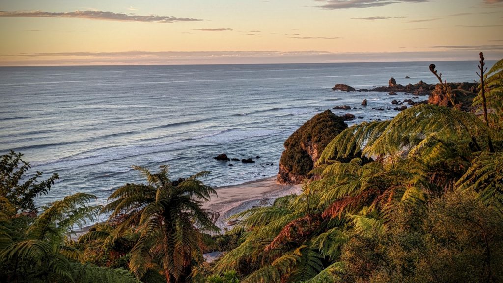
The sunset lighting up the haystack rock on the beach.
