April 21 Earth Day (Day 207)
Today we headed east and then south through almost the center of Tasmania towards Hobart. The whole south-west quarter of the island is inaccessible, by car anyway, consisting of the Franklin-Gordon Wild Rivers National Park, the Southwest Conservation Area and the Southwest National Park, with only one road penetrating between the three large land areas. Our first stop was at a beautiful waterfall accessed by a boardwalk through the rainforest.

Nelson Falls in the rainforest.
Continuing on, we rose up into grasslands and crossed the island divide!
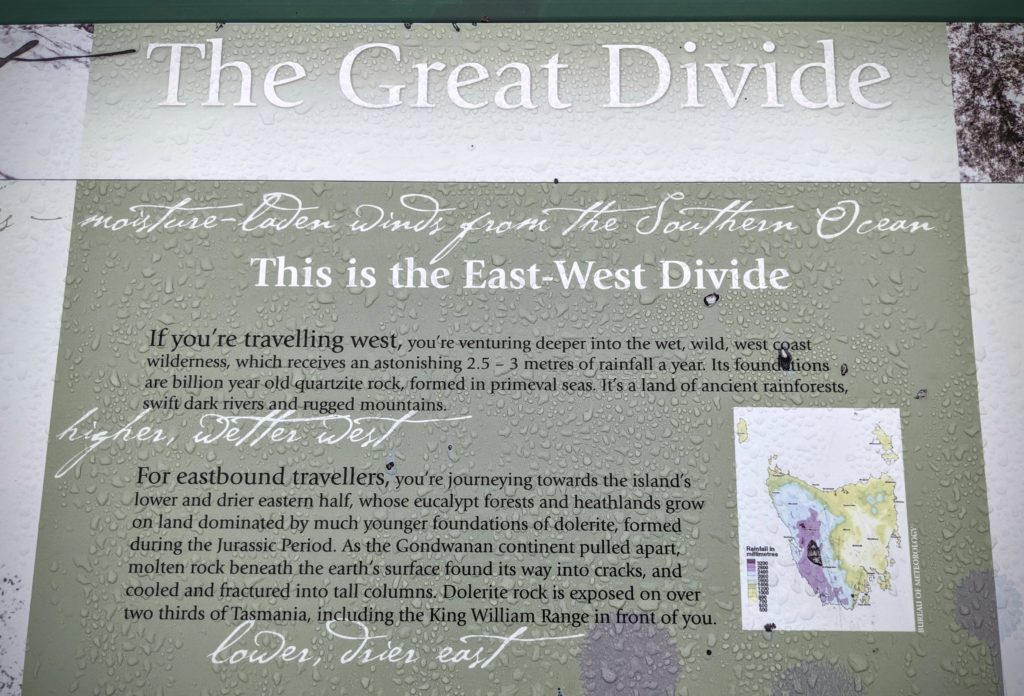
Not the ‘Continental Divide’, but the divide between the higher, wetter west, and the lower drier east of the island.

The tussock grassland, a little more wet today due to the low clouds and occasional sprinkle of rain.
And along the roadside, the distinct square poo of the wombat! We haven’t seen a live wombat yet, but here is proof!
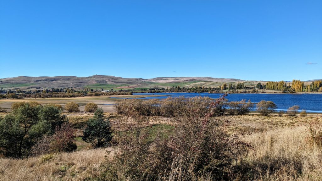
We continued down into the drier, lower east, past the town of Ouse and found our free campsite for the night at Bethune Park Camping Area on Meadowbank Lake.
We saw and heard our first big flock of sulpher crested cockatoos here, as well as a lone kookaburra that sat in a gum tree for quite awhile.
April 20 Queenstown (Day 206)
We had a beautiful morning, breakfast and packed up to move on.
We drove back through Zeehan and took the route south to Strahan (“Strahn” pronounced the ‘Irish way’ we were told).
We didn’t have much time to spend in Strahan, but it is known for the Gordon River cruise and fresh seafood, as well as the Guinness World Record for most water skiers towed behind a single boat! We continued on to Queenstown, another boom and bust mining town! A short visit to view a few outstanding sites.
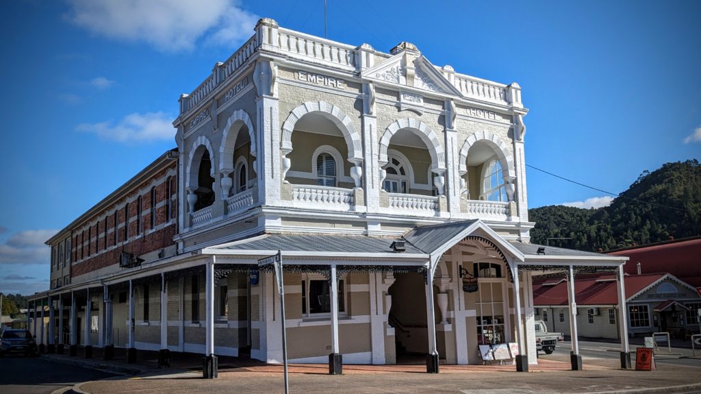
The Empire Hotel built in 1901, next to the railroad station that now houses the scenic West Coast Wilderness Railway.

A feeling of Colorado mountain mining town came to us walking down the main street!
As we drove out of town, we saw the trail to Horsetail Falls, and it looked very intriguing! The barren hills are due to logging and the sulfurous fumes of the copper smelters that killed vegetation throughout the valley.
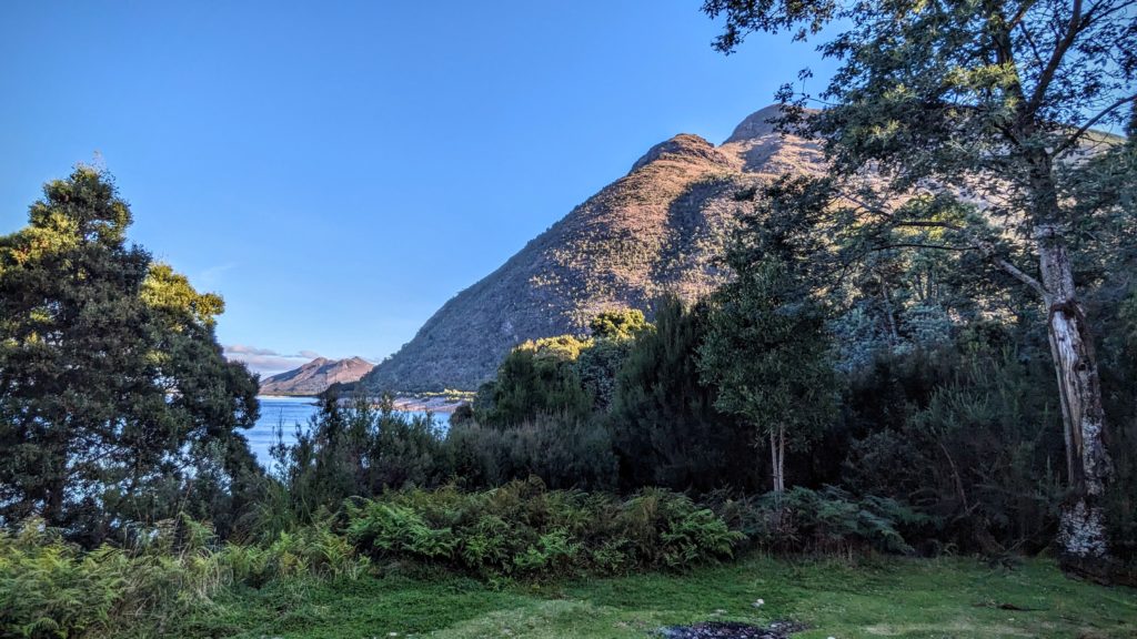
We found our nights spot at Linda Creek Campsite on the banks of Lake Burbury, a reservoir surrounded by hills.
April 19 Pieman River Cruise (Day 205)
We woke to a misty morning and enjoyed a continental breakfast at the restaurant, toasting our bread over a gas burner on an antique toast grill! Then we strolled outdoors and along the short Huon Pine walk into the rainforest. Huon Pine (not a true pine at all, but the only species in it’s own genus) is found only in the south and west rainforest of Tasmania and was nearly wiped out by logging in the mid 1800’s up to 1970. It is prized for it’s golden hue, fine grain and rot resistant oils. It was especially prized for boat building due to it’s rot resistance. “Extensive logging in the past has removed nearly all large trees, but there is regrowth nearly everywhere. One stand of the species has been made available for access to craft wood from dead and downed timber under a strict licensing system. It is illegal to cut living trees.” per Wikipedia. A great story about the magnificent trees is HERE!

The mist over the Pieman River. You can see a faint ‘fogbow’ above the trees on the right.
We had booked a 3 hour cruise on the Arcadia II on the Pieman River to Pieman Heads where the river empties into the Great Southern Ocean.  The only Huon Pine river cruiser operating in the world!

The mist was lifting and the sun was shining as we 19 passengers boarded and we set off down stream at 10 am.
The trees of the rainforest crowded down to the river and were reflected in it’s dark tannin rich waters.
The skipper Norm pointed out features; tributary inlets where miners worked the river bed for gold, huon pine trees that were too gnarled for the mill and were spared the axe and saw, young huon pines beginning their long and slow growth along the bank, while his wife Lorainne served us coffee or tea and a plate of cakes and fruit.

The golden huon pine was evident everywhere. The boat was built as a pleasure craft in 1939.
We reached the dock at Pieman Heads, a tiny community of shacks that have been there since the early 1830’s, self sufficient, now with solar panels and rugged 4WD vehicles. There is a track along the beach and through the forest, but the easiest mode of transport is by river. We disembarked with a bag lunch and had 1.5 hours to meander, explore and eat our lunch before boarding for the return journey.

A boot tree at Pieman Heads.
We walked along the river bank to the windy sandy beach at the river entrance. The bar at Pieman Heads was difficult to navigate in the sailing ships and steamers of the 1800’s and boats would be moored in the river, or tacking outside, maybe for days, before conditions were suitable to cross. The huon pine logged and bucked in the forest with hand saws and axes were rafted down the river then loaded onto ships for the cross then shipped around the bottom of the island to Hobart for milling. The beach was littered with old logs, some we could even see on the tops of the rocky outcrops extending out to sea, attesting to the storms that must batter this coast!

Binoculars revealed logs up on the rocks and the color difference between the dark tannin rich river water and the blue seawater meeting in the rough waves.
We reboarded our boat minus 2 passengers who were waiting for friends to pick them up for a visit across the river. What a fantastic remote place to visit friends!

I don’t think this dingy would hold all 17 of us and the skipper and crew in case of emergency!
It was a wonderful cruise! We had to continue on our way, taking the one vehicle barge-ferry across the river to the road to Zeehan, another mining town, which usurped Corinna’s crown, and population, when a railroad was completed from there to the north coast in 1900.
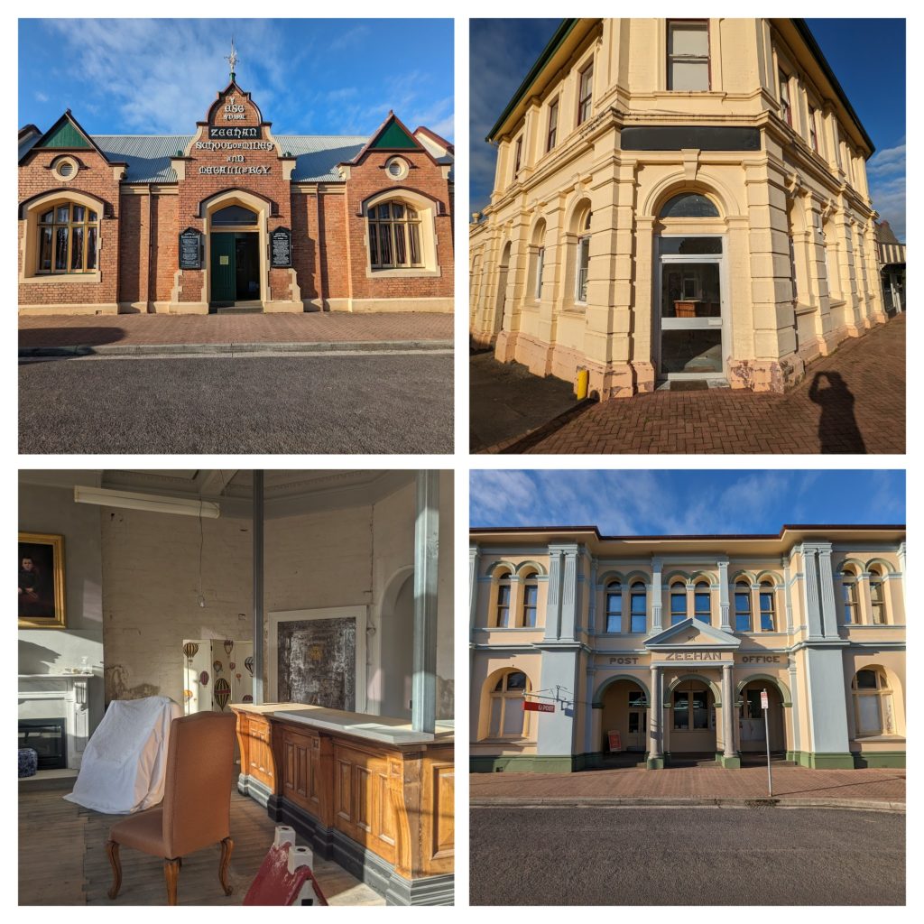
Views of the wonderful buildings from the early 1900’s and the importance of mining in the area.
We took a side road from Zeehan to a free campsite on the coast at Trial Harbour, a tiny community that in the past was a bustling port serving Zeehan. We had a fantastic, rugged site overlooking the rocky coast at sunset!

The waves rocked us to sleep!
April 18 Drive to Corinna (Day 204)
This morning we took a walk around town in a cool breeze under cloudy skies. We were glad we had ‘cracked the nut’ yesterday, it was a much nicer, sunny day! On the other side of town we walked out onto the Penguin viewing platform at the edge of Godfrey’s Beach and read the information about the cute little blue penguins that nest here. They are the same species that nest on the shores of New Zealand as well. Last night as we walked back to the camper along the rocky shore after our restaurant dinner we saw about 8 of the little penguins among the rocks or in the grass nearby, preening their feathers and getting ready for a nice snooze in their burrows among the rocks.
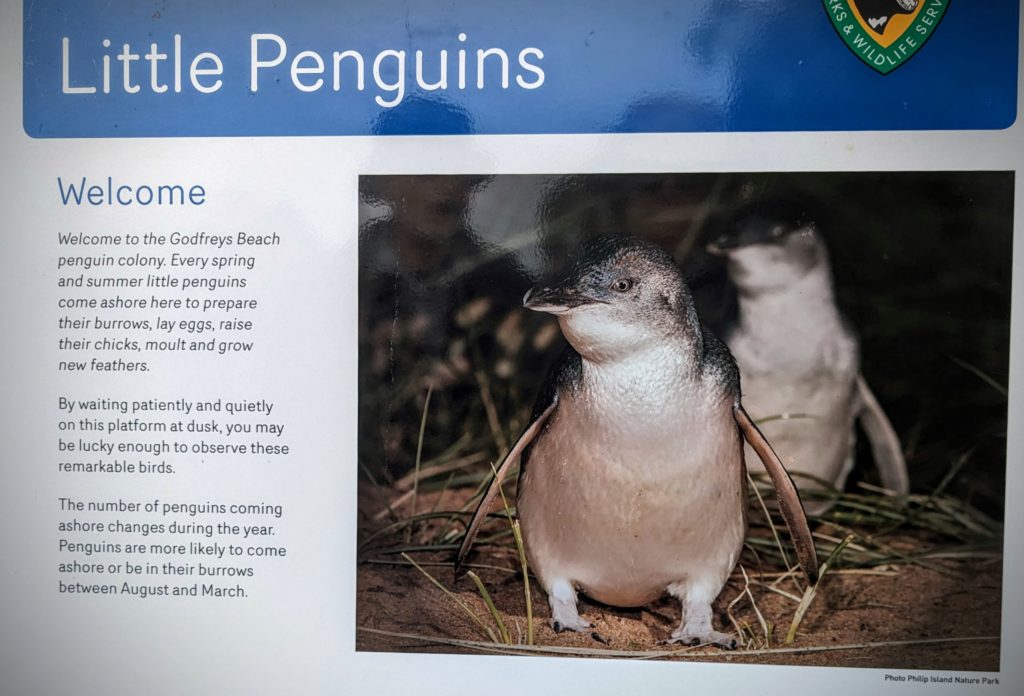
None of our nighttime pictures came out very good, so this is a good substitute! These penguins are the smallest penguin species and so darned cute!
After our walk, that ended with rain beginning to fall, we packed up the camper and headed out for the little town of Corinna in the “wild west” of Tasmania. We decided not to take the ‘dry weather only’ gravel road since it was raining, but opted for the ‘sealed’ roads winding through farmland to the tiny iron-ore mining village of Savage River. The road then became gravel for the last 20km, with a white, slick looking well-packed surface twisting and turning over high tussock grass plateaus then descending into dark, thick rainforest!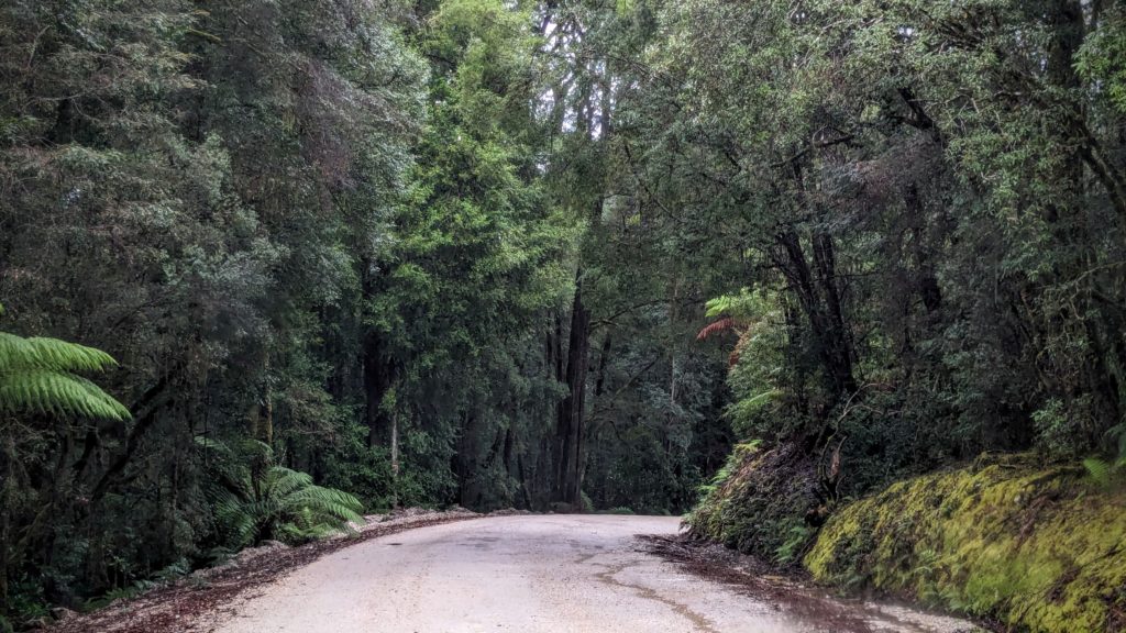 We finally arrived at Corinna, a tiny outpost that if not for the Eco-Village ‘resort’ would be a ghost town! Corinna was founded during a late 1800’s gold rush in the area and boasted 2500 residents in it’s heyday in the 1890’s. The resort makes use of the old hotel and several miner’s cabins as restaurant and lodgings, along with a basic campground with raised platforms for tents to try and stay dry above the wet rainforest floor.
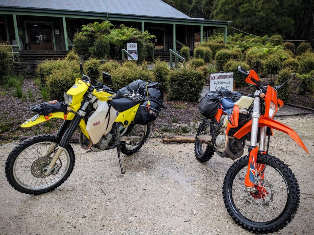
A couple of motorcycles parked in front of The Tarkine Hotel Eco-Village stirred memories of our motorcycle riding days!
We had booked a night at the campground and set up, then headed to the Ahrberg Bar for happy hour, where the woodstove was warming up the place!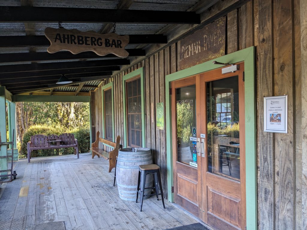
April 17 We Cracked The Nut (Day 203)
Today is a perfect day to explore “The Nut” so we traveled west to the small town of Stanley which is nestled at the base of the ancient volcanic core.

The Nut and the small town of Stanley looking south from the historic site of Highfield across Godfreys Beach.

The view south from the flank of the Nut.
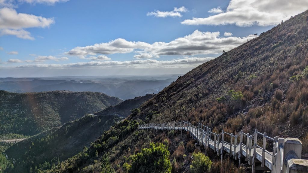
We chose to forego the chairlift and hike the steep trail switchbacks to the top of the butte! The views were fantastic!
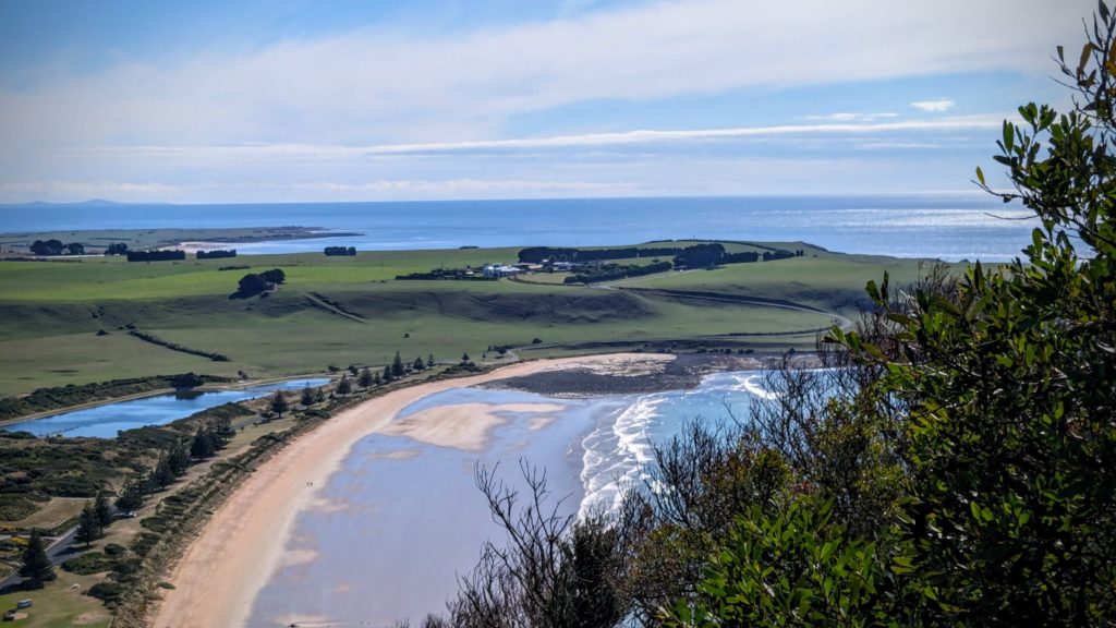
The view north back towards Highfield across Godfreys Beach.
The hike up to the top and around the “Circular Head”, as it was named in the early 1820’s, was in the open grasslands. As we rounded the south section of the loop trail we entered a forest that is regenerating. The top of the Nut was cultivated with potatoes after the native eucalyptus forest was cut and rolled off the top to be used as firewood in colonial times. Native bush is being restored and native wildlife is returning!

A picture and information about the pademelon that is returning to the forested areas!
We finished the 4 mile hike back down the steep trail and drove over to the local “caravan park” to check in.

We got a site right at the rocky beach under the Nut!
We walked along the rocky shoreline the short distance to a seafood restaurant for dinner and returned after dark to spot a few tiny penguins settling into their burrows among the rocks for the night! We didn’t disturb them so we couldn’t get good pictures, but this is a great place for spotting the ‘fairy penguin’, the only penguins that visits Tasmania and breeds here! It is the same species that is found in New Zealand and is known as the little blue penguin there.
