Nov 21 Enchanted Track
A forecast for a beautiful day prompted us to head up to the mountain. We intended to again hike across the Manganui Gorge Bridge but decided to explore the trails a little further down the mountain starting from the Stratford Mountain House, a resort owned and run by the Ngāti Ruanui iwi (tribe), traditional land ‘owners’ of this region. We decided to try the ‘Enchanted Track’ trail, and it was enchanting!
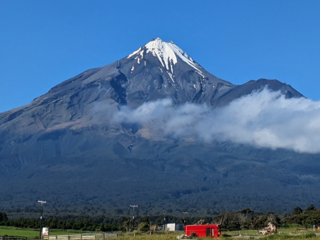
The mountain was almost completely clear today!
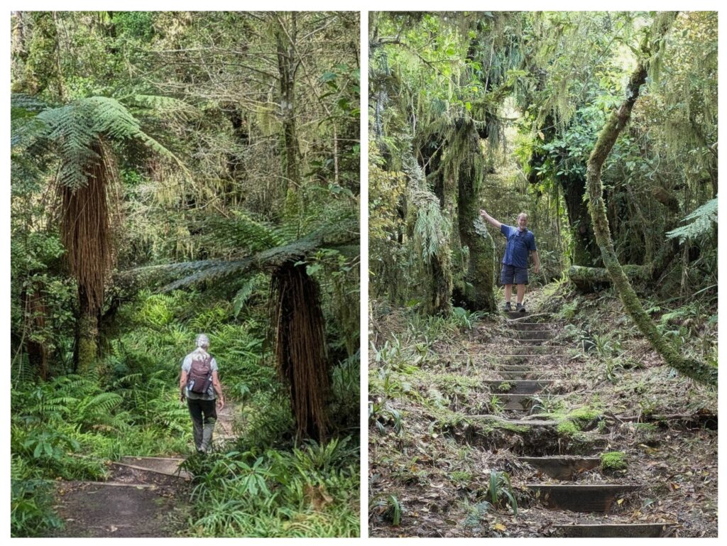
The track went up and down over ridges as we rounded the mountain, through a rain forest atmosphere, full of ferns and mosses overhead and underfoot!
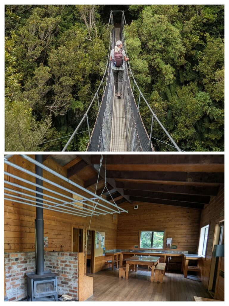
We crossed a swinging bridge over the Waingongoro river and took a detour to the Waingongoro hut, a refuge for trekkers complete with woodstove and a drying rack suspended above it, table, benches, sink with running water from tanks of collected rain water, and 2 separate bunkrooms with ample bunks. ‘Long-drop toilet’ out back!
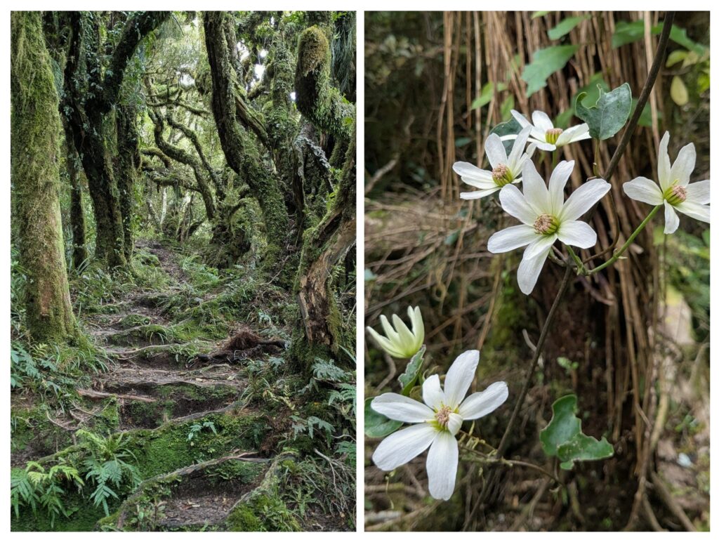
The ‘goblin forest’ of stunted, gnarly trees provides ready made steps of tree roots in steep spots.
As we hiked along I spotted the petals of white flowers littering the path, some were tiny, others about an inch long. Finally we saw the beautiful fragrant large flowers along the path. It is a native New Zealand clematis vine known as ‘puawānanga’ (“flower of the skies”). Usually the vine flowers way up in the canopy, hence the petals on the path, but no flowers around!
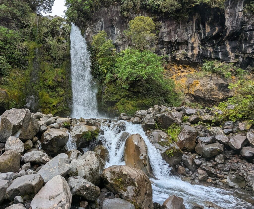
Finally after our 4 hour trek out and back, we ended up driving to Dawson Falls!
Nov 20, 2025 Around Town
We explored various venues around town the last few days.
The Museum: ‘Puke Ariki’ (The Hill of the Chief) is a museum standing on what was a great Pā site (fortified Māori village). It displays several permanent exhibits from natural history and colonial history to a trove of Māori Taonga (a Māori term that means a treasured possession, which can include both tangible items like artifacts and intangible concepts such as language and cultural practices. It represents significant cultural, spiritual, and historical value within Māori culture).
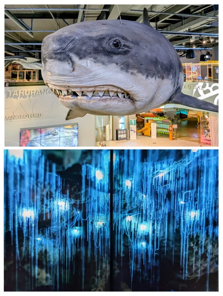
A colossal shark hanging from the ceiling, and photos of a glow-worm cave (which we haven’t visited). Out of cultural respect we are requested not to photograph the Maori taonga, most of which were retrieved from swamps in the area when they were drained for agriculture.
The Bridge: On the coastal walk outside of New Plymouth a new bridge “Te Rewa Rewa” crosses a river. According to its designer it should “evoke a sense of wind as a metaphor for the enduring spirit of the dead buried around the Rewa Rewa Pā site at the north end of the bridge.
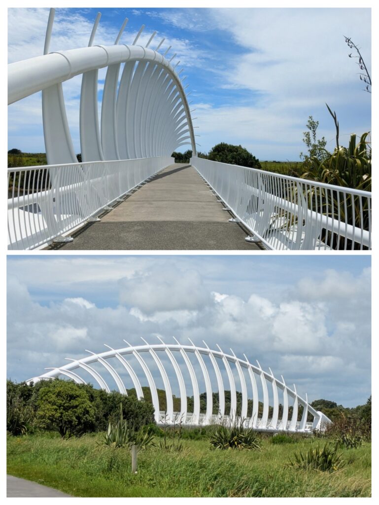
Many think it looks like a whale skeleton.
The Park: Back at Pukepura Park, we took another trail and found an ancient puripuri tree estimated to be 2,000 years old! It is hollow at the base, but still alive!
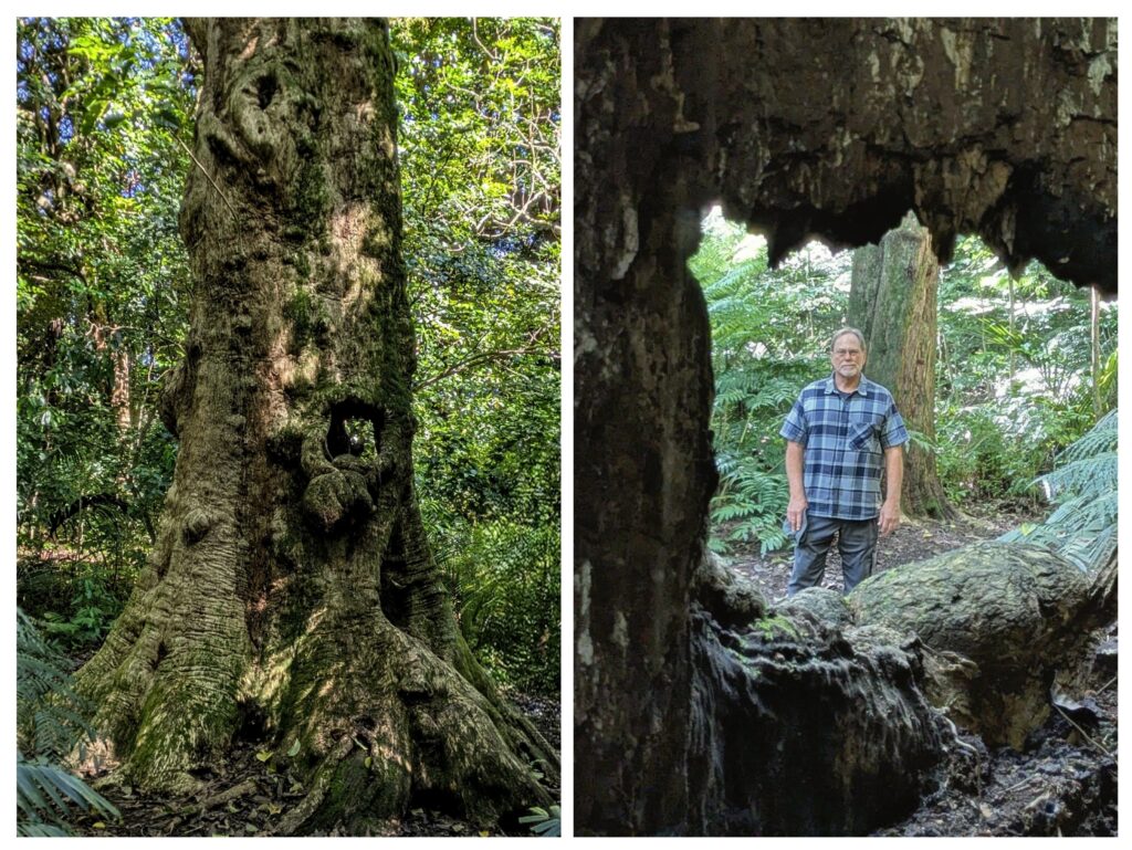
The left picture is the trunk, with a hole visible on the right side. From the back of the tree you can look through the interior of the trunk!
Nov 18, 2025 Pukekura Park
The ‘Jewel of New Plymouth’ is Pukekura Park, a botanic garden developed since 1876 from a ‘wasteland’, ‘a fern, furze (gorse) and tutu filled gully’. Note here that ‘tutu’ is a very poisonous plant, although the Māori had enough experience with it to use medicinally and to make a drink from the carefully strained juice from the berries (the flesh of the berry is edible, but the seeds are poisonous!). We entered the shady, lush ‘gully’ and marveled at the beauty of the place! Forests planted with native and introduced trees shaded the gravel walkways alongside streams and lakes. We parked at the entrance nearest the ‘fernery’, a tropical greenhouse filled with colorful blooms!

It was so fragrant and lush inside!
We then meandered some of the paths, after stopping at the ‘teahouse’ for ice cream cones! The azaleas in the lower right of the picture above are blooming in the ‘Azalea Dell’ at the far end of the long lake.
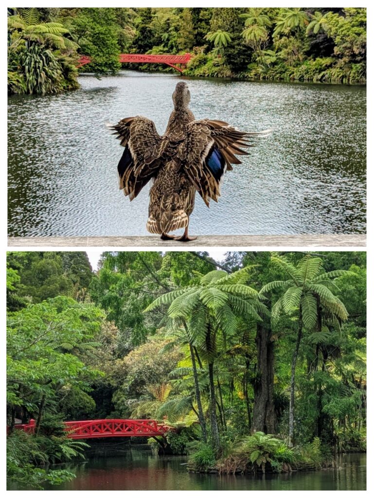
The duck was preening on the railing outside the teahouse. The Poet’s Bridge is in the distance.
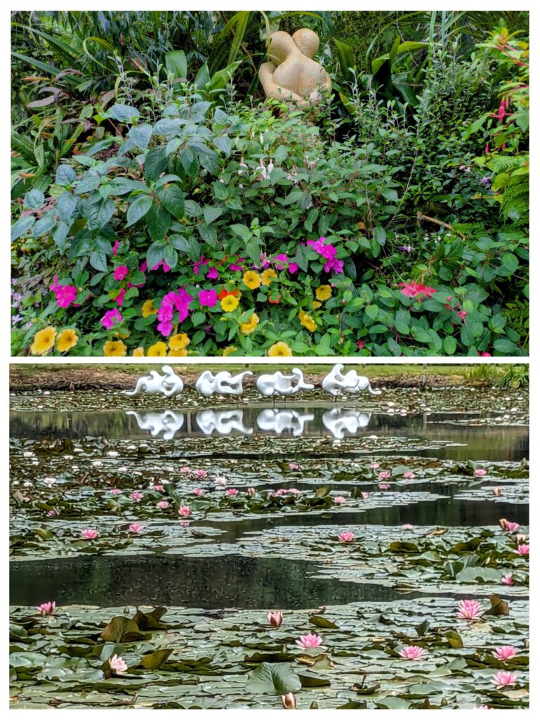
The upper picture is in the ‘fernery’, the statue is so touching! The lower picture is on a smaller lake and the sculpture “Aotearoa” (long white cloud) is reflected among the lily pads.
Added to the park in 1934 was a private estate known as Brooklands Park and includes a small zoo with mostly non-native and farmyard animals.
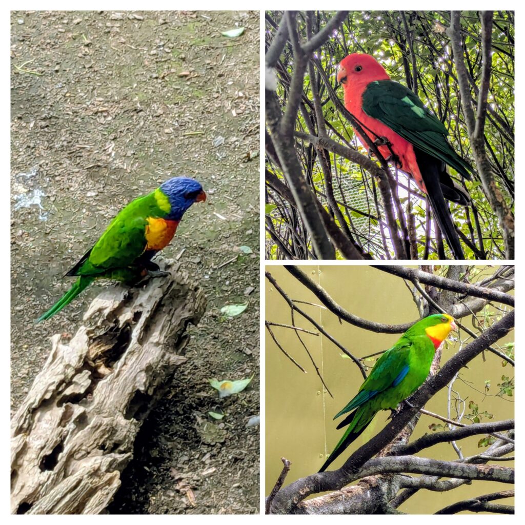
The Australian parrots and lorikeets are as colorful as the flowers in the park!
Nov 17, 2025 Part 2 …Douglas to Whangamomona
We enjoyed our short hike across the Manganui Gorge swing bridge and walk to the ski field, but we had another goal to reach, so we drove down off the mountain and headed east. The town of Stratford is the western terminus of the Stratford-Okahukura Rail line (from the Nov 9 post) and is at the base of the eastern flank of Mt. Taranaki. We decided to drive the Forgotten World Highway from Stratford to Whangamomona, the town where we started our golf-cart rail-trail Forgotten World Adventure. The road travels across the eastern volcanic plain to the town of Douglas where we had to stop!
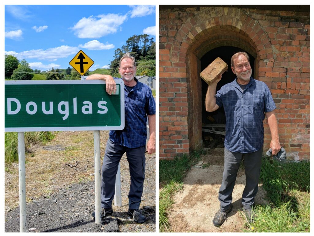
Besides the dairy farms in the area Douglas was known for it’s Brick Works, a brick and tile making factory that was built in 1900 and finally closed in 1981. Most of the bricks that were used to build the towns and some of the infrastructure of the railroad were manufactured here from the local clay.
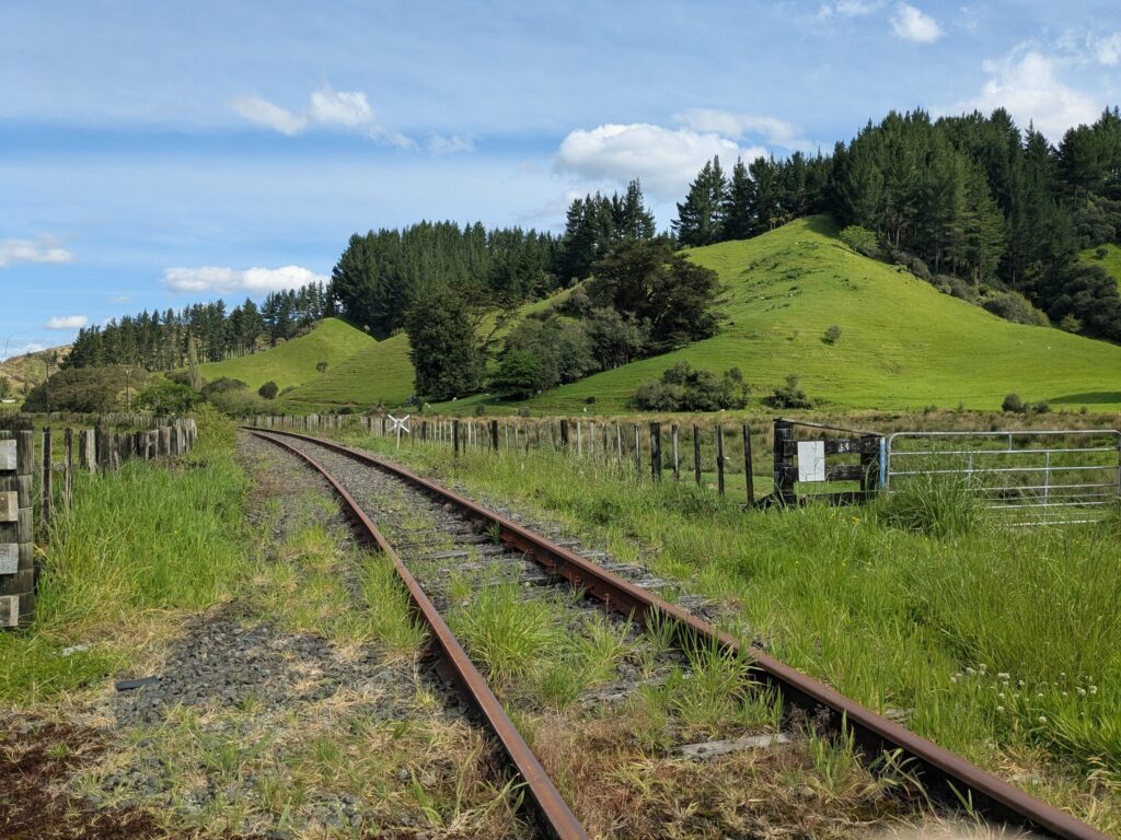
The railroad was just across the road from the Brick Works.
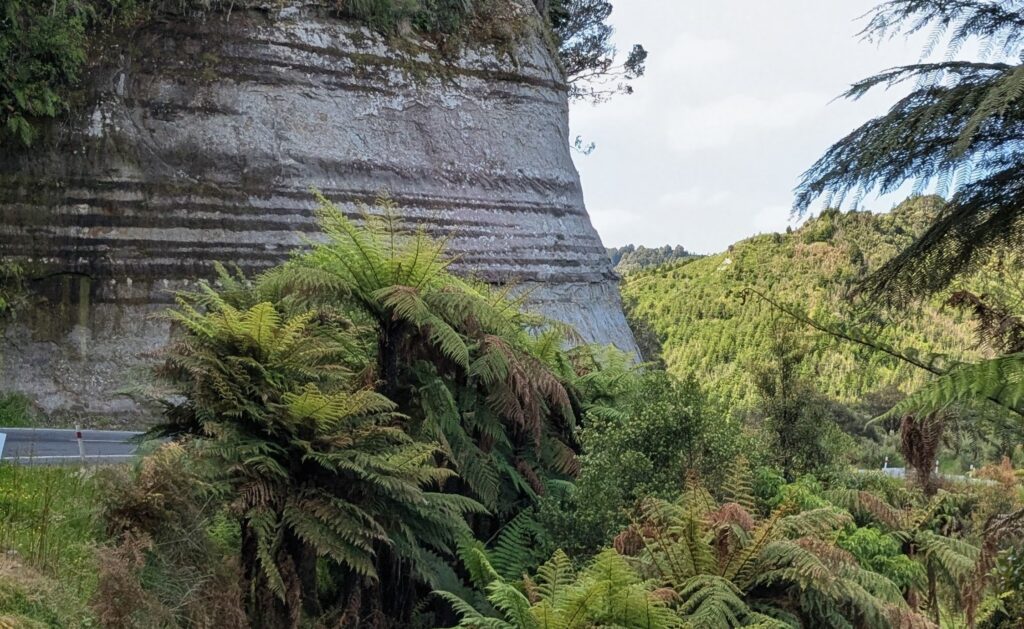 The Forgotten World Highway was originally pack trails in the late 1800’s to early 1900’s. The Railroad construction from 1900 to 1936 brought more settlers, but the Depression of the 1930’s wiped many farmers out and they abandoned their homesteads. After traversing the eastern volcanic plain the Highway becomes extremely winding, going over 3 major saddles of mountains made up of ‘Papa rock’, a soft, blue-grey mudstone or muddy sandstone that was and still is a road planners worst nightmare! It is layered as in this bluff, when wet it is slippery and sometimes the layers of mudstone catch water between them and sheets or slabs slide off from time to time. When dry it can flake off in big slabs as well. We finally made it to our destination and enjoyed sandwiches and coffee at the Whangamomona Hotel.
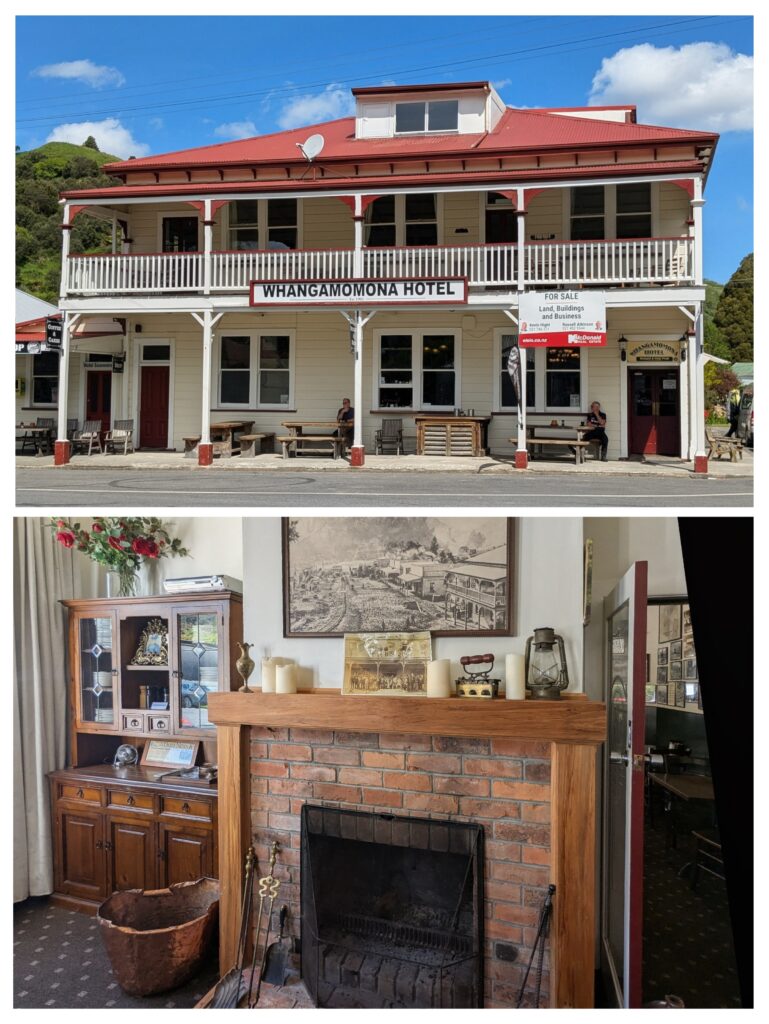
It was a beautiful day for a drive and the Hotel was a welcome rest stop!
Nov 17, 2025 Mt. Taranacki to…
These satellite images show where we are on the North Island. The right image is the North Island, the red square on the upper area is Auckland, the pink outline on the lower left is the Taranaki region. The image on the left is a closeup of Taranaki, the pink dot is approximately where we’re staying. The colors are accurate. The dark circle is Te Papa-Kura-o-Taranaki, formerly known as Egmont National Park, established in 1900. It is covered with native forest surrounding the almost symmetrical cone of 8,261 ft. high Mt. Taranaki. The surrounding volcanic plains have been developed into mostly dairy farms. In January, 2025 Mt. Taranaki became the only mountain in the world granted legal personhood, affording it the same rights, powers, duties and responsibilities as a person under the law, joining the Whanganui River as the only river granted personhood. Imagine 85% of the North Island was covered in forest before Europeans arrived! Since today was forecast to be partly cloudy we decided to take a road trip. We headed up toward the mountain.
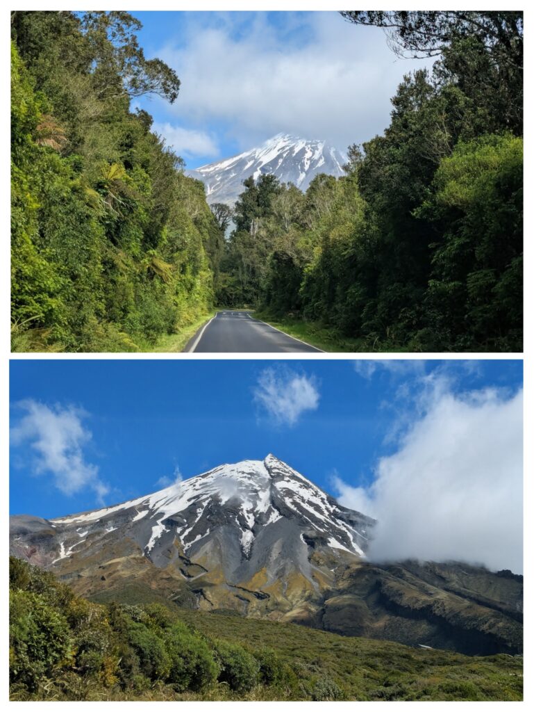
The mountain top faded in and out of the clouds as we drove up the southern flank. At one point the clouds retreated enough that we had a clear view of the peak.
From the gravel parking lot at the end of the road we walked the half mile up to the Manganui Gorge bridge, constructed just a year and a half ago.
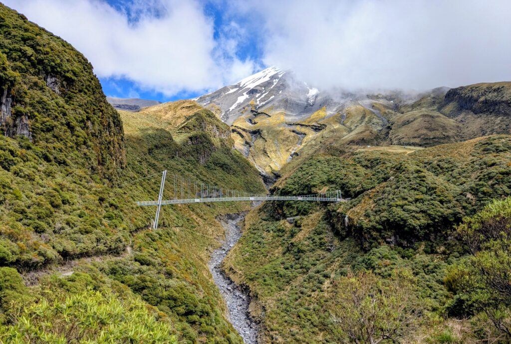
An impressive swing bridge built to make the passage over the Manganui Gorge more safe. Especially since the trail leads to the only ski area on the mountain!
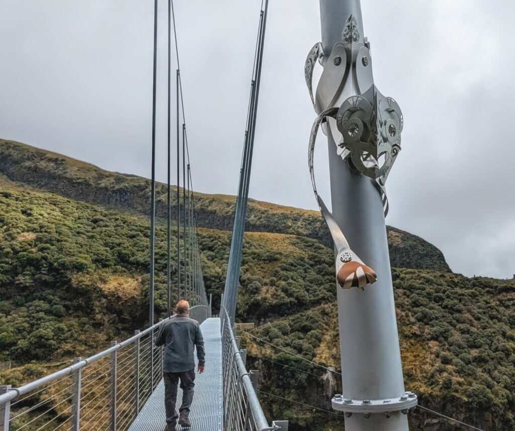
The bridge is guarded by Rakahore, the personification of rock. He is one of the protectors of Mother Earth (Papa) against the attacks of Ocean Maid (Hine-moana). He holds a touchstone that visitors can touch to connect the past with the future.
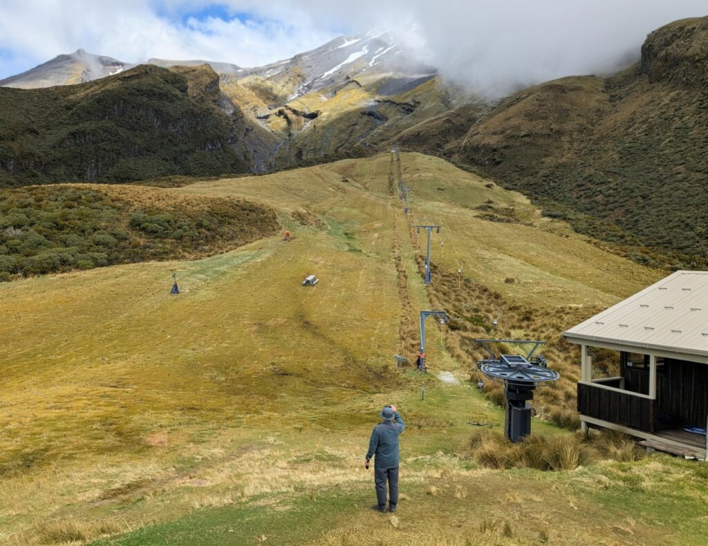
The Manganui Ski slope, 3 tow lifts after a 30 minute hike from the parking area. At least there is a ‘flying fox’, a basket strung across the gorge on cables, to transport your gear to the small ski lodge / mountain hut.
