Nov 16, 2025 Three Sisters
We’re moving on from the rural farmhouse but doing some sightseeing on the way. We stopped at a viewpoint to see the Three Sisters and Elephant Rock across the outlet of the Tongaporutu River.
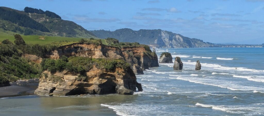
Elephant Rock is in the foreground, no longer looking so much like an elephant. The 3 Sisters are the rock spires in the surf.
The sea stacks are being eroded over the years even as new ones are formed from erosion of the cliffs. At the turn of the century there were 4 Sisters, now only 2 are counted (the smaller of the 3 in the picture above). The Sisters can be approached via a walk along the south bank of the river as it flows to the sea at low tide only. We were going to attempt that walk until we saw hikers returning covered in mud, barefoot, carrying their muddy shoes and attempting to wash the sticky mud off in pools of water along the beach! Also, the tide was coming in! I grabbed a photo off the internet from several years ago of Elephant Rock before erosion caused the loss of the ‘head and trunk’ section of the rock.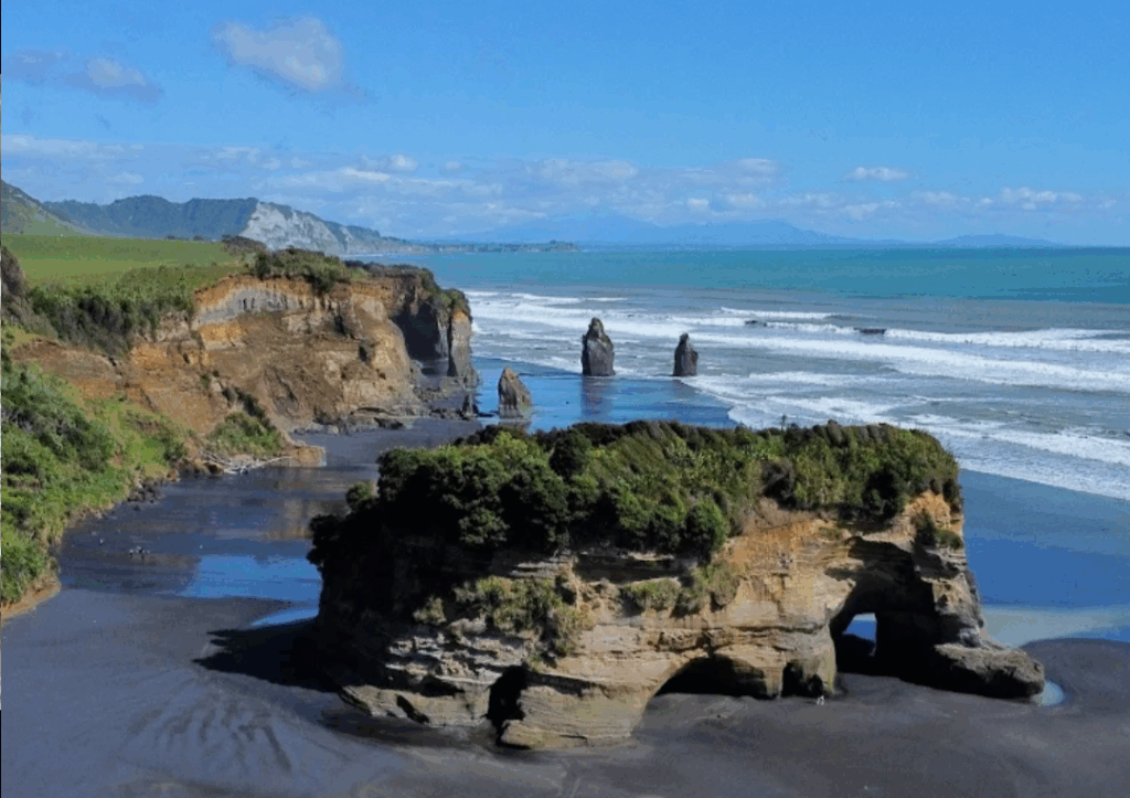
We arrived at our next B&B in the town of New Plymouth in the Taranaki Region of the North Island, with Mt. Taranaki overlooking the whole area!
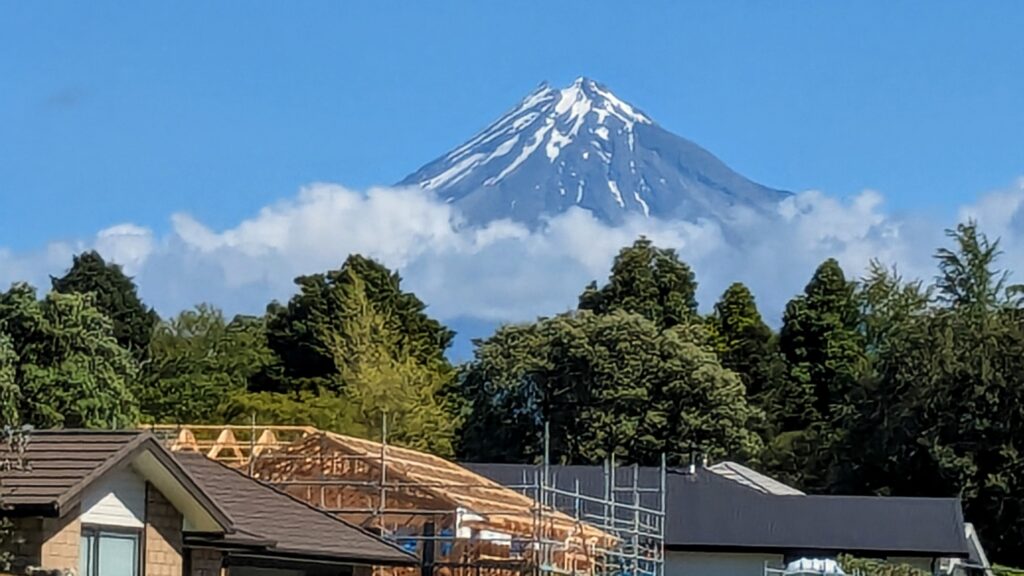
From the front door of the B&B on a good day, Mt. Taranaki can be seen above the neighborhood!
Nov 14, 2025 We left the Property!
Our first outing by car from the property! We went out to celebrate Robert’s birthday at a local pub, a 20 minute drive down a narrow gravel road, hoping we wouldn’t encounter an empty log truck coming up the road! A nearby property is being clear cut and the road is heavily traveled by log trucks and local loggers in their ‘utes’ (the term here for any utility vehicle).
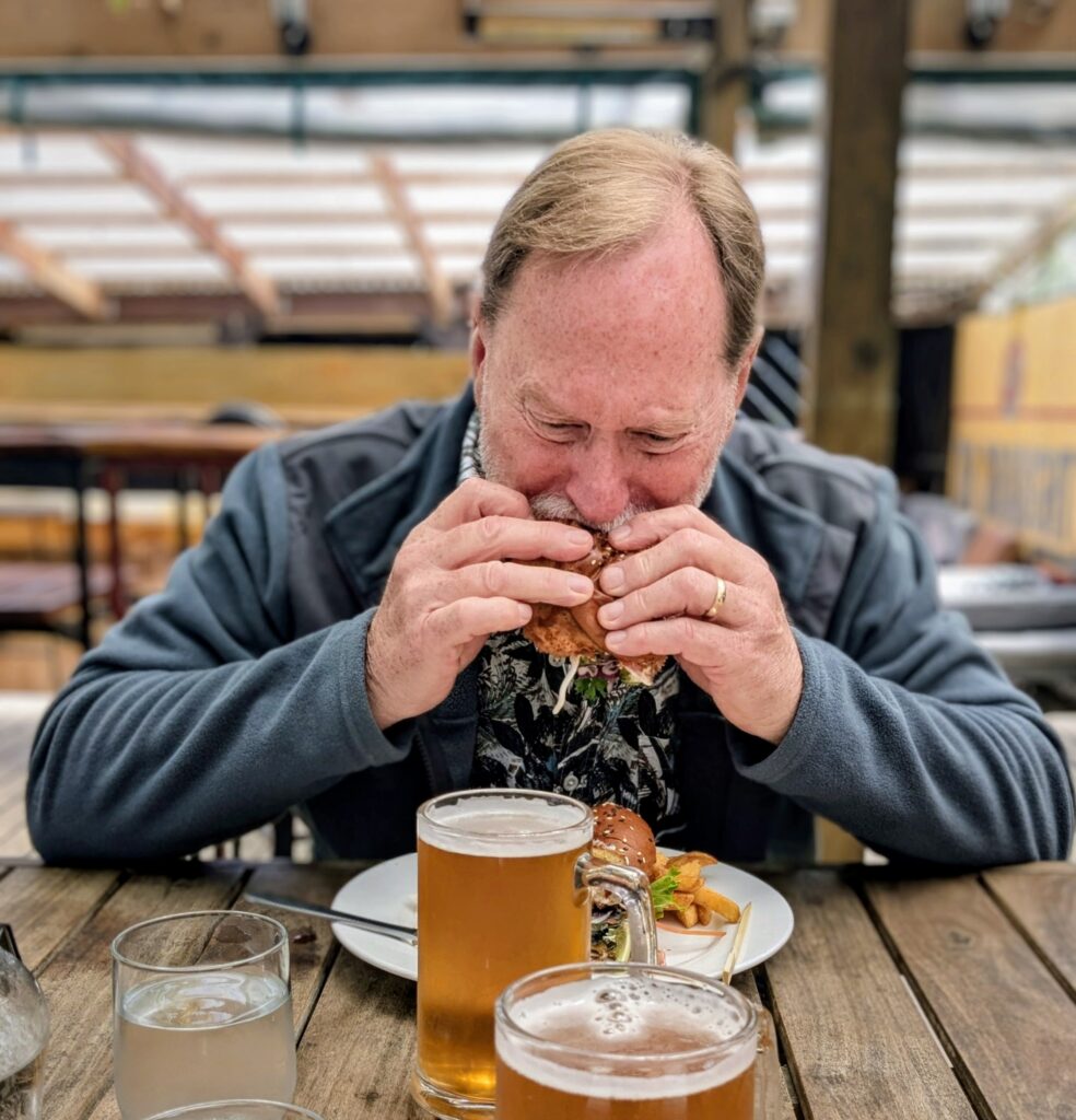
We made it safely down the road and enjoyed a wonderful pub meal of burgers and chips with a beer!
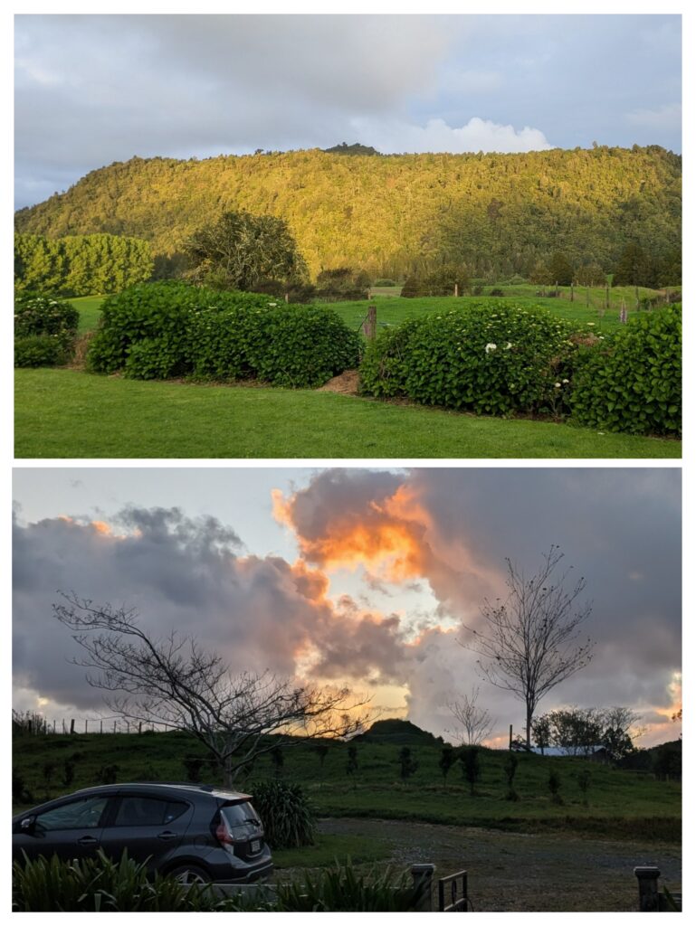
After arriving safely up the gravel road we enjoyed a partly sunny afternoon on the back deck watching the sun illuminate the forested bluff. We had a somewhat colorful sunset to the west at the front of the house!
Nov 12, 2025 Farm Scenes
We’ve had stormy, rainy, windy weather since we got here. We are happy to lounge in the house, enjoying sleeping, eating, snacking, napping, eating again, watching TV, reading and canoodling. We did take a short walk during a break in the weather to stretch our legs.
A view of the homestead as we departed for our walk with the native forest covered hill in the background.
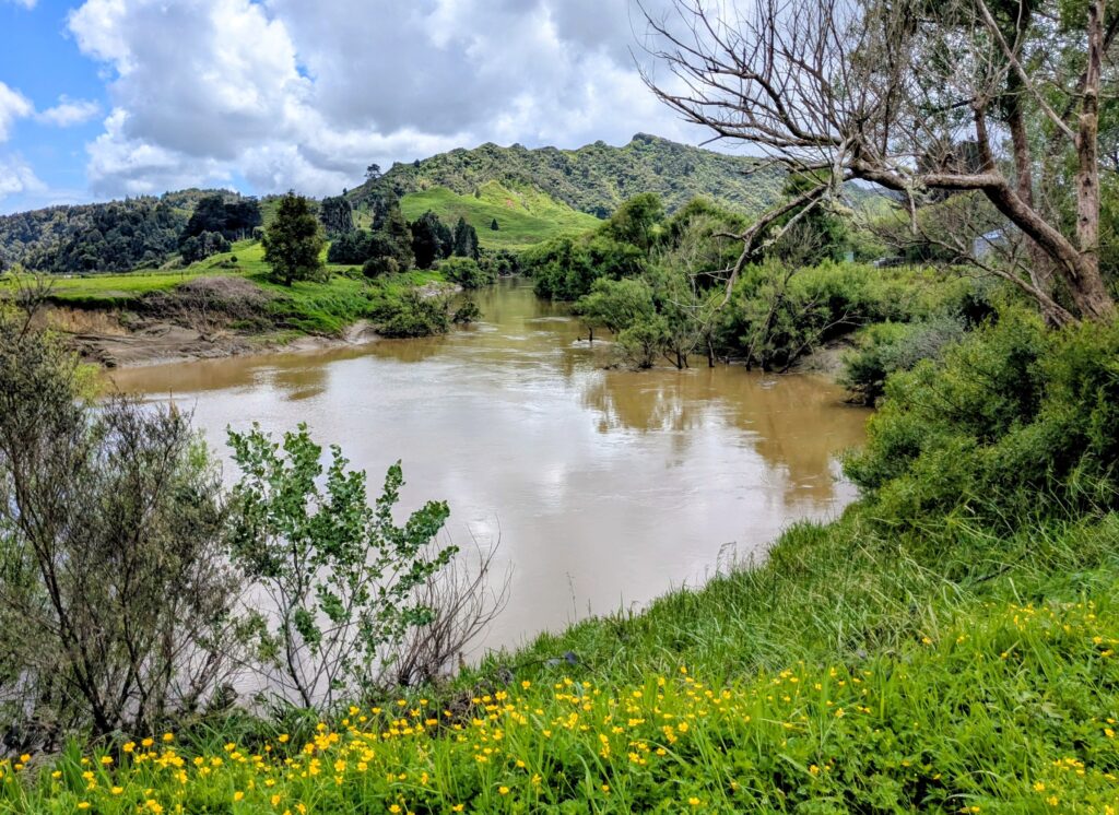
We walked over a hill and down the gravel road to see the muddy Mokau River flowing by on its path to the Tasman Sea.

The close-by hills are heavily grazed by mostly dairy cattle and some sheep. The distant hills are covered in dark native bush.

We enjoy watching the dairy cows parade past the back of the house on their several-times daily trek to and from milking or moving from paddock to paddock.
Nov 10, 2025 Te Kuiti to Awakino
Moving day today. We’re heading west but we have to go north first! The next big town north is Te Kuiti where we resupplied at the larger grocery store and the department store. We also took a nice walk around town and had lunch at a café in the old train station.
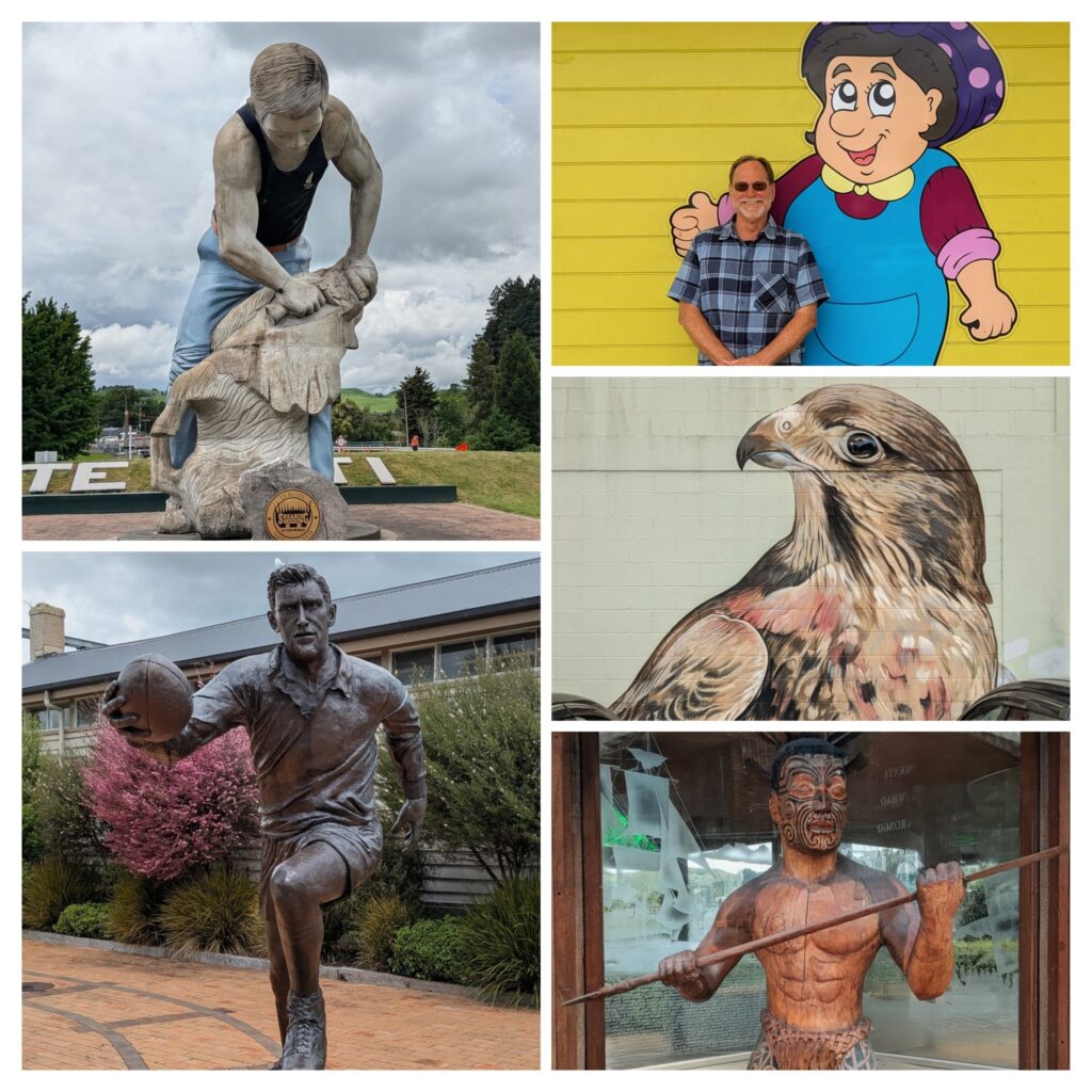
There are lots of ‘larger than life’ sites in Te Kuiti! A huge statue of a sheep-shearer, a statue of a famous rugby player, a mural of ‘Auntie’ at Aunties Laundromat, a mural of the native NZ falcon, and a statue of a Maori warrior!
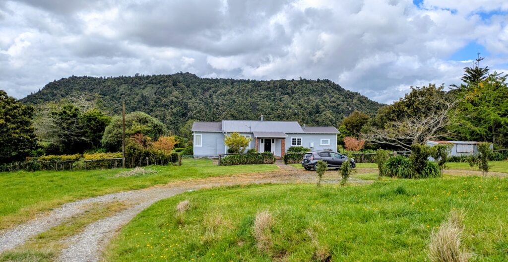
We continued on our way to our next B&B, a large farmhouse in rural Awakino, about 9 miles to the ocean beaches on the ‘wild west coast’ of the North Island.
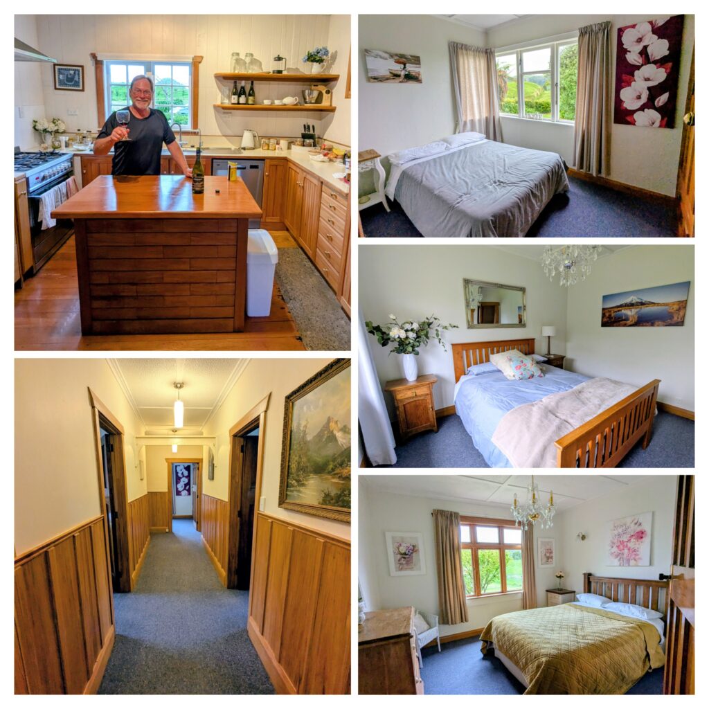
A beautiful old farmhouse with 3 bedrooms to choose from, old-growth knot-free wood paneling, doors and window sashes, wood cabinetry in a modern kitchen with a 5 burner gas stove, and 360 degree views of surrounding hillsides cloaked in native bush!
Nov 9, 2025 Forgotten World Adventure
Our adventure started early in the morning, 6am to get breakfast in town. At 7am we boarded a small bus for a 2 hour ride along the “Forgotten World Highway” a 2 lane winding road through farmland and a beautiful gorge that has never been logged, with dense forest rising up high cliffs on either side. The road was just recently paved! Our destination was the Republic of Whangomomona, a semi-ghost town halfway along the Stratford-Okahukura rail line, a spur off the main trunk line that goes through Taumarunui. We are going to ride that spur rail line almost all the way back to Taumarunui, in a golf cart! This line was discontinued of passenger train traffic in 1983 due to lack of riders, then discontinued of freight traffic in 2009 after sporadic use and derailments due to deferred maintenance and lack of investment.
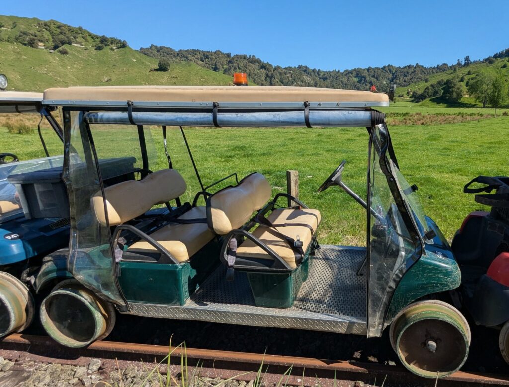
Our chariot awaits! With wheels modified to run on railroad tracks.
We boarded our golf cart in the string of 13 carts after the safety instructions and headed down the track!
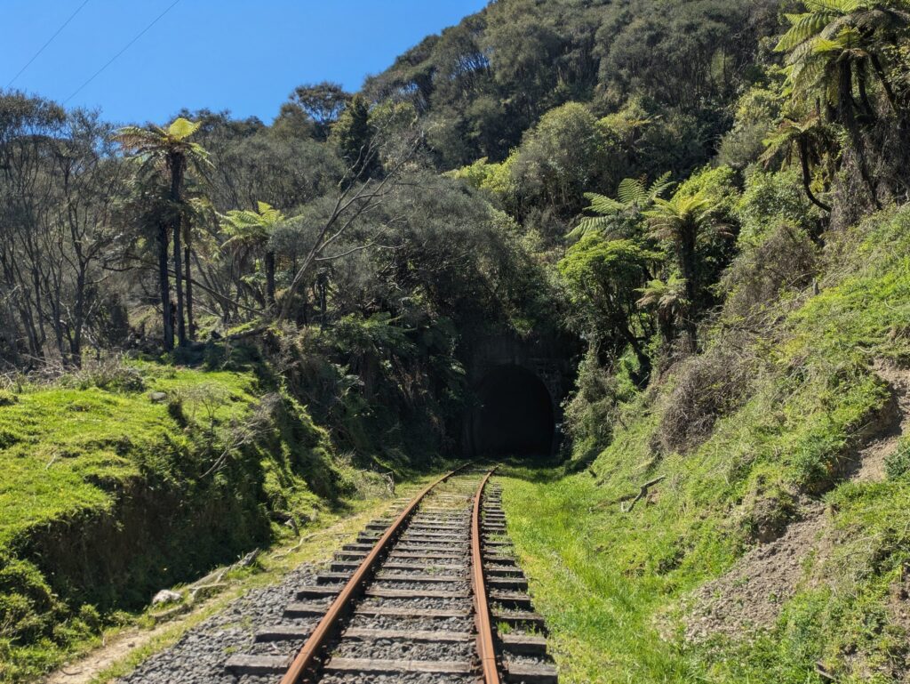
Heading into one of the 21 tunnels we traversed on this half section of the track.
We had scheduled stops where our guides gave us information about the rail line and the history of the area. The rail line was started in 1901 and completed in 1932 at considerable cost and back breaking labor, 91 bridges built and 24 tunnels dug by pick ax and shovel. Unfortunately the expected boom in coal mining, logging and agriculture was never fully realized. Life along the track flourished briefly, timber was logged and sheep and cattle farms were established, but the area was still isolated and the expected infrastructure of mills, mines, creameries and support services never materialized.
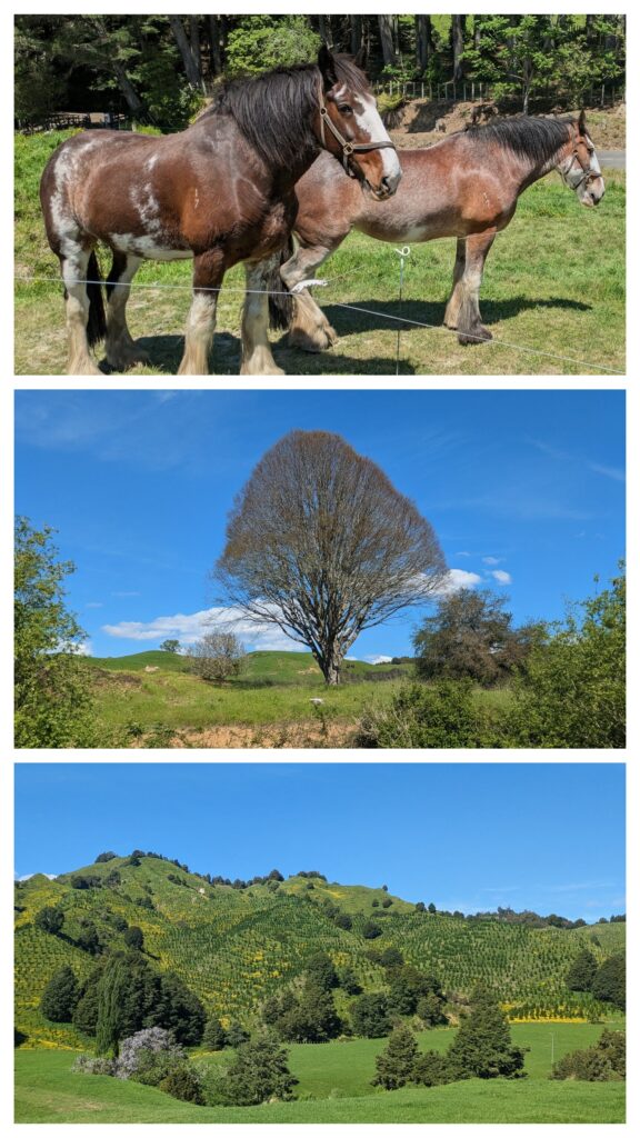
Scenes along the track. Some farms have been amalgamated into larger ‘stations’ that are managed from afar. Some hillsides have been replanted with Monterey pine (yes the California species) to continue the logging industry.
When the line was completed the first boom went bust when the considerable influx of railroad workers moved on. The towns that had been established for their accommodation during the 32 years of construction slowly emptied. The logging boom lasted until the last accessible logs were harvested and frequent floods in the flood prone fields frustrated the struggling farmers. Thus the ‘Forgotten World’ emptied of residents and the logged hills began to revert to wild bush.
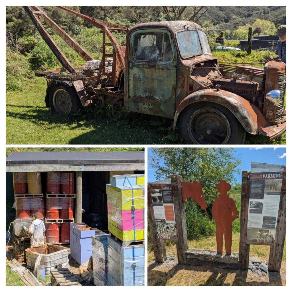
Some of the history explained at the stops, along with food and drink! We had morning tea with cake, a lunch stop and afternoon tea with cookies! Behind the tracks at Tangarakau a worker was busy steam cleaning bee hives.
With the rewilding of the hillsides with manuka bush the ghost town of Tangarakau, which had been a hub of 1200 people in the 1920’s during the railroad construction, has a new lease on life. Manuka, or tea tree as it is also known, has been proven to have medicinal properties, especially with wound healing. The Māori have know this and used tea from the bark for hundreds of years. With the introduction of European bees in the late 1800’s manuka honey became available (native NZ bees are solitary, do not have hives and do not produce honey). The Māori recognized the healing properties of manuka extended into the honey and used it medicinally. Finally in the 1980’s research was conducted and the medicinal value was scientifically proven. This created a new industry of manuka honey production and the scrub hillsides of Tangarakau became lucrative! A honey production facility has been established along the tracks in the ghost town by a few families and a remote campground is available as well.
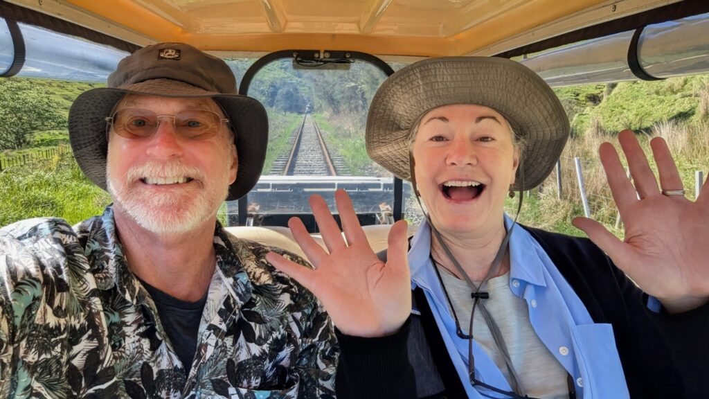
Look Ma, no hands! We’re on tracks, just have to keep the gas pedal down! Unfortunately they are gas powered golf carts, I don’t think an electric cart could run the 60+ miles we covered today!
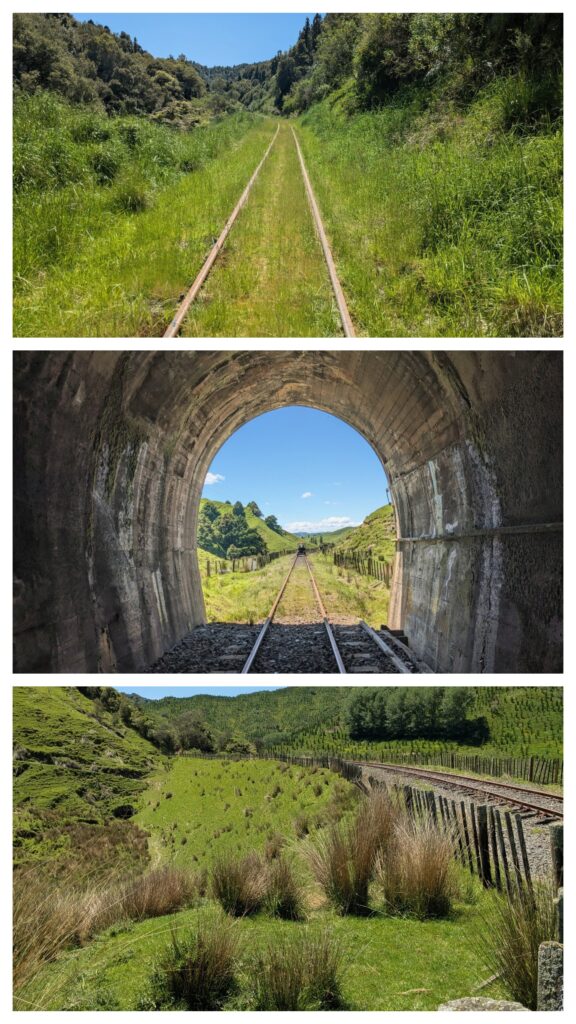
Tracks, Tunnels and Trestles, oh my! the bottom picture is of the largest trestle on the route. A wooden trestle was built to cross the ravine and then laboriously filled in for 3 years by hand with wheelbarrows of rock from digging the nearby multitude of tunnels!
A full and beautiful day ‘riding the rails’! We stayed the night at the Forgotten World Adventures Motel, part of the company that in 2011 leased the mothballed Stratford-Okahukura rail line, did copious maintenance of the line and began the golf cart rail trail! We highly recommend the adventure!
