Feb 18, 2026 Trip to Paihia
We arrived in Waipu on Feb. 15 and stayed a few days with our friend Sam. We had a pre-purchased night of accommodation in Paihia for the 18th so we decided to make it a little loop trip for 4 nights to see some spots in the Northland we missed during our month stay at Sam’s B&B in Oct. 2023. It’s about a 2 hour drive by the most direct route, but we decided to add a loop to the coast including Ngunguru Bay, Tutukaka Harbour and Matapouri.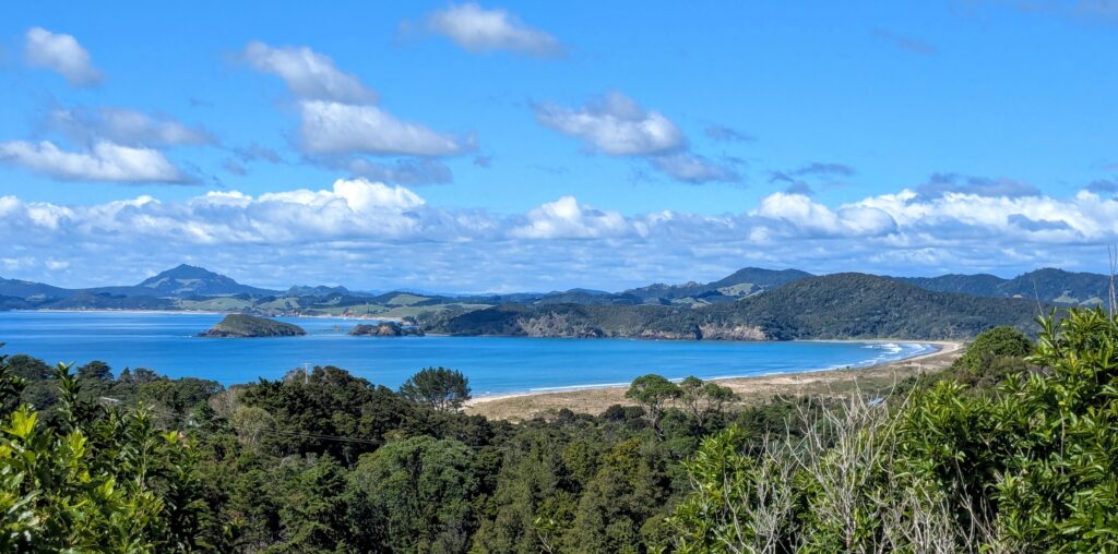
A viewpoint on the high road between the towns of Ngunguru and Tutukaka gave this scene of the bright blue waters of Ngunguru Bay under ‘the long white clouds’ of Aotearoa.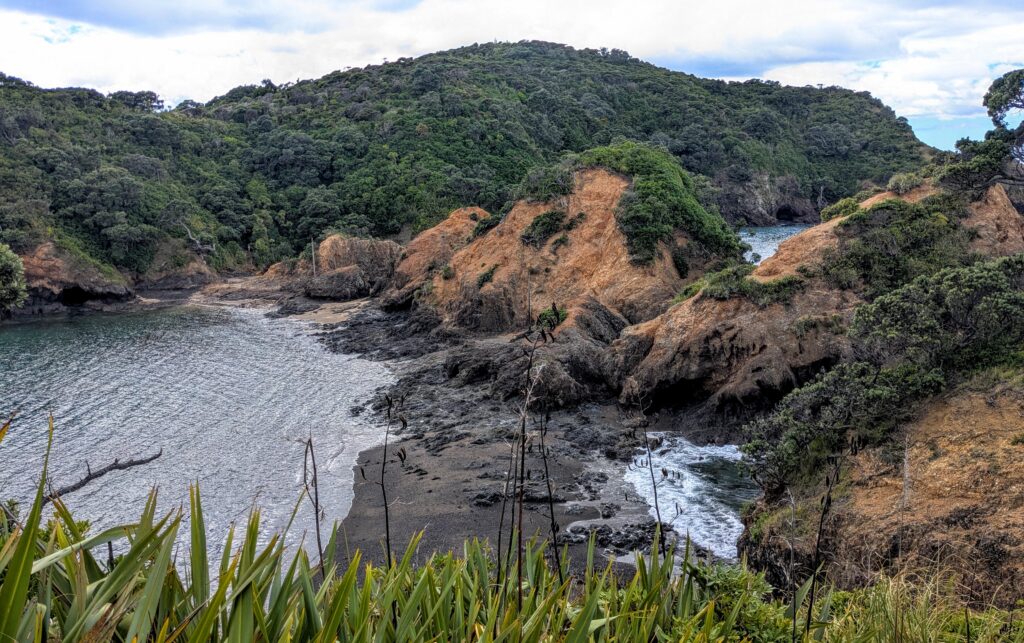
We continued past the town of Tutukaka and out towards Tutukaka Head to the Tutukaka Lighthouse trail. The trail descends down to a thin isthmus connecting to the headland where the lighthouse is situated. We were lucky it was low tide so we could cross the narrow causeway. We enjoyed watching the waves lapping on the sandy narrow beaches in the gaps worn between the harder rocks of the causeway, but we were too unsure of the tide schedule to attempt the half hour hike up the steep headland to reach the lighthouse and the half hour return trip! Videos can be seen HERE.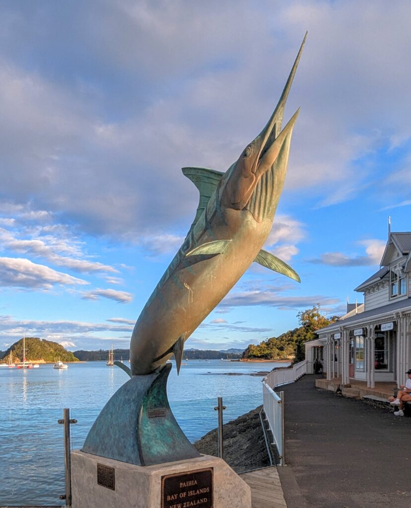
We reached Paihia and had time for a walk around town, our motel being only 1 block from the Paihia Wharf with this great monument to the marlin, Paihia being one of the world famous sport fishing spots of New Zealand.
Feb 14, 2026 Happy Valentine’s Day
We headed for the ferry after our wonderful continental breakfast provided by the B&B and eventually settled into the plush recliners for the 3.5 hour journey across Cook Strait. 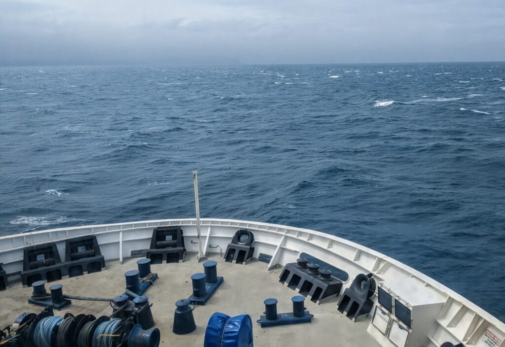
This is our fourth trip across the Strait and by far the roughest, though not very rough compared to what it can be! The rolling lulled us to sleep for most of the trip, but the occasional loud bangs would wake us up! We had a long drive after we disembarked the ferry, ending our day in the tiny town of Mangakino north of Lake Taupo and a little more than halfway up the North Island.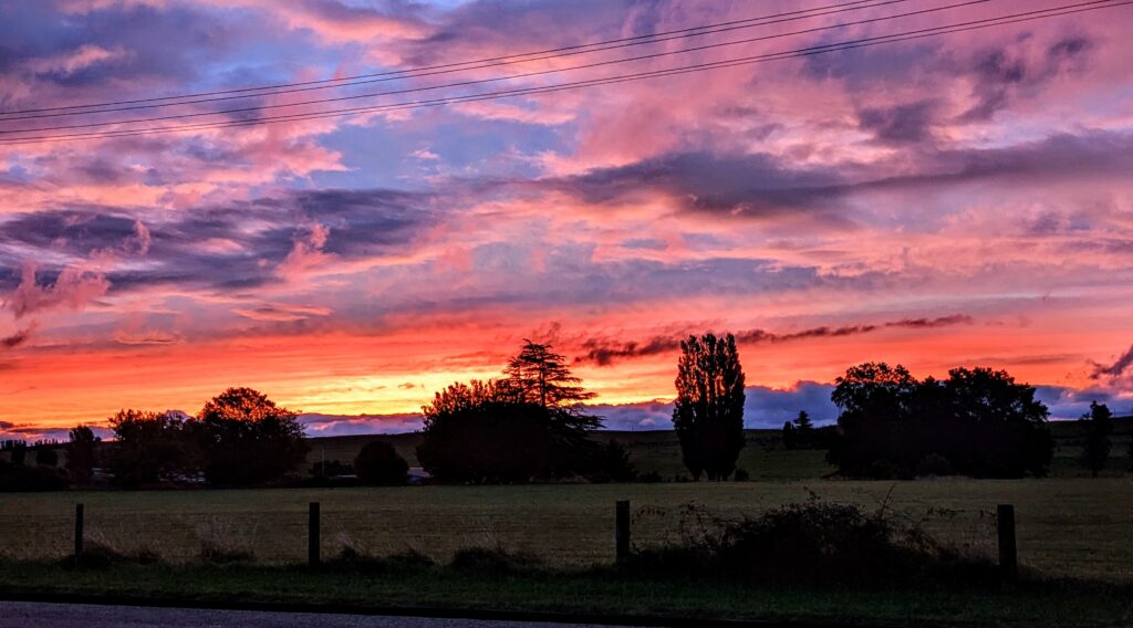
We had a beautiful sunset after a day of intermittent rain, sometimes very heavy, as we headed to our B&B mere blocks from the Mangakino Club where we had dinner.
Feb 13, 2026 On to Picton
We had a beautiful sunrise as we started our trip from the rural farmstay on Banks Peninsula through Christchurch and further north.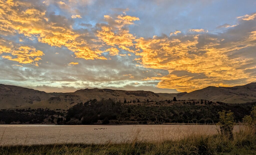
We stopped for lunch in Kaikoura, ‘the Coast with the Most’, and known as the whale watching capital of NZ! We will have to return again to see more of the area!
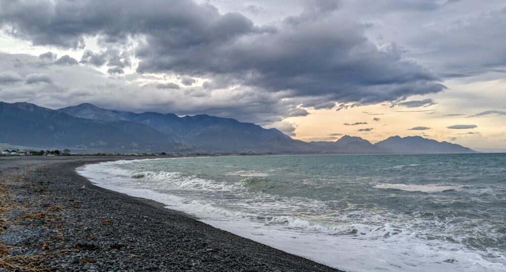
The moody, broody sky over the pebbly steep beach at Kaikoura did not invoke swimming!
We continued on the highway along the coast, following the Coastal Pacific train route we took on Jan. 11, 2024! See the blog HERE! We stopped at the iconic crayfish shop with the giant Lobster we saw from the train 2 years ago!
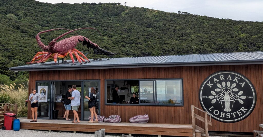
We had already eaten lunch, so we weren’t hungry enough to try the ‘cray’! Next time for sure!!
We reached Picton by early evening and enjoyed a nice walk around town and took a pizza to our B&B for dinner. We have an early morning tomorrow to catch the ferry to the North Island.
Feb 12, 2026 Moving On
Today we started the drive north to Picton to catch the ferry back to the North Island. Being an over 9 hour drive we decided to break it up and headed to near Christchurch, about half way. We found a little B&B in the rural setting of Port Levy, at the end of Port Levy bay on Banks Peninsula, the bulge of land just south of Christchurch. The ‘Shearers Quarters’ is a tiny remodeled sheep shearers hut on a farm at the end of a winding gravel road over the hilly terrain of the peninsula.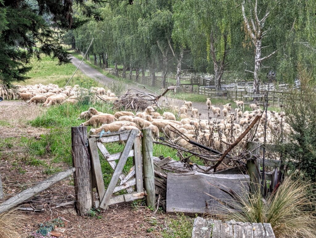
Shortly after our arrival a herd of sheep were mustered up the road past the gate to the Shearer’s Quarters! After the dust settled we took a walk down the country lane to the shores of the bay.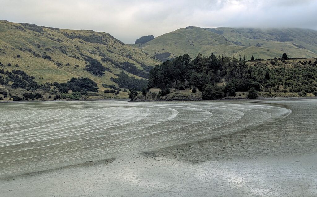
The tide was out, revealing a mud flat where ducks, gulls and a few heron were feeding. The wind, or maybe the tide made concentric waves on the bay’s surface.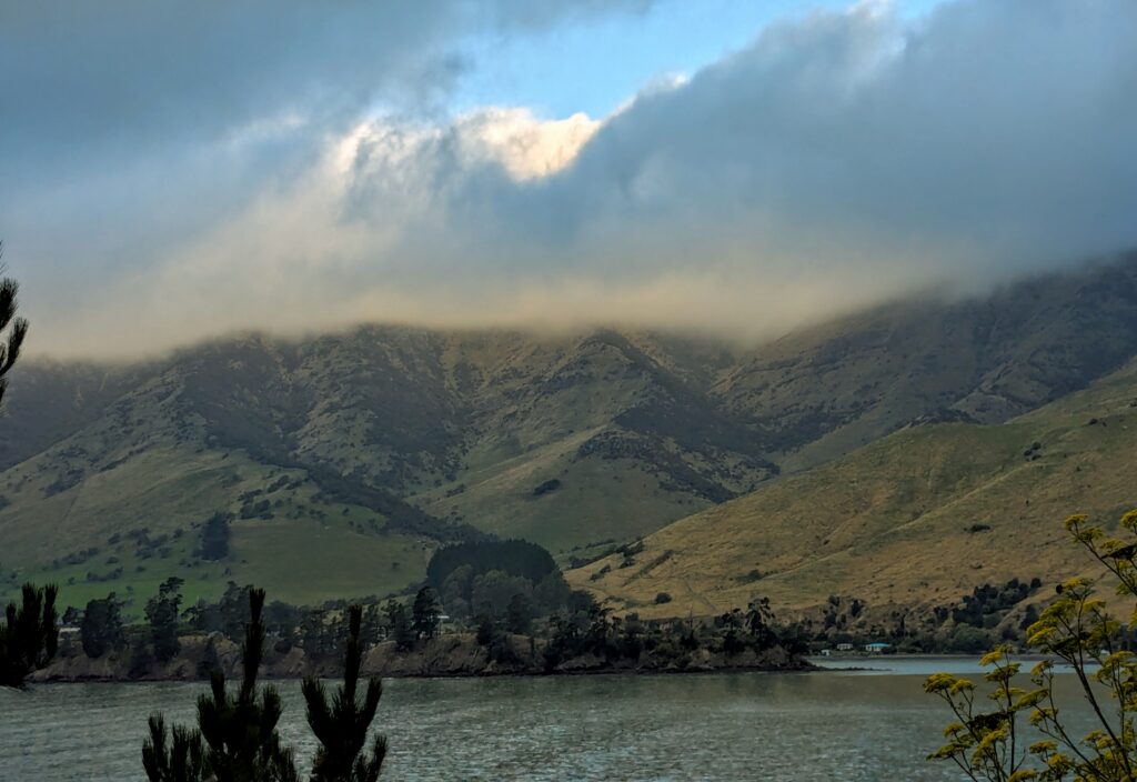 The evening lighting was dramatic on the clouds sitting on the hilltops, with patches of bright blue sky occasionally appearing.
Feb 11, 2026 A Short Train Ride
We took a scenic train ride today, the Seasider Express. 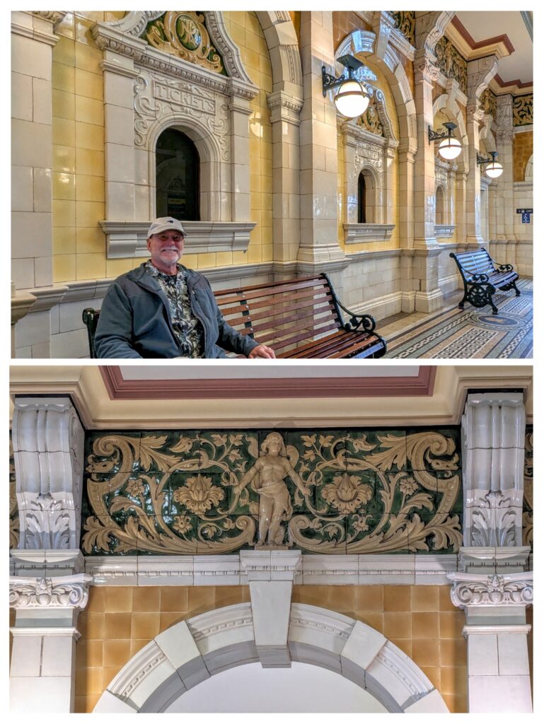
We waited in the opulent lobby of the Dunedin Railway Station with the other passengers for our Dunedin Railways Tour.
Unfortunately is was overcast, with clouds low on the hillsides surrounding us as we rode up the west side of Otago Harbour and into the hills over to Blueskin Bay.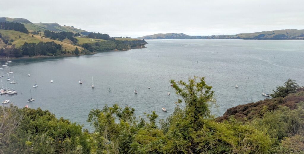
We had a few views from up in the hills down onto the waters of Blueskin Bay, Purakaunui Inlet and Otago Harbour.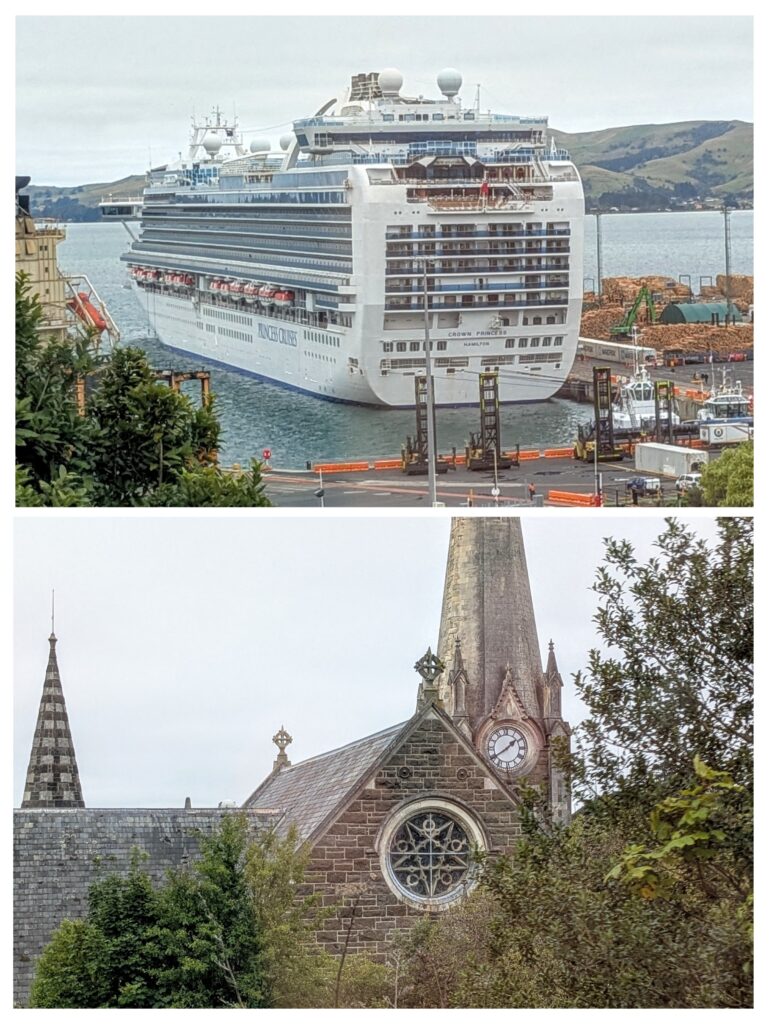
On our return to Dunedin we made a brief stop at Port Chalmers for Cruise ship passengers to disembark and walk down through town back to their ship, while the rest of us rode on into Dunedin. The Church is known for it’s clock in the steeple and is mentioned in THIS BLOG of a casual sightseeing walk through Port Chalmers on a day that looked a bit sunnier than today!
