March 3, 2026 Last Walk on the NZ Coast
We woke up on Sunday, March 1 to a fresh blueberry pancake breakfast at Sam’s, but also with the news that a war was started between the US and Iran yesterday. We have airline tickets for March 4 to fly from Auckland to Dubai, United Arab Emirates, for a 24 hour layover, then continuing on to Istanbul, Türkiye (now the official name for Turkey, pronounced tur-KEE-yeh). News later in the day showed Iran’s retaliation of bombing several Middle Eastern countries including Kuwait, Qatar, Bahrain and UAE, including the airport in Dubai! So we spent the day changing all our near future plans of 24 hours in Dubai and 5 weeks of travel through Türkiye as well as flights from Istanbul to Geneva, Switzerland and a week in Geneva, then flights from Geneva back to Bend. What a disappointment. We had the whole trip around Türkiye planned with accommodations and historical sites we wanted to visit. We had to contact them all and cancel and hope to get a refund! Then rearrange flights or cancel and rebook, to get flights back home. We ended up spending several days on the task, as well as preparing to leave NZ, store the car and the accumulation of clothes, shoes and sundry items we are storing in the car! Finally we had some free time on Tuesday, March 3, a beautiful sunny day, to walk the Waipu Coastal Walkway one more time!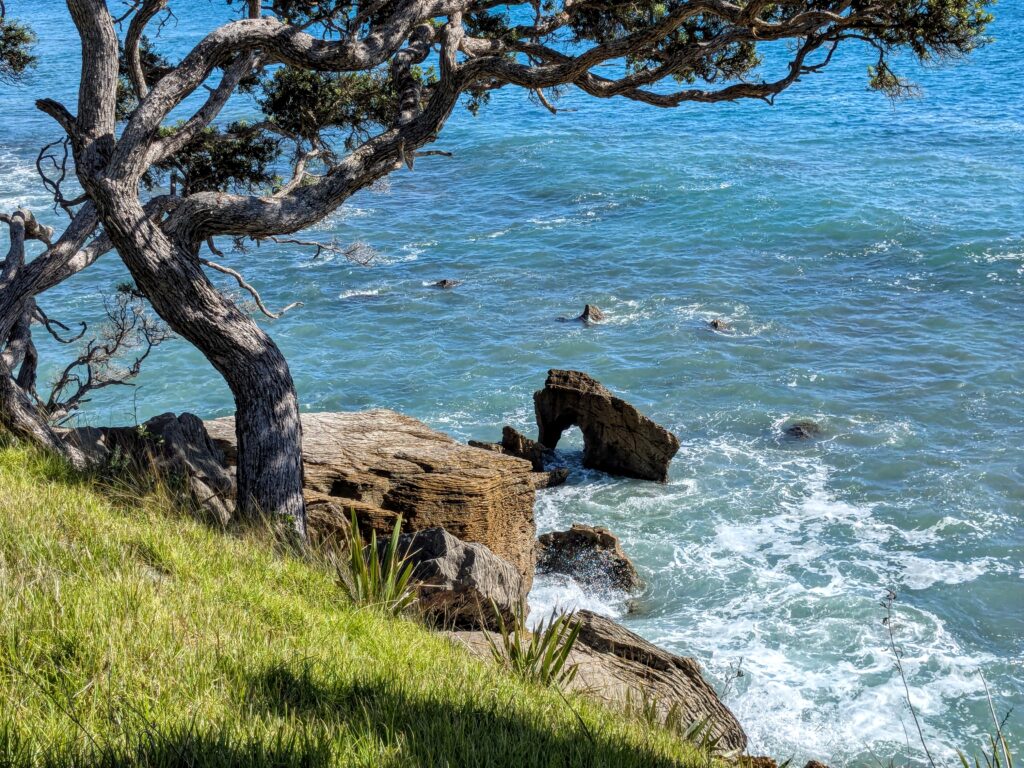
Bream Bay in the South Pacific!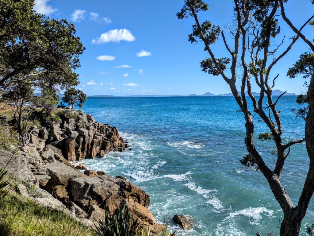
Feb 28, 2026 Classic Kiwi Meal
We enjoyed a classic Kiwi meal, but it could be enjoyed just about anywhere in the British Commonwealth. Fish & Chips! Served in a paper wrapping that acts as plate and tablecloth! Lots of napkins needed! 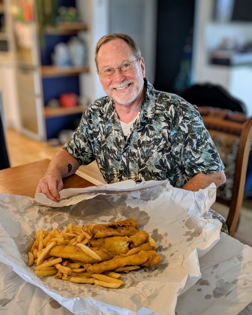
Feb 22, 2026 Back to Waipu
We woke to a cloudy morning, but the forecast was optimistic!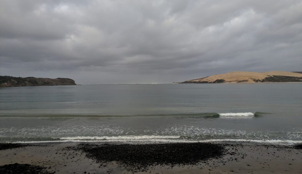
We packed up for our ride back to Sam’s place in Waipu, but we stopped for a short hike up to the windy South Head of the entrance to Hokianga Harbour.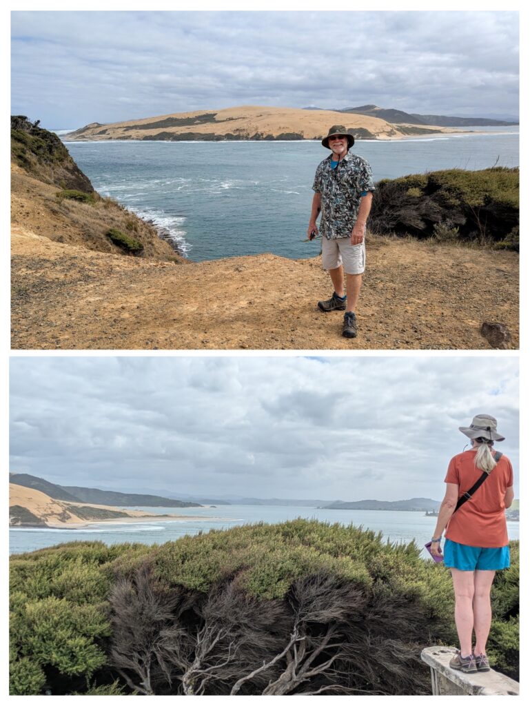
We cinched our hats tight and enjoyed the views!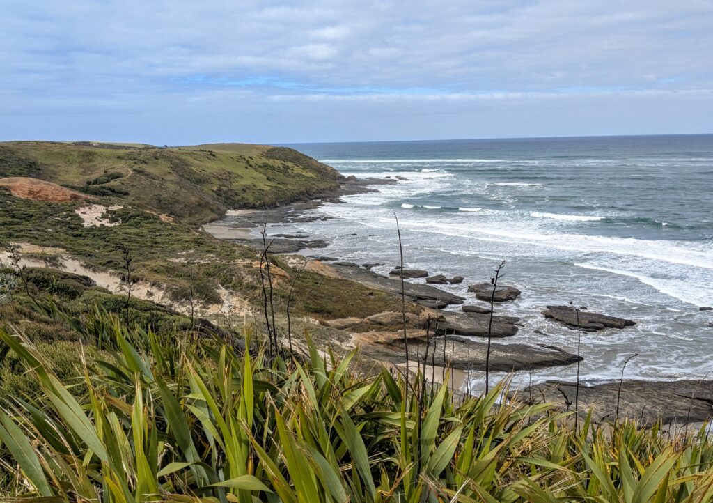
The Tasman Sea was much more rough than the waters in the harbor!
Feb 21, 2026 Omapere
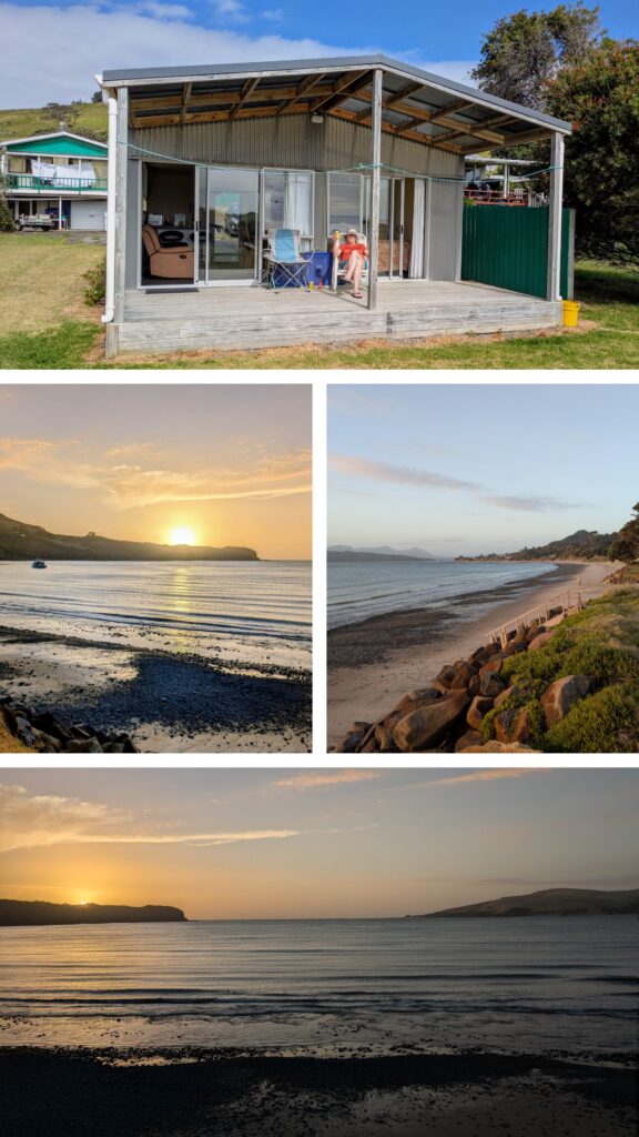 We stayed just one night in Ōmāpere, in a great little ADU just steps to the beach of Hokianga Harbour. We relaxed on the deck and watched the sunset!
Feb 20, 2026 On the way to Omapere and Tane Mahuta
We rose before dawn for a long day of travel. We stopped on the pier in Paihia for a view of the rising sun reflecting on the marlin sculpture. 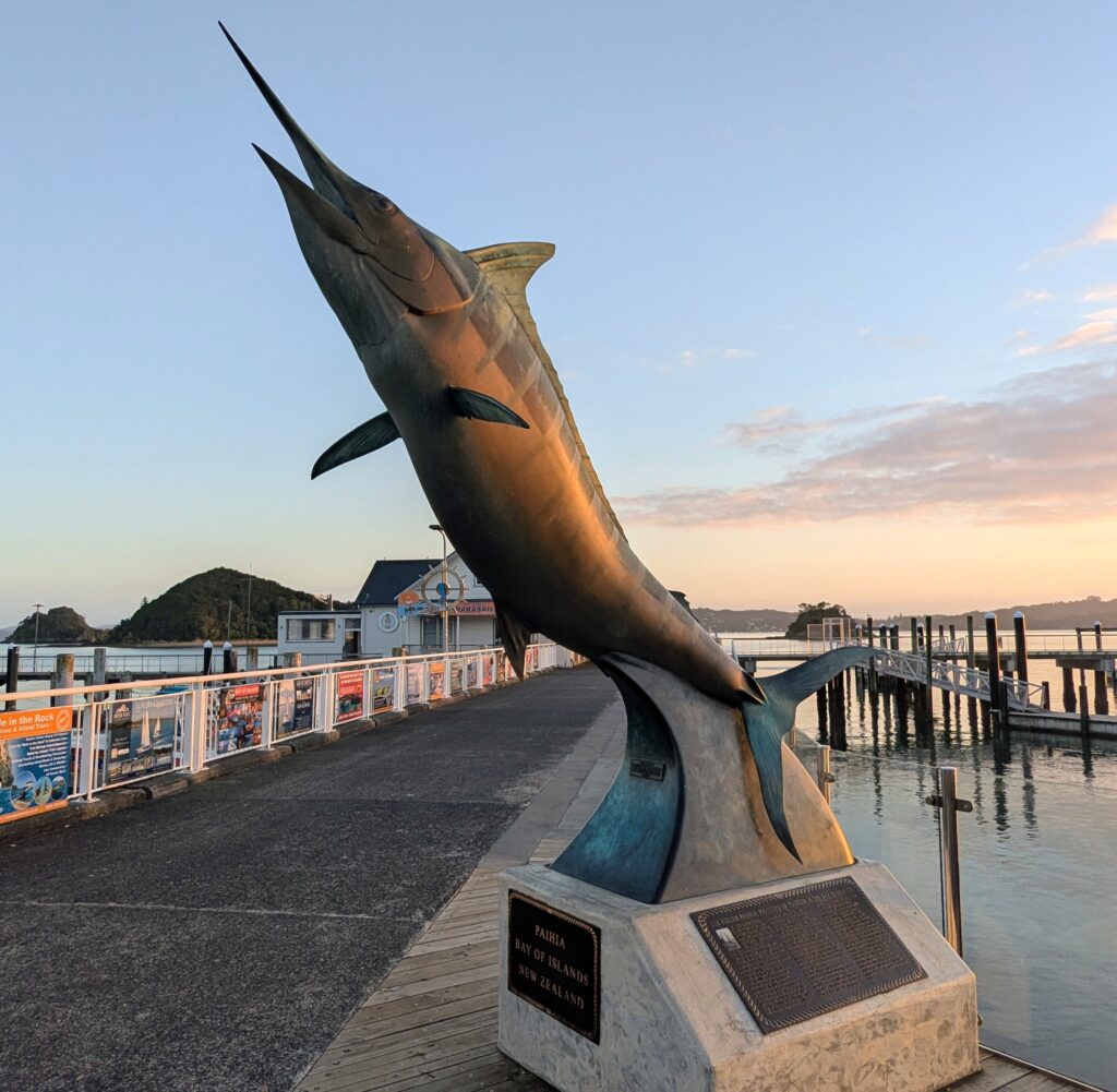
We continued from Paihia west onto Hwy 12 across the long northern peninsula of the North Island, from the South Pacific side towards the Tasman Sea side of New Zealand. Our goal was to explore some of the Waipoua Forest along the northwest coast, a remnant of the ancient subtropical rainforest that once covered the Northland Peninsula. It is the home of Tāne Mahuta, one of the largest trees on earth and the largest kauri tree in NZ. It is an integral part of Māori mythology, the son of Ranginui (sky father) and Papatūānuku (earth mother). He was the child who, with his stout legs, separated his parents from their tight embrace, creating space between them, letting in light and thus allowing life to thrive in the forest to adorn his mother with natural beauty.
We listened in to a wonderful guide describing the story of Tāne Mahuta and of the surrounding forest. We continued our walk through the forest of giant kauri trees.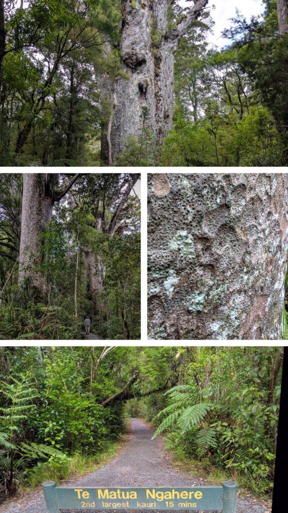
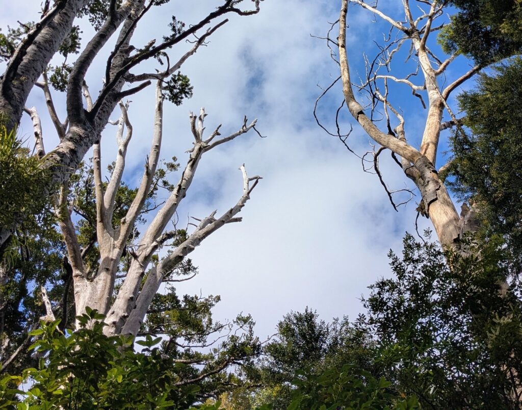
Look closely at the middle left picture of Robert walking on the boardwalk to see the scale of these giants! Unfortunately they are threatened by a tiny microorganism that can be spread in soil and cause kauri dieback disease, which we saw evidence of by the white, barkless skeletons of dead kauri.