Jan 22,2026 Arrowtown, A Tale of Two Cities
Continuing our travel over the Crown Range towards Queenstown we stopped in the tourist center of Arrowtown, an 1860’s gold mining town. Surrounded by mountains it is a picturesque village preserving it’s gold-mining era buildings and identity (mining tourists now!).
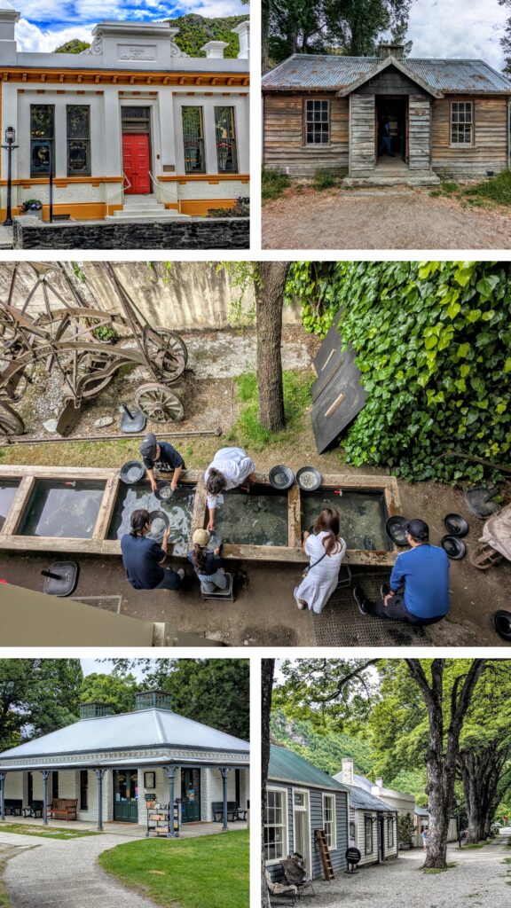
Some of the notable structures in town. The bank of New Zealand, one wooden building from the police camp, tourists ‘panning for gold’, An iconic NZ 1860’s style building housing the library and a block of simple miner’s shacks.
By the 1870’s the easy pickings were gone and the European miners moved on to new strikes elsewhere. The town shrank and resorted to inviting Chinese miners from the played-out gold fields of Australia to work the claims in Arrowtown. Invited, but not welcome, the Chinese were relegated to the fringes of the community. There they created their own space, erecting shacks utilizing discarded or natural materials. They even terraced the hillside and grew gardens, selling their extra produce to their white neighbors. The “Chinatown” has been preserved as well and plenty of signage describes life for the bachelor miners.
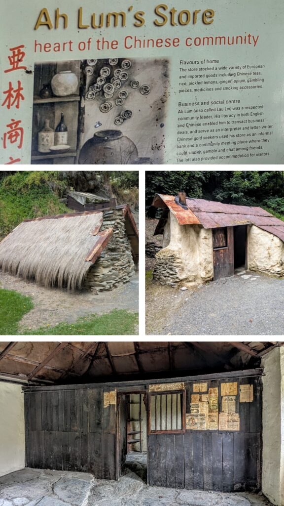
Two of the miners’ huts, one with a tin roof, the other with a thatch roof, look similar to farmers’ huts in Ireland. Ah Lum’s Store was the ‘heart of the community’.
I couldn’t help but notice the similarities to the Chinese experience in Oregon around the same timeframe. Preserved and interpreted in John Day Oregon is the Kam Wah Chung & Company Museum. Active from the late 1860’s until 1952 with the death of it’s last proprietor, Ing Hay (or ‘Doc’ Hay as he was known, being an herbalist and practitioner of traditional Chinese medicine), serving the Chinese miners who flocked to the gold fields around Canyon City, Oregon. The Chinese workers in both NZ and Central Oregon were generally from the Guangdong Province in China, and their communities were centered around stores that could provide them with familiar Chinese goods as well as social camaraderie.
Jan 21, 2026 Cardrona
On our way between Wanaka and Queenstown, we took the ‘shortcut’ over the Crown range, passing through the tiny hamlet of Cardrona. A lonely area of relatively high elevation, populated by more sheep than people, it has a rich history of sheep and cattle herding, gold rush boom and bust, and development into one of the largest ski areas of NZ! We stopped at the only commercial center along the road, the remnants of the town of Cardrona consisting mostly of the Cardrona Hotel. Sheep and cattle were driven into the area in 1860, but the town was established in 1863 after gold was discovered in the area in 1862.
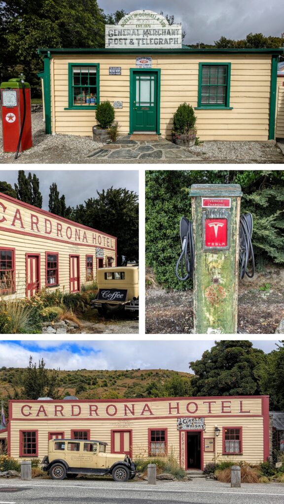
It’s amazing how advanced this gas station was! It had an electric car charger back in the day!
By 1867 most of the miners had left for more prosperous strikes elsewhere, but Chinese miners moved in and some lucrative strikes were found. In 1878 a flood of the Cardrona river filled most mining claims, leading to most residents moving elsewhere. It took almost 100 years of modest sheep-herding before Cardrona recovered, and due to the work of a local farmer/rancher couple who saw the potential of the snowy winter slopes as a ski area, developed their holdings into an alpine and cross-country ski mecca, the Cardrona Ski Resort.
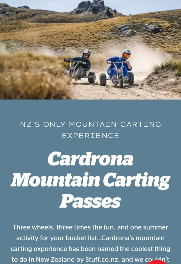
We decided NOT to zoom down the slopes in tricycles!
Continuing along the Crown range pass, we were mesmerized by the lupines blooming along the roadside!
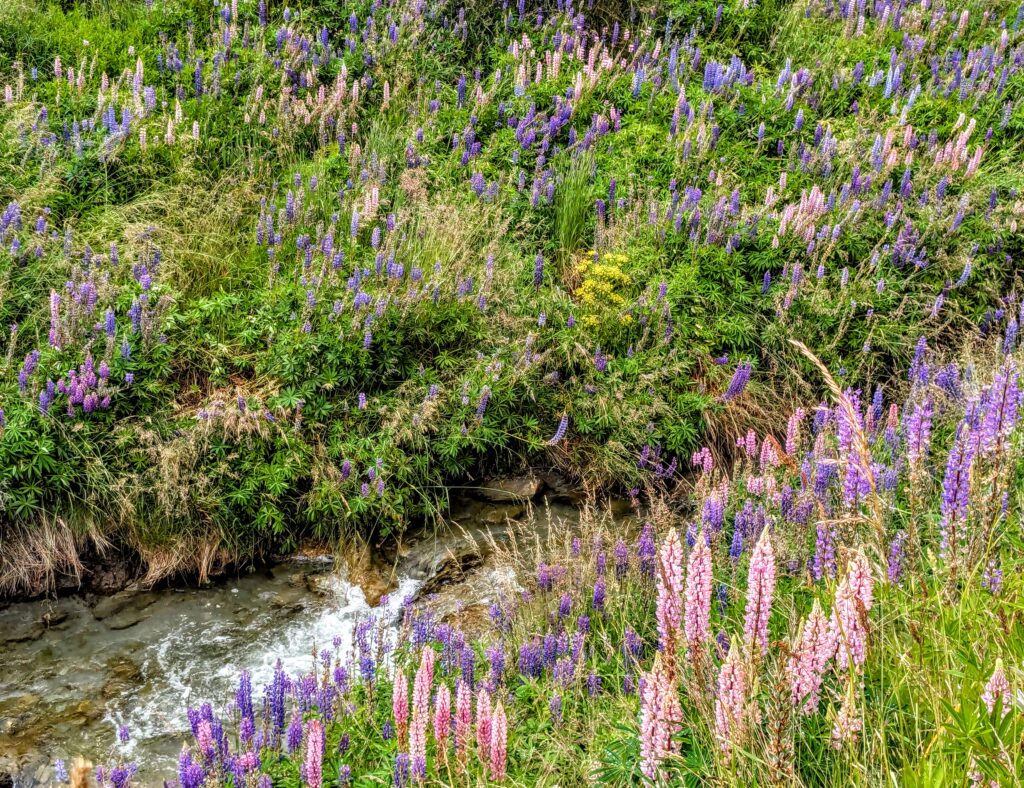
Another wonderful fragrant experience in New Zealand!
Jan 20, 2026 North Lake Wanaka
We stayed closer to home today, looking for waterfalls and scenery closer to the north end of Lake Wanaka. We didn’t find any photogenic waterfalls, but we had great views!
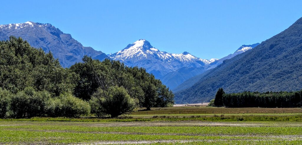
A view of Mt. Aeolus in the Southern Alps. Often mistaken for Mt. Aspiring further south and west, not visible from this valley.
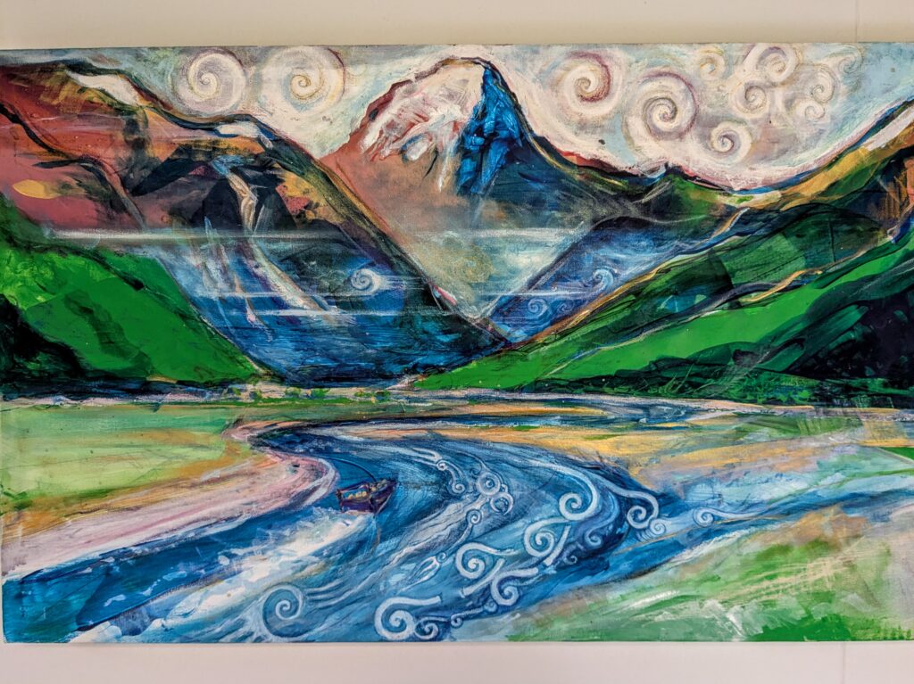
A painting in our B&B, very similar!
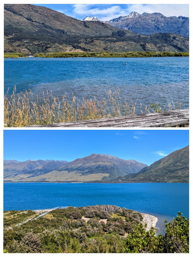
Views of the north end of Lake Wanaka. The top picture is of the brushy area where the Makarora river enters the lake, from the vantage point of a picnic table at a little boat ramp into the lake. The bottom picture is from a vantage point above the lake, looking down at the closed Boundary Creek Campground on the rocky peninsula created by Boundary Creek depositing debris into the lake.
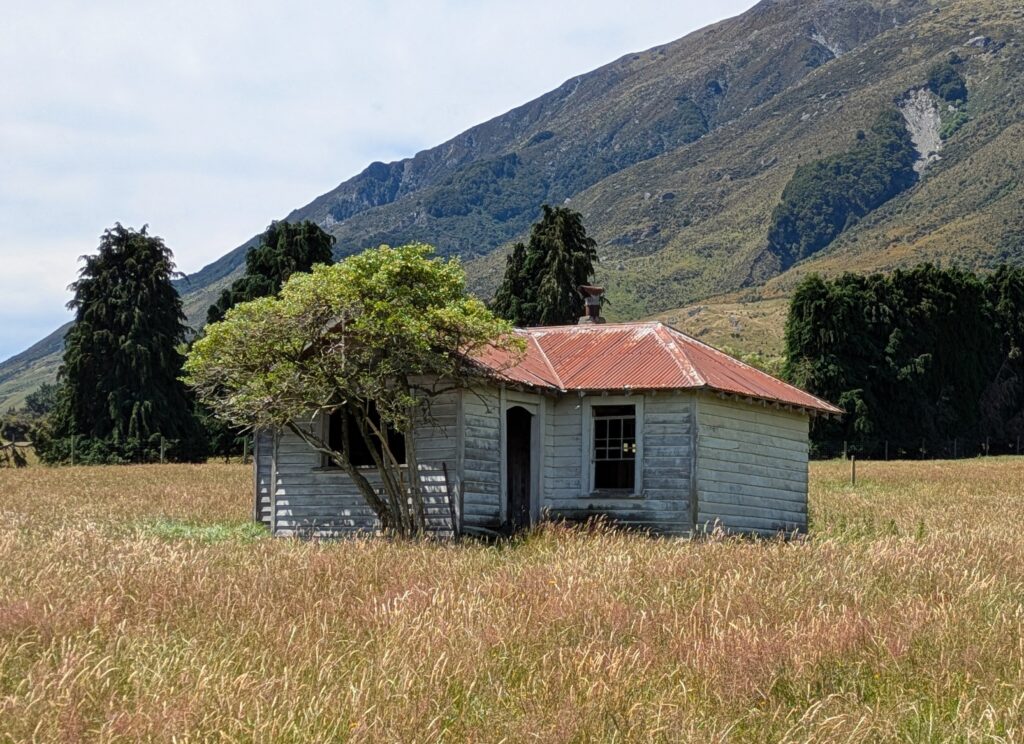
A real fixer-upper near Lake Wanaka!
Jan 18, 2026 “That Wanaka Tree”
We drove into the town of Wānaka, about an hour south of our B&B, in order to do laundry and stock up on groceries. We took some time to walk along the lakefront. Wānaka is at the south end of large Lake Wānaka and is a summer resort town and winter ski town. The area enjoys a ‘semi-continental’ climate with 4 distinct seasons, winter being considered ‘extreme’ by NZ standards, with single digits at night and frequent snowfall. We enjoyed a sunny, balmy day today!
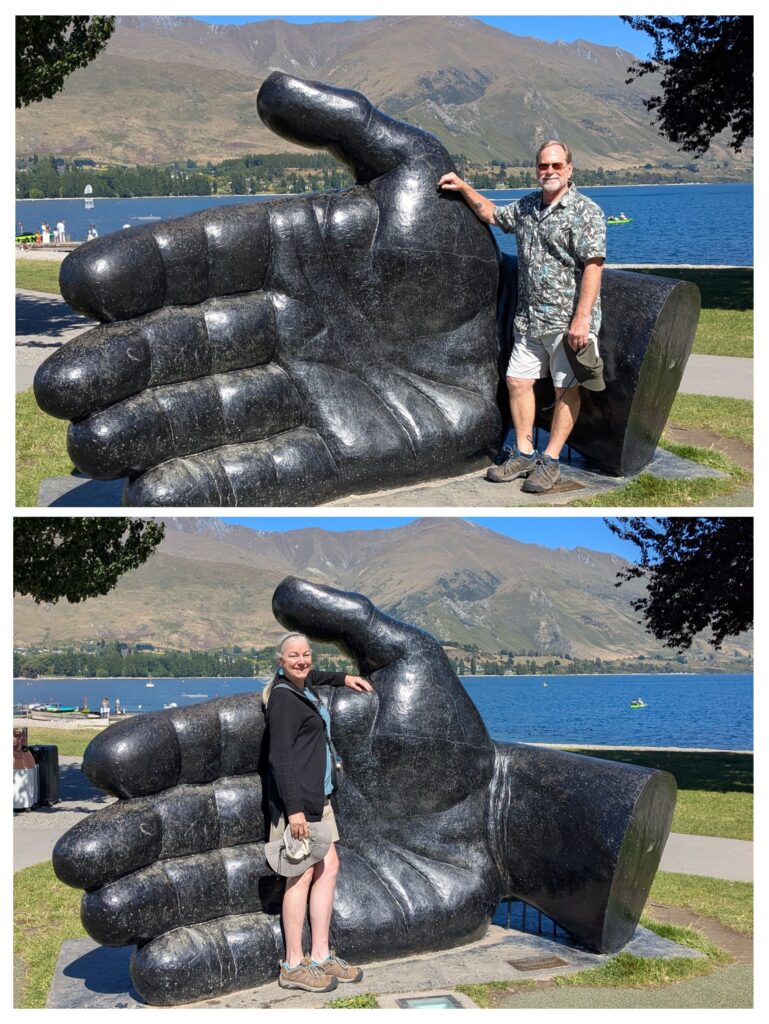
“The Hand That Nurtures” art sculpture on the lakefront park!
At the other end of the lakefront beach we found “That Wānaka Tree”, possibly the most famous tree in NZ, or at least the most photographed!
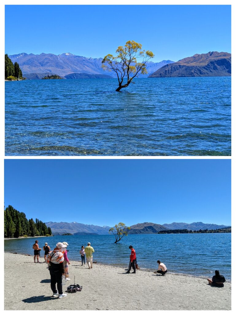
Our photo, the Instagram version on top, reality below. Lots of people milling around to get the perfect photo!
The tree began as a willow branch pushed into the lakebed to act as a fence post over 80 years ago. It has survived droughts, harsh winters and too much love! To see photos of the tree in all weather conditions click HERE! We continued our walk along the lake and found several other “Wānaka” trees, none as famous, or crowded as THAT Wānaka tree!
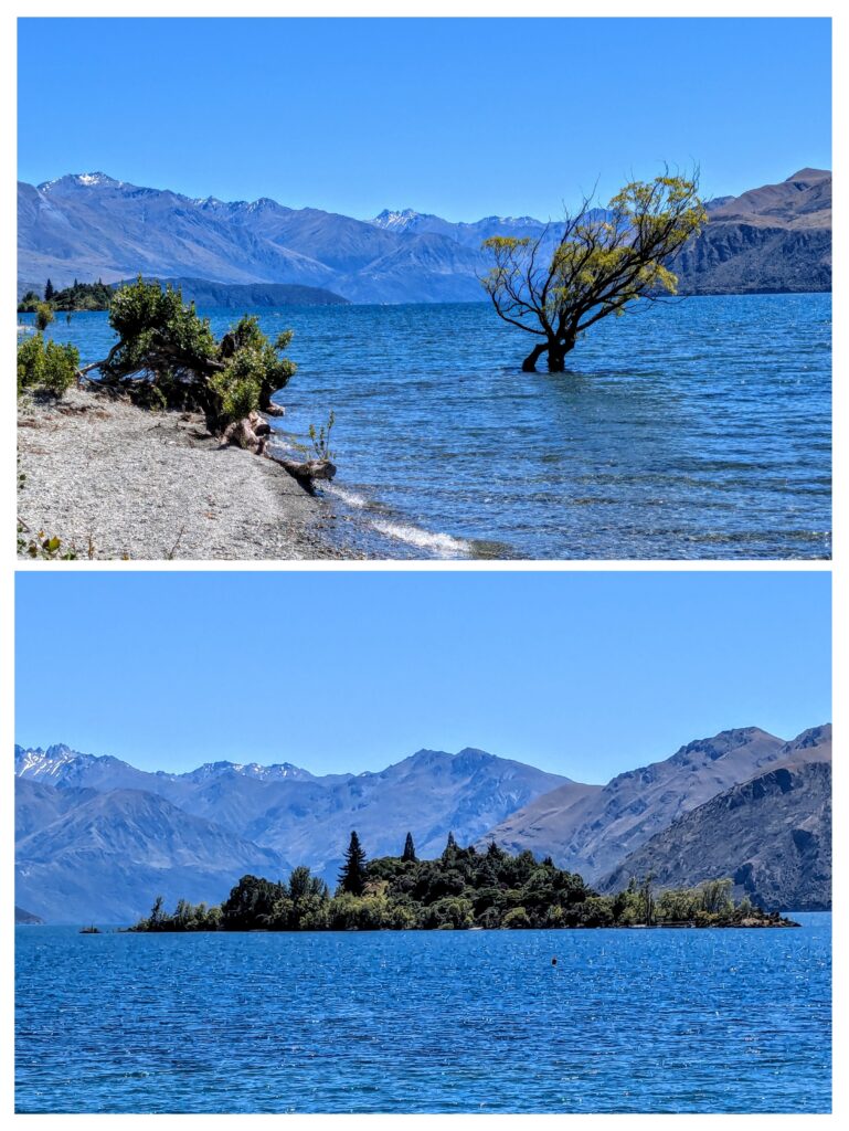
That other Wanaka tree! And Ruby Island in Lake Wanaka, a camping spot for canoes and kayakers.
Jan 17, 2026 Blue Pools
Our outing today to The Blue Pools in Mt. Aspiring National Park didn’t take us too far from our B&B in the tiny mountain hamlet of Makarora. We drove the 10 minutes up the road, parked and started on the short trek across the Makarora river on a stout swing bridge then along the new wood walkway on the embankment and across the second stout bridge, this one over the Blue river as it emptied into the Makarora river.
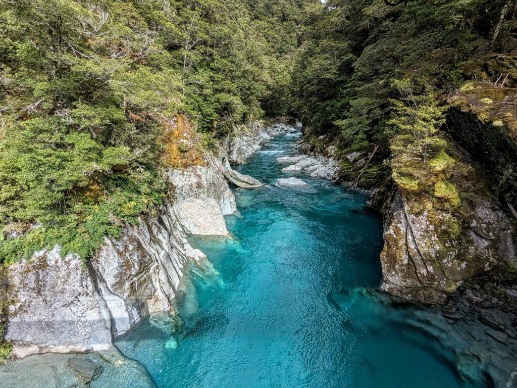
The crystal clear water of the Blue river flowing out of the mountains. You can see the shadow of the bridge we are on, crossing the river.
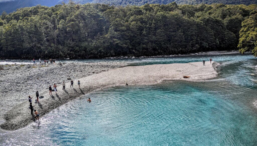
A large pool is formed as the glacial debris flowing from the mountains builds up at the confluence of the Blue and Makarora rivers. Several brave souls were plunging into the ice cold waters! We did not partake!
We were glad we got there a little early, when we left the large parking lot was completely full! We continued to a less visited spot almost directly across the valley from the Blue Pools, up Cameron Creek to a little lookout platform.
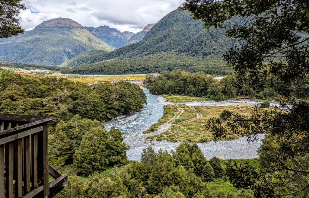
The platform was cordoned off due to instability from a slip below it. But we had a great view across the valley to where the Blue river carved through the mountains.
