October 17, 2023 Rainbow Falls Track (Day 20)
We went to Kerikeri today to find and walk the Rainbow Falls Track. We discovered a lot of historical points of interest too, but I’ll save that for another day. Rain was predicted and we got a bit of it as we ate our savory muffin and drank our cappuccinos before we started our hike. It sprinkled a little as we walked, but we had our rain jackets at the ready!
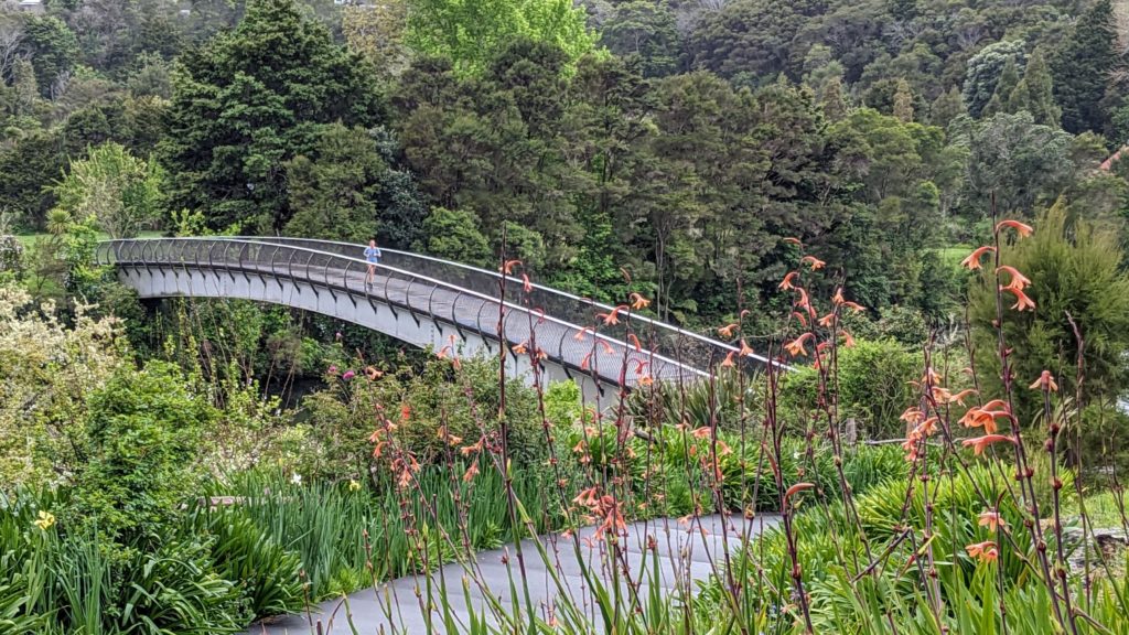
We crossed the footbridge from the historical area into the park where the Kerikeri river track started.

We encountered 2 huge trees covered in burls early on the trail!

The first waterfall, Wharapuke falls, was reached soon after.

The track continued through dark woods full of exotic huge plants, trees and moss covered rock slopes. Going under a highway overpass we saw these black-eyed susan vines, native to east Africa, covering trees and bushes.

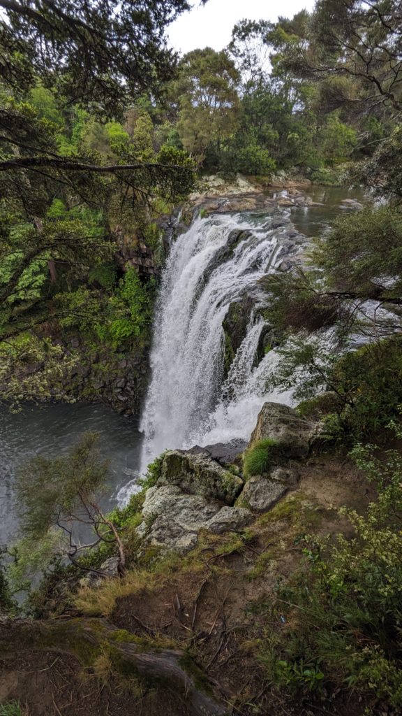
Following a raised wooden walkway we finally approached Rainbow falls. Unfortunately the sun was not out so we didn’t experience the rainbow in the mist that it is known for.

The trail then went uphill to give us a view mid-way up the falls.
At the top several observation decks gave us views of the falls from the top.
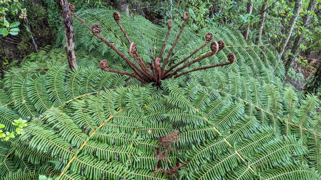
On the left of the deck we looked down at this tree-fern crown, with the new fronds uncurling in the mist from the falls, ready to soak up the sun when it finally comes out!
We retraced our hike back to the parking lot, enjoyed a picnic lunch as the sun came out and dried the grass. In the sun we finished exploring the historical areas, then returned home with a haul of groceries from the bigger store in Kerikeri, the hub of the agricultural community in Northland.
October 16, 2023 East of BOI (Day 19)
While the tire was being fixed we took a morning walk on part of the Waitangi track where we saw the Shag rookery from our first walk on the track on Oct. 4. Now the nests are filled with baby birds and the parents are busy ferrying back and forth from the estuary with crops full of food they regurgitate to the babies who stick their whole heads into the parents mouth! We think there are 2 species of ‘shags’ as cormorants are known here, the pied shag and one I can’t identify.
After the tire was fixed we started on our trip we planned for yesterday, taking the Opua car ferry across to Okiato and touring as much as we could on the peninsula on the east edge of Bay of Islands.
We stopped first at Waipiro Bay for the view!

No access to the beach here. This area is rural and agricultural, with vineyards and sheep+cattle stations.
We drove to the end of the road at Rawhiti, a small community with 2 Maori meeting houses (Marae). After this town is the long track to the Cape Brett lighthouse, 16.3km (10 miles) one way! Kaimarama Bay has a small beach looking out towards small islands and rocks where we stopped for our picnic lunch.

Looking left, from where we came.

Looking right towards other islands.
We backtracked to the first junction and headed south. We found a tiny bay with a protected beach, Te Akau Elliot Bay. We took our chairs and cameras and enjoyed the almost deserted beach.

Returning from our sojourn on the beach. I’m trying to get some color on those white legs!
Continuing south we headed down to North Head, of course to the end of the road!

The Whangaruru North Head campground was the end of the road.
Returning north we got fantastic views of the skinny peninsula.

Looking west across Whangaruru Harbour.

Looking north at Bland Bay, a small town (no services) that looks anything but bland! With Waiatapaua bay and the open ocean on the right, and Whangaruru harbour on the left.
We backtracked to Okiato and caught the car ferry back in the evening light. A great day of exploring!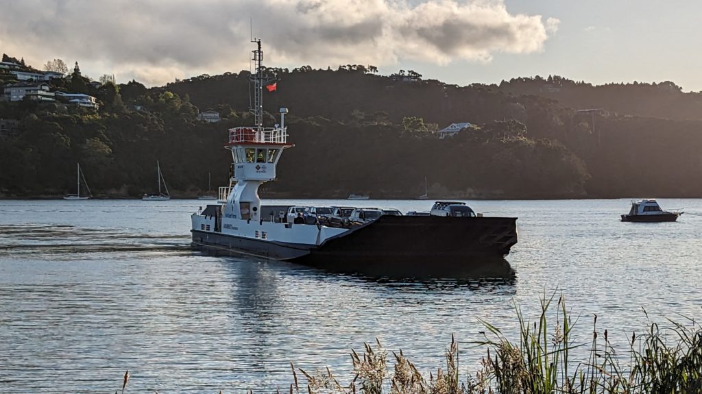
October 15, 2023 Flat Tyre (Day 18)
This morning our plans were thwarted when we went to get gas and found we had a flat tire! Luckily we weren’t too far from home so we put air in it and made it back to the Airbnb. Being Sunday we couldn’t get it fixed, but our host recommended the closest Tyre Shop, in Pahia, which will be open on Monday.
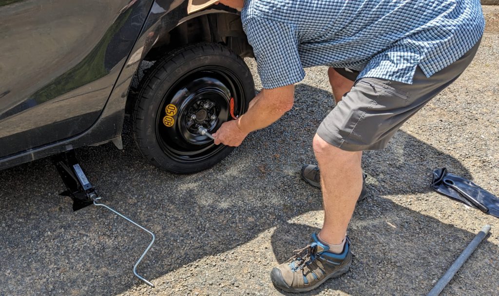
While Robert got to work changing the spare for the flat tire…
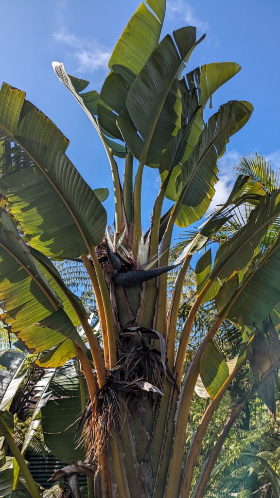
I walked the property and admired the landscaping. This is a Giant (or white) Bird of Paradise along their driveway. It’s huge!
We managed to get to town on the spare tire and do some shopping. We got fish to grill and had a wonderful dinner.

Lemon pepper on 2, Mexican spice on 2!

With salad, sauteed veggies and rice pilaf! We’re eating good!
October 14, 2023 Tipsy Oyster (Day 17)
With such a long day yesterday, and getting home at dark, we decided to stay close to home today. We went into Paihia and visited a few places we’ve passed by before. We had a couple of beers at Charlotte’s Kitchen, right at the end of the wharf and looked out at the bay and the ferry that takes you to Russell. We then tried oysters at the Tipsy Oyster at the other end of Paihia.
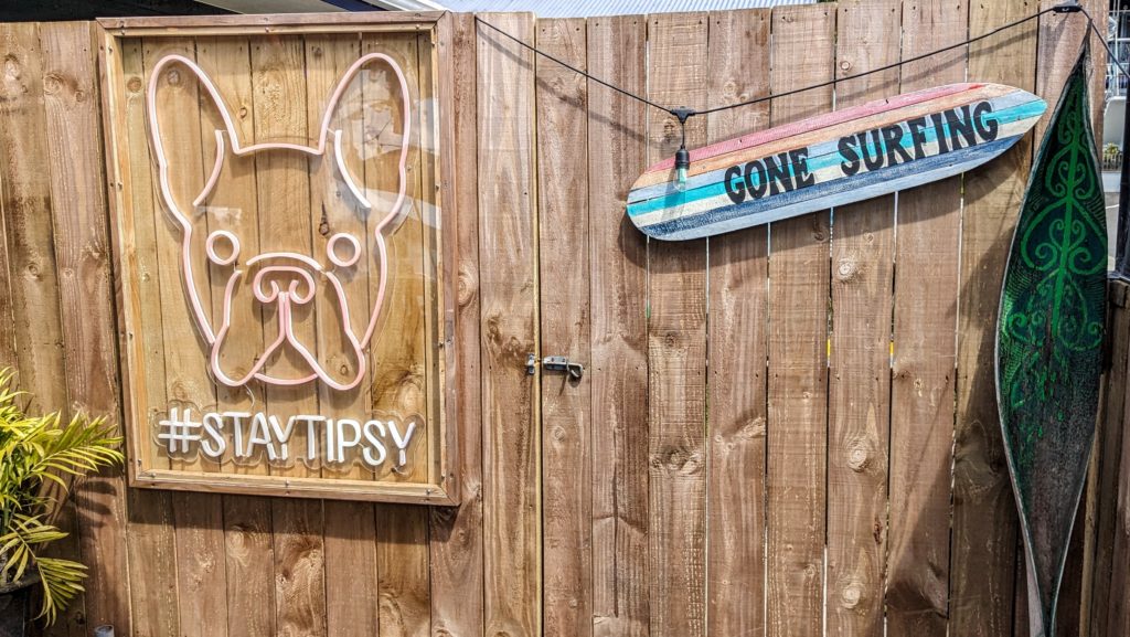
We had a light dinner when we got home and enjoyed the view of the bay from our patio, always changing, and always wonderful!
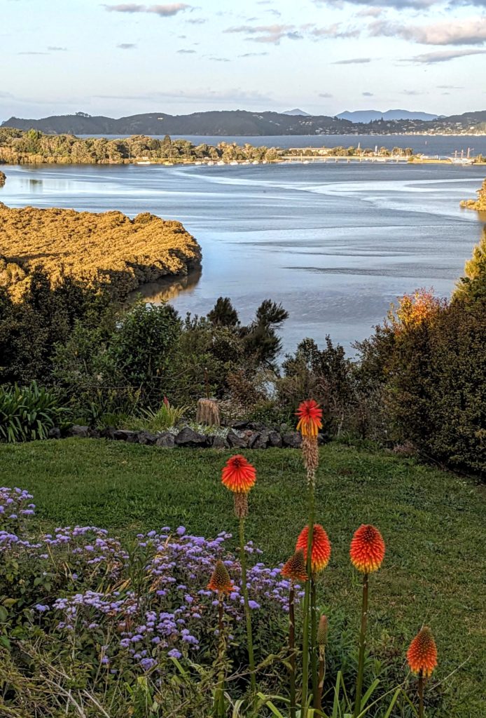
Hope you don’t get tired of seeing the view!
October 13, 2023 Cape Reinga (Day 16)
Another long day for us today. A drive to almost the northernmost point of New Zealand, Cape Reinga.

Our route, no detours until we reach the lighthouse!
A VERY winding road took us through farmland and small towns. We stopped for coffee and a meat pie (best fast food around!!) and made it to the Cape. A light rain fell as we approached, then cleared to beautiful almost cloudless blue sky, matched with a more vivid deep blue of the Tasman sea on our left and the Pacific ocean on our right! The rough water below the lighthouse is where the two bodies of water meet, usually turbulently!

The lighthouse, looking out towards the Three Kings islands in the distance.
The Three Kings islands, know as Manawatawhi (panting breath) to the Maori, it is a protected group of 13, now uninhabited, islands that since 1930 have been protected as a sanctuary for endemic species, “New Zealand’s wildlife jewels”.
To our left we look towards Motuopau island where the old lighthouse stood, past the huge shifting sand dunes.

Now a very protected nature reserve, it can be visited only by DOC (Dept. of Conservation) staff, iwi (tribal people) and researchers.
To our right is the most spiritually significant place in New Zealand, Te Rerenga Wairua. “It is here that after death, all Māori spirits travel up the coast and over the wind-swept vista to the pohutukawa tree” where “They descend into the underworld (reinga) by sliding down a root into the sea below. The spirits then travel underwater to the Three Kings Islands where they climb out onto Ohaua, the highest point of the islands and bid their last farewell before returning to the land of their ancestors, Hawaiiki-A-Nui.”

You can just make out the ancient tree on what looks like the top of the middle cone of volcanic rock.
At the lighthouse a signpost lets you know how far away you are from many places!

We are closer to the south pole than we are to Los Angeles, in the opposite direction! We are also only 1452 km, about 902 miles, from Bluff where we will meet John and Martha in Jan. 2024!

Contemplating life and …
We headed back down the peninsula, exploring gravel roads as we went. We stopped for lunch at Tapotupotu (low-lying) campground on a beautiful bay on the Pacific side.
Another stop was on the Tasman sea side of the peninsula, at Te Paki creek, to see the huge sand dunes! At Kapowairua (Spirit Bay) campground, we walked on the beach in the wind and watched (wild?) horses grazing on the hillsides.
 At the high water mark the sand is mixed with crushed seashells of all colors and sizes!
And finally we reached the south end of 90 mile beach, which starts way up at the Te Paki sand dunes!

It’s not 90 miles long, only 88km or 55 miles. Sometimes used as a highway if the main road, Hwy 1, is closed due to flooding or landslides. Mostly used for tourist buses traveling to Cape Reinga from Bay of Islands. We didn’t drive on it due to shifting sands and not knowing the tide schedule!
We got home right at dark, our longest day out yet!
