Feb 9, 2026 A Day in the Woods
Today we headed for the woods. It was a beautiful sunny day, so we opted to be in the shade of the forest as we explored the Outram Glen Tracks along the Taieri River. On Feb. 13, 2024 we explored the Taieri River Gorge on the ‘Inlander Train’ (read the blog HERE). Today we are much further downstream along the river, and on foot.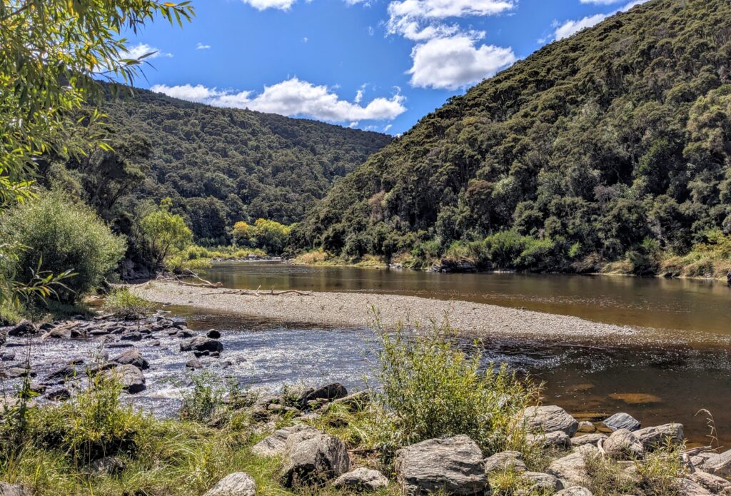
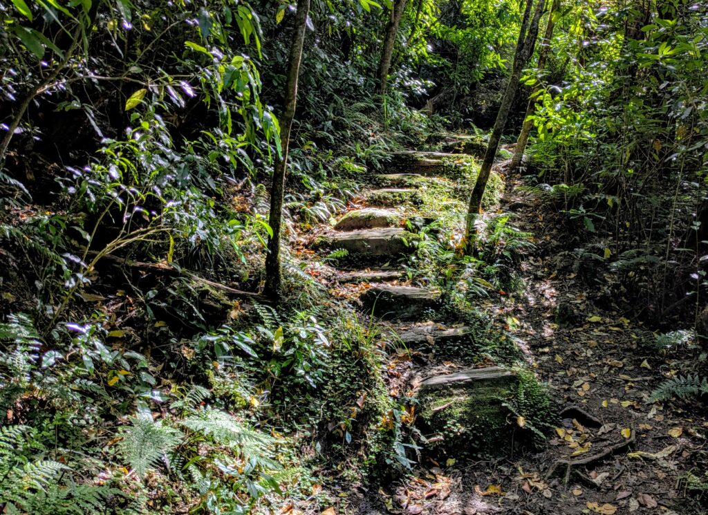
It was wonderfully cool in the shade of the woods, with moss and ferns surrounding us.
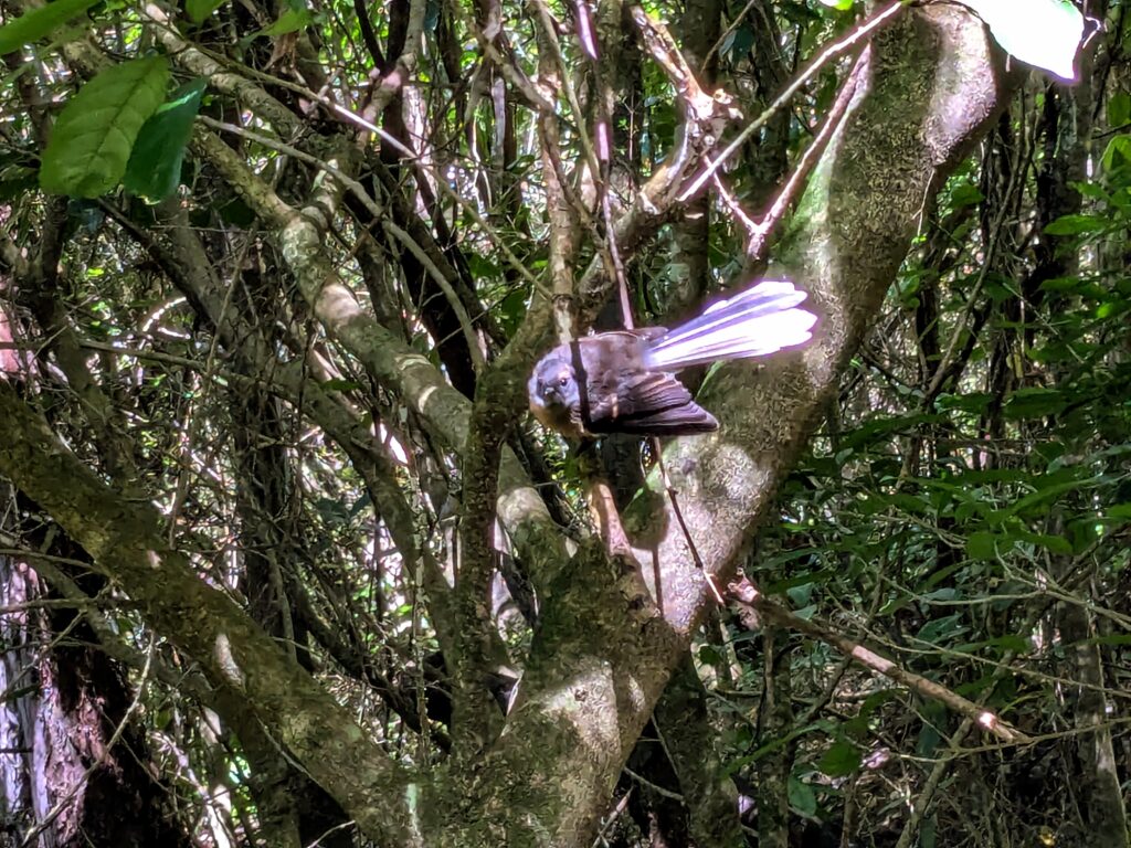
We were accompanied by fantails flitting around us as we stirred up the leaves and sent tiny flying insects up for the birds to swoop around our heads to catch them on the wing!
Feb 8, 2026 A Day at the Beach
We’ve moved to another B&B, in a rural suburb south of Dunedin, close to golden sand beaches. We explored down the east coast as far as we could drive on pavement!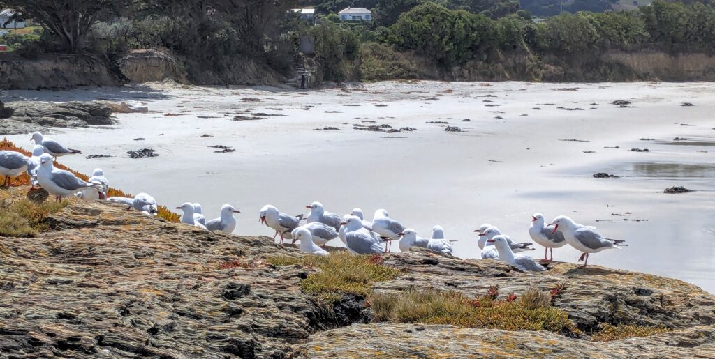
We visited Brighton Beach with rocky outcrops and more gulls than people on the beach on this glorious sunny Sunday.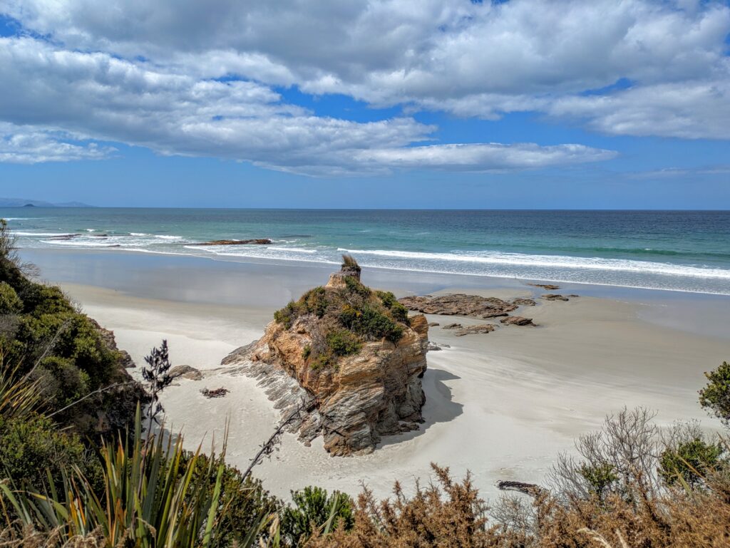
We continued south to Aslaw’s Beach but didn’t find a way down the steep embankment onto the beach, which may explain the complete lack of people on the white sand!
We were able to get on the beach near the mouth of the Taieri River, near the town of “Taieri Mouth”. We were mesmerized by the sea foam blowing across the sand, driven by the stiff breezes and hydroplaning on a thin film of sea water! Watch video HERE!
Feb 7, 2026 A Day in the City
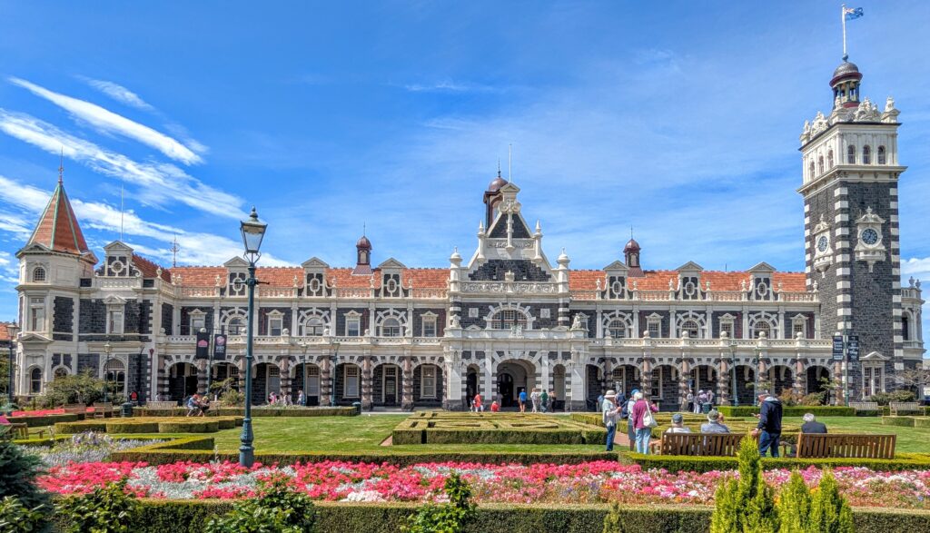
We spent time today in the city of Dunedin, attending the Summer Festival. Of course we had to marvel at the beautiful Dunedin Railway Station!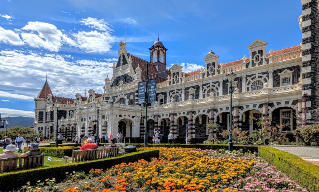
Then we were off to the Festival, like all summer festivals, full of booths of handwares, artwork, clothing, jewelry, etc.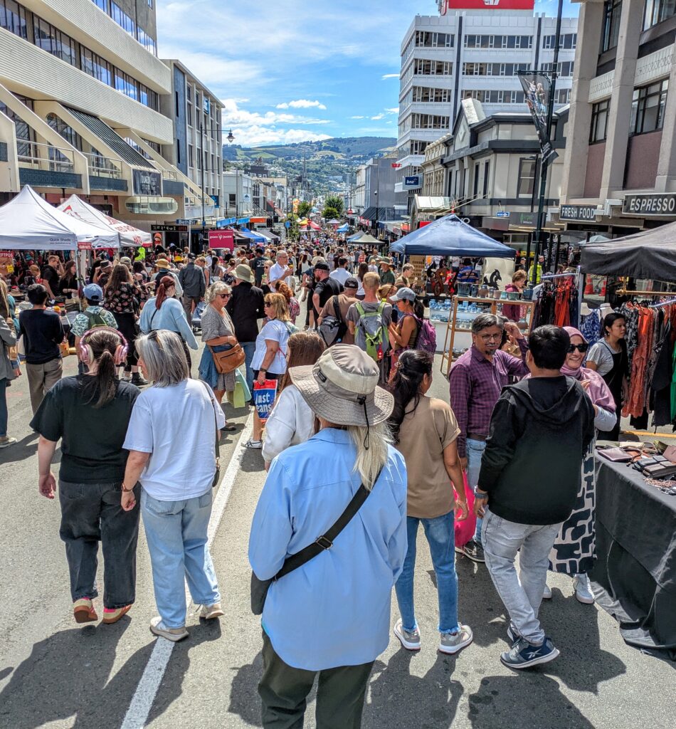
We braved the crowds for a few blocks, then retreated to a pub for lunch!
Feb 4, 2026 Taiaroa Head
A beautiful day for a drive!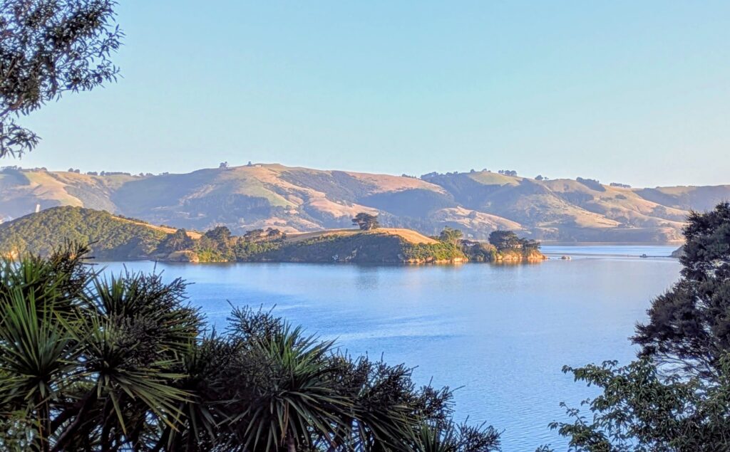
Looking across the harbor to the mainland from our deck, we decided it’s a great day for a drive along that coast!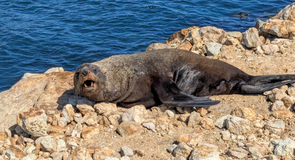
We drove out to the end of the road at Aramoana and walked out onto the manmade ‘mole’ or seawall and joined this sealion basking in the sun.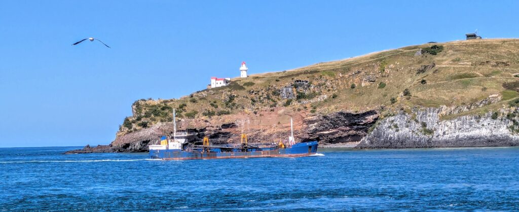
Looking across the harbor mouth at the lighthouse on Taiaroa head, we watched a ship come in, dwarfing the lighthouse! We saw tiny dots of white on the hillside which are nesting northern royal albatross. We didn’t bring our binoculars, but you can watch live-cam videos HERE! Our host worked for several years at the Royal Albatross Centre at Taiaroa Head and we enjoyed sharing our biology and bird care backgrounds!
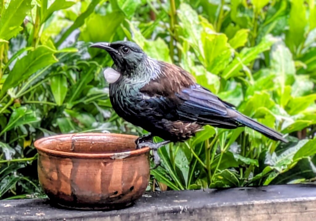
Feb 2, 2026 Tui
Our host provides liquid food for the many birds that visit the lush garden planted on the slope down to the road and the banks of the harbor. The tui came in frequently for drinks and we finally got a great picture!