July 21 Mreznicki (Day 298)
We woke up to a beautiful blue sky, blue water day! We have a 4 hour drive ahead of us so we had a leisurely morning, breakfast and packing. We drove out of the marvelous medieval village of Novigrad and stopped along the bank of the Karinsko sea for pictures.

The sea has beautiful color and the mountains are storm free!
We then headed for those mountains to take the inland route north.
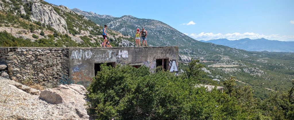
In the mountains we stopped at this abandoned structure for expansive views of the mountains. Very rocky, with scrubby forest overlay, nevertheless home to a variety of wildlife.
Over the mountains, we descended into lush river valleys, passing the crowded Plitvice National Park and the little village of Rastoke near Slunj, both famous for their waterfalls. Owing to it being high season and dry season, we opted not to visit the parks because of crowds and low water levels. For beautiful pictures of the waterfalls click HERE and HERE.
We continued on to our accommodation in the country near the Mrežnica river and the town of Duga Resa.

A very bucolic setting amid farms on the banks of the river that boasts 93 waterfalls!
We unfortunately did not see any of those waterfalls, they were in the far reaches of the river and we were ready to relax on the patio, enjoying a glass of elderwater homemade by our host, before we headed to the nearby restaurant recommended by her.
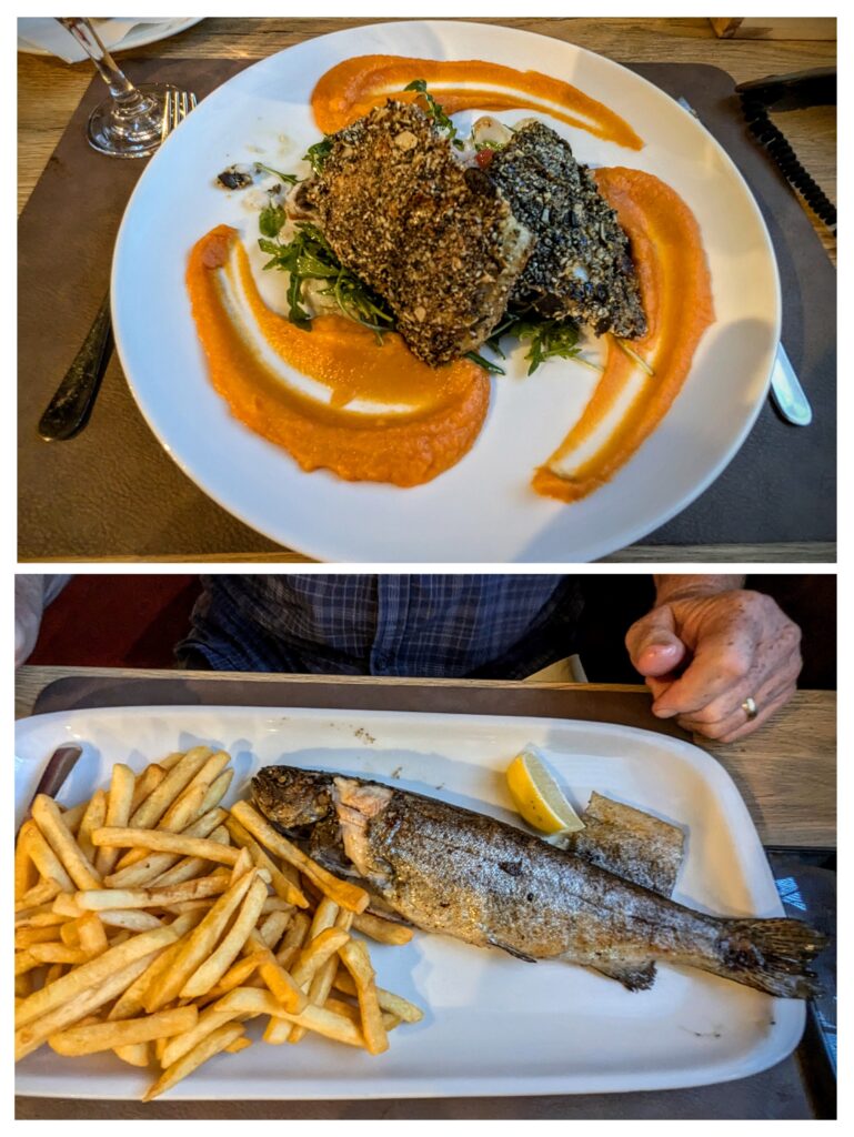
Dinner was worth the wait! I had perch in a pumpkin seed crust on a bed of salad with citrus and fennel and pumpkin puree. Robert had grilled trout and fries and a beet root salad that was actually a big bowl of sliced pickled beets! It was all delicious!
July 20 Scenes of Novigrad (Day 297)
After breakfast we walked down the hill to town before it got too hot! Our first stop was the church which looked like it had some renovations ongoing.
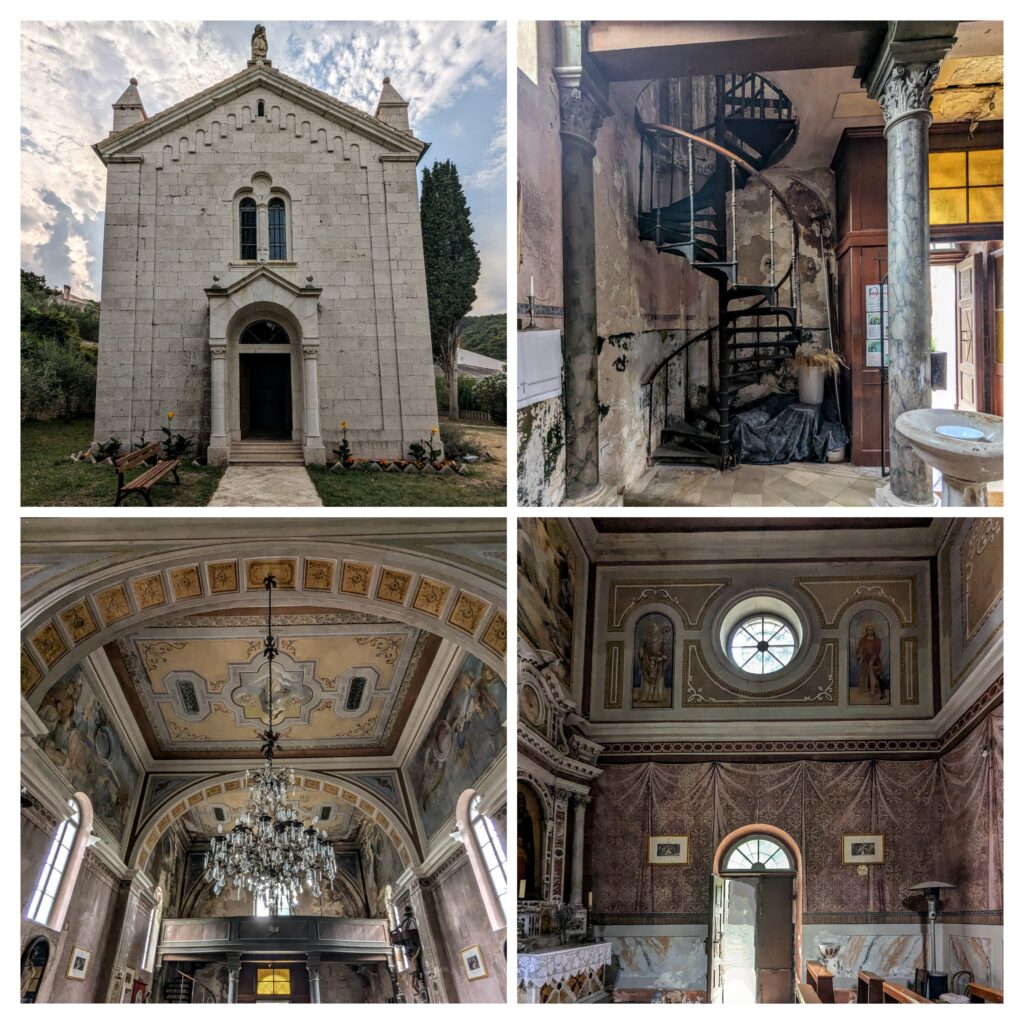
The church looked modest from the outside, but the big chandelier, spiral staircase and extensive frescoes belied its simplicity! The frescoes around the door with the round window above give the appearance of opulent drapery!
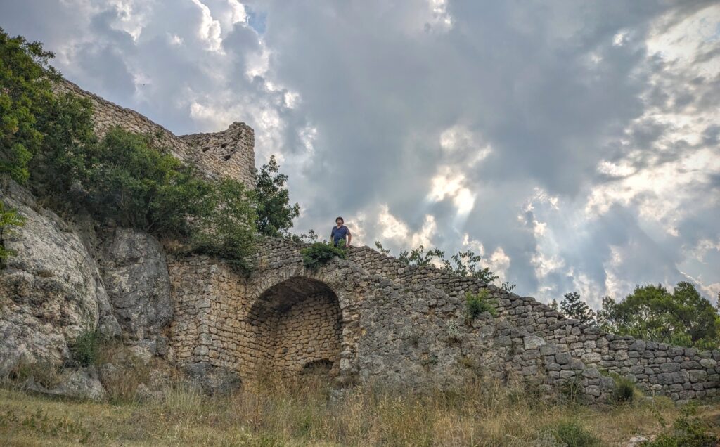
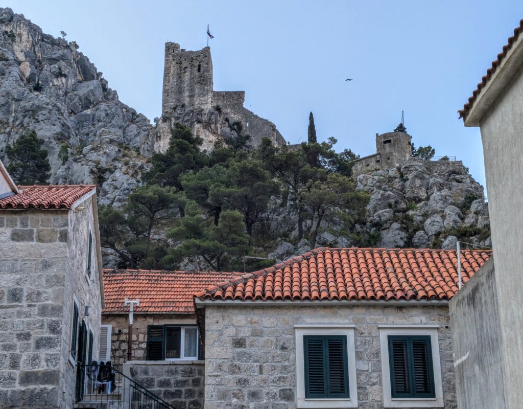
We then started the climb up to the fortification ruins on the hilltop above town.
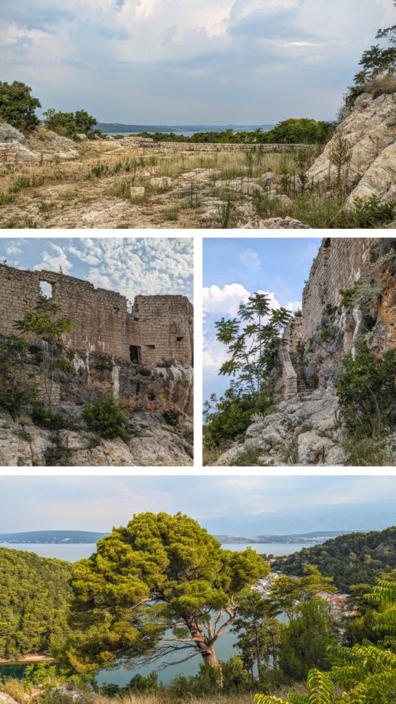
We had the ‘castle’ ruins to ourselves this morning.

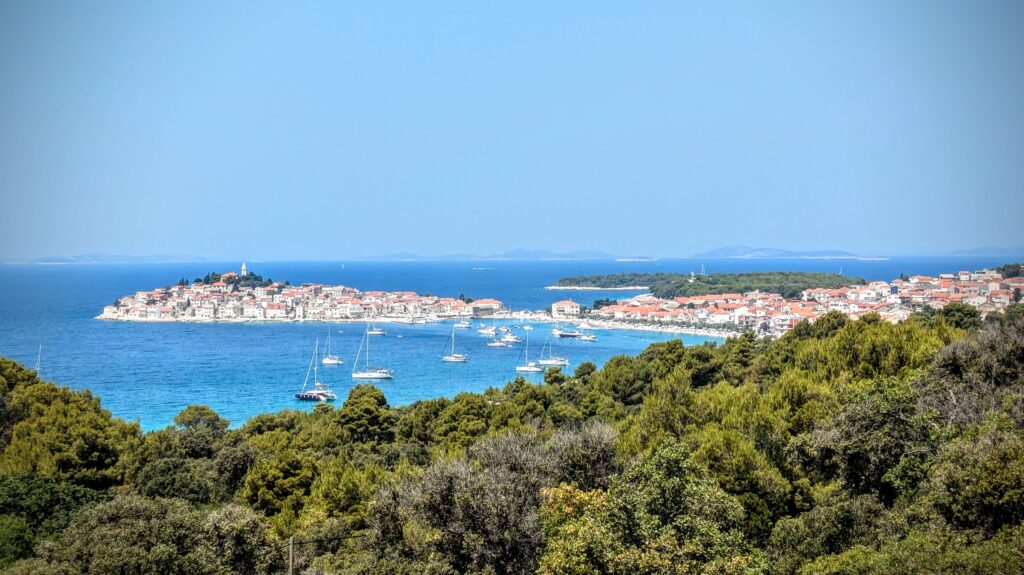
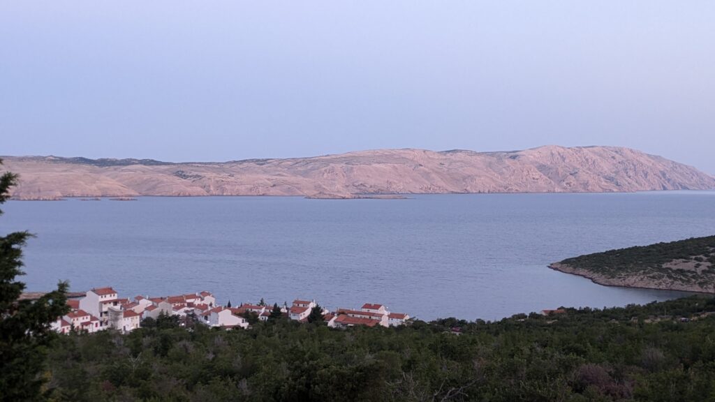
The panorama from the top, looking down on the main town and the harbor which is the tail end of a huge bay penetrating into the Dalmatian coast called the ‘Karinsko more’ or Carina sea.

Another view looks down on the sweep of the bay opening into the Carina sea, in the distance there’s a bridge over the inlet from the Adriatic into the bay.
With the sky clouding over we started our hike down from the heights into town.
In town we visited the ‘Tower Buta’, originally a guard tower at the city’s great gate, which is now a visitor center. Inside was an exhibit of pictures of people from the Novigrad area that emigrated to America in the late 19th century. They sent pictures back from St. Louis, Missouri, Texas and California, the 3 main areas they emigrated to. The docent described a recent visit by descendants of one of those immigrants! Just then the storm gathered force and the wind started blowing. The docent had to get home and suggested we get going too! We hoofed it back up the hill, grateful for the wind and the expectation that the heat wave might break! We made it back to the Airbnb before the rain and small hail storm! We had a nice break for lunch and a nap, then we headed back out for an early evening walk!
The wind quieted down, but it was still hot!
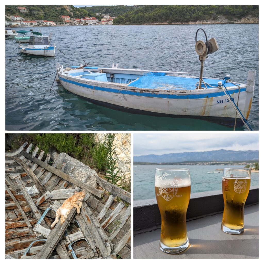
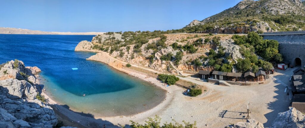
We made it around the bay to the beach and watched the families enjoying a Saturday evening swimming, sunbathing and picnicking. We found the beachside bar and had our first Croatian beers!
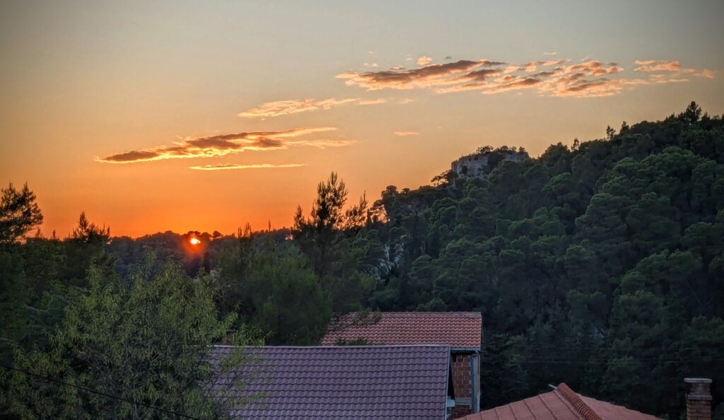
Back at the Airbnb we enjoyed watching the sunset from the top floor balcony of our apartment in the house at the head of a little valley looking toward town.
July 19 To Novigrad (Day 296)
This morning we finally ventured down to the beach! And I even got into the water!
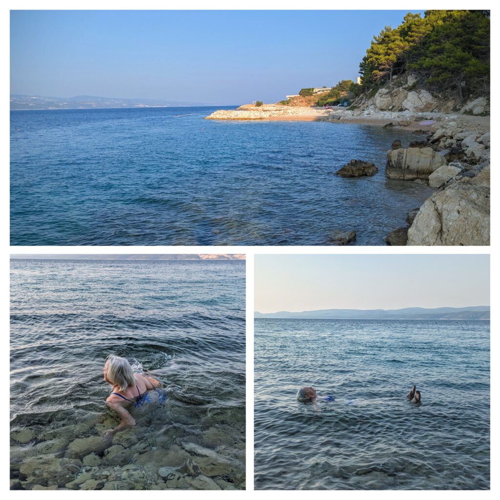
The water is cool and very salty! Floating was no problem at all. The bottom is cobbly and hard to walk on, especially in flip-flops!
We had breakfast and packed our luggage in the car and drove north towards our next stop. We took the scenic route along the coast as much as we could, including a detour along a bulge on the Adriatic coast, about the center of the ‘Dalmatian Coast’ as the area is known. And yes, “The origins of this breed (the Dalmatian) can be traced back to Croatia and its historical region of Dalmatia.” per Wikipedia!
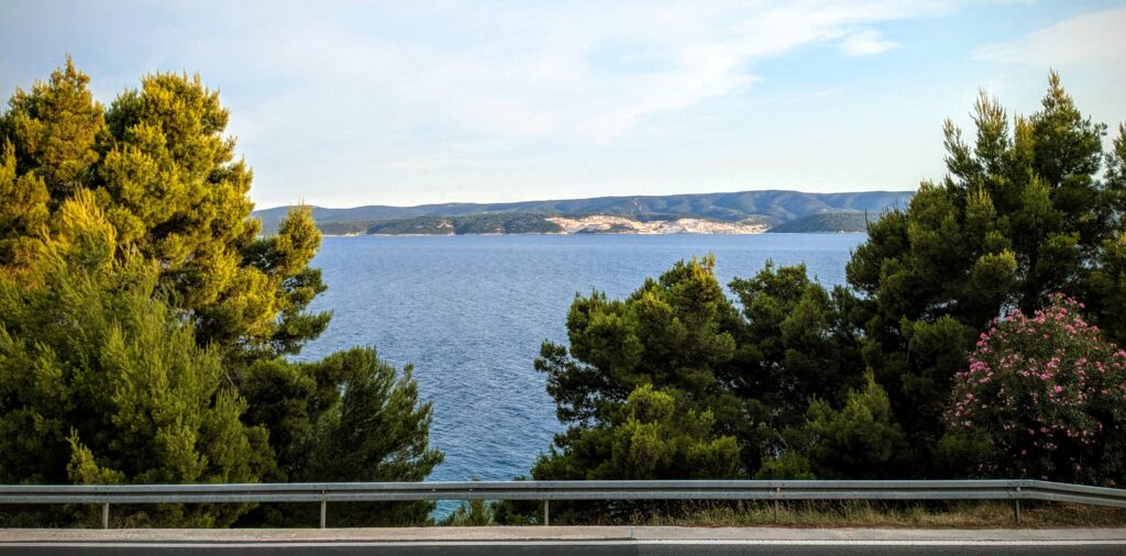
An intriguing town site along the Dalmatian coast.
We stopped to get a photo of the town of Primosten from this vantage point, and to buy a couple of bottles of wine from a stand manned by 2 young men (one about 10 years old!) from a local winery. The major agricultural products in this area are olives and grapes for wine! We continued on to our next destination in Novigrad, Zadar County. There are 2 Novigrad’s in Croatia, this one and another further north in the region of Istria. The first amazing view of the town as you descend toward the small bay where it is situated, from the Wanderers Compass website.!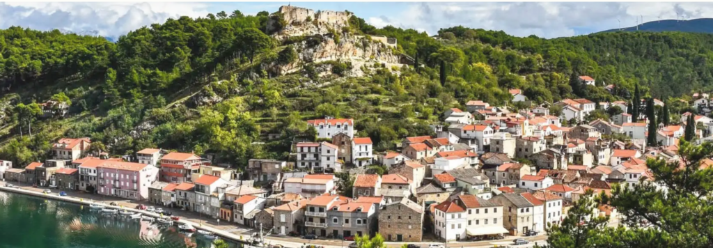
July 18 Zipline! (Day 295)

A very early morning walk through the tunnel and down the steps towards the beach had to be cut short because we had a big day in store!
We drove into Omiš to meet other adventurers for a Zipline course over the Cetina river canyon!
The older part of town with Mirabella fortress overlooking it. This 13th century fortress protected the pirates of Omiš who would retreat with their ships into the safety of the Cetina Gorge upriver!
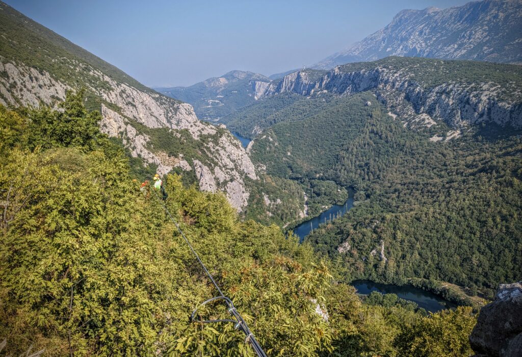
The Cetina river flows from The Eye of Kroatien, a spring north and west fed from the mountains across the border in Bosnia, to its outlet in Omiš.

A brand new bridge spans the end of the gorge of the Cetina river. The highway allows a bypass of the town.
Eleven fellow adventurers climbed into vans along with several guides for the short ride up the gorge to the ‘jumping off’ spot. First we had to gear up with the harness and practice on a short section of cable to insure we knew how to sit and most importantly, how to brake! This is the first zipline that we’ve done that requires the user to actively work brakes on the pulley system you are hanging from! It is a simple matter of lifting the pulley brake pad off the cable, or pressing the brake pad down onto the cable. You just need to know when to not brake and when to brake, or you will crash into the landing or not make it to the landing and have to pull yourself in hand over hand! We all passed the initiation and proceeded to hike about 15 minutes to the first of 8 zipline cable crossings!
High up above the river canyon you can’t quite see out to sea! The hazy skies hint at the humidity and heat we will experience today! You can see the anchor cable in the middle forefront, follow it to see the yellow helmets of the guides at the first platform.

Robert is assessing the zipline route, the first and the longest of the 8!
Since both your hands need to be on the cable brake you can’t take any pictures during your ride.

So here’s Robert, coming in for a landing!

And here on another route, he sticks the landing!

Our second to last ride, does the river look any closer? The routes zigzag down the forested canyon, sometimes through trees, crossing the river twice before a short hike to the road to catch the vans.
It was an exhilarating 3 hour journey from first van ride to returning to town. It was beautiful zipping through or over the forest, with a brisk breeze created by your speed as you descend the cable by power of gravity! It was sometimes hard to focus on the guide at the incoming platform giving you signals to brake or not brake because you wanted to look around and down at the river! Yesterday we changed our time slot from 10 am to 8am, thank goodness because by the time we got back it was too hot to do anything else for the rest of the day! For more information and great videos click here on Zipline Croatia Omiš!
July 17 Down to Omiš (Day 294)
Road trip today! We will travel down the coast, past 2 large towns, Zadar and Split, to our destination along the southern coast. But first we will enjoy the sunrise on the balcony of our apartment in Stinica!
Looking down on the holiday apartments below us. The sun has not yet fully illuminated the island in the distance. The balcony was non-usable yesterday in the heat of the day!
After our coffee and leftover pizza breakfast we loaded the car and set off.

We stopped at the waterside cement pad we were at last night. Robert was hoping he could fly the drone, but people were already swimming there! The back side of the crumbling stone building has a beautiful mural. A local pet walking by panting attests to the day heating up already!
The long narrow islands visible from the coastal road look so barren we wonder what means of sustenance are viable there!

From a distance we could see long dark ribbons on the island. With the aid of binoculars we identified them as rock fences.! Why we wondered? Find the answer HERE!
As we traveled along the coast we saw evidence of aquaculture, just what kind we couldn’t figure out!

This looked like a fish or shrimp farm. But other installations looked like just lines of buoys in small bays. We learned later that these are mussel farms. The buoys hold ropes suspended in the water with mesh sacks for the growing mussels.
Further down the coast we passed a picturesque beach.
On the outskirts of Karlobag, the town name can be deciphered from the shadow in the sand of the swing set!
We stopped in Karlobag for a coffee at a beach bar. The ‘beach’ here was a stone wall with ladders down into the crystal water, with a few swimmers and sunbathers in the intense, hot sunshine.

Across the ‘beach’ were a few pleasure boats, including one that looked almost like a pirate ship!
We skirted around the town of Split which is much larger than we expected!
The tall buildings of Split can be seen in the hot, hazy distance as we took country roads past the peninsula the city occupies.
We stopped briefly in the smaller resort town of Omiš, and finally reach our destination, Sunrise Studio Apartments, just south of Omiš!
The early evening view from our balcony across the road and out across the water to an island. Below the road there is a beach reached via a tunnel under the road and stairs!
