May 13 Back to the Blue Mountains (Day 229)
Today should be the best day weather-wise of our stay here in Glenbrook! So we took advantage of it and caught the train for the 1 hour ride to Katoomba, the gateway town to the Blue Mountains to hopefully see the sights we missed in the mist of our visit on May 8! The Katoomba station is still 1.5 miles from the visitors center so we caught the local bus to Echo Point and it stopped at the restaurant where we had lunch during our ‘Off Train Experience’ with the Indian Pacific Train. Compare this picture to our view from the restaurant deck on May 8th!
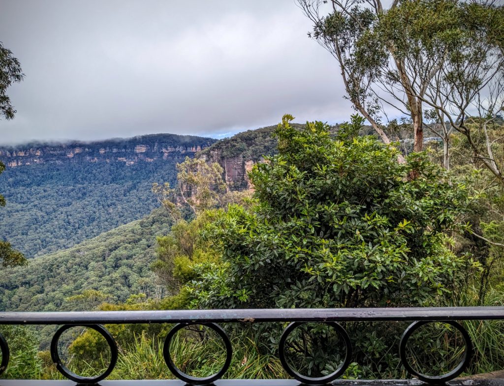
There was still a layer of clouds, but they stayed above the mountains today!
The Echo Point Visitors Center is a very short walk from the restaurant and we finally got a view of the Three Sisters!

The 3 Sisters and the Jamison Valley in the Blue Mountains.

The visitor center is mostly a souvenir shop, but an employee gave us directions for a hike down a steep staircase into the valley, around the base of the 3 sisters, past Katoomba Falls and back up another steep staircase, then along the Cliff Walk back to Echo Point! We purchased some snacks and filled our water bottles for the trek!

The Giant Stairway is VERY STEEP! Steps hewn from the cliff rock itself were started in 1916, but construction was paused in 1918. Work commenced and was completed in 1932 with the addition of metal stairways where the rock itself could not be carved.
Over 900 steps later we reached the path along the talus slopes above the valley floor, shaded by the rainforest growing in the depths of the valley.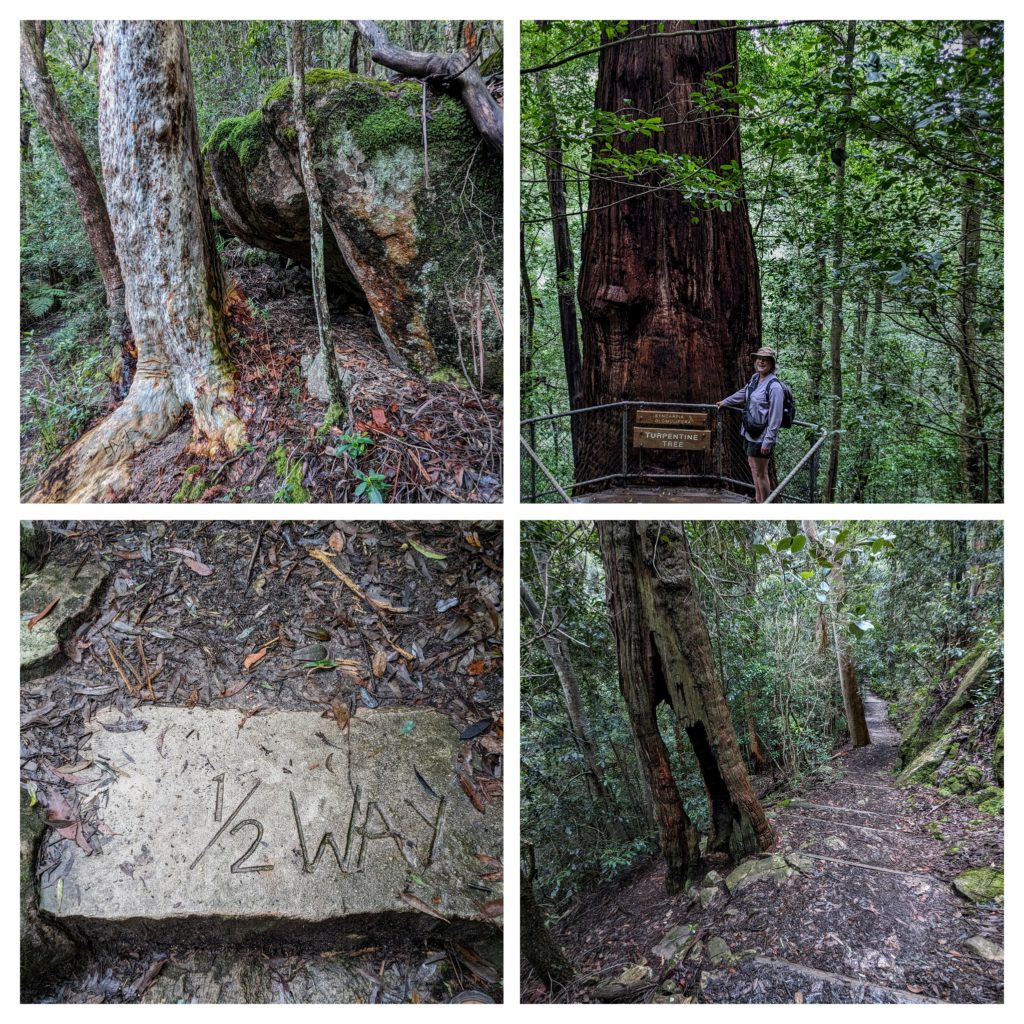 We stopped briefly at the base of Katoomba Falls, an unassuming river flowing around a jumble of huge boulders. Then we began ascending the Furber Steps, bringing us up the cliffs. As we climbed the series of steps, with some flat grade between them, we began to get views of the entirety of Katoomba Falls, an awesome waterfall!
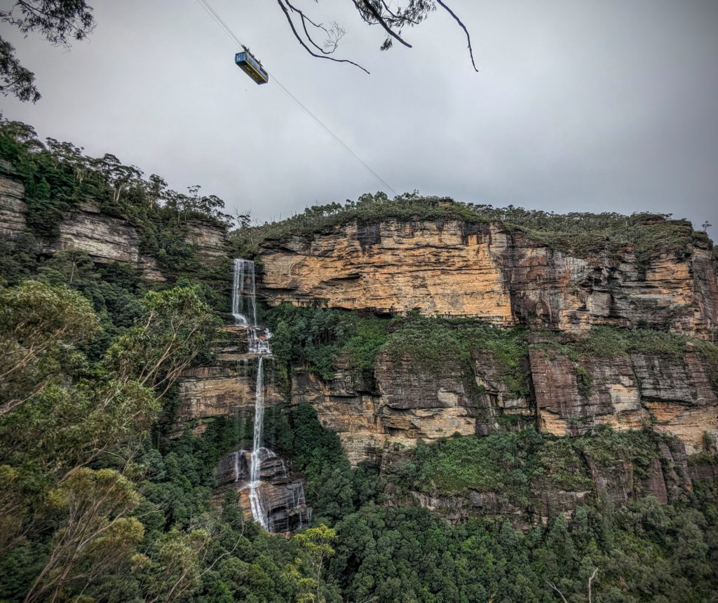
From the bottom you have no idea of the height of the falls! Notice the Skyway gondola above the falls, crossing between the cliff faces. We rode the gondola on May 8th and had absolutely no view, or even idea of, the magnificent falls below us!
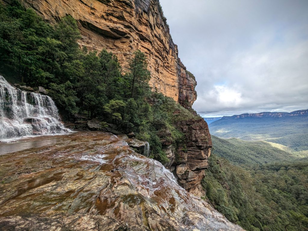
A spur trail took us closer to the falls than we anticipated, giving us a view of the river cascading over a bench of rock overlooking the valley.

We finally reached the top of the cliff and were level with the Skyway gondola!

As we hiked the Cliff Walk back to Echo Point we passed the Katoomba Cascades waterfall. The path was getting crowded now.

One last look back at Solitary Mountain in the Blue Mountains National Park as the clouds finally broke up and the sun came shining through!
Giant Stairway to Furber Steps Loop was an awesome 3 hour hike, strenuous at times, but worth it! We caught the bus back to the train station and the train back to the Airbnb for a busy night of packing for our early morning departure tomorrow!
May 12 Happy Mother’s Day (Day 228)
Happy Mother’s Day to all the Mothers out there! We hope you all had a wonderful day, and were celebrated by your children and fur-babies! We had a great relaxing day walking around town and seeing all the families out and about. We stopped at a pub and enjoyed a snack while listening to some live music.
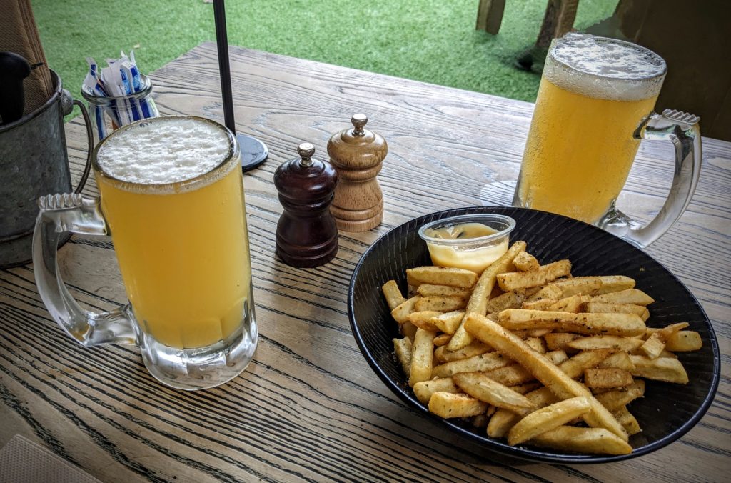
Delicious fries or ‘chips’ as they are known here!
May 11 Glenbrook (Day 227)
The forecast today was for showers, but the weather held long enough for a walk about town to pick up groceries and stretch our legs. We meandered into a park across from the row of shops that include the Continental Deli, the Greengrocer, the Foodworks Grocer and the Bottle Shop & Liquor store, which is the street we got to know the best!
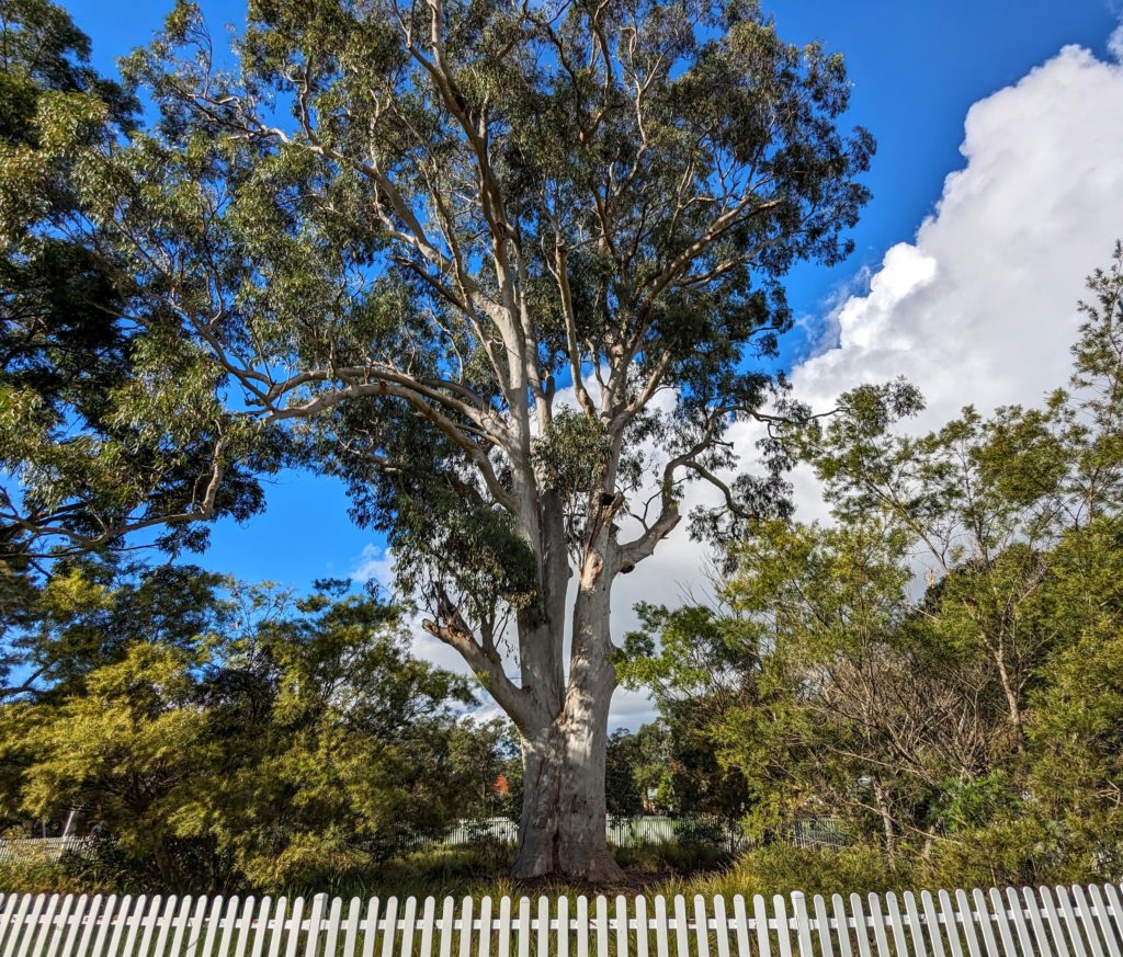
This huge Eucalyptus in the park must be significant, it is encircled by a well maintained picket fence!
Eyeing that big cloud moving in we headed back to the Airbnb before the rain started!
May 10 Sydney! (Day 226)
Another day of predicted rain, but we have reservations for a dinner cruise on Sydney Harbour! We caught the train into Sydney in the early afternoon and as the train entered Central Station it started pouring down rain! While we got coffees and planned our route around the city the rain let up and we were able to walk from the station through the CBD (“Central Business District”-what we Yankees call “Downtown”) to King Street wharf where we will catch the boat in 2 hours.
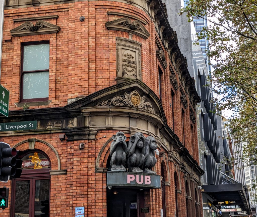
Amongst all the modern skyscrapers and historic architecture this building caught our eye!

We passed by the Town Hall, next to an old church and a complex of government buildings from the late 1800’s.
We then made our way to ‘The Rocks‘, an older neighborhood by the Sydney Harbour Bridge with harbour views, museums, shops, restaurants and bars, and lots of history. This is where the first convicts were brought in January 1788 to start the colinization of Australia! per ‘The Rocks Discovery Museum. Unfortunately we only had time for a few pictures before the rain started again!
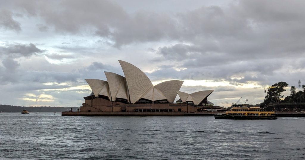
We got a glimpse of the iconic Sydney Opera House between buildings, and the view opened up as we approached the harbor! At the end of this arm of the harbor is Circular Quay (pronounced ‘key’ here), where the passing ferry departed from.

A walk to the end of the harbor wall gives you a view of the Sydney Harbour Bridge. If you look closely you can see people walking on the arched bridge structure!
We walked through the rain back to King Street Wharf as the sky darkened with clouds, obscuring the sunset. We boarded our boat at 6pm for our 3 hour cruise and it was fully dark now, but lit up with the lights of the city. We were seated, offered wine and menus. The rain had passed and after the boat left the dock and our orders were taken we were free to go on deck and enjoy the views.
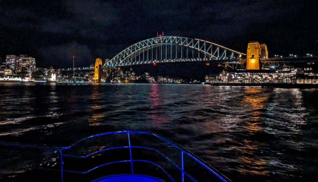
The Harbour Bridge was alight!

As we approached and passed the Sydney Opera House we were amazed. In most pictures it looks like white sails on the Harbour, but at night it is aglow with lots of color!
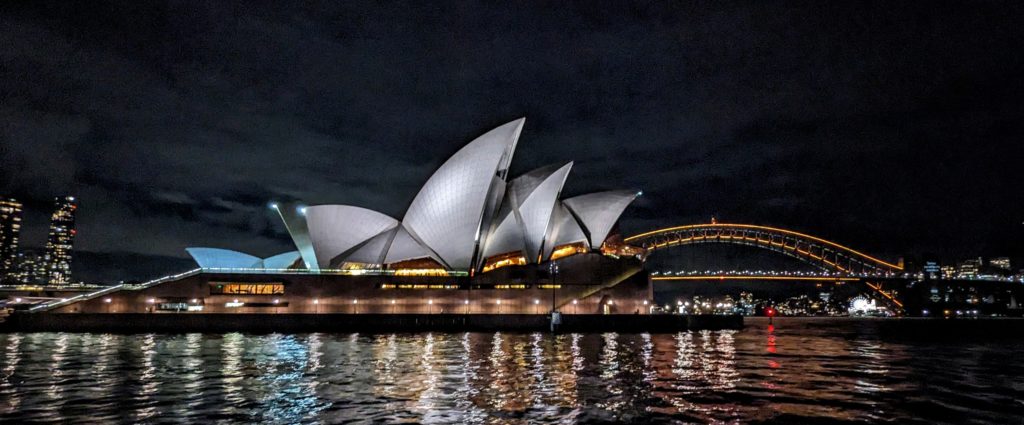
The sail imagery is apparent as we pass to see the side of the buildings.
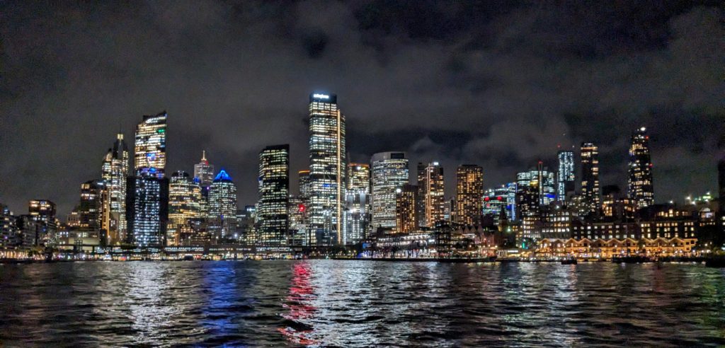
The night skyline of Sydney is stunning.
We enjoyed our dinners and chatted with our server and other passengers and all too soon we were back at the dock. We walked back through the city, still busy with people going out on the town.

Even Town Hall was lit up for the night!
We stopped for a nightcap at the pub we passed earlier and the 3 wise monkeys will keep the secrets of the rest of the night!
May 9 Day of Rest (Day 225)
Rain predicted today, but it was sporadic. We had a wonderful slow morning then went for a walk around Glenbrook where we are staying.

Our Airbnb with a great porch, down a long driveway in the trees.
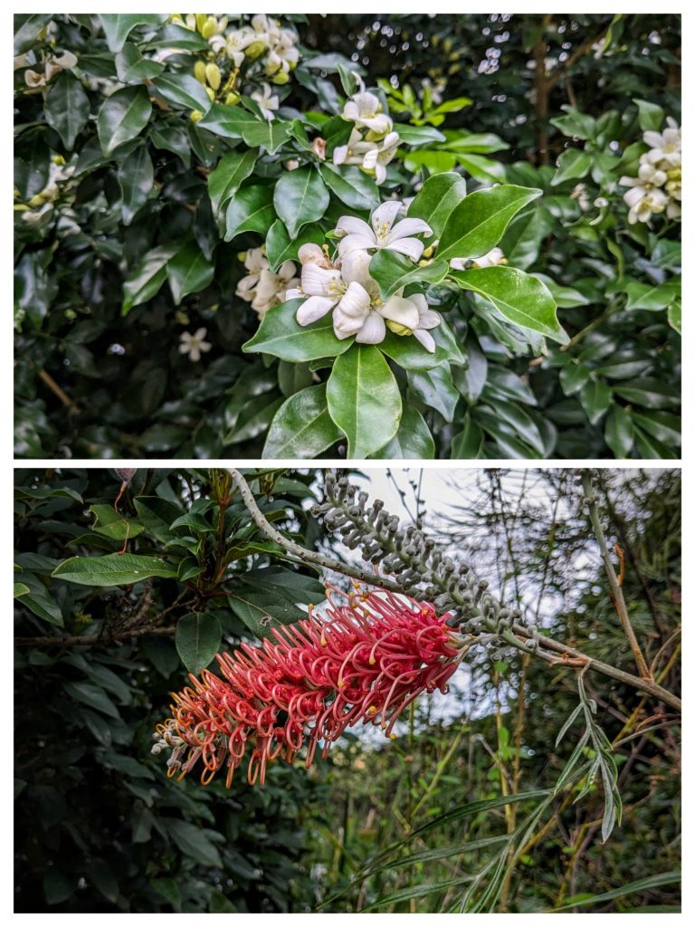
Beautiful flowers are blooming all around town. The white flowers are extremely fragrant!
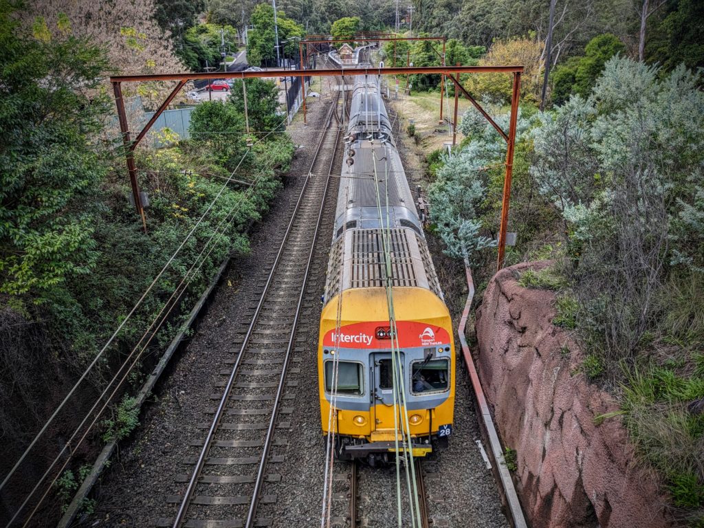
The quaint train station is only 2 blocks away, convenient for our trip into Sydney tomorrow!
