May 3 Serpentine Falls (Day 219)
A cloudy morning greeted us, but the air was refreshed by yesterdays rainfall which was modest here, but caused some flash flooding south of Perth! We headed out to do some sightseeing at Serpentine National Park, a short 30 minute drive from our Airbnb. A short walk from the parking area took us past signage acknowledging the aboriginal connection to this unique spot.
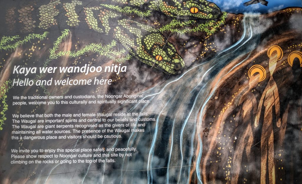
The Aborigines of Australia have a 65,000 year history of human habitation on the continent!
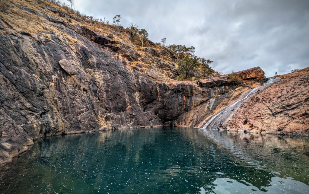
On to the falls, which thanks to the rain, was flowing into the deep blue pool.
We hiked up to a lookout above the falls through a eucalyptus forest with such fresh air it reminded us of Vick’s VapoRub minus the menthol! VapoRub has 1.2% Eucalyptus oil!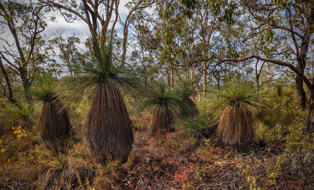
As we approached the top of the bluff we found this plant, looking like a grass, but in a tree form!
They are Grass Trees! A native plant of 66 species found only in Australia! The ‘trunk’ is made up of older leaf bases cemented together by a resin. The older leaves hanging down like a skirt around the trunk form an insulating layer around the plant protecting it from fire.

At the top of the bluff we looked down on Serpentine Falls and the pool, in the center of the picture.
We finished the day with a cookout at Joe & Candice’s place!

We couldn’t get the gas grill to work, but it served as a base for the George Foreman electric grill! Probably for the best since the chance of a bush fire from open flame is so dangerous with the drought still prevalent!
May 2 They Found Us (Day 218)
We all know that a Democracy entails participation by the governed!
“The hallmark of democracy is that it permits citizens to participate in making laws and public policies by regularly choosing their leaders and by voting in assemblies or referenda. If their participation is to be meaningful and effective—if the democracy is to be real and not a sham—citizens must understand their own interests, know the relevant facts, and have the ability to critically evaluate political arguments. Each of those things presupposes education.”
So, Deschutes County forwarded our ballots to our present location, which we provided the address to before we left the country! We spent today perusing and studying the voter pamphlet online and voting in the 2024 Primary Election, then running around town looking for a place we could print out the forms we need to fill out as absentee voters, signing them and emailing the ballots back to Deschutes County! We then relaxed inside while it rained and thundered outside!
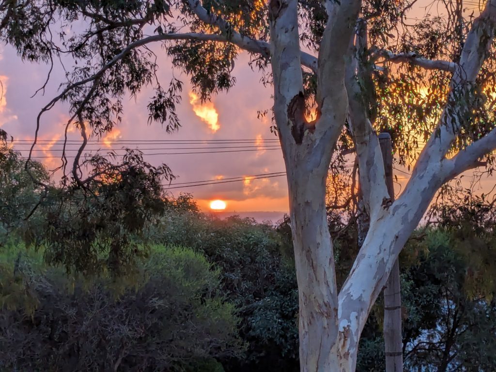
A beautiful sunset ended the very blustery, stormy evening!
May 1 Birthday Breakfast (Day 217)
We went out for a Birthday Breakfast this morning!

Birthday Brekkie (as it is referred to in Australia!) at a restaurant called Avocado! Of course we had avocado on Robert’s Eggs Benedict Brekkie, and my Full Brekkie which included eggs, bacon, sausage, sauteed mushrooms, blistered tomatoes, baked beans, toast and hash browns! I had to bring some home!

The restaurant is in a beautiful setting beside a creek that is dammed to form a lily-pad covered pond, and surrounded by orchards of avocado trees and apple trees.

Beautiful art work in the lobby too!
We finished up the day having Joe & Candice and the girls over for dinner and dessert! And of course fun-time/exercise with a toddler, lots of giggling and laughing!
April 30 Rain! (Day 216)
Today Rain is predicted! Possibly breaking the 7 month dry spell for Perth, the longest on record! It did finally rain but it was mostly bluster, wind and thunder! We were out for a little while and spotted these interesting birds!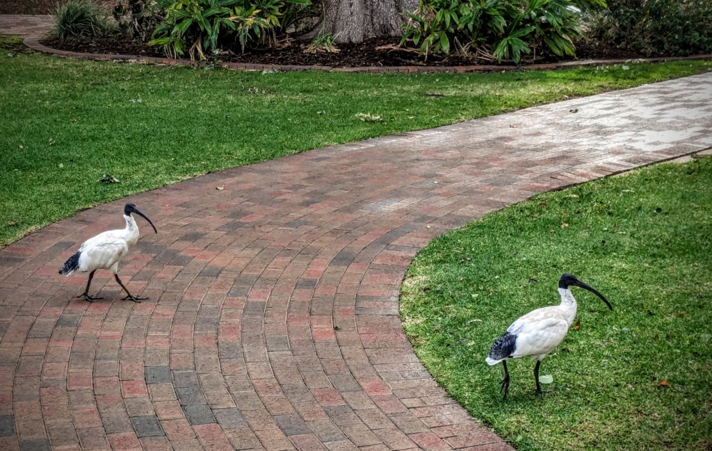 The Australian White Ibis looks like it just strolled in off the African plains, but it is a native Australian, though absent from Tasmania. It has become a nuisance in some urban parks, where we observed them sauntering through.

Ahh, a taste of home! $10 Australian is about $6.53 US!
April 29 Indian Ocean Beach (Day 215)
Road trip today! We did some errands in town, though we actually have not been to Perth proper yet! There are so many suburbs around Perth that have all the amenities we need, we have not felt the need to go into the ‘city’! We chose to travel south a little bit and visit a beach! On the way we stopped at a park on the Swan River and discovered that New Zealand is not the only place with eclectic/artistic toilets!
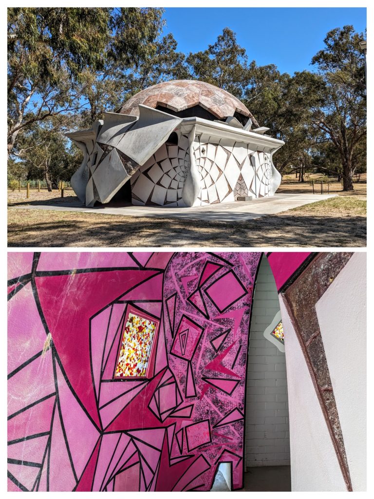
Wow!
We traveled through the south and west suburbs to the small beachside community of Falcon, on a small sliver of land between the Indian Ocean and Collins Pool, a large body of saltwater with it’s inlet just south of Falcon. We stopped at a lookout point and headed out onto the golden beach.
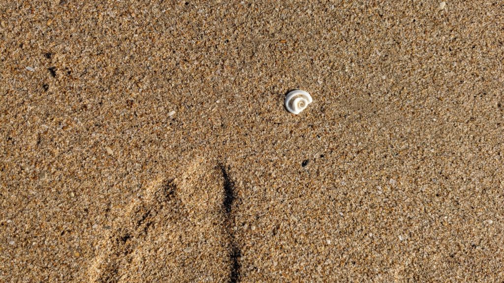
The ‘sand’ seems to be ground seashells!
We enjoyed a walk around the point, past a few people soaking up the warm rays of the sun, past a stand-up paddleboarder entering the water, and found a board walk to take us back to shade!
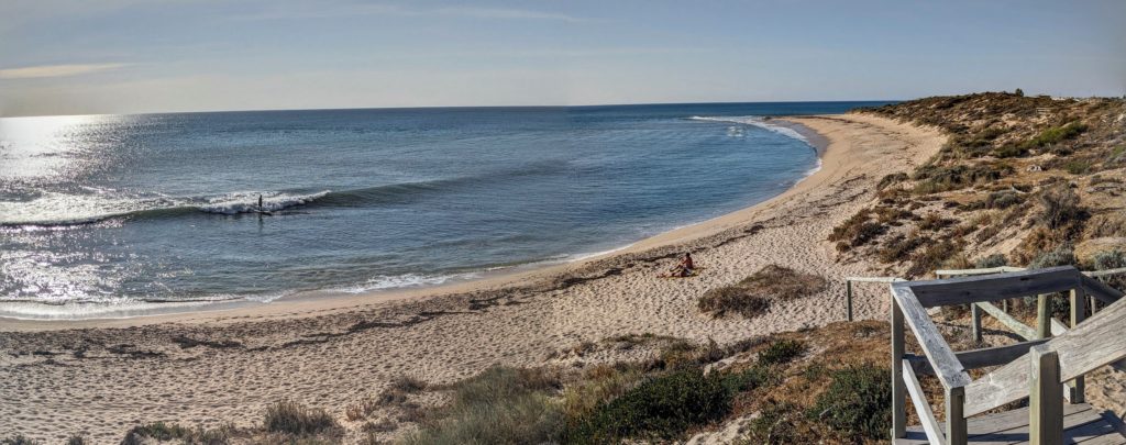
Up above the beach we turned to take in the view and saw the paddleboarder catch a wave and surf it back into the beach!
We took a more rural route home, past dry brown paddocks, some small acre ‘lifestyle block’ ranchettes and turned off at Serpentine National Park to visit Serpentine Falls. We were too late, the park was closed, bummer, but with the drought the falls is probably underwhelming right now!
