March 14 Pororari River Walk (Day 169)
A cloudy but decent day was forecast for today so we went on an easy hike along the Pororari River where it flows out to the ocean at Punakaiki, about a 20 minute drive from the Airbnb. We did this walk on Feb. 28 as part of the longer loop hike taking in the Punakaiki River as well.
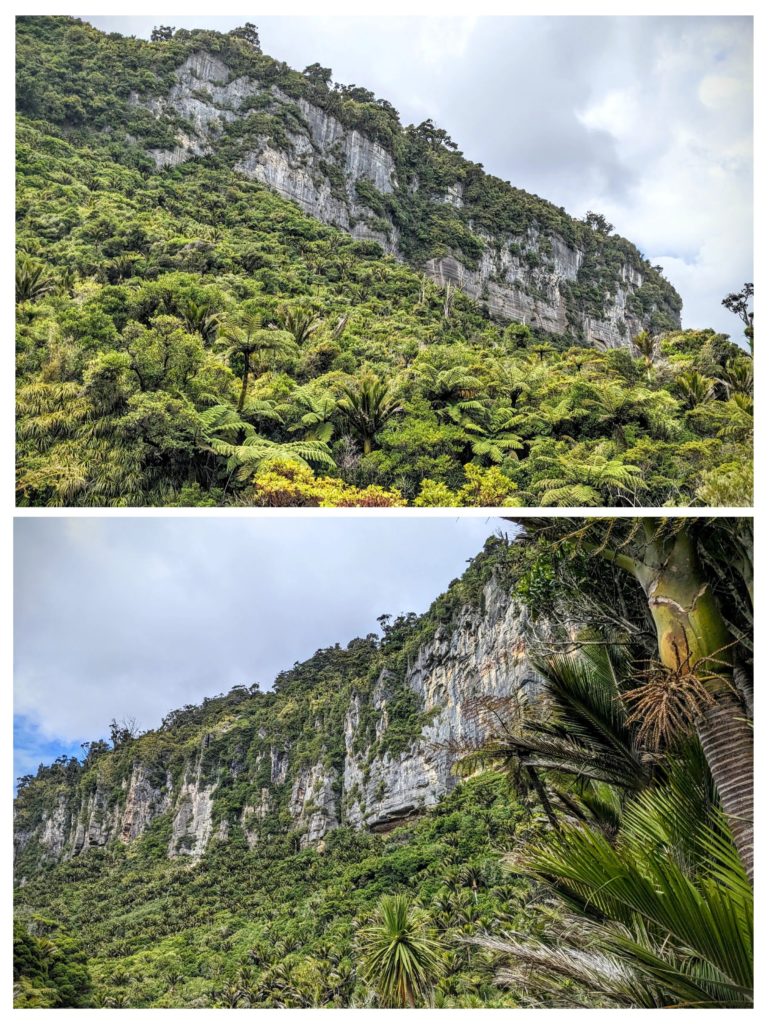
The limestone cliffs covered with prehistoric looking native forest on both sides of the river as we started our hike. The top picture is the north cliff face, across the river. The bottom picture is the south face, above us as we headed upriver.

We hiked through the forest…

Up rock stairs, down through caves…

and over the river on the swingbridge, and onto a smaller, less traveled trail.
The Inland Pack Track we turned onto is the old 1867 trail that miners built to avoid the treacherous climb on a rope ladder over the cliffs near Fox River. The track was built in haste by out-of-work miners and within 6 months it was a morass of mud, the many bridges over the numerous creeks and rivers were in disrepair and it was rarely used by the miners who were focused on getting to the goldfields as quickly as possible, obstacles like cliffs be damned! I don’t think the track has been improved since! After about a mile of huffing it up the narrow, muddy, slippery trail we turned back. We still managed to do a 6.5 mile hike in 3.5 hours!

A weka came to visit while we rested back at the swingbridge. It appeared the minute the crackling of our protein bar wrappers was heard! The ‘camp-robber of NZ’?
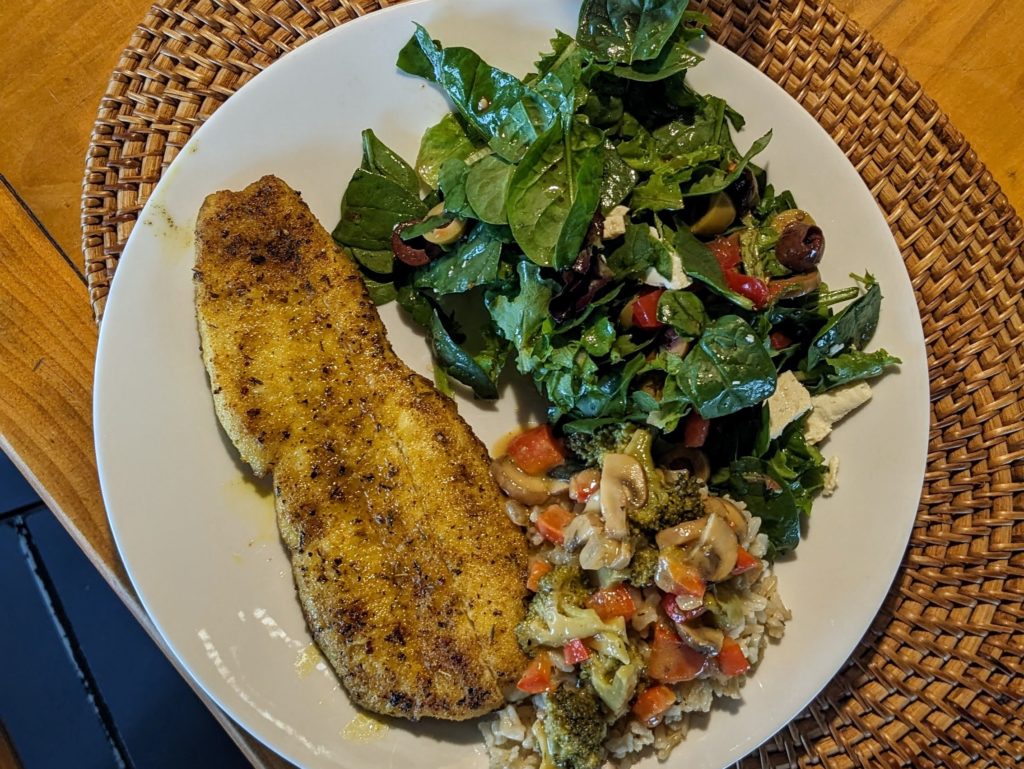
We headed home and enjoyed a wonderful sunset.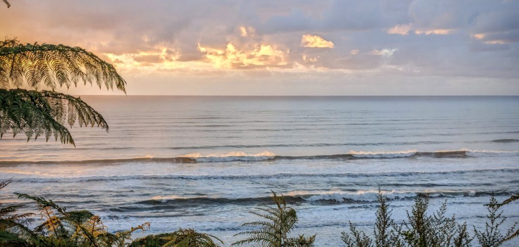 We grilled lamb chops and veggies and made a salad garnished with nasturtiums I collected at the trailhead.

How to eat a nasturtium garnished salad!
March 13 The Property (Day 168)
We took the opportunity to walk around the property today, or I should say walk up and down the property, because it’s on a hillside. The driveway up to the house we are in is pretty steep, sometimes the tires slip on the way up! The driveway continues up to the owner’s house and we found gravel and wooden walkways going into the bush. One walkway led to a greenhouse and small garden.
A second walkway led to a small chicken coop, with only one resident right now, the other 3 free range chickens we spotted partying around a campfire pit at the end of another grassy walkway! We returned down the main driveway, taking in the fabulous view of Woodpecker Bay where the Fox River flows into the ocean.
 The division between the driveway up to the house we are staying in and the driveway up to the owner’s place is graced by this buddha head and beautiful abalone shells.

A calm and relaxing place to stay! HERE are some pictures of the house we are staying in.
March 12 Supply Run (Day 167)
The weather today couldn’t decide to be foggy, sunny, or drizzly , so it did it all! A foggy morning, then a brief sunny stint convinced us we should get out, drive the hour to Greymouth for our last supply run, fill the gas tank and maybe do a little sightseeing.
As the clouds and fog came and went the color of the ocean changed dramatically, from a teal green to a dark blue!
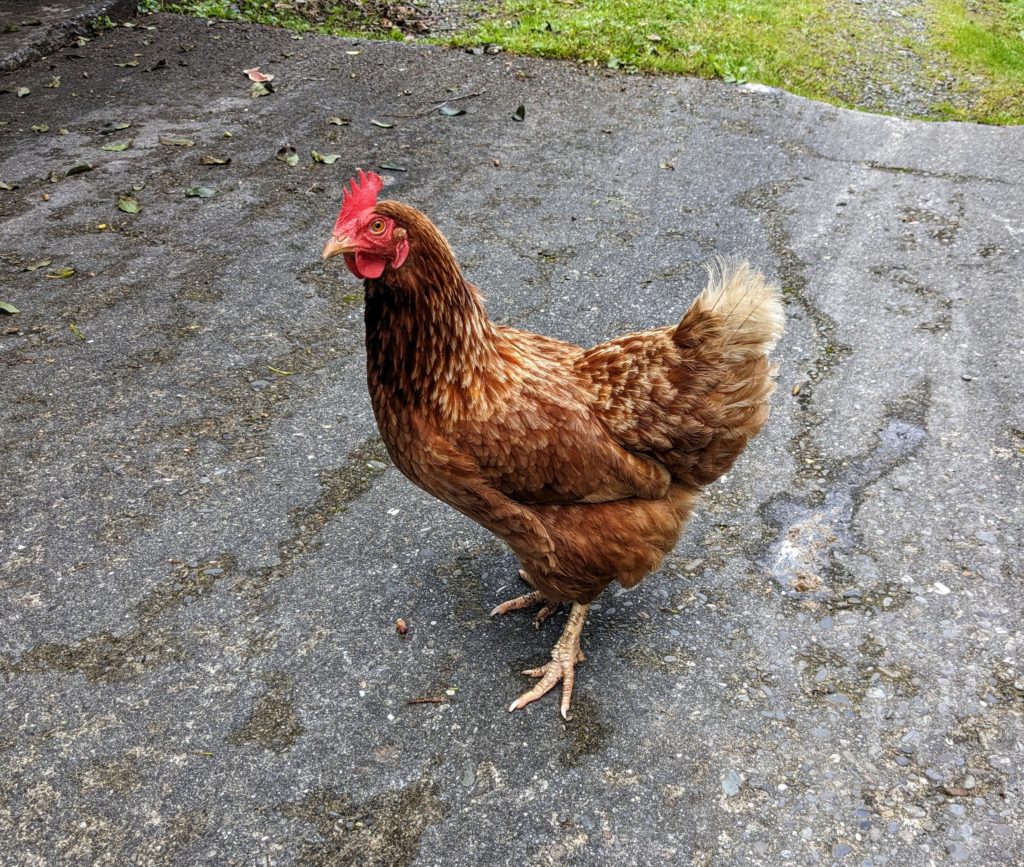
One of the 3 free range chickens pecking in the driveway greeted us at the door when we left!
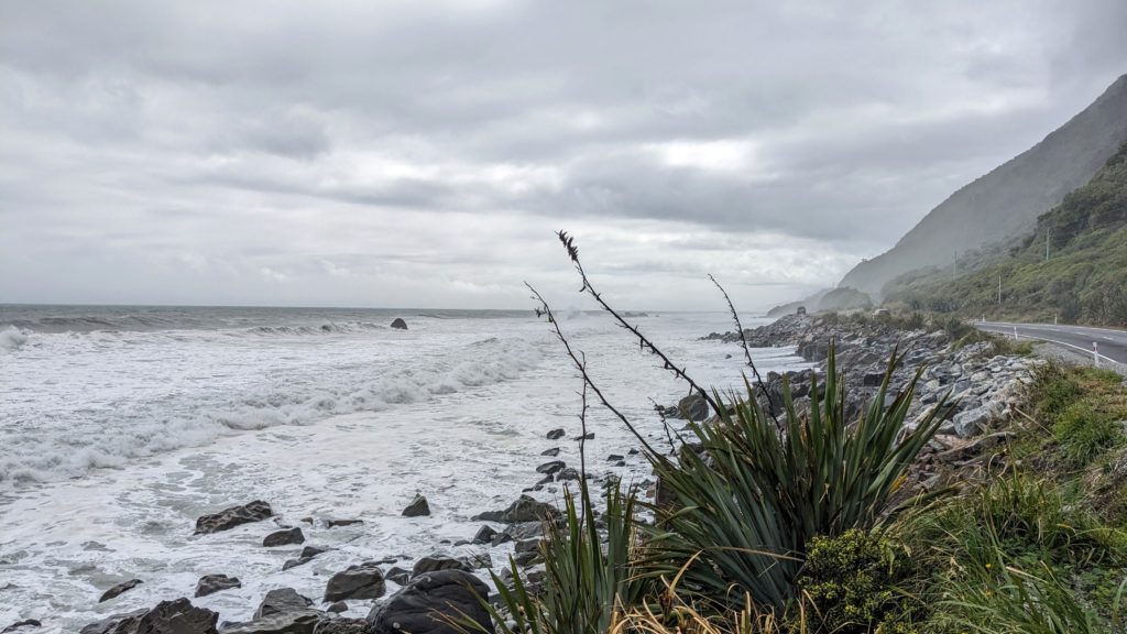
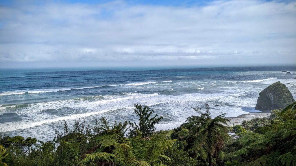
A little way down the coast the fog seemed to move in again, and the skies were dark towards Greymouth. It was high tide and the waves seemed like they were going to reach the road at times!
We went through Greymouth to a park on the south end of town hoping to see some mining history and do some walking around a Heritage Park, but it turned out to be a ‘wild west’ themed touristy Heritage Park, so we passed on that and went back into town. We got back into Greymouth around the time the Tranz-Alpine train was scheduled to arrive, and a light drizzle started! We hung around the station to watch the crowds and see the train again. I did more signboard reading and checked out the huge polished greenstone Jade boulder at the railway station while we waited for the train.
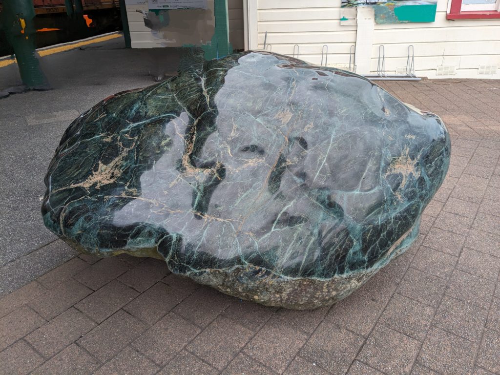
The greenstone or Pounamu is highly prized by the Maori and only found on the west coast of the South Island.
After the train pulled out, with loud horn blowing, we did our shopping and went to the fish shop to get more elephant fish, some perch and some seafood chowder. The same counter person gave us some smoked fish to add to the chowder! We got back home and prepared another wonderful fish dinner. Later, after dark, I went out on the deck before going to bed and saw light on the waves below us. I thought at first the moon must be out, or car headlights from the road below us were shining on the crests of the waves, but it was cloudy, no moon, and there were no cars. I woke Robert up and insisted he come out to see this, and we were mesmerized! The crests of the waves were glowing blue, suddenly bursting into blue light, sometimes far out from the beach, the line of blue light extended linearly as the waves crested! It couldn’t be caught in a photo though. Later Robert googled it and we learned about the luminous plankton that sometimes blooms in the ocean. The action of the waves seems to stimulate the plankton to glow blue or green. We were delighted to have been witnesses to this phenomenon!
March 11 Dinner Tonight (Day 166)
One of our purchases from the fresh fish market in Greymouth was elephant fish.
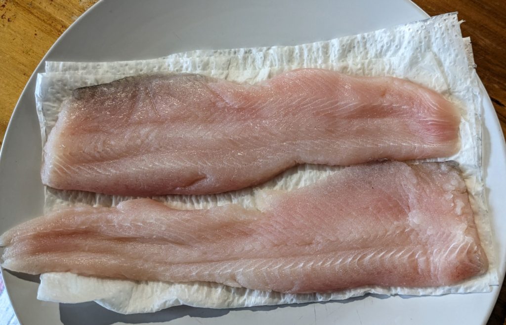
Two good fillets!
Never heard of it before, but the counter person at the fish shop gave us pointers on cooking it, suggesting butter is the best oil and a light coating of spiced flour. So we cooked it up on a sheet of foil on the grill and voila!
Tasty, not fishy at all, with a side of rice-vege pilaf.
Curious about what elephant fish is I googled it; Closely related to sharks.

Weird looking, but delicious! Some references say it’s also found around Australia too.
March 10 Constant and Joyce Bays (Day 165)
A hazy foggy morning developed into a sunny warm afternoon so we drove about 20 minutes up the road to Charleston, a tiny village closer to Westport. Charleston’s beginnings in the 1860’s mirrored and competed with Fox River’s (the area we are staying), as gold mining hubs. In Charleston’s case, there is more of a village now as compared to Fox River, but in the heyday of the gold rush era they were about equal in size! According to a NZ history site “From the junction of the Buller Gorge road (leading into Westport) southwards to Charleston, the road passes over a series of flat terraces. These flat areas were originally under the sea, and have gradually been uplifted over thousands of years. Concentrations of fine gold accumulated with black sand along ancient beaches. The area was swarming with gold prospectors in the 1860s and 1870s, and original forest was cleared. There is now little sign of mining activity except at Mitchells Gully mine, open as a tourist attraction, where old tunnels and mining machinery can be seen.”
We stopped at Constant and Joyce Bays car park and started the short walk along the rugged coast.

The two bays are tiny and Constant Bay has a nice sandy beach.
We walked further through the stands of tall flax plants and emerged on the rocky shoreline.
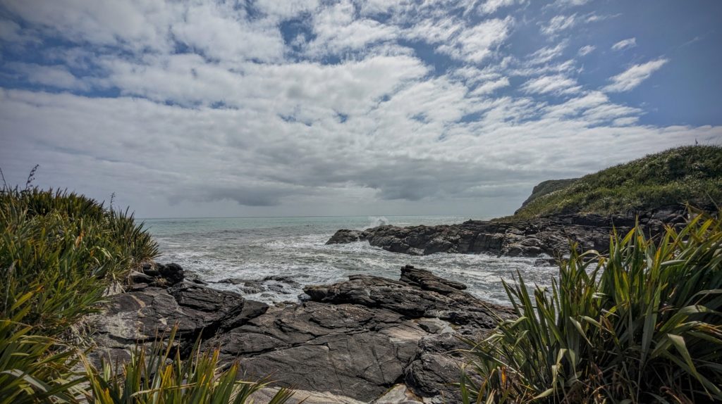
The entrance to Constant Bay is tiny and narrow. The waves were intimidating!
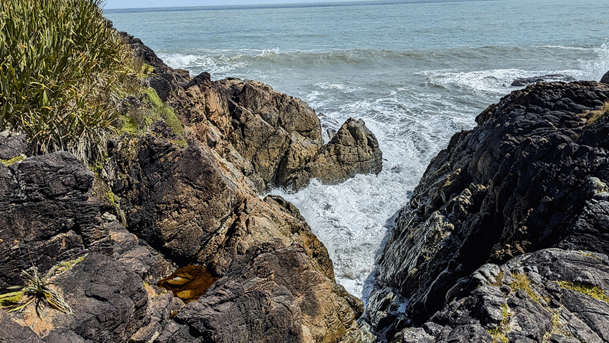
Further along the trail the waves were crashing in this inlet!
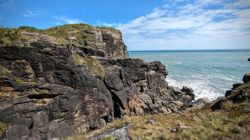
At the rocky headland the path looped back to the carpark.
While taking in the view here we spotted a small backpack in the rocks across a chasm and speculated where it came from and who got it over there? Eventually a young woman in climbing gear appeared, maybe from a small cave we saw in the rocks. Then we noticed bolts in the rocks in several areas for climbing ropes and realized this must be a pretty good rock-climbing spot! What a view, but no option for mistakes with the crashing waves below!

