February 18 Dunedin CBD Museums (Day 144)
A beautiful sunrise for our last full day in Dunedin.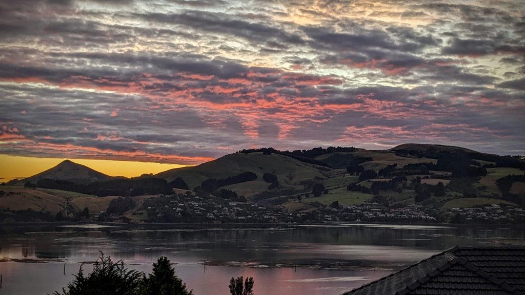
We decided to go into the city and do some sightseeing. There are several museums, gardens and architectural sights to see. We parked the car near the railway station and went into the nearby museum “Toitu Otago Settlers Museum” and got a cup of coffee. We couldn’t take the coffee into the museum so we headed to the center of town, the Octagon.
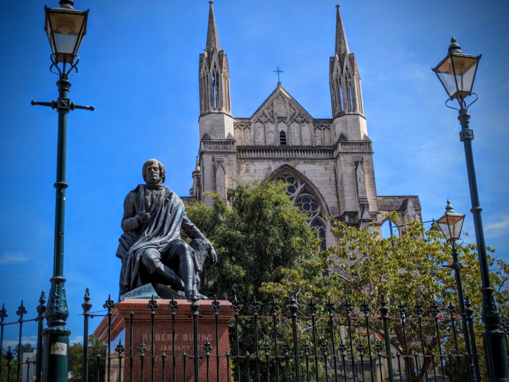
A sculpture in the Octagon, of Robert Burns, famed Scottish poet. Dunedin being founded by Scots, and the first Presbyterian Minister Thomas Burns being a nephew of Robert Burns it seems fitting that Burns the poet would be memorialized in New Zealand.
We walked back to the museum and perused the many exhibits of cultural history of the area.
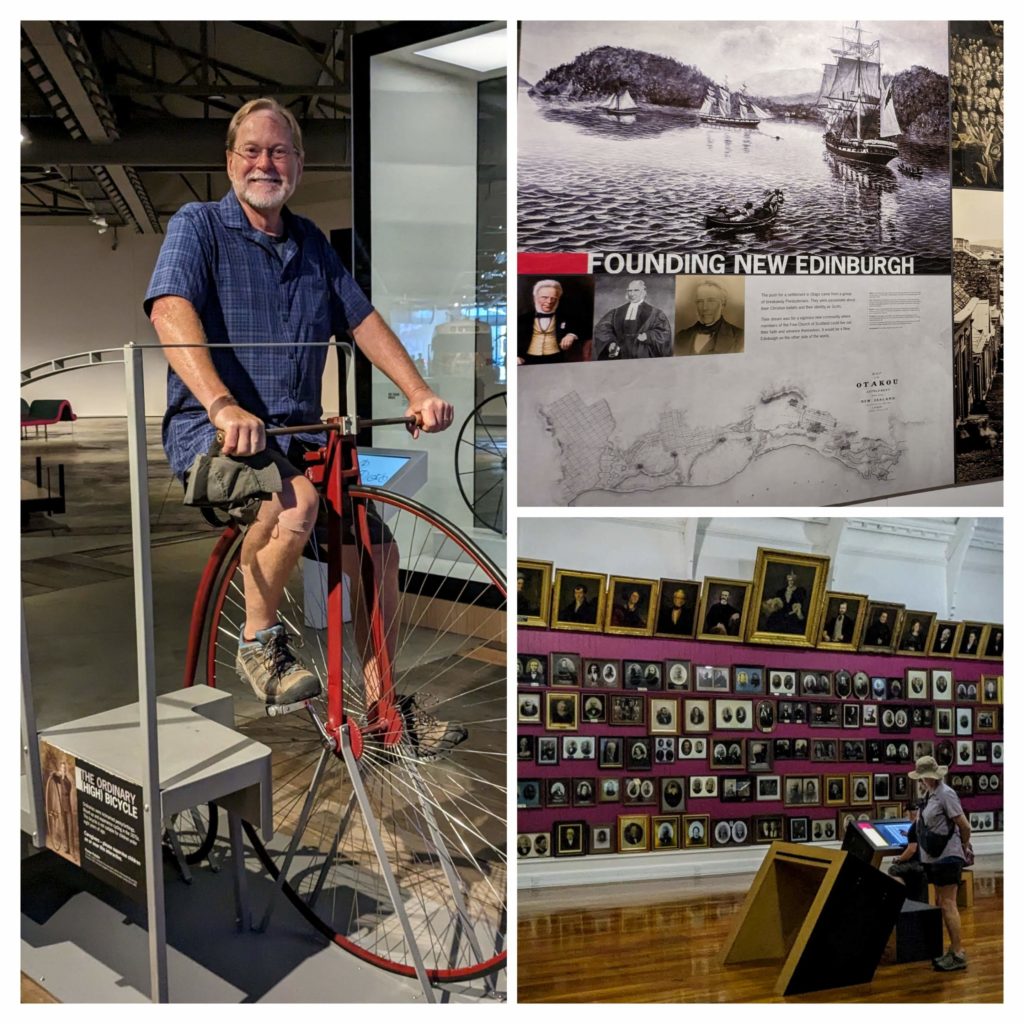
Lots of history of the “founders” of Dunedin – the Scots.
Just outside the museum is the Chinese Garden of Dunedin, “built to take you on a journey to a greater understanding of history, culture, heritage and tradition. Its origins come from a desire to celebrate the city’s Chinese heritage and its valuable sister city relationship with Shanghai.”

It is truly relaxing and beautiful.
After the museum, the garden and the walking, we returned to the Octagon for lunch and a walk further around the center to see the spires that rise above the other buildings.
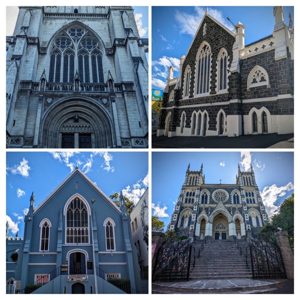
We found 5 huge churches within a few blocks of the Octagon! Two of them are no longer churches, one is an art center, the other a vacation rental!
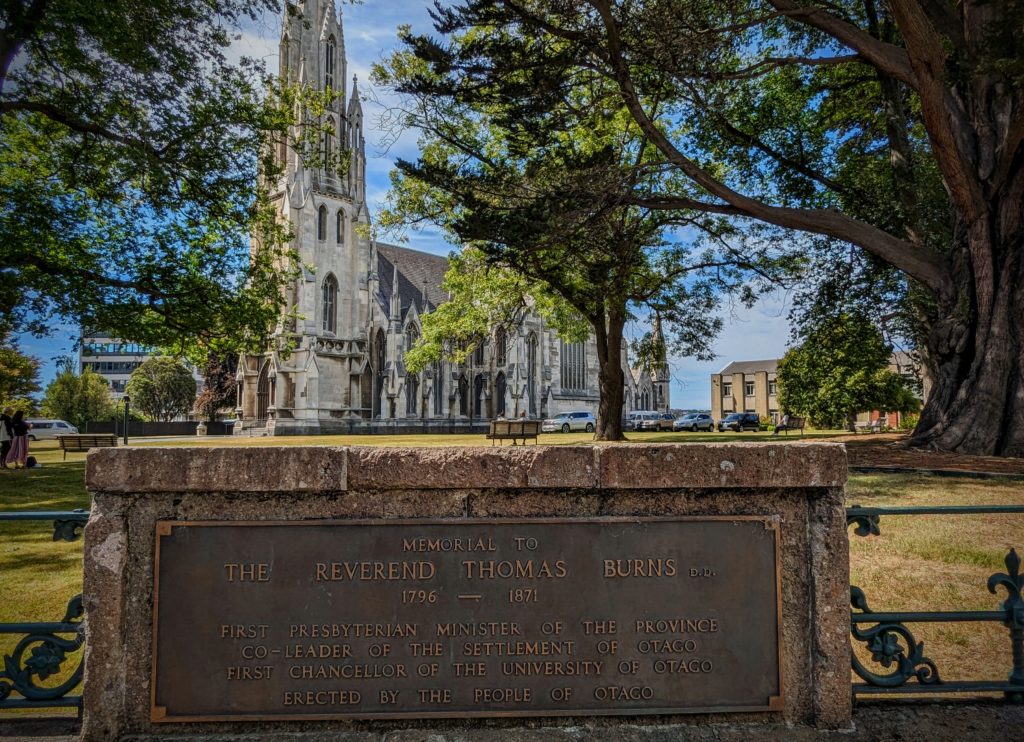
The grand daddy church, aka First Church, because the minister was one of the founders of Dunedin!
Along our walking path we came across a few pubs too!
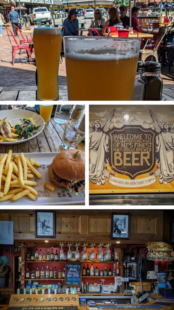
Gee, there are angels in pubs too!
After visiting all those pubs! (Just kidding!)
February 17 Aramoana Spit (Day 143)
Today our explorations take us up the opposite side of Otago Harbour from yesterday, the mainland side, to the Aramoana Spit, the other side of the harbour entrance from the lighthouse. ‘Aramoana’ in Maori means ‘pathway to the sea’. From the 1880’s the site was used as a pilot station for navigation around the mouth of Otago Harbour and eventually a long sea wall was built out towards the sea to inhibit the spread of tidal sands that would block the harbour mouth.
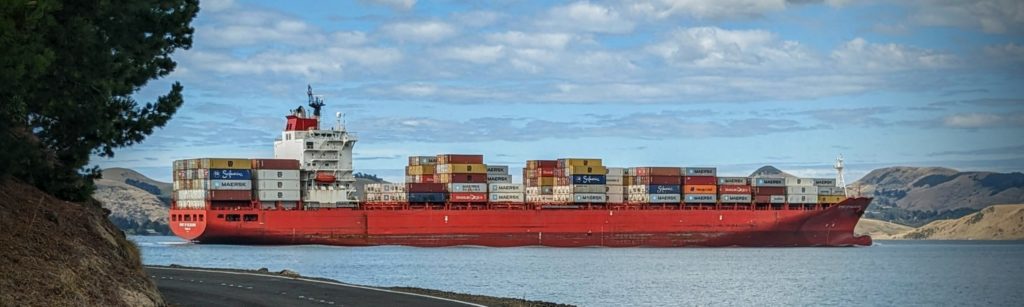
As we drove along the harbour edge we saw this container ship navigating in towards Port Chalmers, the main port. It looks so close to land! The navigable waterway is narrow and well marked in the wide harbour!
We reached the end of the road in Aramoana, a small beach resort village with no services, but lots of small holiday houses, and parked the car at the end of the ‘mole’ or seawall.
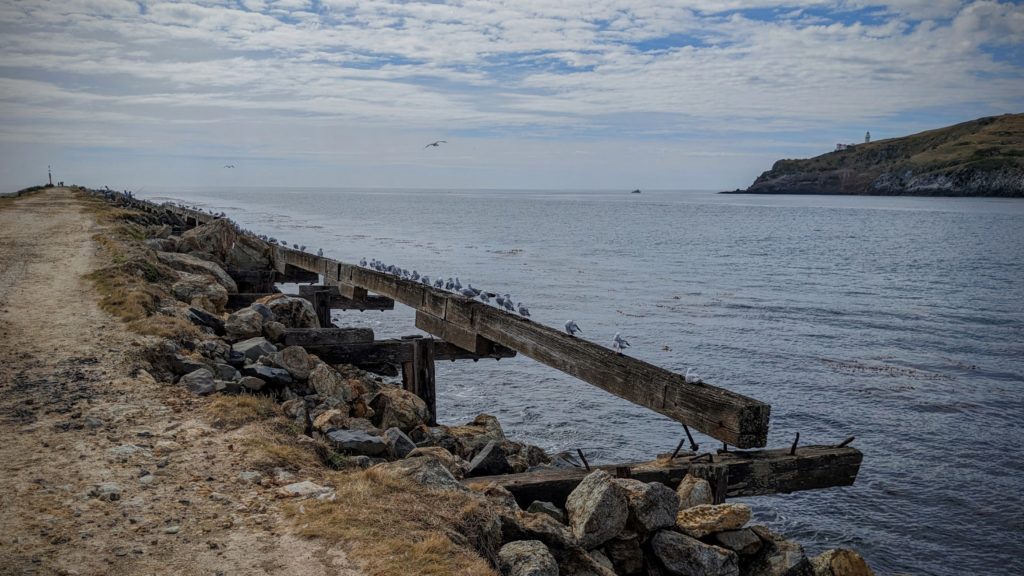
We walked out onto the ‘mole’ amongst the gulls and terns (“The Birds” vibes again!) and occasional sea lions.
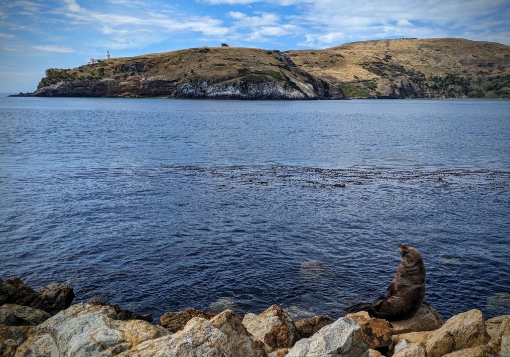
This sealion had a view of the lighthouse, the Royal Albatross Centre (the square building at the top of the hill) and the blue penguin beach across the harbour mouth.
From the mole the Aramoana Spit Beach extends north and we ended up driving to a spot to access the north end of the beach to avoid walking the length of the beach in the sun!
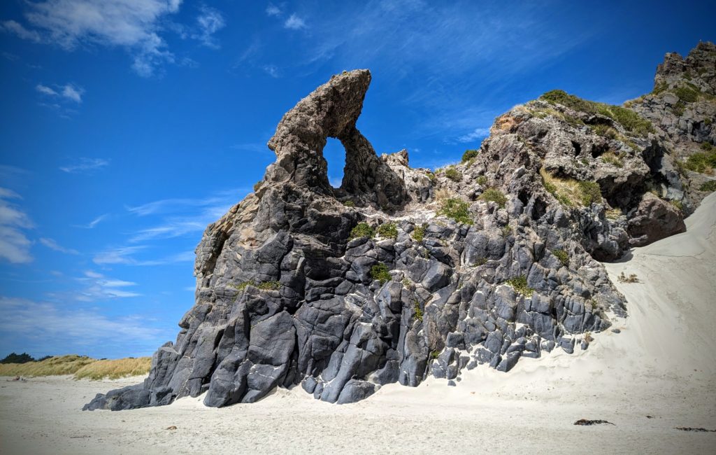
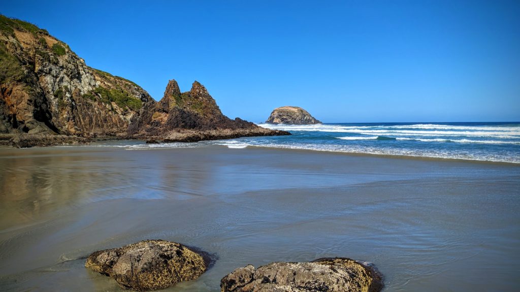
A landmark of this beach is the ‘keyhole’ rock formation.
Past the keyhole the beach was covered with small seashells, tons of them!

In some places they were several inches deep!
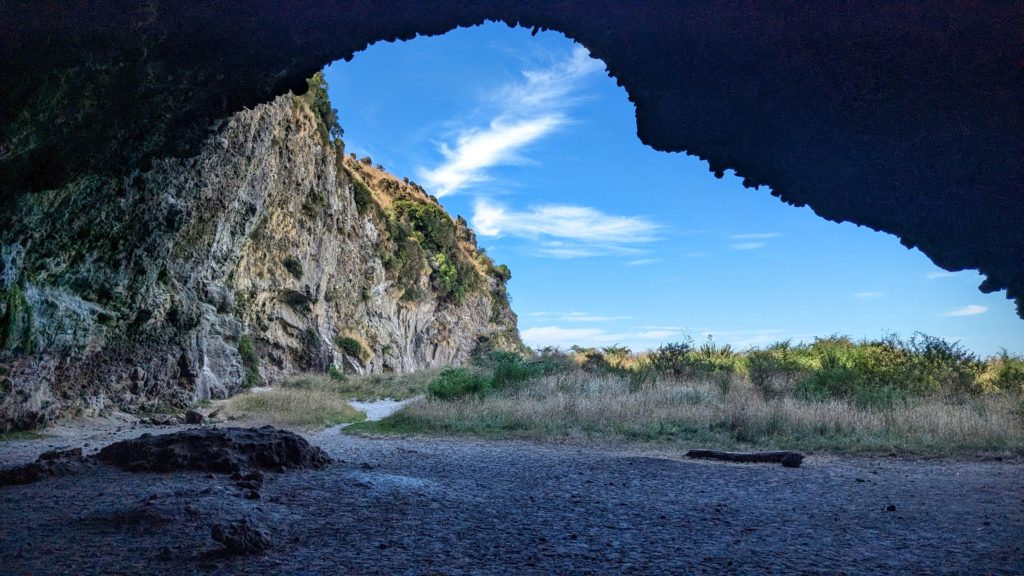
Our next stop was further north at Long Beach where there are some sea caves. A short walk through a forest and along a cliff face brought us to the beach where there were a few beachgoers and some sealions. We walked along the dunes close to the rockwalls and saw some rock climbers, then heard someone up in the rocks yell a profanity as a sealion barked, apparently upset that the rock climber stumbled upon it resting in the dunes! We found the sea caves and did a little exploring.
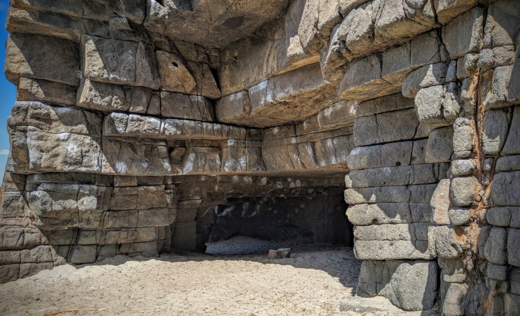
The first cave looks almost fake, like a set from an Indiana Jones movie, the rocks looking like hewn boulders carefully fitted together like something from Machu Picchu.
The much larger ‘Ballroom Cave” extended further back into the darkness, but we had no flashlights. The little blue penguins also use this beach to haul out of the water at sundown, and even nest and rear young in the back recesses of the caves. We saw lots of bird footprints in the sand and assume they are of penguins leaving and returning to their nest sites!

We finished our day of exploration with a walk in the surf as we watched a cruise ship out at sea turning to make a run into the harbour.
February 16 Otago Peninsula (Day 142)
We explored the peninsula that separates Otago Harbour from the Pacific ocean today. A beautiful sunny, slightly breezy day. We drove from the B&B on the northwest side of the harbour along the edge of Dunedin and then along the harbour edge all the way to the tip of the peninsula at the entrance to Otago Harbour!

The lighthouse at Taiaroa Head. The Royal Albatross Centre is located at the tip of the peninsula. This is the world’s only mainland albatross colony in the world! Most breed on remote islands far from human civilization! The albatross is the world’s largest seabirds. The young birds that hatch at this colony will take 8 months of care from the parents until they fledge. They will then go to sea for 3 to 8 years before they return to the same site to find a mate and breed. They can live up to 40 years! The main threat to the albatross worldwide it plastic pollution!
We didn’t see any albatross that we could identify, but there are lots of birds along the peninsula, some places even reminding us of the Alfred Hitchcock movie “The Birds”! Just the other side of the tip of the peninsula from the viewing deck over the Pacific, on the protected harbour side, is the site of another bird colony, the little blue penguin colony. The penguins are out at sea during the day feeding and come into the nesting site after sunset, perhaps to avoid the sea lions that were lying around waiting! The viewing platform at this beach closes an hour before sunset, then opens for tours to view the returning penguins. We didn’t stick around all day for that, but click HERE for a great description with photos!
We backtracked to about mid-peninsula and crossed a narrow to Papanui Inlet, driving through rural areas on gravel roads to reach Okia Flat where we had our picnic lunch. We then hiked between Big Pyramid and Little Pyramid to reach Victory Beach on the Pacific side of the peninsula.

The trail started as a farm road until the pyramids, then became a hiking track through sand dunes to the beach.

The Beach! Awesome, and we were the only people there! A few sealions and birds were our only neighbors!
A walk on the beach, then the hike back to the car, passing a few people hiking in, and we moved on to the next beach, driving around Papnui inlet onto Cape Saunders and down to Allans Beach.
There were a few more people at this beach, being more accessible with less of a hike! There were a few sealions here too!
We then drove around Hoopers Inlet to reach Sandymount Recreation Reserve.

A boathouse on Hoopers Inlet. These shallow inlets must be great for fishing and bird watching!
Lots of hiking in Sandymount and we took the track that lead us to the viewpoint overlooking Allans Beach where we just came from!

The beach looks so much bigger than when we were standing on it, we were, however, at the far end of it!
We continued on the track to the viewpoint at the summit after passing through a small forest with a resident all black fantail bird that serenaded us with a song. The view was great, if you climbed on top of the monument marker, the vegetation having grown up a lot it seems!

Looking south towards Sandfly Bay.
It was a great drive home from there, along the spine of the peninsula, Highcliff Road, looking down either to the Pacific Ocean on the left, or down to Otago Harbour on the right!
February 15 Portside (Day 141)
A gray rainy day in Dunedin today, so we did laundry and took it to the closest laundromat to use a dryer, it being too rainy to hang laundry on the clothesline! The closest laundry is in Port Chalmers, and there happens to be a great pub across the street! The Portsider!

A beer and a great cured salmon plate with fresh made ciabatta bread and creme fraiche-mustard spread!
February 14 Valentine’s Lunch (Day 140)
Yesterday on our train ride through the Taieri Gorge at the stop at Hindon Station we noticed a gravel road across the Taieri river and wondered how to get there. It looked so peaceful along the river, a great place to have a picnic lunch. So today we figured out how to get there! There is no route through the gorge, but there are lots of rural gravel roads up in the hills around the gorge, leading to all the stations (farms, or what we would call ranches) scattered across the landscape. The main road is paved, but narrow and winding, up and down the hills.

The lowest point on the road is a stream crossing, probably a ford when it’s raining. Very lush along the stream, but the hills are brown and dry.
About 60km (37 miles) from our Airbnb we reached the Hindon Station site, coming down a steep hill past several buildings that are private residences now, but were town institutions like the school and railroad employee housing back in the day (1870’s to 1890’s)
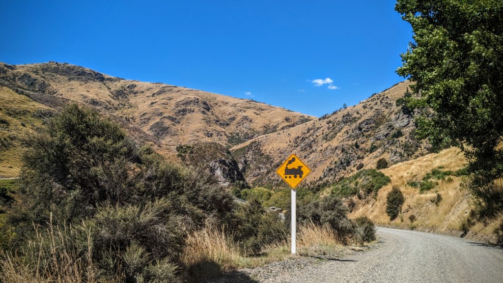
There is an interesting railroad crossing here, a shared railroad bridge and road.
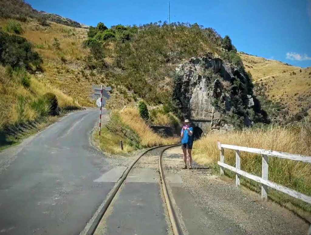
As Robert drove the car over the bridge, I took some pictures. The road turns to the left while the train tracks turn right and enter a tunnel behind me
We pulled into the only shade available on the flood plain along the river and set up the grill to cook some sausages for lunch!
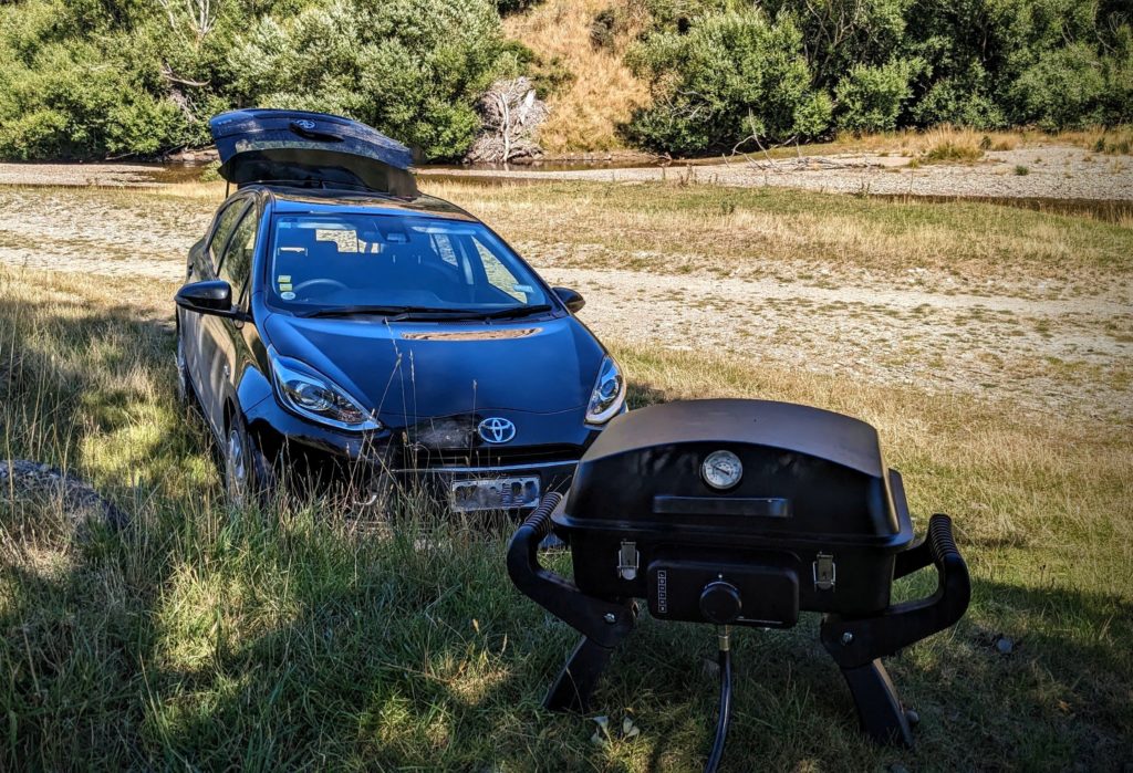
A little berm was a great spot to set up the grill. We got our lawn chairs out, but had to be careful because there was a strong wind blowing through the gorge.
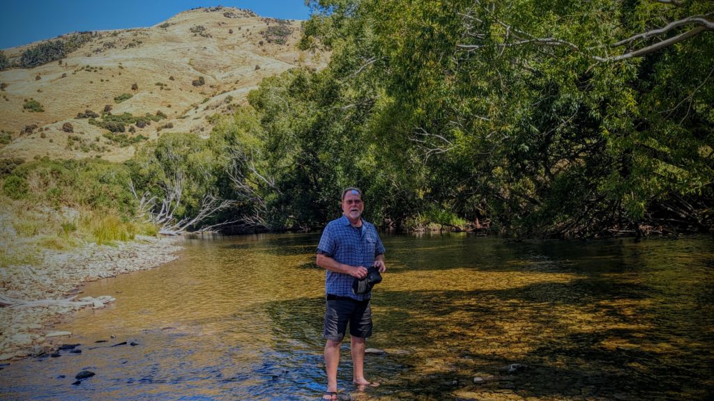
After lunch we took a stroll and cooled our feet off in the shallows of the river.
We packed our picnic supplies up and drove back up into the hills out of the gorge. We continued north on a main road through Central Otago towards the town of Middlemarch. The scenic train used to travel to Middlemarch, but was discontinued in 2019. According to the Dunedin Railway CEO; “The key factors influencing that decision for us is the extra demand around cruise ships – we’ve had to increase the number of cruise ship trains. In addition, we’ve got greater demand for passengers wanting shorter trips. And the challenger for us is the length of the Middlemarch trip – six and a half hours plus – and most tourists don’t have that amount of time to spend when they’re in Dunedin.”
It was evident to us that this decision has had an adverse effect on the Middlemarch railway station and the environs around it. However, it is where the Central Otago Rail Trail begins (or ends), the original Great Ride of NZ! The Strath Taieri Hotel across the street from the station has probably lost some business, but it’s 2 sentinel statues indicate the real value in the community!
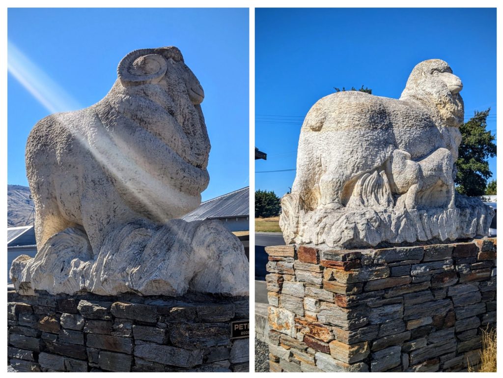
The Ram and the Ewe with Lamb are what’s really important in this rural area that is very reminiscent of the Columbia Plateau back in Oregon!

