Goosenecks and Moki Dugway -March 30
That’s Goosenecks State Park, just northwest of Mexican Hat, Utah. And Moki Dugway is the name given to a treacherous 3 mile stretch of Utah 261 between Mexican Hat and north to Natural Bridges National Monument.
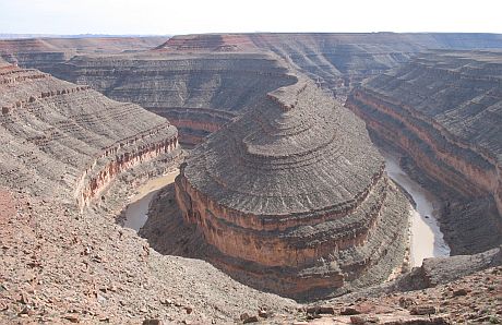 Goosenecks State Park presents one of the best examples of entrenched river meanders in the world. Over a linear distance of one and a half miles, the San Juan river flows for more than six miles through the twists of the canyon before joining Lake Powell after about 35 miles.
 You had better pay attention to the road hazard warnings at the bottom of Moki Dugway!
 We rode our motorcycles up the twisting 5 mph grade, carved on the face of a cliff to the top of the mesa.
 On the way down we had views to the valley floor, 1100 feet down in a 3 mile section of road!
Monument Valley
No words can do justice;

Moonrise over the Mittens, shadow of one mitten on the other.
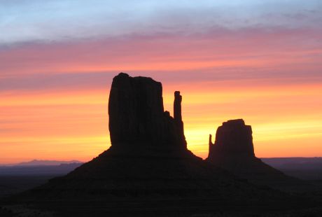
Waking up to the sunrise behind the Mittens, view from our window.
Monument Valley -March 28 & 29
We explored Monument Valley, in the Navajo Nation Tribal Park, by motorcycle and by foot over a day and a half. We had great weather and a priceless view from the camper window overlooking the ‘Mittens’.
 Robert & motorcycle at John Ford’s Point Overlook. Monument Valley may look familiar to fans of John Ford’s westerns. Great stills from those movies can be viewed by clicking here.
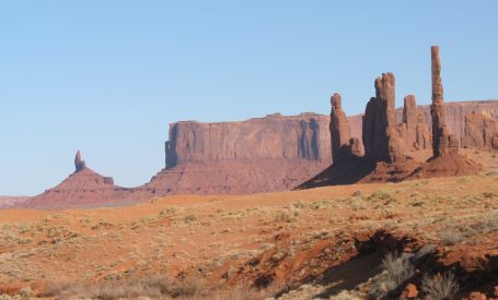
Totem Pole and Yei Bi Chei 'monuments'.
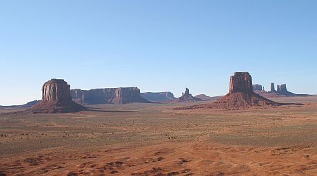
Artist's Point Overlook.
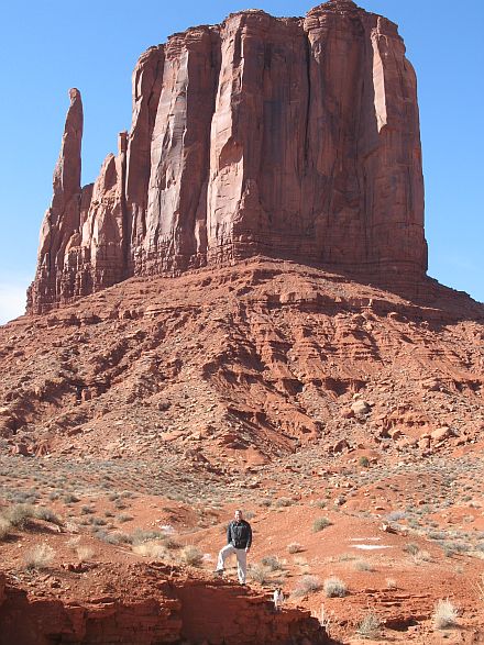
Robert & Mavrik hiking around West Mitten.
Navajo Bridge -March 28
Construction on Navajo Bridge was begun in 1927 and completed in 1929, replacing Lee’s Ferry as the safest crossing of the Colorado for 200 miles. There is a great visitors center explaining the history and the newest nearby residents – California Condors! Releases of Condors in the area began in 1996 and they have been roosting on and under Navajo Bridge lately. It’s a great place to see one of the most magnificent and endangered animals in the U.S. Interestingly, the first wild release of Condors was conducted in the Los Padres National Forest near Big Sur on the California coast, very near our favorite ‘wide spot on the road’ camping site, but we’ve never seen them there.
 You can walk across the original 1929 bridge. The new vehicle bridge is on the left, with the unique visitor center in between.
 Rafters floating under the bridge on their way into the Grand Canyon. This is the last of ‘civilization’ they will see until the foot bridges deep in the Grand Canyon!
 An immature Condor roosting on the cliff under the bridge.
Lonely Dell -March 28
Lonely Dell was the name given to the home and ranch that housed the families that ran the ferry over the years. They were very isolated and needed to grow and raise their own food. With lots of hard work and irrigation from the Paria river they farmed many acres.

Some original buildings from circa 1880.
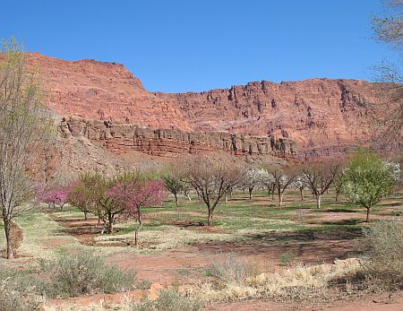
The orchard is in bloom.

A current resident of Lonely Dell.

The Paria river flowing past Lonely Dell.
 Goosenecks State Park presents one of the best examples of entrenched river meanders in the world. Over a linear distance of one and a half miles, the San Juan river flows for more than six miles through the twists of the canyon before joining Lake Powell after about 35 miles.
 You had better pay attention to the road hazard warnings at the bottom of Moki Dugway!
 We rode our motorcycles up the twisting 5 mph grade, carved on the face of a cliff to the top of the mesa.
 On the way down we had views to the valley floor, 1100 feet down in a 3 mile section of road!


