December 25, 2023 Christmas (Day 89)
A Pohutukawa Tree in bloom! Fresh corn on the cob for dinner!!!

Christmas Eve here, just enough time to head into town to pick up some supplies before we take the ferry to the South Island. On our way back we drove up to West Wind -wind farm, on the hilltops above Makara Beach. We knew it would be socked in, being overcast down below, but we had only been up there when we hiked up from the beach way back on Dec. 1, a sunny day!

Yes, it was socked in! The wind was not as strong as we anticipated though!
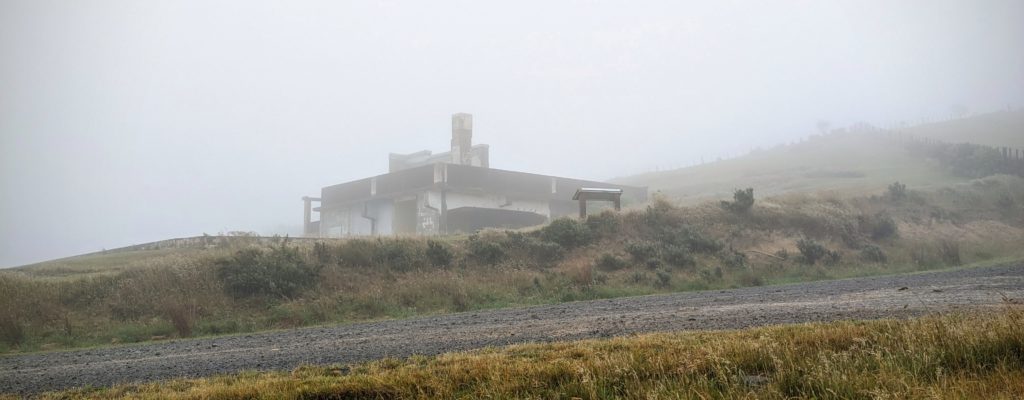
Across from the parking lot was this defunct building in the fog. We don’t know what it’s function was in the past, but it is abandoned now.
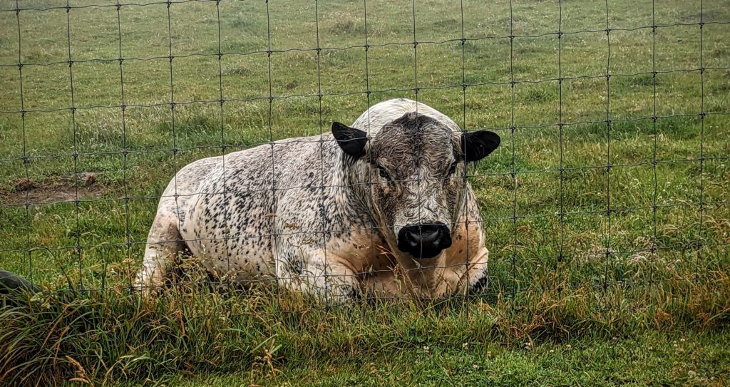
We met this bad boy on the way up, and got the picture on the way down. Wouldn’t want to meet him on the road!

On the way back down to Makara Road we spotted Jack & Jill’s farm! We recognized it by the paddocks and the wind break of pine trees. The sheep must be shivering up there now after their shearing! Jack said that their appetite increases after their shearing!
After a morning of organizing and cleaning the car interior for our move to the south island in 2 days we drove the 1.4km down to have lunch at Makara Beach WhareKai, ‘dining hall’ in Maori. It is a quaint cafe that is open only on weekends and is run by the couple that deliver the mail here! It was threatening rain but there were lots of beachgoers. Some were lounging on the cobble beach, some walking the path around the beach, even several snorkelers in wet suits emerging, one with a speargun! It was a calm day at the beach wind wise!
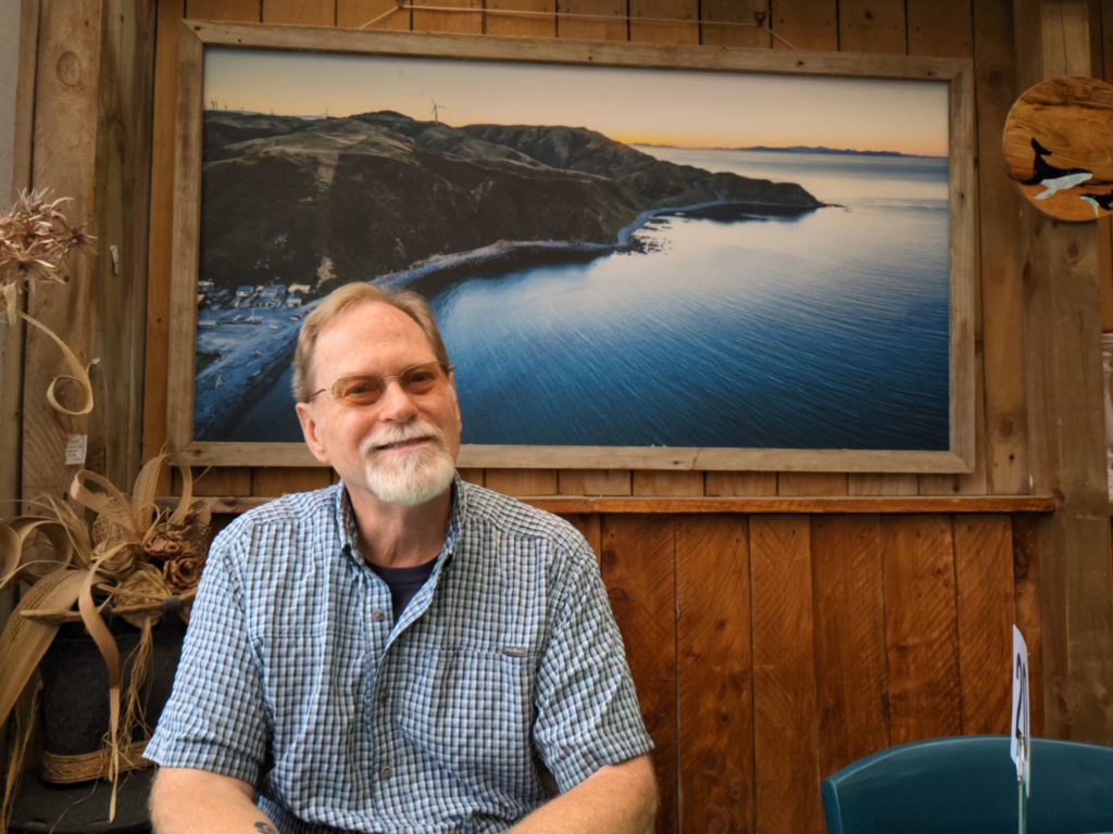
Robert with an aerial view of Makara Beach behind him.
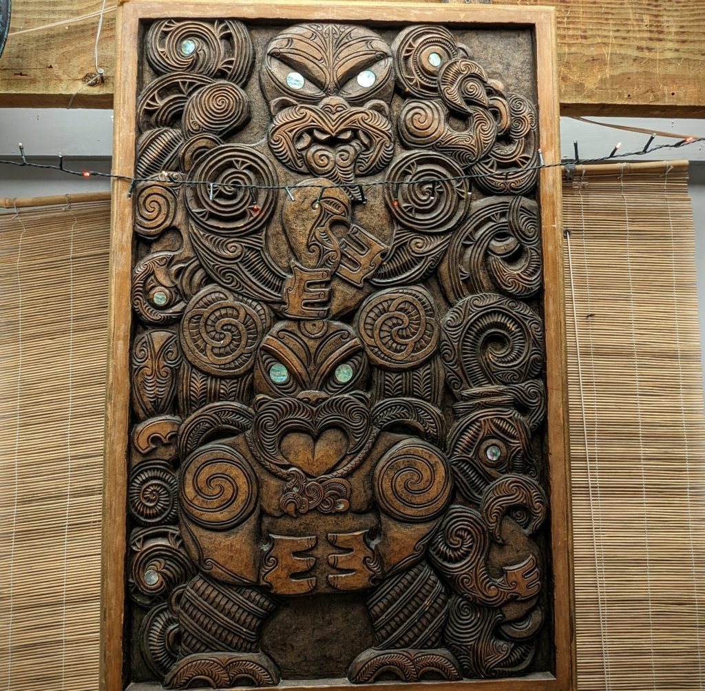
An intricately carved panel in the dining hall. You can see how much the koru is used in the carving. “Koru, ‘loop or spiral’, is based on the appearance of a new unfurling fern frond. An integral symbol in Maori art, carving and tattooing, where it symbolises new life, growth, strength and peace.” per wikipedia
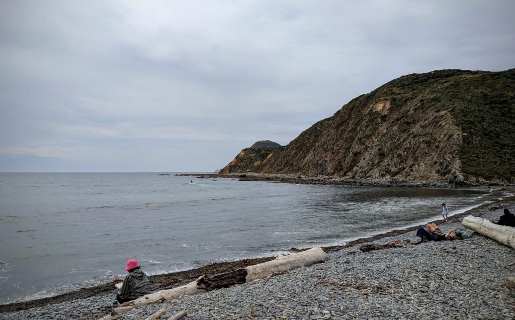
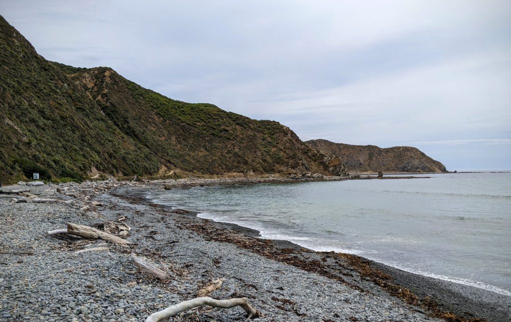
The beach is calm today!
Overcast today, but warm and calm. We drove down towards Wellington and turned slightly north to the City Park called “Otari-Wilton’s Bush”, the only botanic garden in New Zealand dedicated solely to native plants! And like all other city parks, entrance is free! ‘Otari’ is a Maori word meaning ‘place of snares’. When Maori arrived in the area it was covered with dense podocarp broadleaf forest in which they hunted birds. I’ve heard the term ‘podocarp’ used a lot in describing forests here in NZ. HERE is the best description of the NZ podocarp trees, basically a southern hemisphere conifer that bears cones and fruit. Not to be confused with the introduced pines that are grown here for lumber or wind breaks. Needless to say, most of the NZ native forest was cut for lumber or burned to create pasture for the sheep and cattle that were introduced in the mid 1800’s. About 17 acres at this spot was protected by Job Wilton, one of the early European landowners. It was eventually purchased by the city of Wellington and has been expanded to create this unique reserve in the city limits!

The carved gate at one entrance to the park.
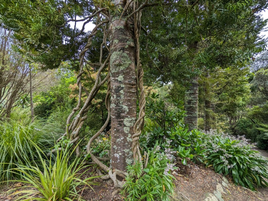
A native tree supporting native vines.
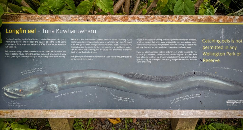
A creek runs through the park, harboring eels. I learned some new things about eels. They live in fresh water, then at maturity (20-60 years!) they swim to tropical ocean waters to breed (no one knows where exactly!) The young ‘glass eels’ are carried by currents back to NZ where they swim upstream to live until maturity!
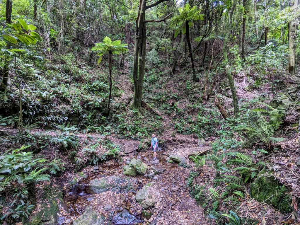
Crossing a tributary creek, the scale shows how big the tree ferns can get!
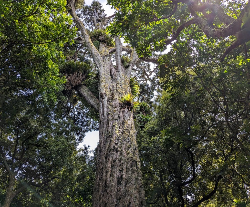
Moko, the 800 year old rimu tree (a podocarp) we hiked to.
This morning was grey and misty, but we had plans to escape over the Remutaka* range to the east where it was predicted to be sunny and warm! We drove today, our destination the terminus of the Remutaka Rail Trail, a hiking and cycling trail that follows the 1878 Remutaka rail line that connected the eastern Wairarapa region to the markets of Wellington. The Wairarapa region is named from Lake Wairarapa (in Maori mythology it is the eye of the fish that is the north island that the demi-god Maui fished up from the sea). It is a very rural area raising beef and dairy cattle, and sheep. In the 1980’s a viticulture industry began and the area is now known for its wineries and olive groves. The spine of mountains dividing the eastern area from the wetter western side creates a rain shadow and the Wairarapa tends to be warmer and sunnier than Wellington, but colder in the winter!
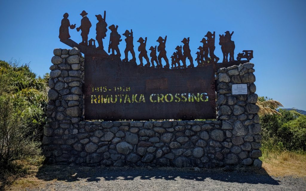
As we left the mist behind and crossed the summit of the road we stopped at the ‘Rimutaka Crossing’ view point.
This commemorative structure memorializes “the thousands of infantry soldiers who marched over the Rimutaka Hill (from 1915 to 1918) prior to their departure to the Western Front as part of the New Zealand Division in WW1.” It was a 27 mile, 3 day march for the soldiers, mostly from the Wairarapa region and further northeast, on their way to the infamous warfare trenches of Europe.
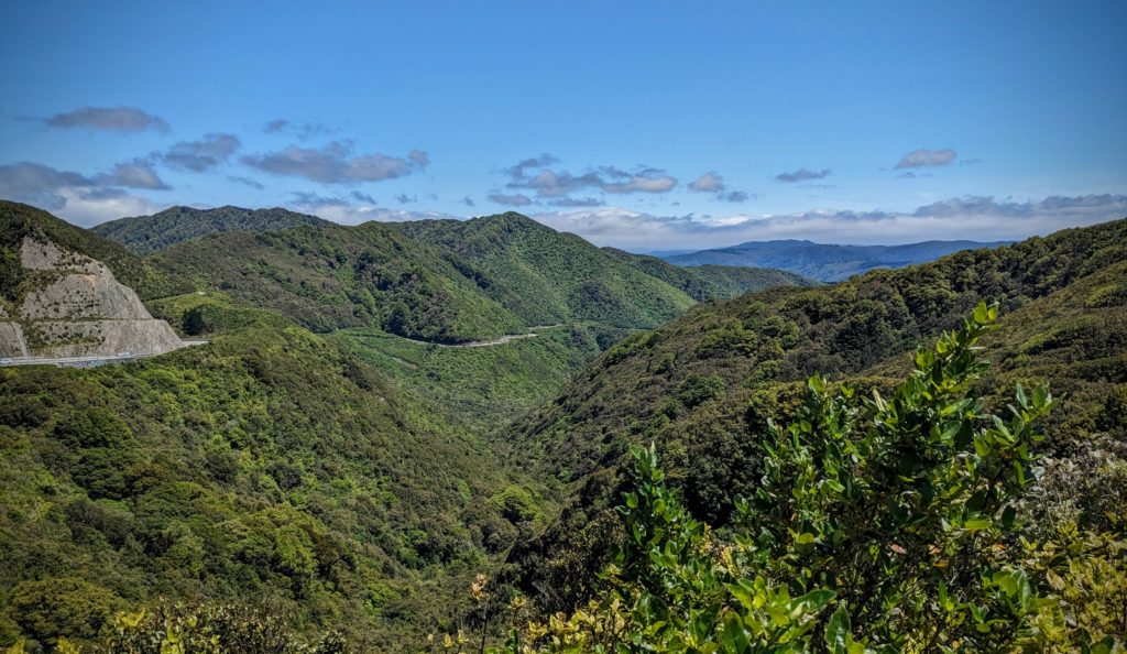
Looking back past the hills towards the mist engulfing the Wellington area.
We descended from the summit into the tiny town of Featherston and turned right onto the road to the Rail Trail. We arrived to brisk winds flowing up from Palliser Bay on Cook Strait, winds coming up the valley of Lake Wairarapa all the way from the east side of the south island! We hoisted our day packs, tightened our hats on our heads and headed up the trail. We started out through a regenerating forest, with shade and kawakawa bushes, along a stream. Then we came out into the open to the actual rail bed at Cross Creek camp. It was a small community of railroad workers at the end of the steep downhill run of the railway, before it followed the valley up to Masterton, the largest town of the Wairarapa region. Very little of the town is visible, but plaques with history and pictures tell the story. The Railway was operational from 1878 to 1955, 77 years!

Soon we headed up ‘The Long Straight’ as this 299 yard section was known, the longest section of straight track on the whole line, only 274 meters!
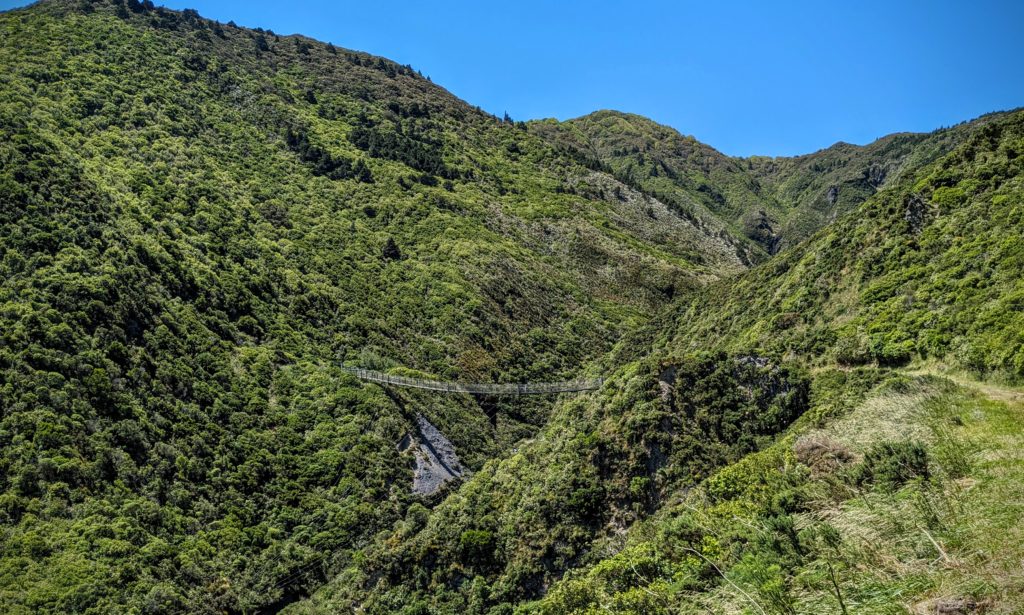
Three and a half miles into our hike we spotted our goal – The Siberia Suspension Bridge!

As we approached the bridge the wind was whipping even stronger and we read this information!

The bridge is about a football field in length and was visibly swinging in strong gusts of wind! But we braved it and headed across!
We made it across the bridge! Then went through the Siberia tunnel at the other end and turned around to retrace our steps back over the bridge and back down to Cross Creek where we ate our picnic lunch. We had one more destination on our list, another suspension bridge in Kaitoke Regional Park, on our drive back towards Wellington!
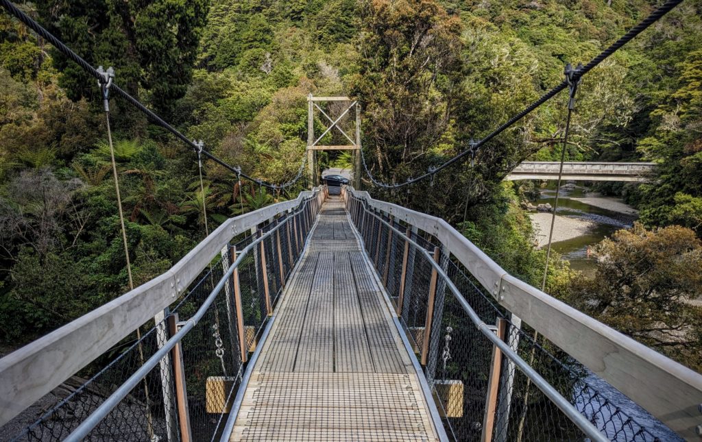
This was an easy one to get to! See our car at the end of the bridge?
We were glad for the quick and easy access to this bridge, the 7 mile hike in the sun and wind really wore us out! We got home in an hour and a half, and grilled some lamb burgers for dinner!
*Remutaka; all things Remutaka (range, forest park, rail trail, etc.) used to be spelled Rimutaka. I don’t know when the spelling change occurred but the NZ Travellers Road Atlas we bought 3 years ago has the Ri spelling!