February 26 Walk on the Beach (Day 152)
We did laundry this morning and hung some on the line outside and put some on a drying rack in front of the woodstove, still warm, but cooling down from the morning fire to take the chill off. After a hearty breakfast we headed down the hill to finally check out the beach! High tide had passed, but it was still 4 hours until low tide and there is a strong undertow!
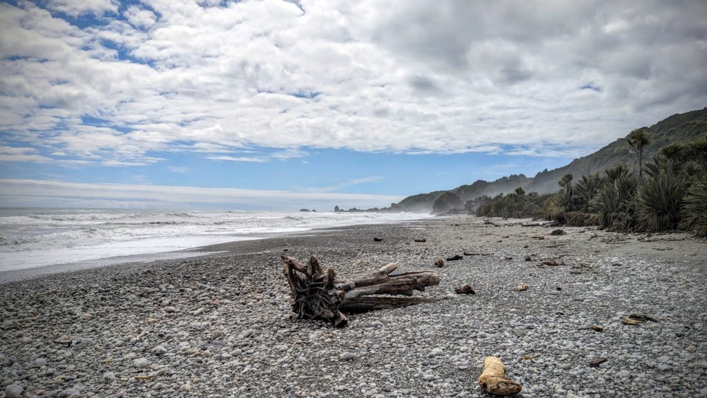
The beach is pebbled with colorful rocks that are constantly tumbled in the surf. You can hear them rocking and rolling in the waves!

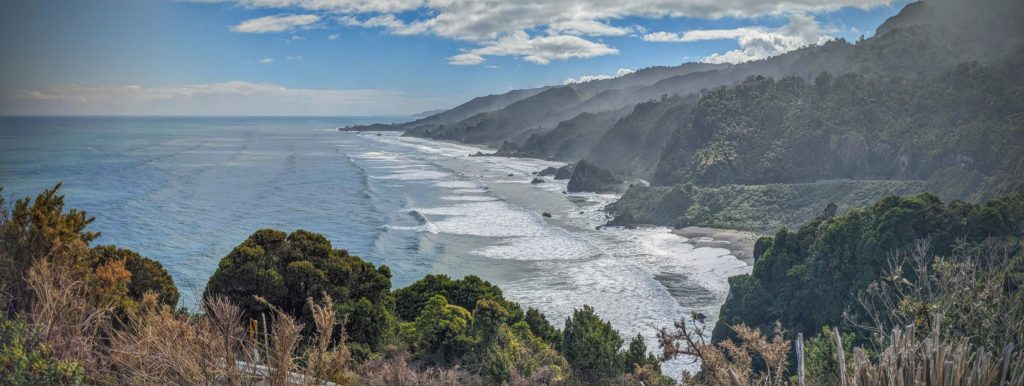
We walked down the beach until we could see our B&B up on the hillside. The big dark square building is the garage, to the left you can see the peak of the B&B with the woodstove pipe rising above the house. It’s about a half mile walk to the beach.
While Robert set up and flew the drone, I walked the beach and collected pretty rocks! Robert concentrated on the drone!
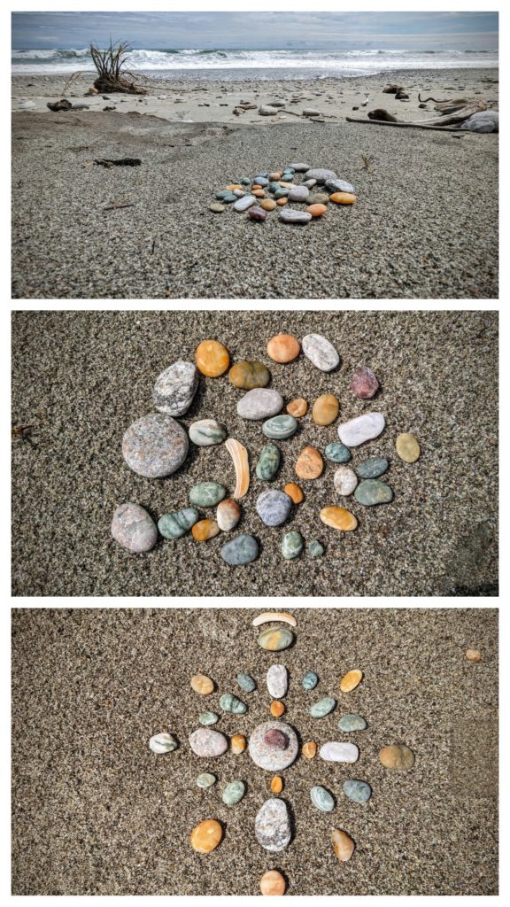 I played with rocks!

The only rock I brought back from the beach, to add to the collection of heart-shaped rocks at the B&B!
February 25 Market Day (Day 151)
Sunday is Market Day in the small community of Fox River, only 2km (1.2 miles) down the coast from our perch on the mountainside above the ocean. We had a great breakfast then headed to the Market!
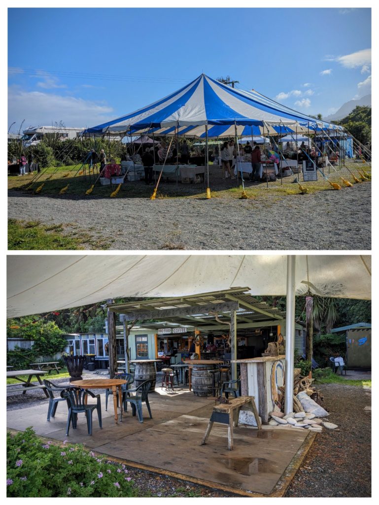
A central tent with vendors hawking mostly craft items, several vendors ring around the tent, in the sun, selling jams, honey and crafts. Against the cliff wall is a small restaurant with a tented patio and a spot for a singer playing folk-country songs.
We were there at about 10:30am and there were some shoppers. We wandered around viewing the wares, not many of which we could pack in our bags to bring home! We walked to the Fox River along which there is a ‘freedom camping’ parking lot, with a bathroom available, and the entrance to a walking track that goes up into the mountains along the coast. We had a bite to eat at the market and listened to the music before driving further down the coast to sightsee.
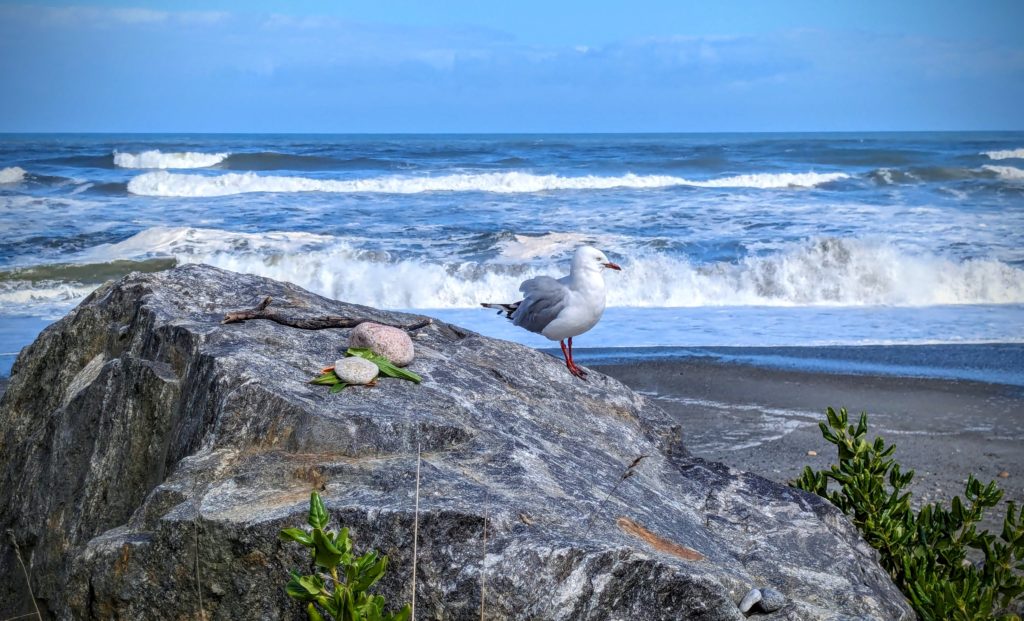
At the tiny community of Punakaiki we walked along the closed road that fronts the rip-rap that the high tide waves were washing against! This gull did not seem fazed by our presence!
Driving home back up the coast the view is spectacular! The sun is finally burning off the haze of moisture left from the storm yesterday.
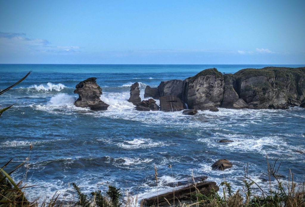
Closer to our Airbnb this rock outcrop really shows the power of the ocean in wearing down the rocky coast!
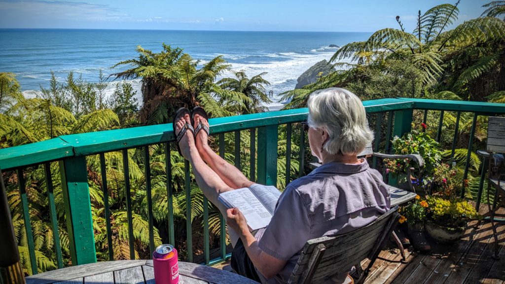
Settling on the deck in the sun, we wondered “why go anywhere? It’s beautiful right here!”
We got a real “hippie vibe” from the market and the community in general! I looked up more info about Fox River and found this post about the Fox River Commune. And this YouTube about the Commune.
February 24 What a Difference a Day Makes (Day 150)
We got up at 5:30am to see the full moon set over the ocean and saw it disappear behind clouds. Later those clouds grew into a regular nor’wester! Winds and rain!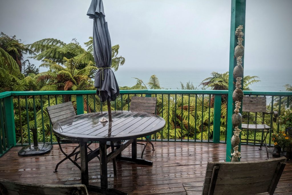

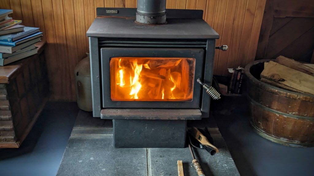
Thank goodness for a woodstove and dry firewood!
February 23 Over Arthur’s Pass (Day 149)
After an early breakfast we packed the remainder of our gear and headed out by 8am for the long drive over Arthur’s Pass to the northwest coast of the South Island. We took some of the longest straight roads we’ve been on since we got to NZ! The Canterbury Plains are famous for that I think! The Plains are comprised of the fields left behind by the glaciers that carved the mountain valleys to flow to the sea. The Rangitata River to the south, the Rakaia River in the center and the Waimakariri River to the north all flow into the Canterbury Bight of the Pacific Ocean. The flow of these rivers provides irrigation for the most productive farmland in the country. The fields were bright green with grass, dotted with sheep and dairy cows and divided by the huge well manicured tree-hedges we’ve seen all over the country.
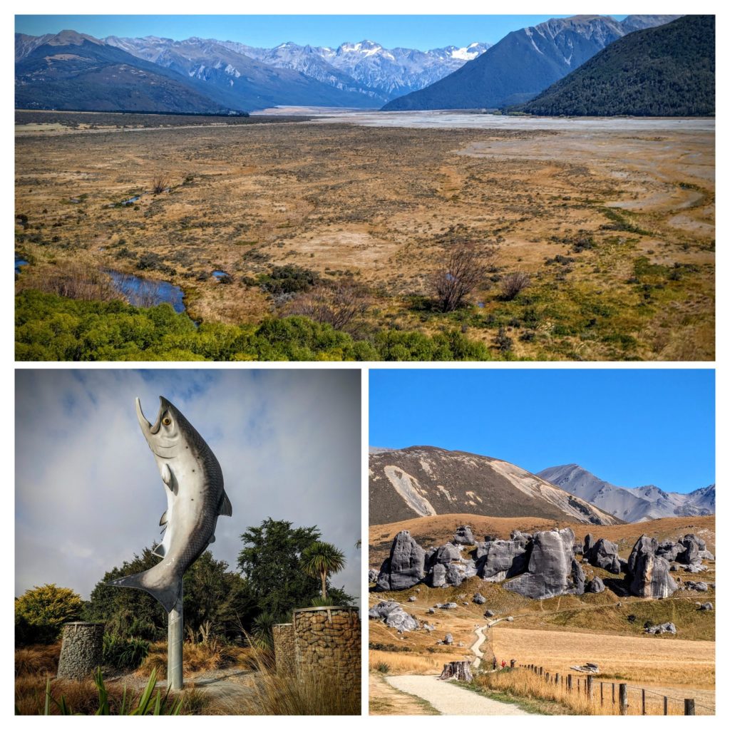 At the mouth of the wide, braided Rakaia River we stopped at the rest area before crossing the longest bridge in NZ. We admired the huge salmon statue (bottom left picture) that the town is so proud of. Chinook salmon eggs from the McCloud River in California were introduced into the NZ river in the early 1900’s for sport fishing. Past that river obstacle we proceeded over Porters Pass to Castle Hill (bottom right picture). These rock outcrops are sacred to the Maori of the area, they have been used as backdrops to Lord of the Rings and Narnia movies, and they are popular spots for climbers to freeclimb and ‘boulder’. A great story with some history is HERE. Finally we entered the Waimakariri River Valley on our way up to Arthur’s Pass (top panorama picture).
We stopped at the small Arthur’s Pass Village, a store, a restaurant, a train whistle stop and a few other buildings house the 48 or so permanent residents. There a lots of tramping tracks radiating out from the Village though, this being an accessible spot in the midst of the Southern Alps! We had lunch at the restaurant and perused the gift shop, watching diners being pestered by several Kea parrots, then proceeded down the other side of the pass through the Otira River Gorge with 16 percent grade!
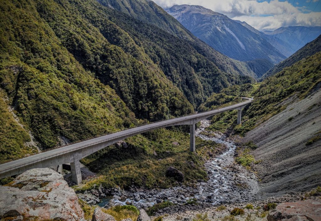
The viaduct (bridge) opened in 1999 improved what is known as Deaths Corner!

Deaths Corner was named for a rock landslide that occurred about 2000 years ago that dammed the river. The river finally cut through it creating the gorge.
We still had an hours drive to Greymouth to do our grocery shopping, then another hour to the Airbnb. But it was worth it! A warm ocean breeze, a clear sky for a fabulous sunset. I’ll let the pictures tell the story!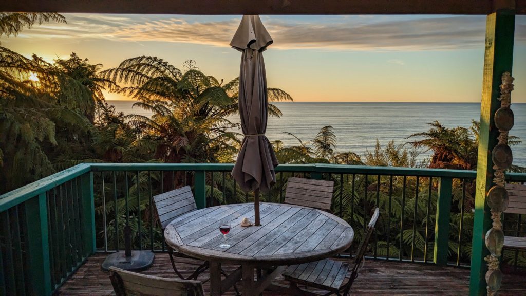

February 22 The Dell (Day 148)
Another beautiful day! Off we went to the Mt. Somers Track to do some walking in the beech forest. We drove up the short gravel road to the trailhead and headed to the Nature Trail. We thought there would be reading panels with information about the nature around us. Nope, it was a trail that just led you into nature along a creek!
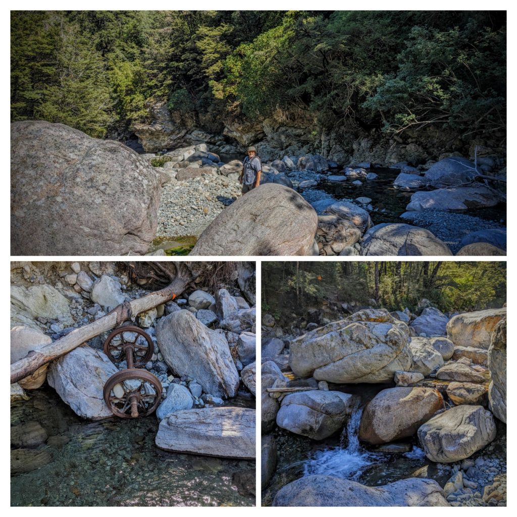
We ended up at the mangled ore cart up the embankment from the stream and took that track back to the carpark. We attempted more of the Mt. Somers Track but it was too steep for us today!
We then drove the few miles to the trail we were going to do yesterday, the Lake Emily Track along the Stour River. A nice flat river valley track! We intended to do a timed walk, but then saw we were just a quarter mile from ‘the Dell’. The track was out in the open until we got the the Dell where a stream flowed out of the hills to join the Stour River. We walked up and into the forest to a beautiful small boulder strewn canyon with a cold stream flowing over the moss and fern covered boulders while birds chirped and sang around us from the boughs of the beech trees!

The water was so refreshing when we splashed it over our heads!
We headed back to the Airbnb for our last dinner there and to pack up for another move tomorrow. After packing what we could we went out into the garden and explored the ‘secret garden’ behind the small house. The garden is filled with whimsical statues, gnomes, beautiful flowers, sitting areas and vegetable patches. Our host even shared with us the green beans he picked this morning!
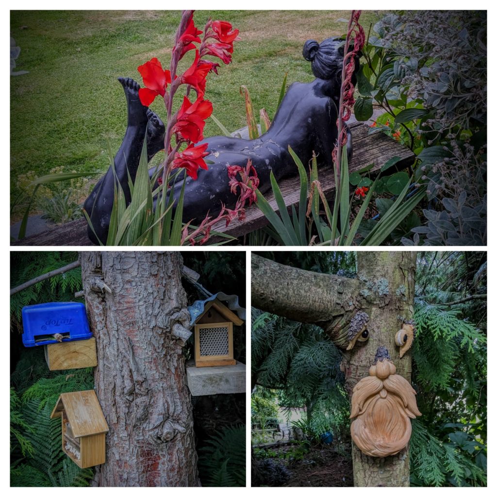
The small houses with tubes are bee houses for the solitary native NZ bees.
