January 27 Beaches (Day122)
A good weather day is forecast so we headed out to see the beaches along the Southern Scenic Route to the west. Just a short 25 minute drive away we reached Gemstone Beach, a cobble & pebble beach below a windswept bluff on the Great Southern Ocean. Lots of colorful rocks, some of which are considered gemstones, have been rolled and polished in the surf for millennia. To our untrained eyes they just look like a bunch of rocks, pretty rocks anyway!

There are ‘warning-private property’ signs on the bluff, but you can’t see the house until you are down on the beach because it is built into the bluff, looking out across the beach. The panorama is kind of weird because google photos put it together from several of my pictures! It looks like a tsunami is coming!
We started back towards Riverton, stopping at several more beaches as the clouds came and went. Our next stop was Monkey Island, a tiny island rising out of the surf very close to shore along a sandy stretch of beach that reaches Gemstone beach around the curve of the bay. No monkeys, but you can reach the island at low tide. The Maori in the area used the island as a lookout for whales back in the day. The Pakeha shore whalers did the same, and named the island for the ‘monkey winch’ that was used to haul boats ashore. We visited at high tide so we didn’t get onto the island.

I did find several pieces of sea glass in the rocks here.
The next stops were a tiny un-named beach near Cosy Nook, and then Cosy Nook itself, also pretty tiny.

The small cribs or baches were homes for fishermen who kept their boats here. Now they are holiday houses and the fishermen have moved to Riverton.
As we headed home we saw this penguin gathering in front of a farm. We have no idea why or what for, but it’s cute!

If you look past the penguins on the left you can see 2 giant pigs. We haven’t seen many pigs on farms, mostly sheep and cattle.

My haul of pretty rocks and sea glass from our day at the beaches! I left them on the picnic table at the B&B.
January 26 Friends (Day 121)
Up at sunrise for an exciting day!
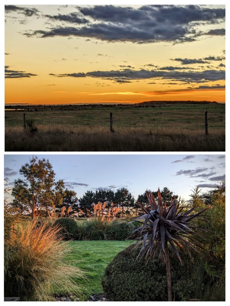
The morning light really enhanced the natural beauty of the NZ landscape here!
We were off soon after to meet our friends John & Martha in Bluff where their cruise ship was making its first NZ port of call on their Sydney to Auckland cruise! We got to Bluff to see the ship being guided into port by a tugboat. While we waited for their disembarkation we walked around the small town center.

It’s another town of great murals showcasing the town’s highlights, in this case Oysters! Unfortunately oyster season isn’t until March.
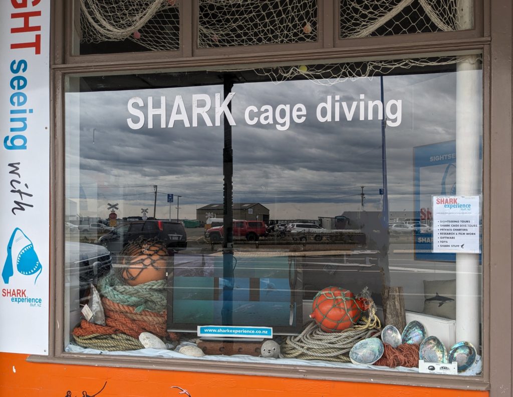
We thought that when we meet them we’d take them here to sign up for an adventure of a lifetime!

Finally the bus dropped them off a few blocks from where we were waiting!
We decided to head out to the Catlins, the least visited area of NZ! The Southern Scenic Route takes visitors from Invercargill to Dunedin, sometimes through farmland, then along the coast and even into coastal rainforest, with access to the southernmost tip of the South Island, lighthouses, waterfalls and wildlife!
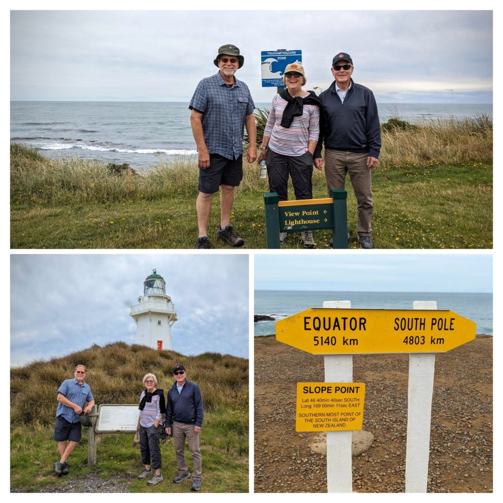
We entered the Tsunami Zone to get to the Waipapa Point lighthouse where we saw one lone sealion on the beach. Then to Slope Point, the southernmost point where you are closer to the south pole than to the equator!
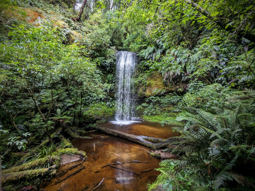
We traveled on into the rainforest to Koropuku falls on a muddy, slippery, narrow path.
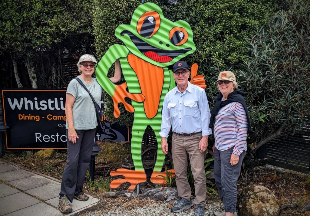
We finally reached the Whistling Frog for lunch where we all chose the fish & chips!
A more inland route took us back to Bluff for John & Martha to catch their ship. This route took us through farmland with lots of sheep, convincing them that NZ really does have 5 times more sheep than people! Yet that is the lowest ratio of sheep to people in 170 years!
We had a great time today with our friends and bade our goodbye’s as the bus arrived to take them back to their ship and new adventures!
January 25 Town & Beach (Day 120)
A beautiful sunrise foretold a beautiful day today. 
So we ventured out to walk through town. There is one main street, highway 99, with just one block on either side comprising of residential blocks. There are a few very old houses that need restoration and some newer holiday homes. Closer to the river are the commercial businesses along hwy 99. Some buildings are beautifully decorated with murals!

This mural highlights the Tui, the iconic NZ bird that is found throughout the country and adds it’s melodious song to the surroundings!

This mural highlights the treasure of the southern ocean and the Aurora Australis (the Southern Lights)!
As you approach the river entrance the town spreads out a little more and a bridge crosses the river. More holiday homes are on the south side of the river and spread along the the oceanfront beach. The town is situated between the oceanfront and the estuary of the Pourakino River. Before European settlement the area was home to a large Maori Pa, they were drawn to the area for the abundant food from the sea and the fresh water estuary. The first European settlers were shore based sealers and whalers in the early 1830’s. The town’s heyday was about 1862 with lots of whaling and shipping, importing goods from Australia and other parts of New Zealand to move them on throughout the country. As the river began silting in and ship based whaling prevailed, Riverton’s importance decreased and by the 1880’s the main industries became fishing and farming.
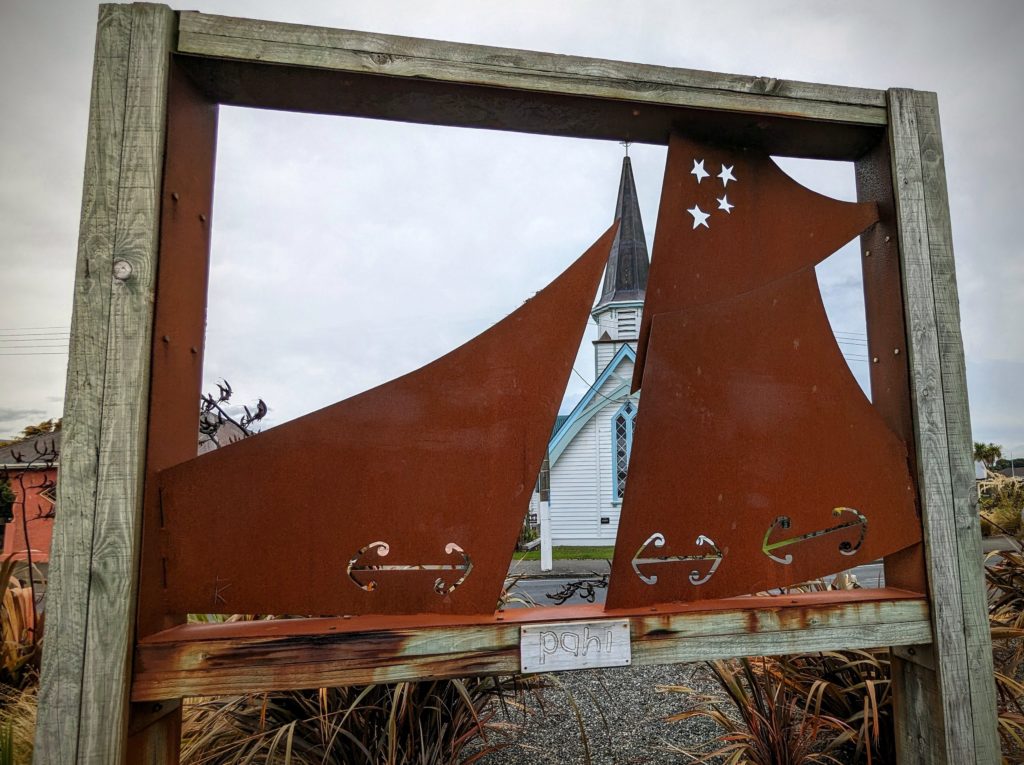
To commemorate the shared importance of sea going vessels to the people of Riverton, this art installation combines the woven flax sails of the Maori waka and the canvas sails of the Pakeha wooden ships.
We continued our walk along the river towards the ocean where we got another view of Stewart Island.

Stewart Island still looks like a little bump way off in the distance.
Walking along the shell strewn beach we were lucky to see dozens of Oystercatchers along the shore, two of the 3 species found in NZ no less!

The Pied Oystercatcher is the smaller bird with a white breast, the Variable Oystercatcher is the more rare larger all black bird. this one looks similar to the Black Oystercatcher we’ve seen on the Oregon coast. Unfortunately the picture doesn’t show the bright orange beaks the birds have.
January 24 Riverton (Day 119)
Another cold windy day so we didn’t do any walking, but we drove to the beach of Riverton, where the Pourakino River flows out to the Great Southern Ocean.

Way out in the distance on the right you can see a bump of land that is Stewart Island. The 3rd largest New Zealand Island, and the most southerly inhabited NZ island. There are groups of islands further south that are no longer inhabited.
We braved the cold wind briefly then headed back to our “Cute Cosy Hut”, and when those words are used it means “eclectic, tiny, outside toilet”! With no wifi, internet, or cell phone service, we were ‘roughing it’!

The landscaping has grown up around the hut, making it private and lush.
A large deck makes outdoor living possible, but not with the weather we had today! The deck connects the hut with the outdoor flush toilet in a small shed screened by bushes. The shower is around the corner from the front door and had great water pressure and lots of hot water! Occasionally birds would try to get into the shower room to nest under the roof.

The outdoor bathtub, big enough for 2, is raised above the main deck and overlooked by a horse who was there only part of our stay.

Outside the front door is the picnic deck looking towards the paddocks that marked the end of town.

And finally, the full moon rising over the trees to the northeast of the hut.
January 23 Moving Day (Day 118)
We woke to a cloudy drizzly day, great for a travel day. We’re moving to Riverton, way down on the south end of the South Island, an over 6 hour drive down the center of the island! We are going to go very close to Queenstown, the “Adventure Capital” of NZ so we decided we’ll stop to check it out. But first we drove through the small town of Cromwell, Otago District. Otago is becoming famous for its wineries and apparently its stone fruit orchards as well, as advertised by this giant sculpture! The peach, apricot and nectarine are joined by a pear, rounding out the fruit salad around Cromwell.
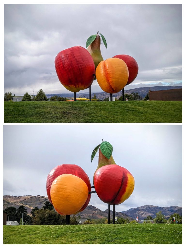
From this angle it looks like one of the colorful flightless birds around NZ!
We started up a mountain pass along a rushing river and stopped at a viewing platform at Roaring Meg. Roaring Meg is a turbulent stream that drives a hydro-electric power station and merges with the Kawarau River, which runs between the towns of Cromwell and Queenstown.
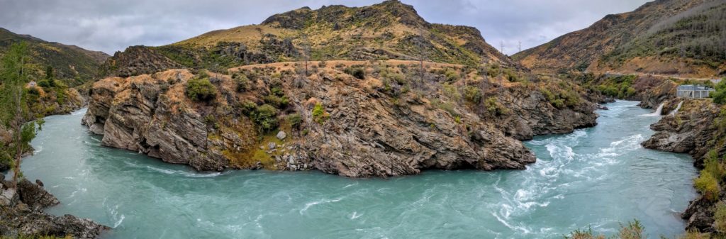
You can see the power station on the right, with the stream flowing out to the river.
We continued up and over the pass and down into Queenstown, seeing a line of cars for several kilometers leaving town! No matter what season, Queenstown is always busy it seems. We drove around looking for a parking space and finally found one about a 20 minute walk into town! Our destination was Fergburger! We had to try the iconic burgers! We figured out that it’s best to call in your order by phone rather than stand in line to order, then wait in line to pick up your burgers, especially on an unseasonably cold windy day like today! By the time we reached the restaurant we had only a 5 minute wait. They have very limited seating, so we headed outside to try and find a spot out of the wind to consume our burgers. Robert got the “Sweet Bambi” venison burger, while I opted for the “Ferg-lafel”, the falafel burger (I’ve had too much lamb lately – can you believe it!!).
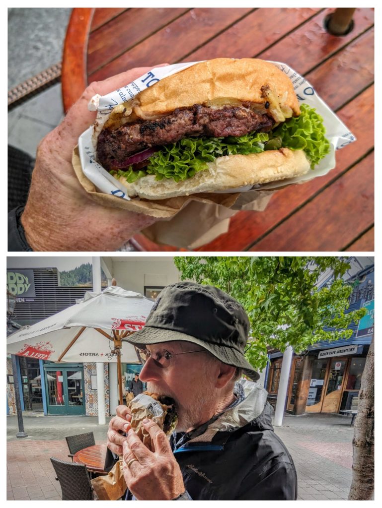
They are huge and delicious. I couldn’t finish mine and wrapped it up for later!
We walked around the lakefront back towards the car to finish our long driving day, we still had about 3 hours drive to Riverton!

A little bit of view at the lakefront. Queenstown is surrounded by mountains.
