April 6 On to Gladstone (Day 192)
We woke up to cloudy skies and went to the beach to try and catch the sunrise.
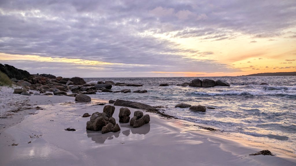
A muted sunrise on Jeanneret Beach.
We decided to head back to St. Helens, use the town wifi for an hour, then move on to new venues. We chose the unsealed road through the eucalyptus forest in the far north east of the island to experience the “off the beaten track” wilds. Logging activity is apparent, but it being Saturday we didn’t meet any logging trucks on the road. 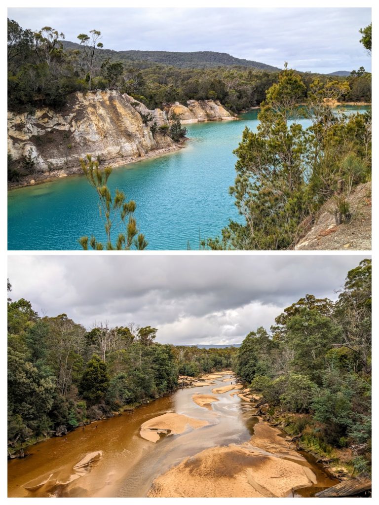 We crossed the Ringarooma River on it’s path to emptying into the Ringarooma Bay in Bass Strait, the body of water between the island-state of Tasmania and the mainland of Australia. Then as we approached the town of Gladstone we stopped at Little Blue Lake to admire it’s bright aqua-blue water, a little muted on this cloudy day. It looked suspiciously like an old quarry and I later found out that it was the site of a tin mine and the color comes from suspended clay and high levels of minerals in the water. We reached Gladstone and checked out the town’s free campsite next to the community center, with bathrooms available! We decided to stay for the night, set up quickly and took a walk around the 2 blocks of town. We found the cafe-tavern and stopped in for a few drinks. I chose Guinness while Robert had a glass of red wine. I think we were the talk of the locals who came and went, with me being the beer drinker and Robert being the wine drinker! It’s the first Aussie bar we’ve been in, and with the muddy utes (the local pick-up trucks) out front, filled with the carcasses of wallabies and cages with hunting dogs, we expected Crocodile Dundee to stroll in! The locals told us that the hunters go out to shoot the wallabies for sport, then use the carcasses for dog tucker (dog food).
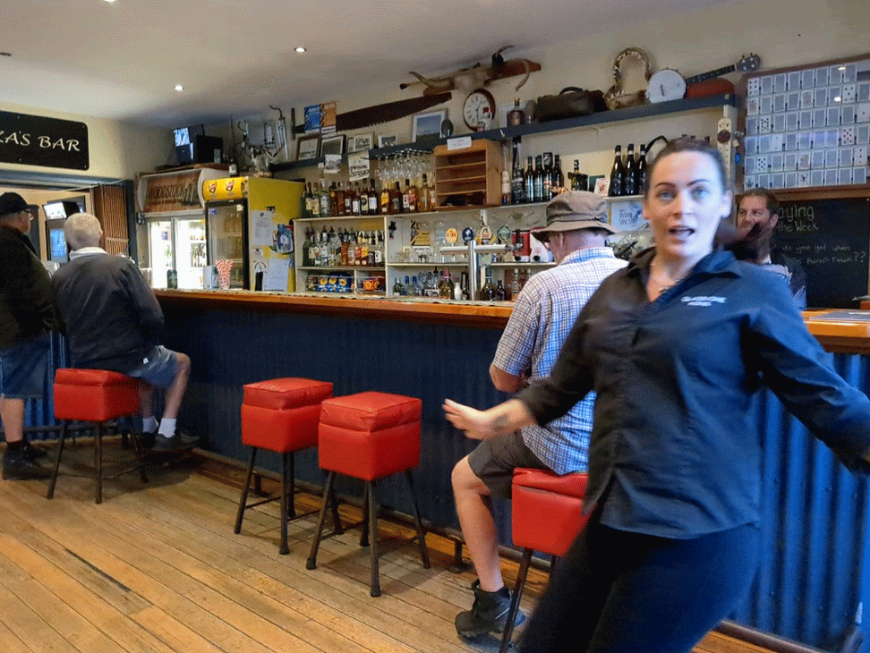
Not Crocodile Dundee, but a photo-bombing bar tender!! A fun evening at a local bar where a customer served us our drinks while the bar tender was serving folks in the cafe section!
April 5 Binalong Bay (Day 191)
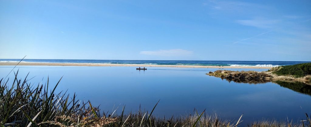
We had a beautiful sunrise, with a pair of black swans touching down on the lagoon where yesterday there was a canoe! 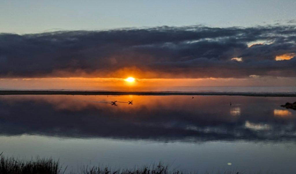
Unfortunately the sun couldn’t burn away the clouds and rain was threatening so we packed up to find better weather! Another day, another beach! Heading further north up the East Coast we stopped at St. Helens on Georges Bay for supplies and to replenish water, then drove around Grants Lagoon and to the beaches along Binalong Bay. Another free site courtesy of the Tasmania Conservation Department, this one with a ‘hybrid’ toilet that uses a micro-flush system. The sites were large and separated and we had a peek-a-boo view of the water!
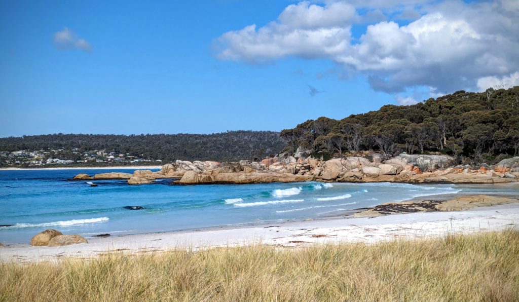
Jeanneret Beach, a tiny but gorgeous beach with sugar-white sand, clear baby-blue water and a nice slope for swimming!

The orange tinted rocks border the beach and are great for sunbathing and tide watching!
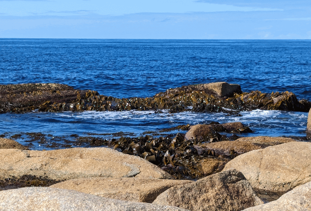
Watching the waves flow over the seaweed was mesmerizing.
This rocky headland separates this beach from the larger Swimcart beach that has a long camping area spread along it filled with campers.
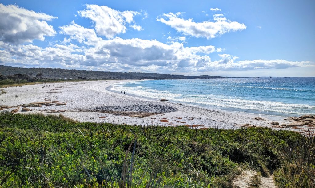
Swimcart beach has rougher waters and a definite undertow, no swimming here!
We walked along Swimcart beach, and it was such a nice day, in the 70’s, we headed back to Jeanneret Beach and took a dip in the cool sea water!
April 4 Chain of Lagoons (Day 190)
We moved on this morning to another campsite, a free spot with a view of the ocean! It was a short drive of about 40 minutes and when we found our spot we were smitten!
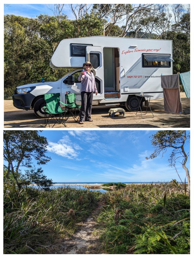
We quickly set up, even to the clothesline! As “Nick (Craig Nichols) would say “every hobocamp needs a clothesline”! Our setup and our view!
The end of the Lower March Creek lagoon separates us from the beach, but it is only a short walk away!

And finally we took a long walk on the beach and watched the incoming tide wash away our footprints in the sand!
April 3 Freycinet NP (Day 189)
We woke to the promise of a wonderful day to explore Freycinet National Park, encompassing most of the peninsula across Great Oyster Bay. On the way into the park we encountered our first live wallaby (we’ve seen plenty of road-killed!).
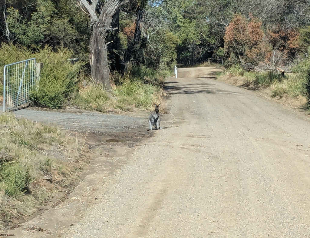
Such a cute fella, glad to see a live one!
We headed into the visitor center and learned that there is no available caravan camping in the park, but they gave us other available options. We then headed to the end of the road to see the famous Wineglass Bay! The crowds of selfie-taking tourists on the trail attest to Wineglass Bay’s Tasmania bucket list status! We didn’t have time for the 3 hour hike down to the beach and back, or the 5 hour circumnavigation trail to Hazards Beach and around the headland, so we settled for the hike up to the Lookout.

The purple line marks our hike up to the lookout and back.
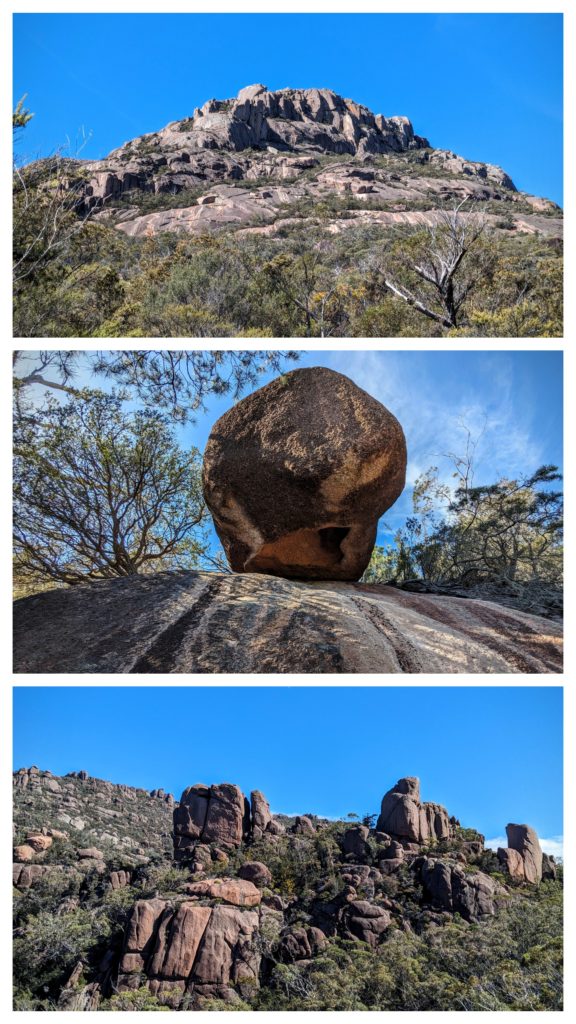
We hiked up through the weathered granite rocks that gave us vibes of Arizona!

The view of one of the best beaches in the world is stunning! The name ‘wineglass bay’ comes from the whaling days of the 1820’s when so many whales were dragged into the bay to be butchered it stained the water wine red!
After our hike we traveled to the end of the other road in the Park, to the Cape Tourville lighthouse.

from this vantage point you can see the entrance to Wineglass Bay and the strip of white sand beach in the mid-distance!
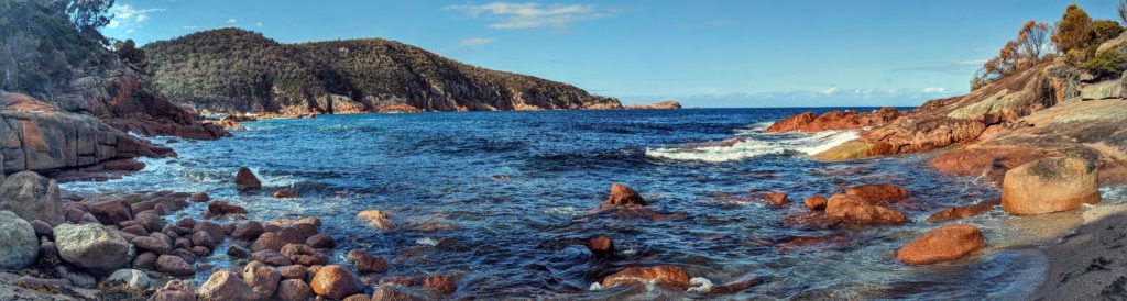
And finally, as we descended from the lighthouse point we stopped at Sleepy Bay and discovered where “Sedona Meets the Sea!” The red rocks sloping into the deep blue of the Tasman Sea!
We ended up camping at a local restaurant, The Pondering Frog, at the head of the peninsula, for a good night’s sleep!
April 2 Rain (Day 188)
As it was forecast, it rained! Finally breaking the 2 month drought here in Tasmania! We took the break as a chance to go to town, do laundry, dump, get water and use the free wifi in town to update this blog.
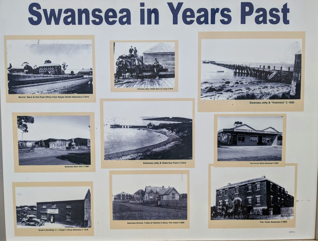
The old time grocery/hardware/department store in town has a wall of great old photos.
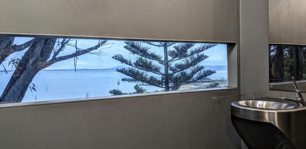
I’ve never seen a public toilet with a window. This one is on a slope overlooking Great Oyster Bay!
