Near the Kofa Cabin is the New Water Well, one of many wells in the Refuge that predate wilderness designation (some even predate Wildlife Refuge designation).
Driving on Wilbanks Road back to Kofa Cabin & New Water Well.
The watering trough ramada appears to be an oasis in the desert, surrounded and shaded by trees.
The windmill pumping the well is framed by weather worn tree limbs.
Posted on February 2nd, 2014 at 12:17 pm | No Comments »
From the campsite we’re at now we can drive to new areas in the Kofa Wildlife Refuge. We loaded the Jeepster up with supplies necessary if we get stuck out there, food, water, warmer clothes, etc. and headed out to explore. We found our way to the Kofa Cabin (which we visited Dec. 15, 2013) then continued south on Wilbanks Road towards the Kofa Monument. Driving quite a way in a gravelly wash, probably the best way to get through the Kofa Mountains, we nearly missed the sharp turnoff uphill to the monument.
The rock monument is on a hill surrounded by mountains.
The Mavrik photo!
The inscription plaque.
Posted on February 2nd, 2014 at 10:49 am | No Comments »
We moved to a new area we haven’t visited before that gives us access to the northeast corner of the Kofa National Wildlife Refuge. The New Water Mountains are the dominant range here and mostly encompassed in a wilderness area.
The New Water Mountains.
The obligatory saguaro picture!
Posted on February 1st, 2014 at 10:40 am | No Comments »
We moved closer to town to re-supply, get fresh water and dump our ‘used’ water. The rack for the back of the Jeepster was modified for just this purpose, so we can dump into the “Blue Boy” and avoid driving the camper all the way to the dump station. We also brought along containers for fresh water, and the laundry to do in town. It was such a pleasant day we rolled the windows and the back up for the safari effect!
Going to town Safari Style!
Posted on February 1st, 2014 at 10:30 am | No Comments »
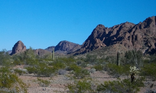
Today we decided to stick closer to camp. On the simple map you can pick up at any of the 3 entrance kiosks into the wildlife refuge, the roads and water sources are marked with little accuracy. There is a symbol for ‘Hidden Valley Tank’ within walking distance of our campsite, but looking out at the mountains, how could we find it?
It’s like looking for a needle in a haystack, a water source in the arid mountains of Arizona!
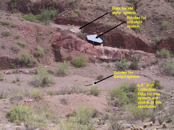
I started with an internet search for GPS coordinates for water sources in Kofa Wildlife Refuge. Maybe the Fish & Wildlife Service doesn’t want to make it that easy! I couldn’t find any information pinpointing water sources here. Next I checked Google Earth and found what looked like a corrugated metal roof in a nearby narrow canyon. The ‘old style’ of water source enhancements usually consists of a dam holding water in a natural depression with a roof over it to minimize evaporation.
From the Kofa Nat’l. Wildlife Refuge website.
This must be it! Now I had to find the latitude and longitude to pinpoint the spot so we could walk right to it with our handheld GPS. I used a website; http://www.latlong.net/ ,which I use to pinpoint our location for the map “Where are Robert and Mary Jo now?” on our website. I found the telltale roof on the map and scrolled over the spot to get the coordinates. I put those into our handheld GPS hoping they are correct because sometimes the coordinates I get for our website puts us many miles away, sometimes into Mexico! Off we headed to the northeast, walking cross country.
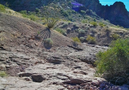
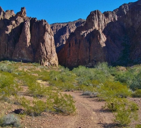
We reached a wash we believed to be the outflow of Hidden Valley and followed it up.
There it is! The valley is more narrow and steeper than we imagined!
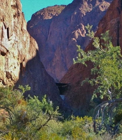
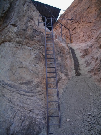
We found a path through the wash to the base of the tank.
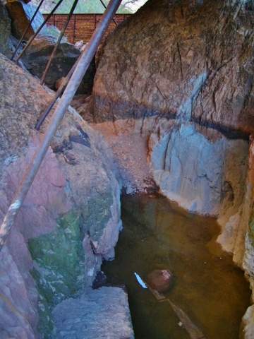
A climb up the ladder afforded us a view of the tank itself, rather empty now.
Mission accomplished. We were wondering how they got all the equipment, metal, cement, etc. to the site and when they did the enhancements?
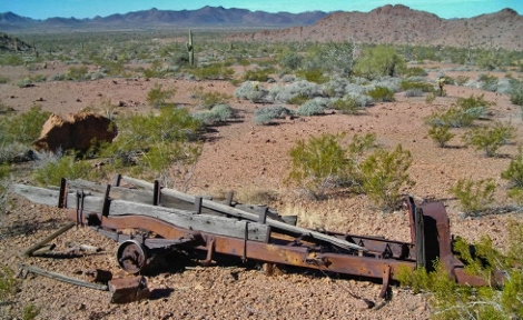
As we hiked out we found the chassis of an old truck, maybe it had been used for the tank construction.
Hiking further out we found evidence of an old road leading to Hidden Valley. It wasn’t going our way so we hiked cross country back to our campsite.
Posted on January 21st, 2014 at 8:44 am | 2 Comments »