Jan 15, 2026 Franz Josef
We set off this morning on our move to the southern end of the Southern Alps. We drove through the town of Franz Josef, stopping to get some groceries because this is the biggest town (population of about 500) between here and our destination of Makarora.
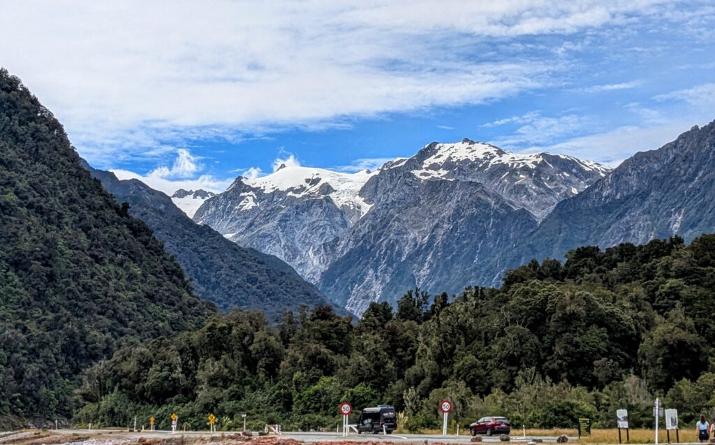
The view from the main street in Franz Josef, looking up at the Franz Josef glacier high in the mountains.
The road took us south along the coast in spots, then turned inland and followed the Haast river through the Haast pass, named by the provincial geologist Julius von Haast when making the first official crossing over the pass in 1863.
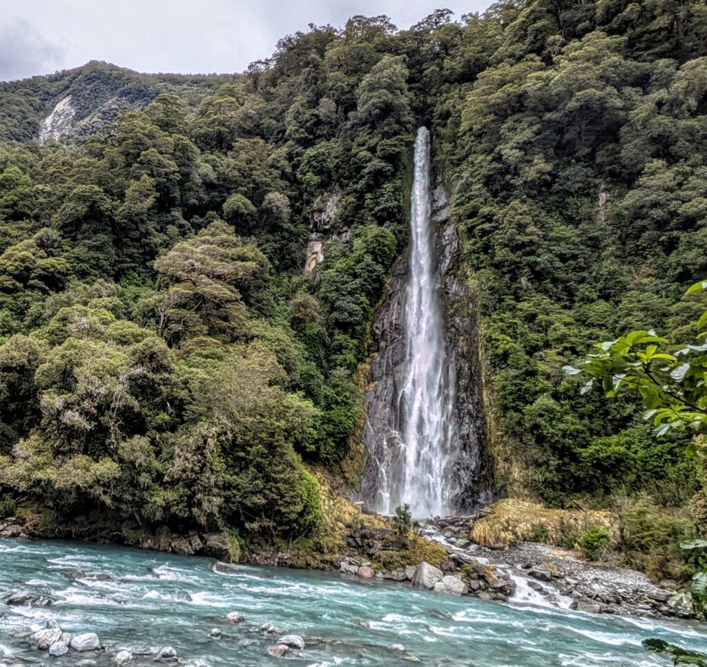
Thunder Creek Falls, one of 3 large falls along the pass route.
Jan 14, 2026 Sunset on the Coast
Our last night in Ōkārito we enjoyed a beautiful sunset on the wild west coast!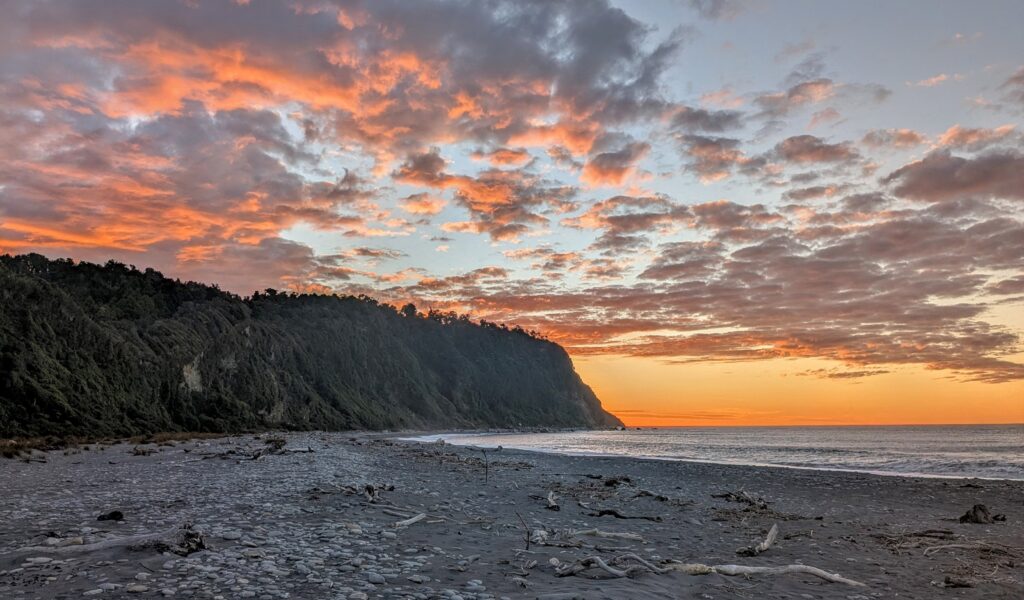
Jan 14, 2026 Forest to Beach
The nearby Pakihi Walk Lookout affords you a fantastic view of the Southern Alps on a good day. Unfortunately today was not a good enough day. We took the short hike to the viewing deck, but clouds obscured the view of the mountains for us, so we took a trail around the hilltop viewing platform.
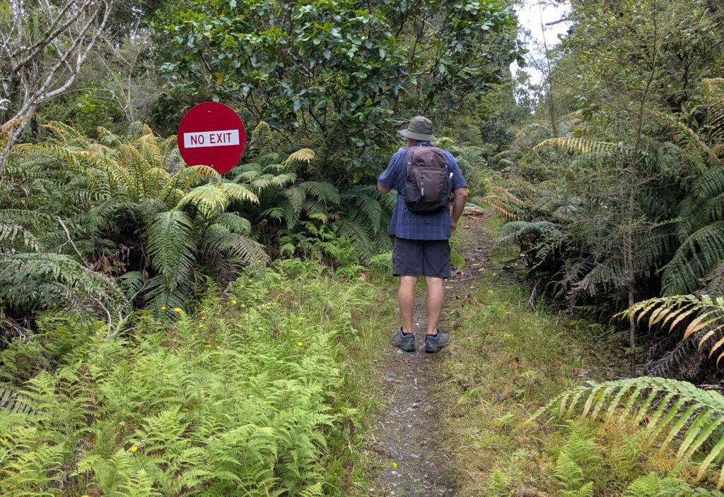
The trail led into the remnant rimu tree forest, but as the sign says, ‘No Exit’. The trail goes out to a lagoon, not to the beach, but we enjoyed being in the cool regenerating forest and turned around when we reached the marshy area.
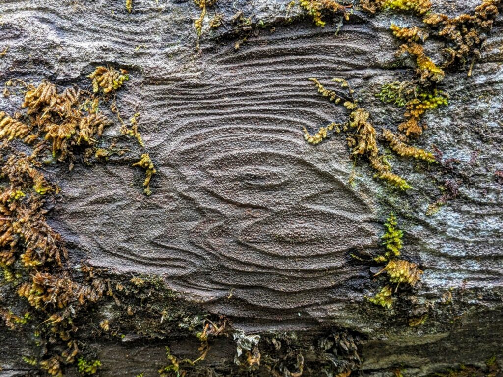
A long ago naturally fallen rimu tree that we had to step over has amazing bark detail.
We finished our 2 mile walk and returned to the tiny enclave of Ōkārito and went down to the beach. You should be warned however, that the Wild West Coast beaches are not to be trifled with! They are not ‘bathing-beauty’, white sand swimming beaches. They are wild, rugged, dangerous places where you are NOT encouraged to swim!
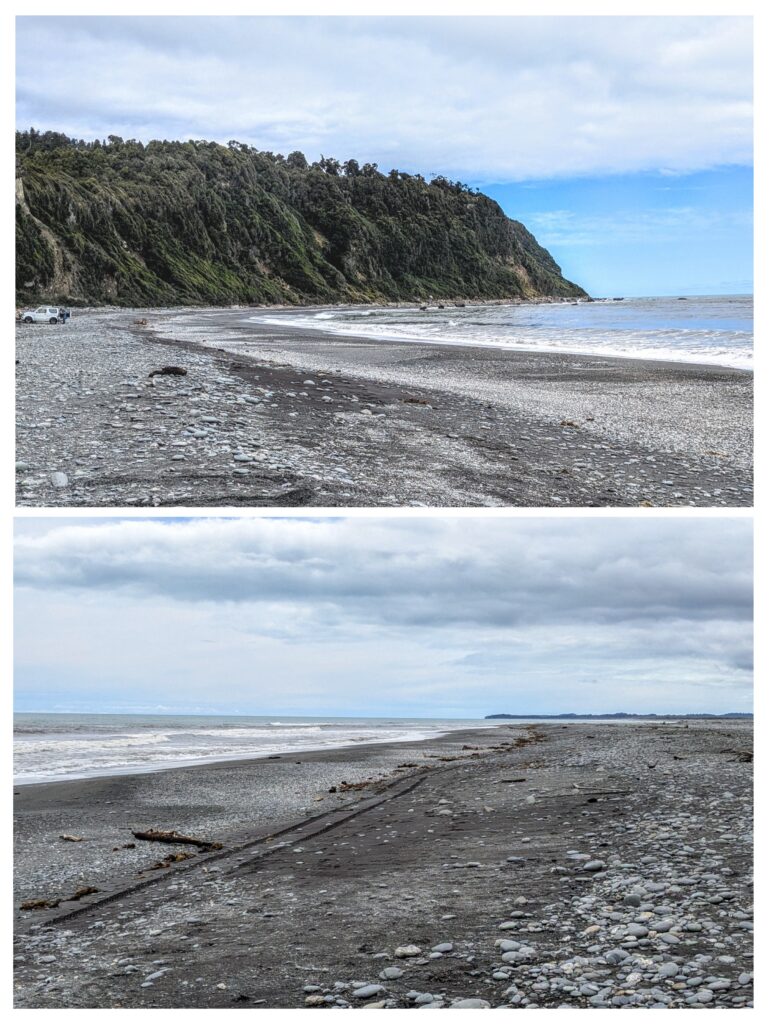
One lonely fisherman in the distance who drove down to the water’s edge. The only other people were a few tourists who stopped briefly, like us, to snap some pictures of the empty, grey sand and cobbles with drift wood scattered along the tide line. I did find a small piece of pounamu (NZ jade) worn and polished by the rough sand and crashing waves over millennia.
Jan 13, 2026 Birds
The blooming flax plants along the deck of the B&B are frequented by multiple tui birds, the largest concentrations of these birds we have seen! The flax flowers are providing nectar to the birds, and the birds are transporting the flower pollen from plant to plant! The Tui and the Flax Flower.
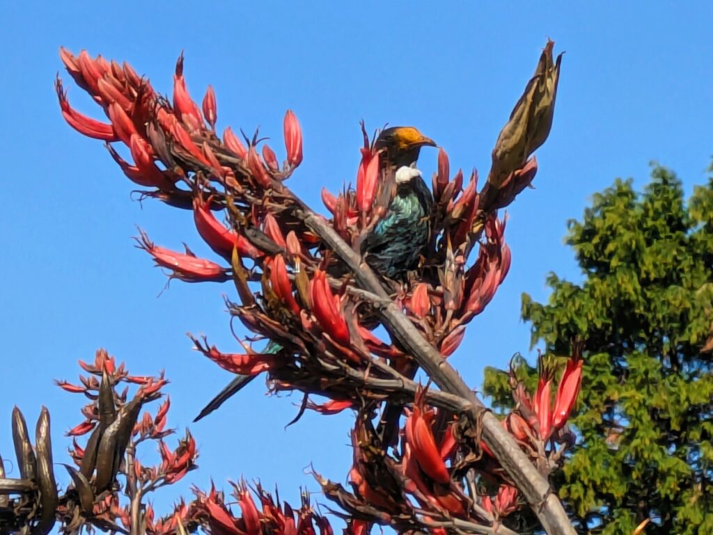
The orange face on the tui is actually the flax flower pollen! I thought this orange-faced tui was a subspecies of the normally black-faced tui. No, he just has a dirty face!
We decided on a short walk today, to the beach, then through a wetland, forest and up a hill for a view above the windy beach.
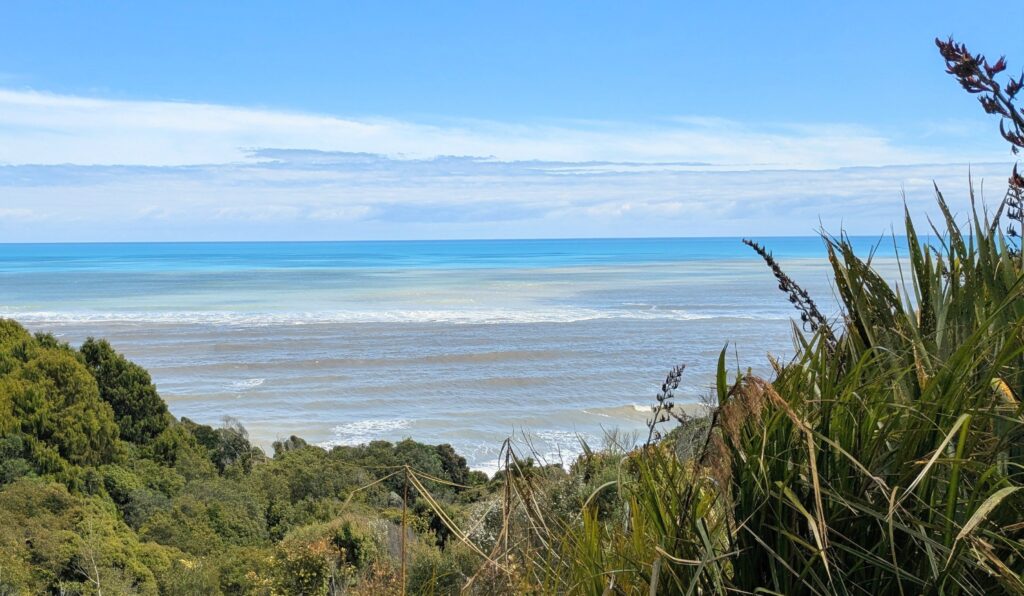
From above, we can see the blue ocean beyond the ‘dirty’ rough waves, stirred up by the wind and the influx of silty glacial outflow from the Whataroa river, the Okarito Lagoon and the Waiho river surrounding us.
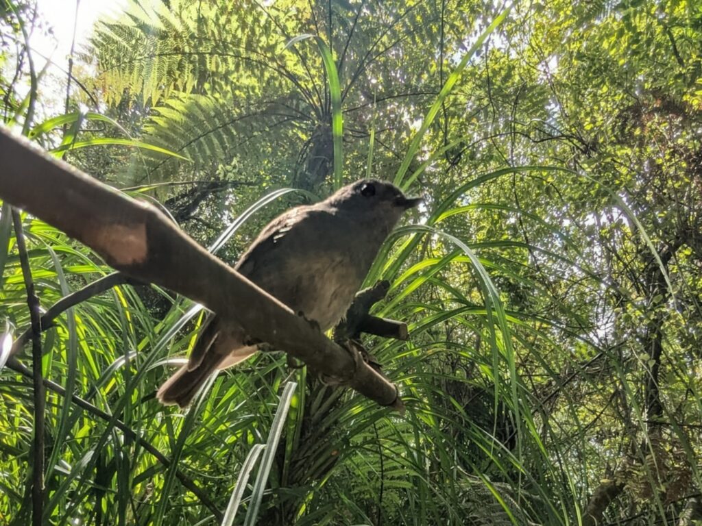
On our walk back we were visited by a South Island robin, a native wren-sized, apparently fearless bird. It hopped around us and almost landed on us, snatching insects out of the air and from the ground that we had stirred up walking along the trail.
Jan 12, 2026 Franz Josef Glacier
We are staying at a B&B in Ōkārito on the shore of the Tasman Sea. On a clear day several peaks of the Southern Alps can be seen out the back from the bedroom window, over the long thick leaves and flower spikes of the flax plants. Today we decided to drive up to the Glacier car park in Westland Tai Poutini National Park to see what’s up there.
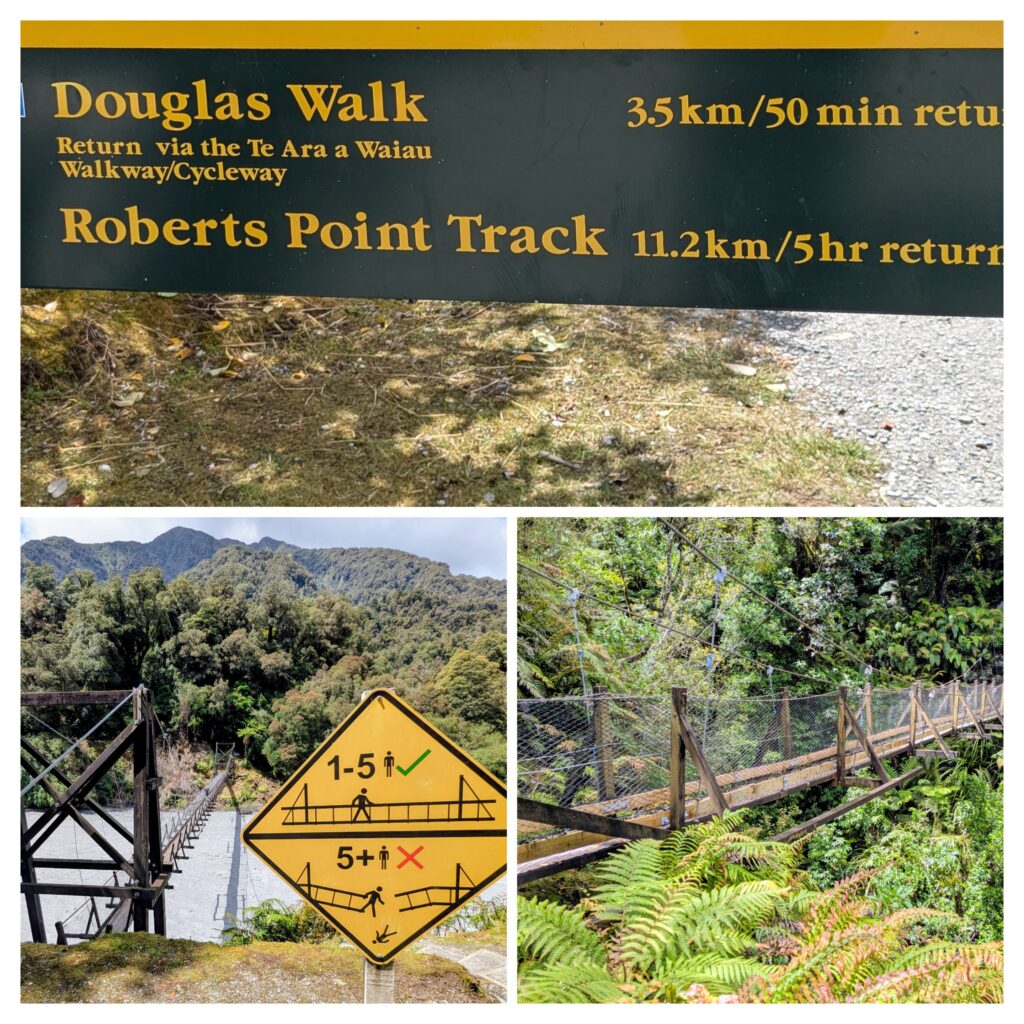
It is Kismet! We HAVE to do these trails!
In about 20 minutes we reached the first swingbridge, strictly only 5 persons on the bridge at a time, or you will fall & die!!!! Looking down at the roiling glacier water, the Waiho river, thick with silt from the glacier, you pay attention to the rule! The second swing bridge was restricted to only one person at a time, but was shorter and less swingy! The third swingbridge was another story entirely!
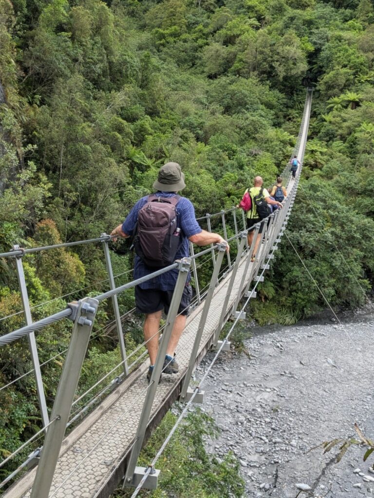
This longer bridge had a limit of 5 people, and was very swingy and bouncy, with the ends an uphill climb!
Only the first bridge crossed the river, the other two crossed side valleys with the river to the side, with views of several waterfalls on the opposite valley cliffs.
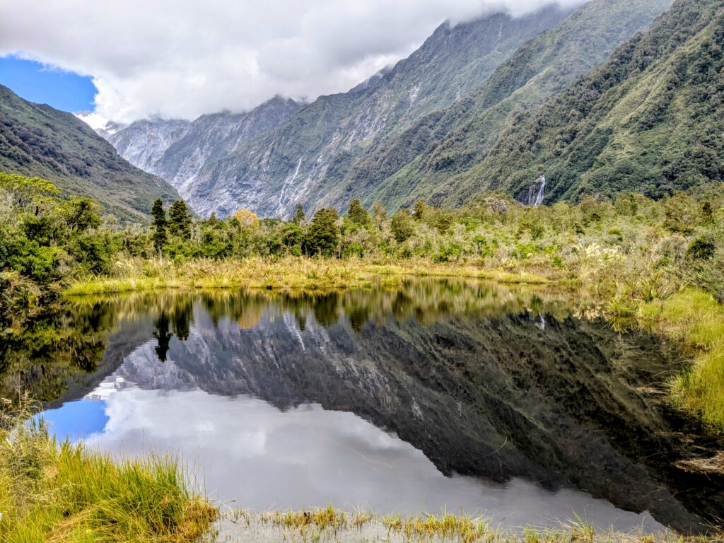
Returning from our timed hike (we didn’t have time to get to the Roberts Point viewpoint) We found this beautiful reflection of the mountains in this ‘kettle pond’ formed from a block of ice from the retreating glacier around 1800. Back in 1894 a young 9 year old boy camped by the pond with his family. The pond retained his name as Peters Pool.
We returned to the car park and discovered another trail that takes you to a viewpoint for the glacier, which has retreated far beyond a day hike from the parking area!
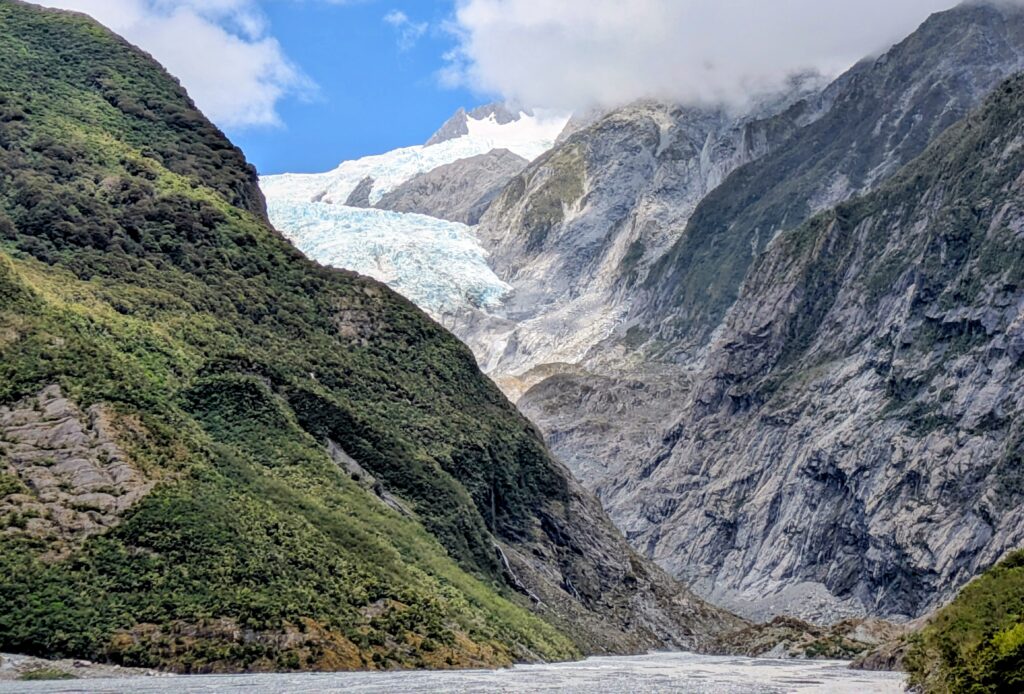
In the distance up the valley is the fast-retreating Franz Josef Glacier, named after the then Austrian Emperor Franz Joseph in 1866. The misspelling of Joseph to Josef came about in the 1900’s, read about it HERE.
