Jan 11, 2026 Stormy Day for Travel
We loaded the car in rain in Greymouth then unloaded it in torrential rain in Ōkārito about 3 hours and south about 164km (101 miles) later.
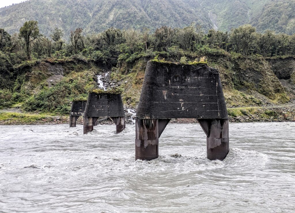
We stopped to watch the Whataroa River flow around old railroad pilings. The river must be swollen from the all day rain, running grey with the silt flowing down from the glaciers high in the Southern Alps.
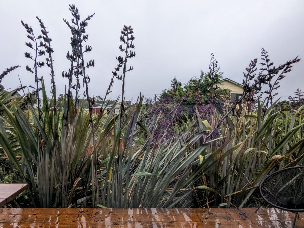
Our B&B is surrounded by huge native flax plants with the tall flower spikes swaying in the rainy breezes.
Jan 10, 2026 On to Greymouth
The weather is changing, a storm coming in from the Tasman Sea. Our beautiful sunny weather has fled from the dark clouds moving in from the west.
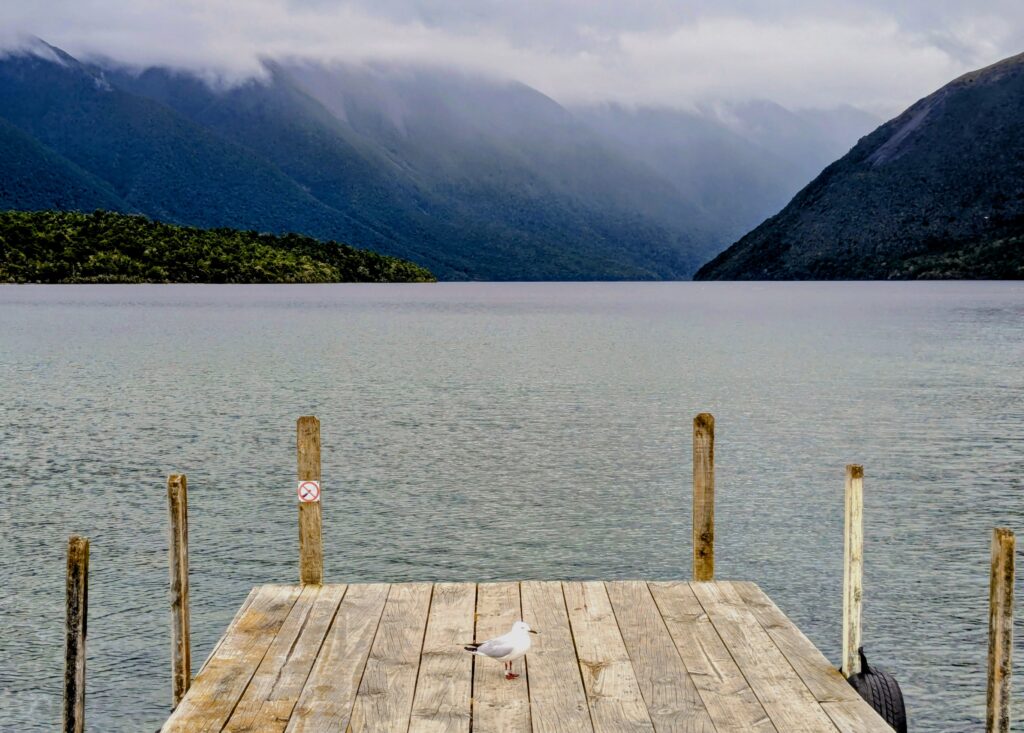
Our last look from the boat dock at West Bay.
We stopped in Murchison for a short walk around town. Then to Reefton for a lunch break.
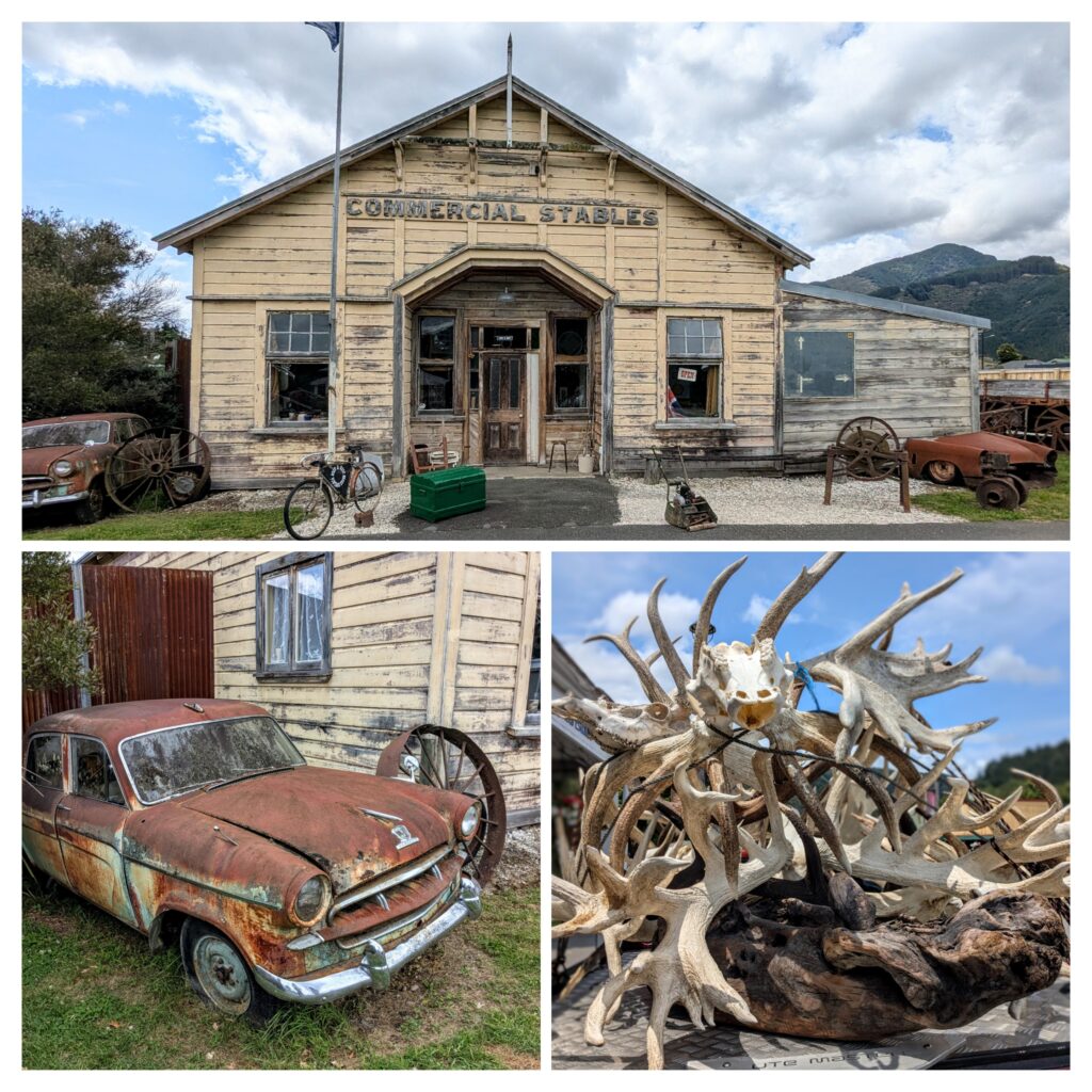
The old car and building in Murchison, a town of slightly over 500 people, established during the gold mining era of the late 1860’s. The pile of antlers were in Reefton, a larger gold mining town of over a thousand that became the first place in NZ to get electricity in 1888! Now it is more of an artist enclave.

Near Greymouth we stopped to see this locomotive. When Europeans entered the area in the mid 1800’s the valley of the Grey river was covered in forests of ancient large Rimu and Kahikatea trees, “red and white pine” to the Europeans. With the introduction of mechanical means like this locomotive many sawmills were kept busy into the 1960’s! The cleared land was converted to farmland or replanted in plantations of ‘exotic’ trees like Monterey pine. Only public outrage in the 1970’s stopped the complete annihilation of the native forest, protected now in public lands. Almost all logging of native trees was stopped by 2002.
Jan 8, 2026 Easy Lakeside Hike
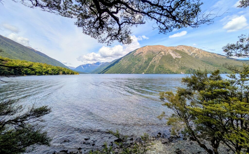
A relaxing 7.5 mile hike along the east bank of Lake Rotoiti, through the ‘honeydew forest’ of sweet perfume.
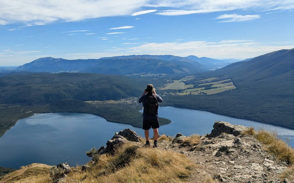
Jan 7, 2026 Mt. Robert
We tackled Mt. Robert today and summited! We got an early start for a tough uphill climb to above the treeline.
Robert on Mt. Robert!
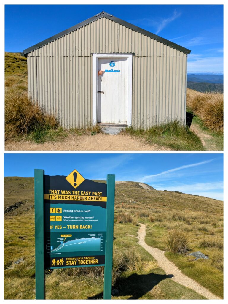
Above treeline is the Relax Hut, constructed by the Nelson Ski Club in 1957. Beyond the hut is the Robert Ridge Route and warnings “That was the easy part”! We chose to take Paddy’s Trail down the mountain, but out in the open under the sunny sky.
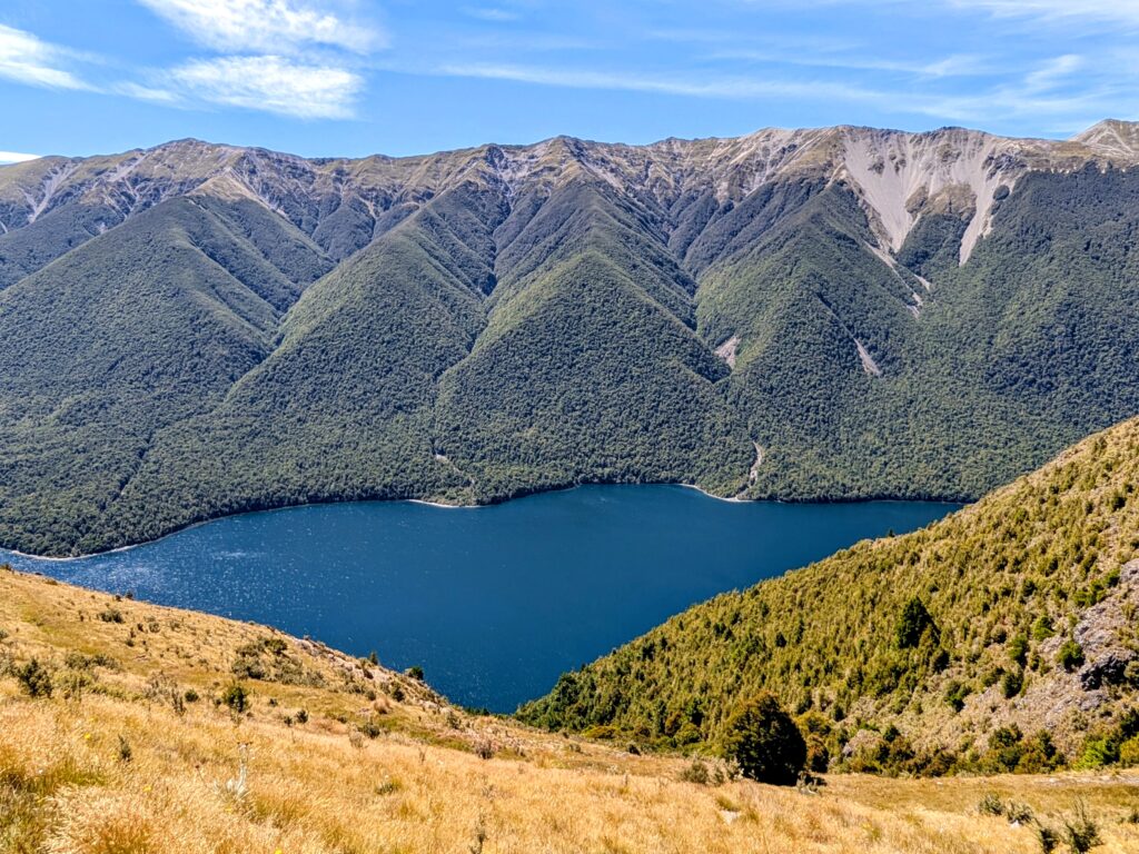
Beautiful views across the lake, above treeline.
Jan 6, 2026 Buller River & Beech Forest
Today we took two walks, the first along the Buller River, the only outlet from Lake Rotoiti.
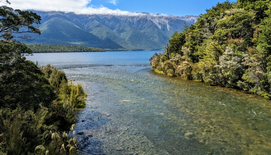
Crystal clear water flows out to become a recreational river mecca for white water rafting, jet-boating and fly-fishing for brown trout!
We then drove to the other side of the lake to walk through the “honeydew forest” of beech trees. The unique relationships between a species of NZ beech trees, a microscopic tree scale insect and a black fungus creates a fairytale forest of heady aroma! The spicy sweet scent is hard to describe, not flowery, but more honey scented with a back hint of baby powder. The sweet ‘honeydew’ droplets of nectar flow out of tiny hair-like anal filaments of the scale insect that is burrowed into the bark of the beech tree. The ‘sooty mould’ grows where the honeydew is dripping and eventually coats the infected trees and appears to flow off the trees onto anything in the surrounding area. The sooty mould feels rubbery on the trunks of the trees. Walking through the honeydew forest you can imagine elves or fairies living amongst the ferns and mosses covering the forest floor along the banks of streams flowing down the steep rocky slopes of the mountains surrounding the glacial lake.
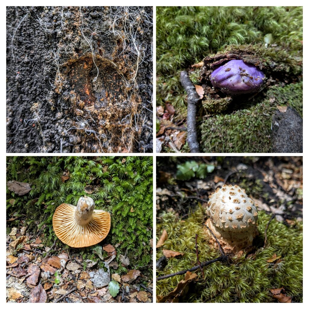
A closeup of a beech tree infected with the honeydew scale insect. in the middle is an anal filament with a droplet of the ‘honeydew’, the waste product of the sap-sucking insect. There are other fungi growing in the forest too, 3 samples found on our walk.
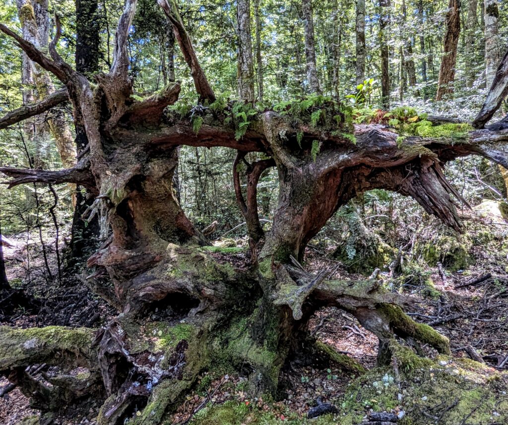
The roots of a long ago fallen tree, covered with ferns.
