November 25, Bach Beauties (Day 59)
We went into Te Puke to do some errands in preparation for our next move. Our time in Bay of Plenty is winding down and we’re getting ready to move down to Wellington for our next adventures. While we have been here at Bay View Bach for the past 26 days we’ve seen the flowers budding and now blooming!

Indigo?

Mandevilla?

Blue hibiscus?
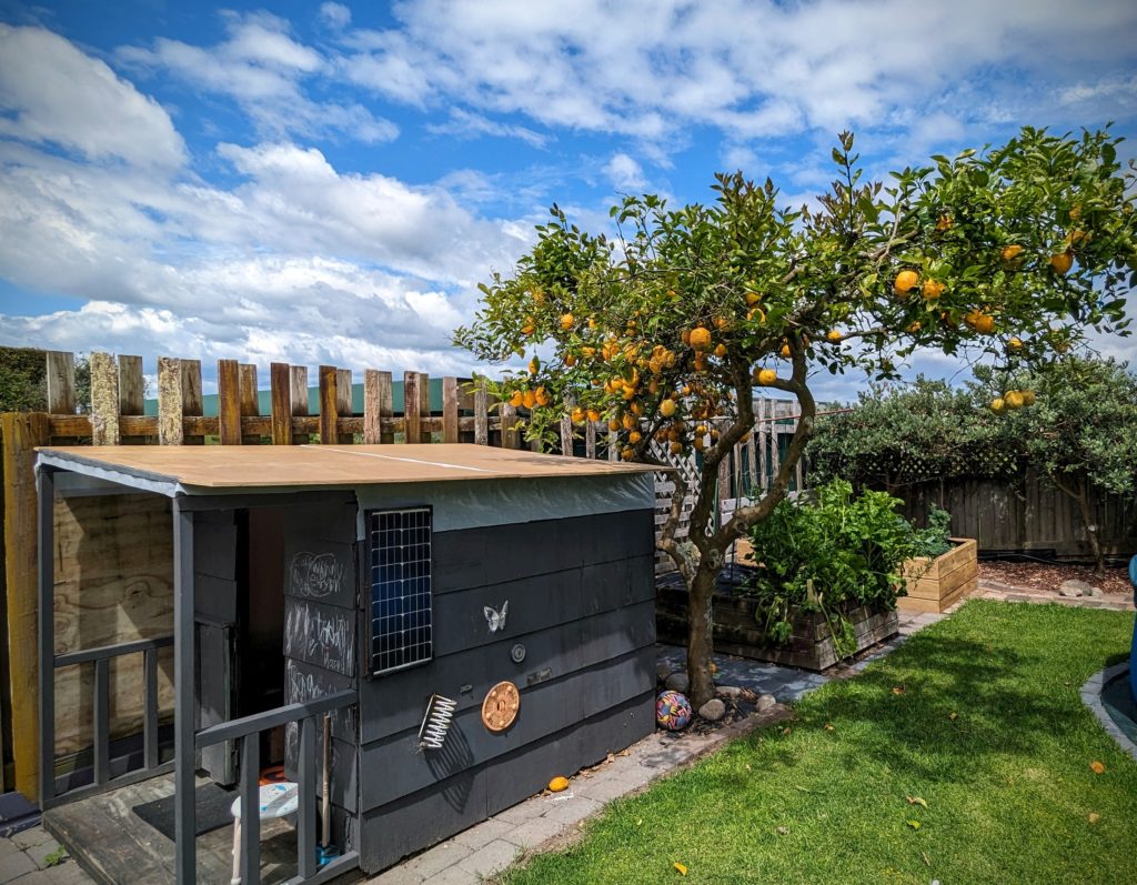
And the prolific lemon tree! Overlooking the cutest play house! I used many lemons on the grilled fish and found out that grilled lemon is delicious!
November 24, 2023 Lunch at the Beach (Day 58)
This morning we took our walk down to town with a slight detour towards Okurei Point. We found another marker with more information about Historic Maketu “One Community, Two Histories” (Maori and Pakeha-European). This point of land was settled by Maori between 700 and 1000 years ago and was a prominent village with fortifications and cultivated fields of kumara (sweet potato), taro, uwhi (yam) and hue (bottle gourd). When Capt. Cook sailed by in 1796 he noticed the large village above the cliff and named it Town Point.

An aerial view of Okurei Point. The red arrow points to our Bach, the blue arrow points to Maketu Beach.
We headed to Maketu Beach to the Maketu Beachside Cafe & Restaurant for lunch.

Literally beachside!

Robert ordered the pan-fried fish & chips, with a great cabbage salad. I had the fish burger with the salad on it!
We heard the patter of feet and looked up to see a gull walking on the semi transparent roof!

His/her webbed feet!
November 23, 2023 A GORGEous Day (Day 57)
We left our B&B after a quick granola breakfast to head down the east side of the Coromandel peninsula. Our first stop was Hot Water Beach, where at low tide you can feel hot sand under your feet, dig a hole in the sand and let it fill with the hot water that is rising from 2 hot springs. It has become a very popular spot and was already filled with people.

The 2 hot springs are in a tiny area at the end of the rocky point, so everyone was gathered there. It will be inaccessible in and hour when the tide comes in!
Since we had no shovel, no swimsuits and didn’t want to pay the $25 (NZ) parking fee we took a loop road to Hahei Beach nearby. We were rewarded with a beautiful empty beach near Cathedral Cove (which unfortunately is closed due to storm damage from the February cyclone Gabrielle).
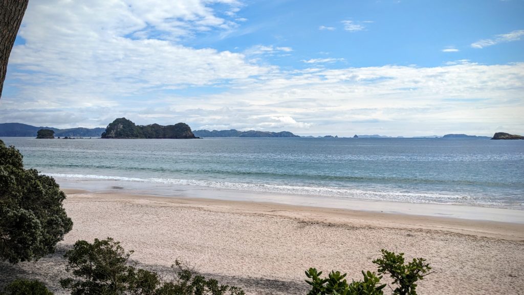
A beautiful sandy beach with picturesque islands in the distance.
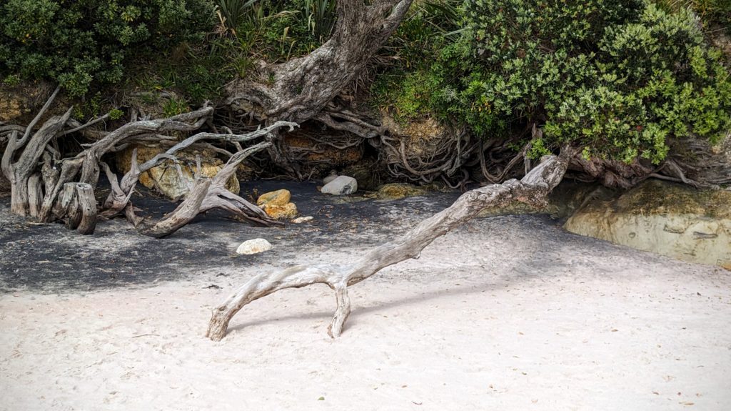
The roots of this pohutuwaka tree seem to be clutching the sand!
Walking into the little village we spotted this huge fig tree in the yard of “The Lawnmower’s Son Art Space“.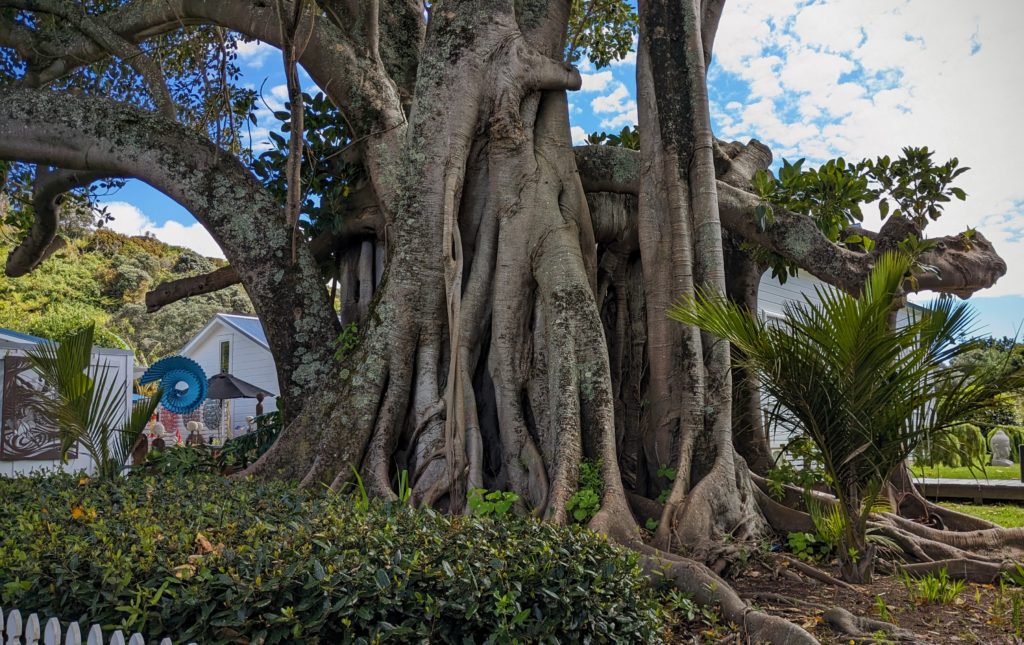 We continued south through the beautiful countryside and returned through Karangahake Gorge to explore it more. The gorge is only 20km (about 12.5 miles) long but is full of history and beauty. It was a major gold mining area in the 1870’s. The local Maori (the Hauraki tribes) were opposed to the mining of their lands, but were persuaded through various unscrupulous methods to sign away their mining rights by 1875 and the Ohinemuri field was officially opened to prospectors. The Ohinemuri river cuts through the Karangahake Gorge. Placer mining proved unprofitable, but new methods first in the world to be field tested here, using the Crown Battery to crush the gold ore and the cyanide process to extract the trace gold from the rock, were begun in 1889. History HERE. Lots of infrastructure was built, huge stamp mills, train routes, tunnels, bridges, etc. Most is all gone now and the river is slowly recovering from the devastating pollution. The railway operates a portion of the line as a scenic train. The gorge now has a walkway/bikeway on the rail route through tunnels and along the river. As we approached the historic walkway we detoured slightly for a view.
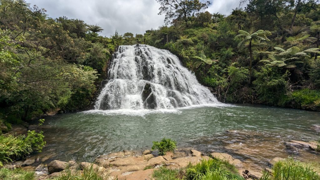
Owharoa Falls, just a short walk from the walkway/bikeway in the gorge!
We drove to another section of the walkway to try the Rail Tunnel Loop hike.

From the parking area you cross Highway 2 and the Ohinemuri river on the old rail/road trestle and enter the 1km long tunnel! The tiny dot above Robert’s head is the other side of the tunnel!
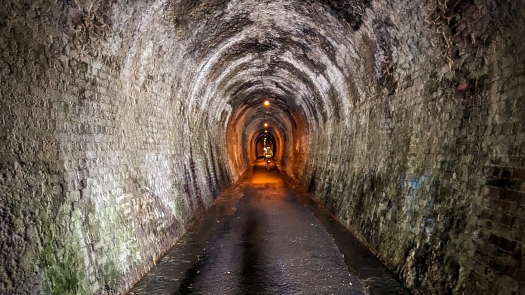
The tunnel is lighted! Bicycles and a few walkers passed us.
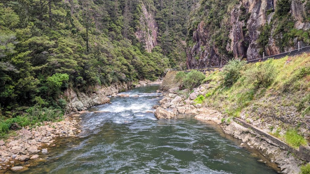
At the other end you emerge and cross under Highway 2 and over the river. A great view of the gorge from the bridge.

A map of the tunnel route. Unfortunately cyclone Gabrielle damaged the trail so the loop walk to and through the other tunnel (with windows overlooking the river) was closed.
We headed home to the Bach and had a great grilled fish dinner and a beautiful sunset!
November 22, 2023 The End of the Roads-Coromandel Part 2 (Day 56)
We woke to a muted sunrise looking out over Colville Bay and Hauraki Gulf.

A beautiful pink sunrise.
We got the binoculars out to view the islands and as the sun broke through the clouds we discovered that we could see the SkyTower in Auckland! It is in the distance as you look straight through the gap between the two islands in the center of the photo! We enjoyed breakfast on the deck and packed up to drive north to the end of the road at Port Jackson.

A lot of the drive was along the waterfront with huge Pohutuwaka trees growing along the beach. Several were in bloom with crimson puffs of blossoms! (Not visible in this photo though) You can see the road winding along the distant bluffs.
At Port Jackson (just a few farmsteads) we found that the road continued another 7km to Fletcher Bay, so of course we went!

Approaching Fletcher Bay from the single lane winding road over the hills! Square Top Island sits off the point.
There is a DOC (Dept. of Conservation) campground, and a welcome rest to stretch our legs. A storm damaged concrete building sits at the edge of the beach, built for what use I don’t know.

A vantage point for a view of the beach.

Walking the beach was relaxing. I even found beach glass.
We returned along the winding road, admiring the views and avoiding the campers and cars coming towards us.

A wide spot to stop with fantastic views!
We returned almost to Colville (where we got coffees on our way out to the end of the road) and took the Port Charles road to traverse the peninsula to the end of the road at Port Charles. We ascended the Moehau Range (avoiding the grader, roller and water truck that were working on the road) and stopped to overlook the forest at the summit.

The Kiwi Lookout at the summit. It is apparently “one of the best places to hear kiwi in NZ” according to the signage. You have to be there at night though!
Again, we went a few km past Port Charles to a lovely beach on Port Charles Bay. We climbed back over the mountain(?)range and returned to the town of Coromandel, past the Driving Creek Railway! What a curvy ascent & descent, rivals anything we’ve done in the US! We found a boat yard and Robert rigged up a hose to spray off as much of the mud and gravel from the car as we could! We then traveled the 45 km to our B&B for the night in Whitianga where we grilled some veggies and fish we picked up at the grocery in town.

Another beautiful sunset!
November 22, 2023 Coromandel, Part 1 (Day 55)
We started out early on our road trip to explore the Coromandel Peninsula, the piece of land between Hauraki Gulf where Auckland sits and Bay of Plenty where we are now based. We got through the morning rush hour in Tauranga and through the suburbs, crossing the base of the peninsula through the beautiful Karangahake Gorge. We headed up to Thames (named so by Captain James Cook in 1769 because it was the first large river he had seen in the country, the river Waihou) and then inland to almost the middle of the large Coromandel Forest Park.
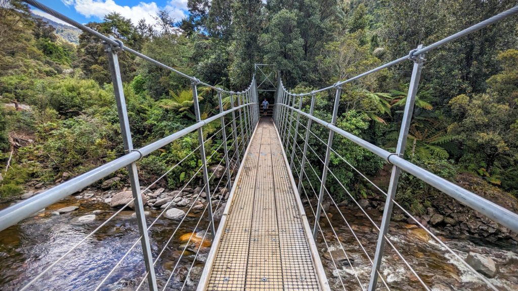
We came to hike a little bit of the many trails in the Forest and to see this suspension bridge!
We met a group of teenagers on the bridge, they kindly stopped to let us over, then engaged us in conversation, asking where we were from and how we like NZ. They had spent a day and night hiking and camping in the Forest and were very friendly and outgoing. They told us of a waterfall we could see just off the trail a few hundred meters past the bridge.
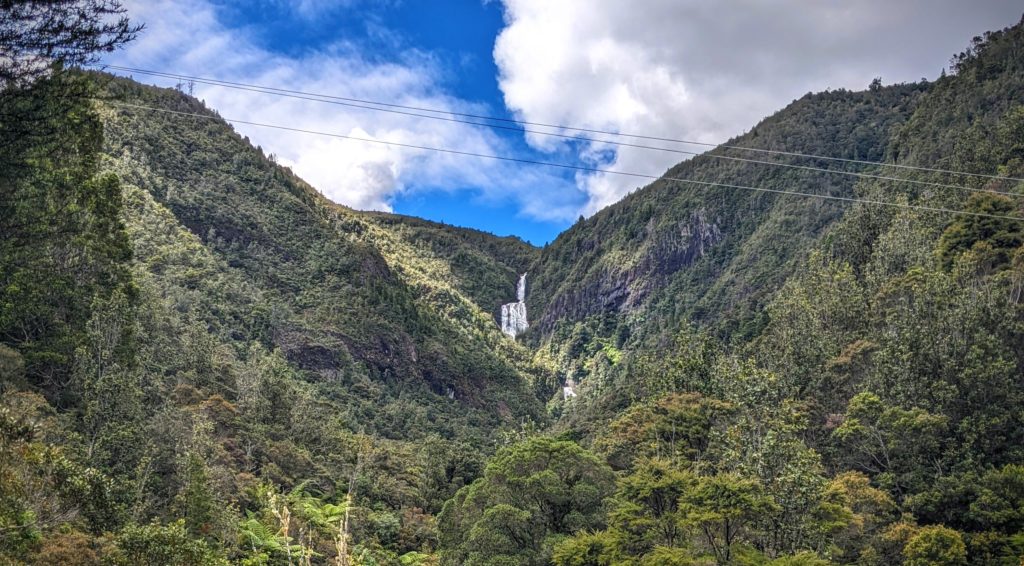
Billy Goat Falls, in the distance. Unfortunately Billy Goat Track, from which you get closer views, is closed now.
The history of the area is (as usual) tragic after Europeans arrived. The mighty Kauri forests that were here for millennia were logged off in less than 100 years.
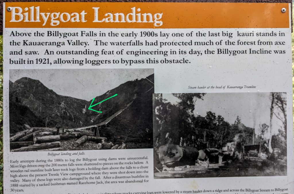
The green arrow points to the waterfall. It is amazing that so much effort and expense was utilized to exploit and deplete a resource in only 60 years!
History of the Kauri Forest of the Coromandel can be found HERE.
We left the Forest and headed to the Beach, the west coast of the Coromandel peninsula, through Thames and north to the town of Coromandel.
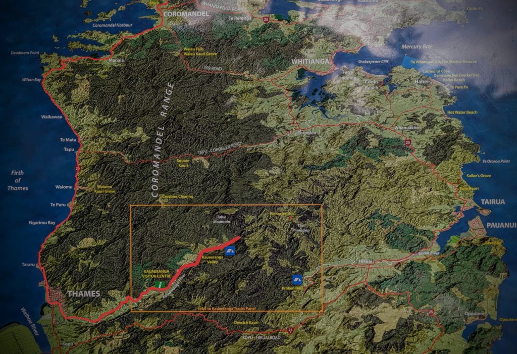
The red traces our trip from the forest to the coast.

We traveled along the waterfront with views across the Firth of Thames.
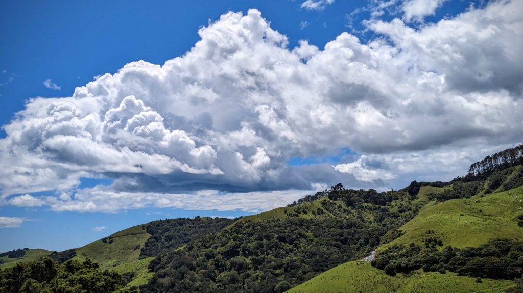
Then went above the water through pastures. You can see a small ribbon of the road in the lower right of this photo.
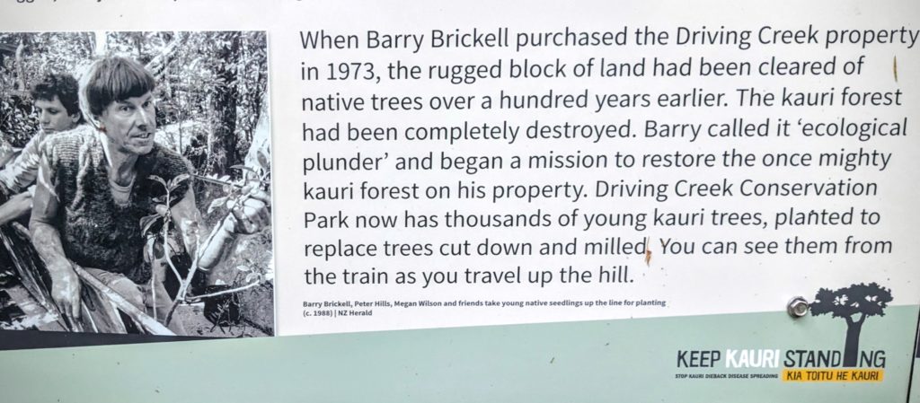
Our destination was the Driving Creek Railway, a tourist destination with purpose! Built by conservationist/potter Barry Brickell in 1973 it opened to the public in 1990.
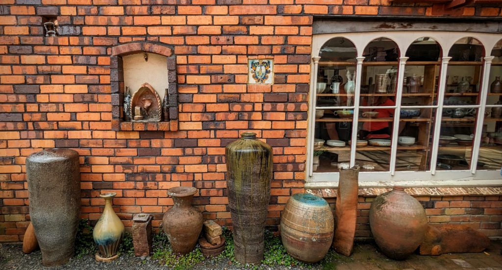
The ‘railway station’ is in the midst of the pottery studio with hand built kilns of brick and work studios.
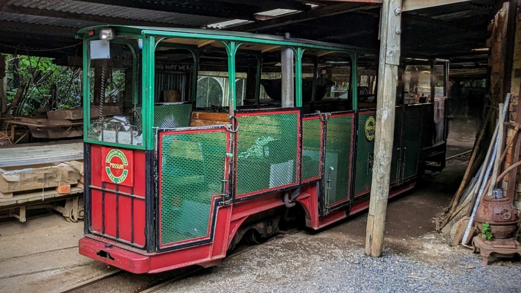
We joined the 2 dozen or so other travelers on the train and headed up the steep slopes of the property. Brickell utilized ‘reversing track’ to facilitate the climb, switchbacks basically, so the driver pulls into the reverse track, moves to the other end of the train, switches the track and drives up the next section.
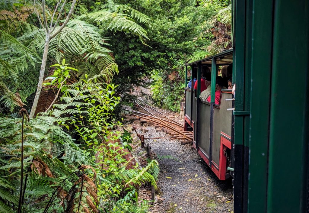
Approaching the reversing track.
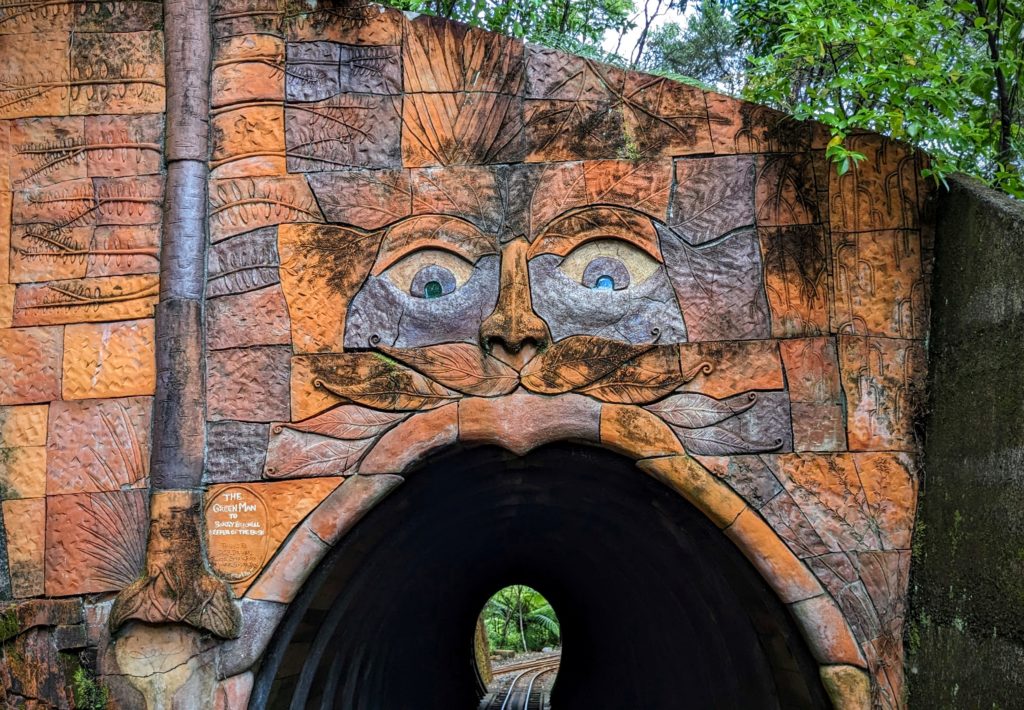
3 tunnels were built by hand also! This is the most impressive!
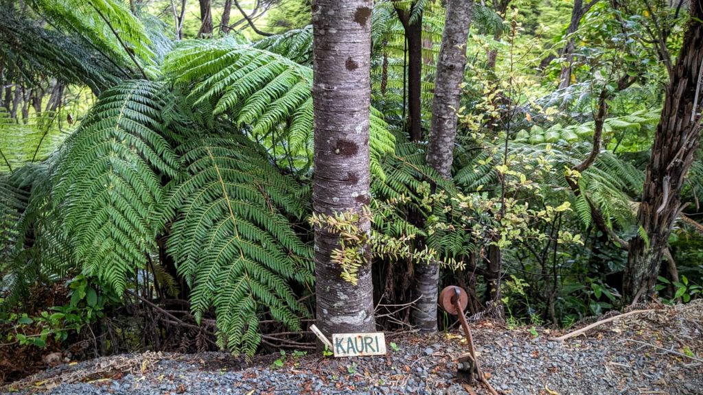
Brickell rehabilitated the steep rangeland by planting thousands of native trees.
He reminded me of Don Kerr of The High Desert Museum, he even looks a little like him, driven and focused on their passion in life. Both have left impressive legacies!
We enjoyed our train ride, the fabulous views from the ‘Eye-Full Tower’, walked around the wildlife sanctuary and continued to our B&B outside Colville. We had a wonderful evening, grilled some lamb chops and vegetables and toasted to the wonderful sunset view!
