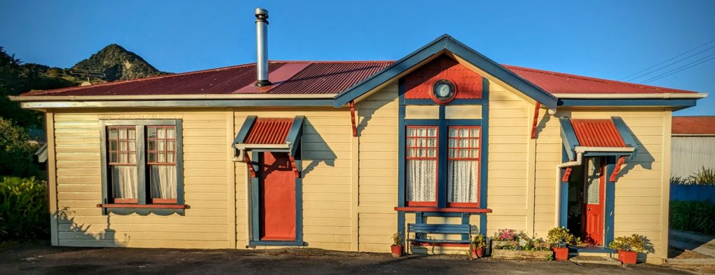
November 15, 2023 Day of Rest (Day 49)
Today we enjoyed a slow, sunny, beautiful day here at Bay View Bach in Maketu. A ‘Bach’ is a traditional Kiwi Holiday home, usually a simple cabin at the beach or in the mountains where families gather for school holidays. Here’s a short history of the iconic Kiwi Bach. Of course in the age of AirBnB and VRBO you can find grander designs than a simple cabin! We are very comfortable, with all we need at our bach!

The living room and deck of the Bach, with the fabulous view!
We are located in the small town of Maketu, and have finally learned the proper pronunciation (I hope) as ‘mac-eh-two’. Also, we have been schooled in the pronunciation of the nearby larger town (and Kiwifruit capital of the world) Te Puke as ‘te-pock-eh’.
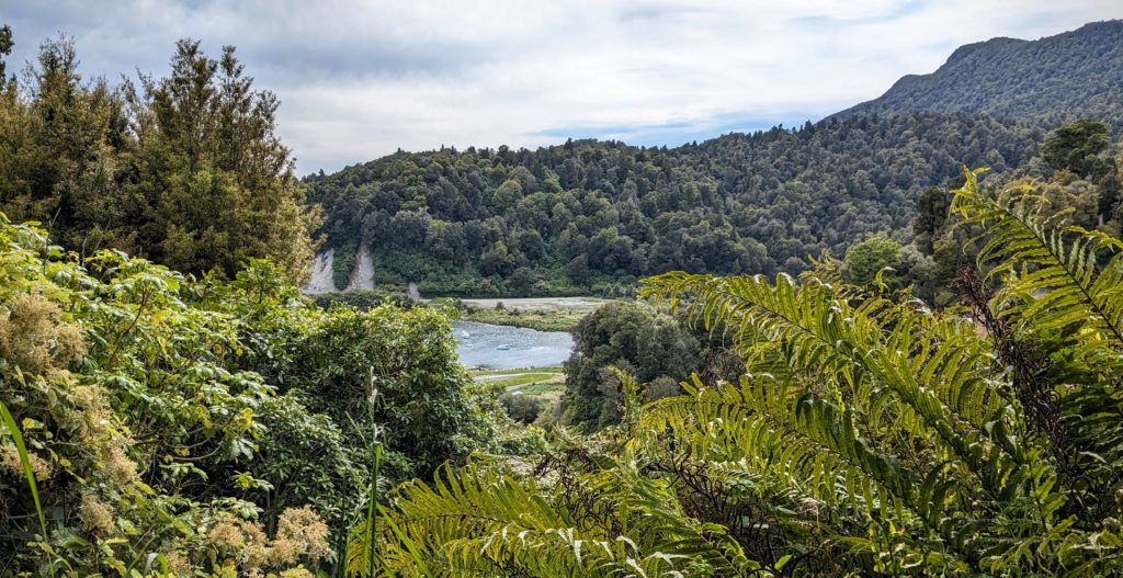
November 14, 2023 Water & Forest (Day 48)
We started out after a hearty breakfast into a chilly very windy day. The sun would break out of the clouds briefly, but it felt like rain was threatening. We were taking highway 38, most of which is gravel, through the heart of Te Urewera (literally “the burnt penis”, why? I couldn’t find out, this is as far as I got! Another reason to come back!).
Our first view of Lake Waikaremoana, “sea of rippling waters”, at the south end of Te Urewera. It was so windy there were whitecaps on the lake!
We stopped at the visitor center at Aniwaniwa, but it was closed and has been since this sign from February 12!

Highlights are mine. Translations: Papatuanuku=’The Earth Mother’; manuhiri=’visitor, guest’; kaimahi=’worker, staff, employee.
Luckily the store/office of the Lake Waikaremoana Holiday Park was open and we could get our hot coffee & tea! At the suggestion of the gentleman behind the counter we should take the road to the right before we cross the bridge to see a great waterfall and swimming hole. So of course we did! After driving down a smaller gravel road to the end we parked and walked the trail to emerge to this!

Papakorito Falls!
Returning to the main road we crossed it and parked at another parking area to follow a trail towards the sound of a waterfall. After walking up and around a forested hill we descended to the next waterfall.

Aniwaniwa Falls, I learned later!
We clambered down a steep slope to the base.

If you look closely you can spot a black swan in the lower right, calmly swimming around. We tried not to disturb it.

Robert is the happiest Birthday Boy! Nature is delivering great presents!

Hiking back up on what turned out to be a loop trail back to the car, we encountered a third waterfall with a tranquil swimming hole. Too bad it was too cold to swim!
All the signage for the falls was apparently destroyed in the cyclone because tho we saw posts, there were no signs. We left the falls area and continued on the winding and narrow road, ascending along a ledge above Lake Waikaremoana and descending through lush forest, opening to valley meadows in the interior at small towns.

The views of the lake were fantastic. The lush native forest grows right to the edge!
Robert had to keep his eyes on the road!

Glad we didn’t meet anyone coming the other way!

Signs we are approaching a town!

A Marae being repaired/restored.
We reached the town of Ruatahuna – The Heart of Te Urewera. There was a health fair going on, we didn’t stop, except for the traffic on the road!

“Wandering Stock” as the signs said!
“I’m ready for my closeup!”
We stopped at a picturesque park just out of town hoping to have some lunch, but it was too windy!

We stretched our legs a bit, then continued on to another less picture worthy spot, but less windy too!
We could tell when we left Te Urewera because the forest changed from lush diversity to monoculture pine trees (can’t really call it a forest), planted in rows.

Looking back at the lush forests of Te Urewera on our way back home.
What we took away from our 3 day adventure is the peace and beauty of the area and the generosity and resiliency of the people who call it home. What disturbed us was the difference between the lush forests of the interior and the barren, blistered, overgrazed looking pastures around Gisborne and towards Wairoa. The areas where the cattle and sheep graze had gashes of tan earth where sections of the hillsides seem to be sliding down. I don’t know if it was the impact of Cyclone Gabrielle, or 150 years of forest elimination and intensive agriculture or a combination of both that create that circumstance. I can’t claim I’m not partly responsible, I do like a glass of chardonnay with my lamb chop!
November 13, 2023 From Sea to Mountains (Day 47)
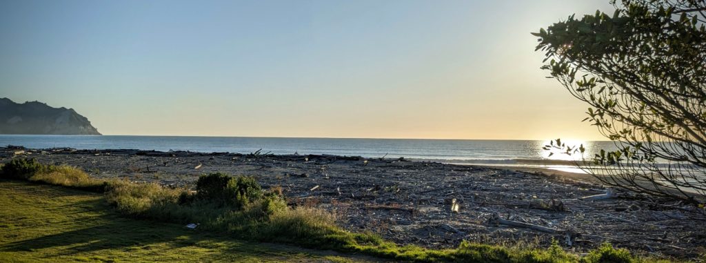
Sunrise on Tokomaru Bay.
We started out our day with a great breakfast and lattes delivered to us by our host! Made with fresh milk from the cows he milked this morning! We shared a great conversation sitting outside in the sunshine, then we packed up and continued down the east coast. The mid February cyclone Gabrielle severely impacted the whole east coast and cut the access between Tokomaru Bay and the town of Tolaga Bay, where we were heading, when forestry slash crashed into this bridge!
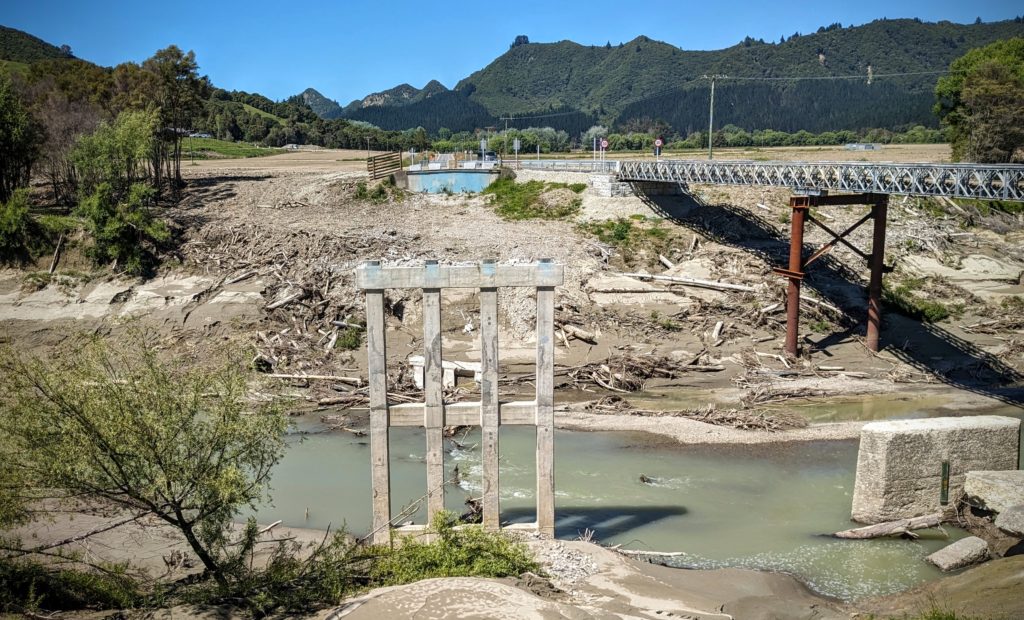
The bridge that was wiped out in the storm in Feb. with the temporary bridge to the right. It was a little scary on the bridge as it creaked and clacked as we drove over!
We reached Tolaga Bay and looked for the Tolaga Bay Wharf that it is famous for.
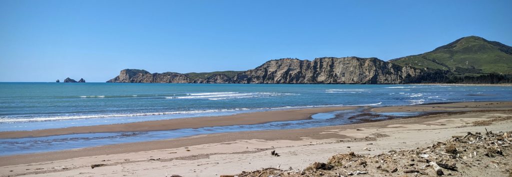
It’s a beautiful bay and a site of one of the first landings in 1769 by Captain Cook in New Zealand.
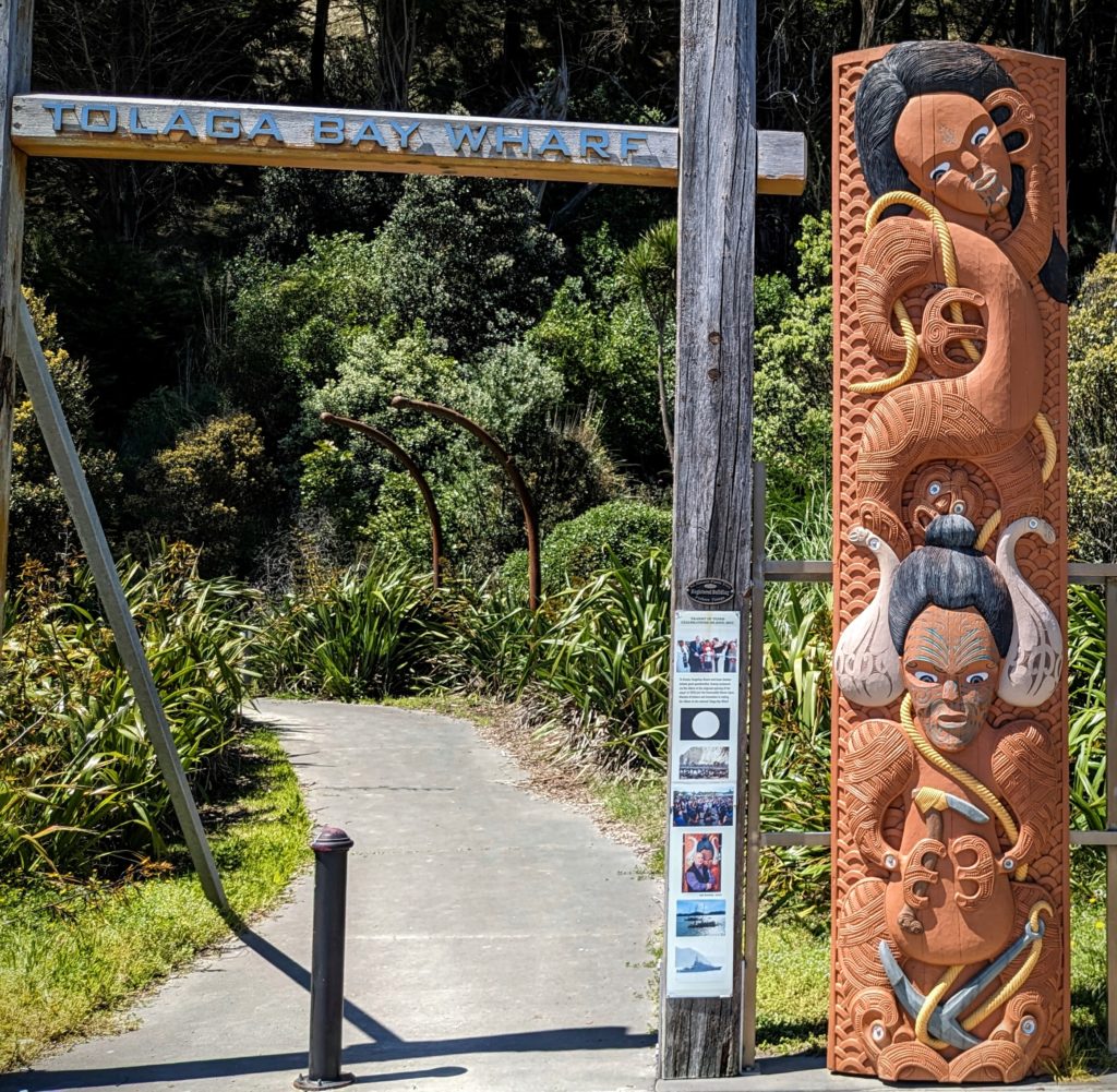
We found the wharf and the beautiful carved entrance way. Unfortunately the storm Gabrielle caused damage and the wharf is no longer safe to walk out on.
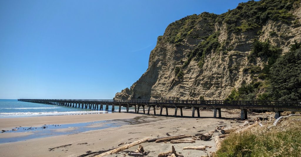
From the beach you can see the length of the wharf. It was a popular place to fish from.
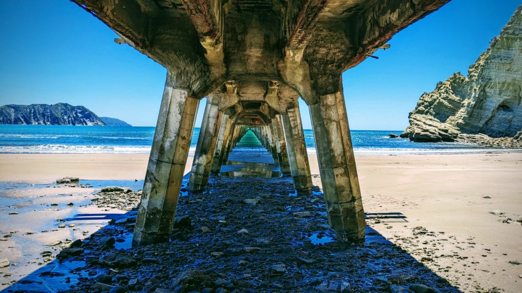
Walking the beach to get underneath the wharf you can see the damage, and the beautiful green sea water!
Since we couldn’t walk the wharf we continued on our way, looking for a site to have our lunch. We brought along our gas grill to grill some venison sausage we picked up in Tokomaru Bay!
We found a free campsite on Opoutama Beach on the way to the small Mahia peninsula with a picnic table and a great view.
After our lunch we continued through Gisborne, the largest town in the region, and one steeped in history, both Maori and Pakeha. We will have to return some day to learn all that history, we still had 2 hours to our destination! At Wairoa we started heading inland towards Te Urewera, the largest most pristine rainforest on the North Island. “In 2014, a world-first law brought an end to government ownership of Te Urewera National Park and recognised the rainforest as its own legal entity and the Tūhoe people as its legal guardians. It also gave the forest the same legal rights as a person.” We will explore tomorrow. For tonight we will relax at our AirBnB overlooking the forest and a small lake, surrounded by an orchard.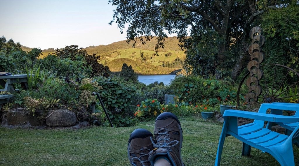
November 12, 2023 Road Trip Part 2
- After lunch at the little park in Waihau Bay we continued along the coast then inland a little bit until we saw a sign for Lottin Point. Well, a point must mean a view, so of course we turned off onto the single lane road past bucolic pastures with sheep and cattle, down around curves onto a gravel road.

What a view! Is that Lottin Point? We never found out!
At a fork in the road there is a sign “toilets” to the right, motel to the left. We started towards the toilets but decided the gravel road was a little too much for the rental car and turned back towards the motel.
-

From the top of the hill before descending down the driveway.
The motel seemed so out of the way we needed to learn more about it. We drove into the driveway, parked and walked to the reception door which was locked. Just then a man who was painting a part of the building called out ‘Can I help you?’. It turned out to be the owner of the Lottin Point Motel and we had a great conversation with him, culminating in him offering to take us to the beach down the sketchy gravel road in his truck. When we returned up the hill he offered us beers, of course we couldn’t refuse, and we spent more time talking at a table on the patio, looking out at the fabulous view. He eventually admitted that painting was done for the day! He introduced us to the Japanese philosophy of Ikigai-‘a reason for being’, a concept referring to something that gives a person a sense of purpose, a reason for living. A wonderful hour we spent at the motel with the proprietor!
The view from the lawn, by the picnic table.

The little things in life that give us pleasure!
- We reluctantly left the sunny patio and continued to Te Araroa to find the largest Pohutukawa tree in the world! We were not disappointed!

In a field on the grounds of a school near a beach is this impressive tree!
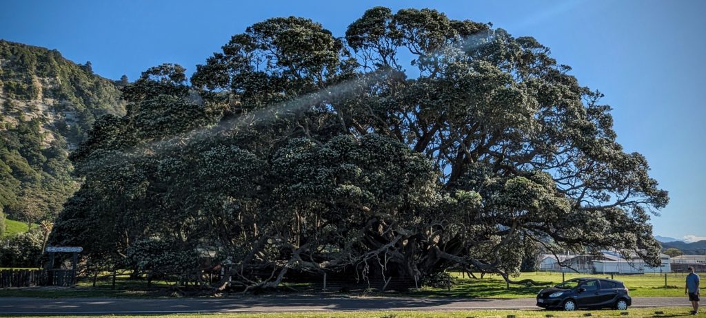
You have to back way up to get it all in! Imagine when all the white buds open into crimson flowers for Christmas!
We still had over an hours drive to our night’s destination so we hurried along towards Tokomaru Bay. We arrived with a few hours of daylight still to go. Our accommodation was the old Post Office building, built in 1906.
It has been restored and serves as a Bed and Breakfast. A wonderful, quiet, comfortable place.
We took a short walk to the beach past interesting older buildings that should be restored!
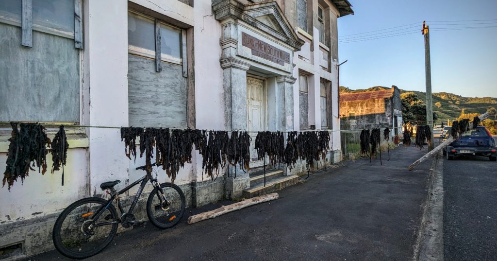
The old New South Wales Bank building. Someone is drying seaweed in front of the building!
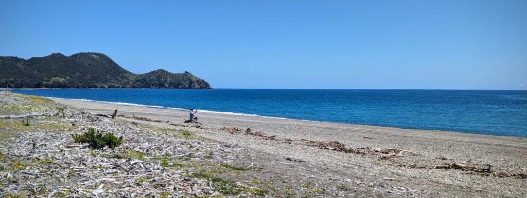
The beach is beautiful, but like many beaches in the region it has been badly impacted by the cyclone Gabrielle that hit the region in February 2023, 9 months ago! In fact Tokomaru Bay was cut off from the rest of the country for 6 weeks because the storm caused so much forestry slash to sweep down from the mountains from the rain that it destroyed a bridge linking the area to Gisborne, the largest city.
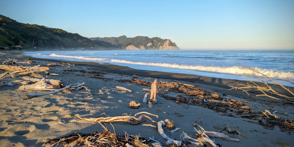
The beach was calm in the evening light, but it was littered with driftwood.
We returned to the B&B and had a wonderful grilled lamb burger dinner and retired for the night after sitting out on the bench in front looking at the stars which were bright and numerous!

Good night!
November 12, 2023 Road Trip Part 1 (Day 46)
We started out early (for us) at 7:30ish for a long day of driving along part of the East Cape of the North Island. Our first stop was in Whakatane (pronounced fah-kah-tah-neh) for some bacon and egg pies and coffees. As we drove out of town we noticed a lot of walkers and runners on the road with numbers on their shirts. We took a side road up to a viewpoint (we try to stop at every one we see!) and asked a volunteer what was the function. It is an annual fundraising challenging walk/run called Toi’s Challenge, an 18km (11 mile) route that takes the runners up over the viewpoint and back into town. We were happy to drive up!
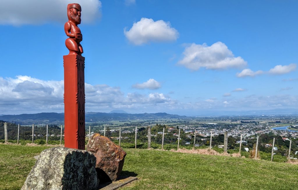
I think the statue is of Toi, an early chief of the Maori in the Whakatane area about 800 years ago. It is positioned on the site of a prominent Pa (fortified village) overlooking modern Whakatane.
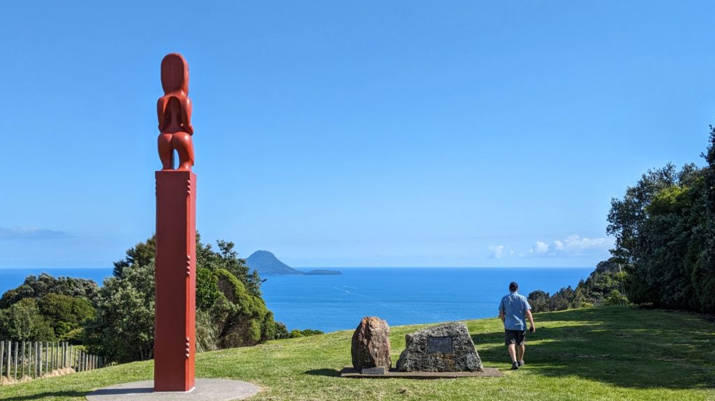
The statue looks out to sea, somewhere out there is White Island where 21 people died (some after being in hospital) after an eruption in December 2019.
We continued along the coast past Opotiki where Highway 2 cuts across the cape to Gisborne. After that there are virtually no roads into the interior! About a 40 minute drive further we crossed the Motu river. It looks almost like the braided rivers that flow out of glaciated valleys, but there are no glaciers here! I think that storms just scour out the steep valleys in torrents once in awhile!

The mountains start to get more rugged and steep, with less obvious human impact!
Somewhere up in the interior mountains is Mount Hikurangi, a sacred place to the local Maori. It is the highest non-volcanic mountain on the north island and purportedly “the first land in the world to catch the rays of the new day’s sun”, open to interpretation!…According to Wikipedia. Further past the Motu river we came to a wide open stretch of beach and a lonely old building.
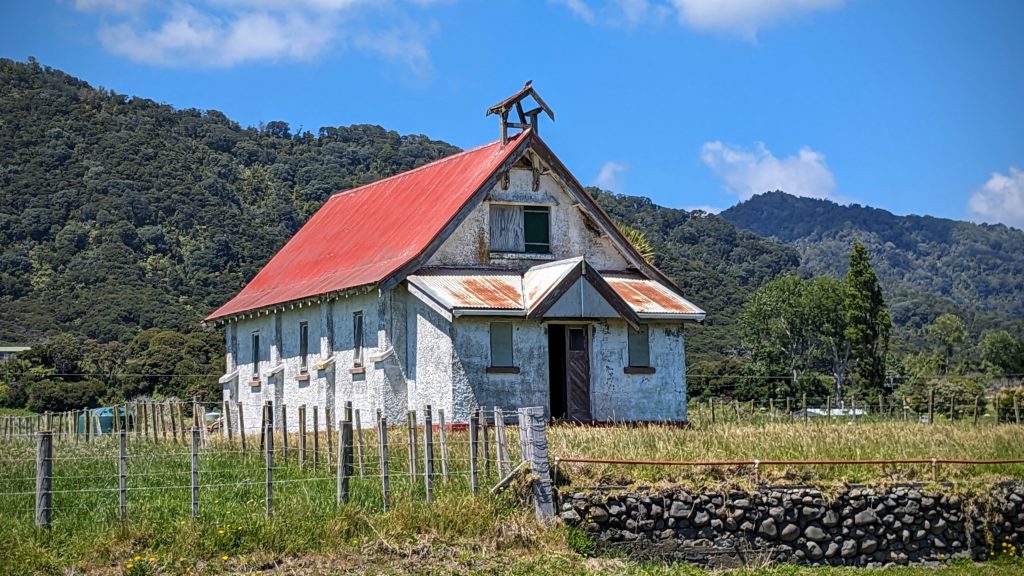
I thought church at first, but maybe a schoolhouse?
Just down the road is a much newer complex of buildings, the Otuwhare Marae at Omaio. A marae (pronounced mar-i) is explained here.
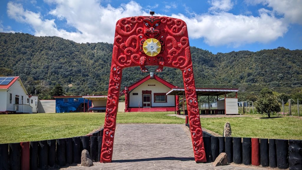
This Marae is prominent in that it’s right along the road and has this intricately carved gateway.
Both the old schoolhouse and newer Marae face out to the expansive sea on Omaio Bay.
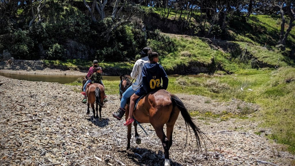
We stopped at a shady spot to have some lunch and saw these locals enjoying a Sunday ride along the ocean. It was too windy for lunch so we moved on.

We reached Waihau Bay just in time for our next coffees!
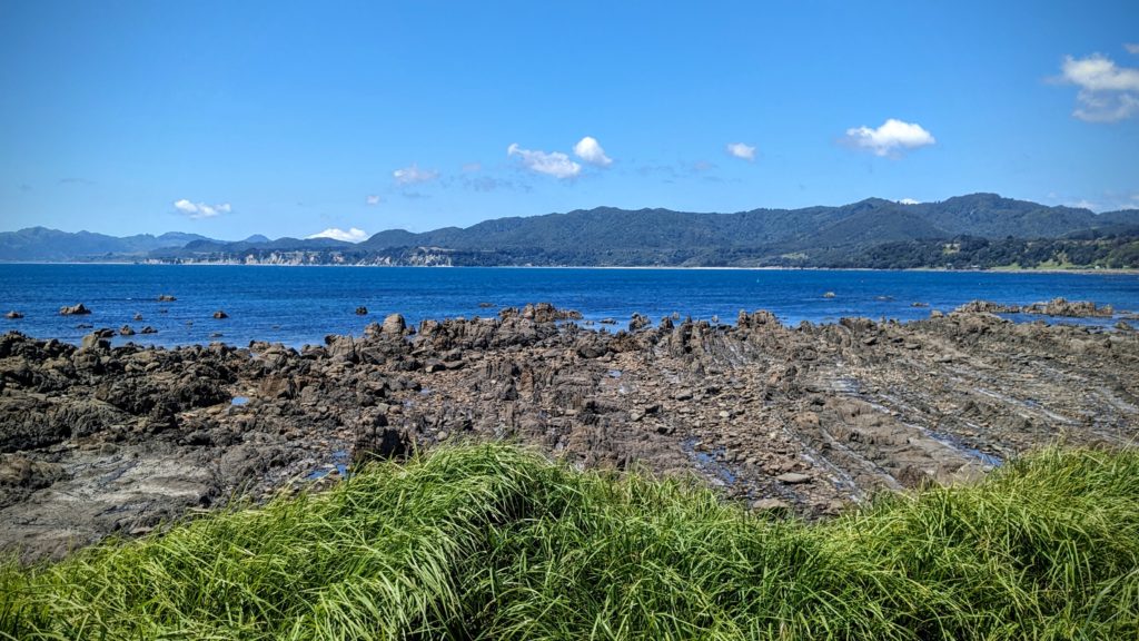
The landscape was a little different here with interesting vertical rock formations going out into the bay. Volcanic maybe?
We enjoyed our lunch at a small park next to the Waihau Bay Lodge watching 2 snorkelers in the bay and a fishing boat driving up onto a trailer and being hauled ashore by a tractor!
