October 12, 2023 Cruisin’ BOI (Day 15)
We got up early to make the 8:45am cruise. We got cappuccinos in town and got aboard in time. It’s ‘shoulder season’ so the boat was half full, about 25 people. A comfortable number, no crowding!
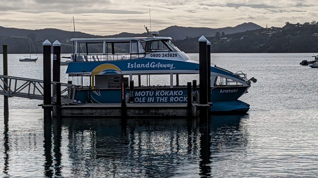
Our boat, with a wonderful crew of 3, the captain and two guides.
We started across the bay towards Russell, but didn’t stop there. Our first stop was on the small island of Motuarohia not too far away. It is known for being the first landfall in Bay of Islands for Captain Cook in 1769!

The blue dot is our boat, at about the spot where Captain Cook made landfall. We disembarked at the spot where the tree symbol is.
A quick hike up a trail and stairway took us to an observation deck with 360 degree views! The sun came out and we enjoyed the expansive views.

You can see our boat in the bay on the right!
Looking further to the right, we could see back into the interior of the Bay of Islands, named so by Captain Cook when he had the same view in 1769!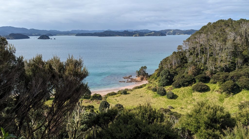 After about 40 minutes we reboarded and cruised past several other islands of interest, then headed through a passage between two of them, out to the open ocean!
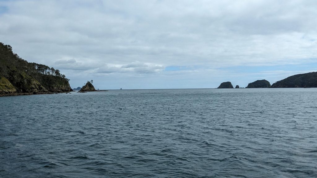
The captain pointed out the distant rock shaped like a fin. The motor was so loud, and with the wind rushing by, I don’t know what he said about it except that it’s shaped like a shark fin!
We passed by several remote rocks looking for seals, we spotted a few, but never did see any dolphins riding the wake of the boat. Our next stop was to view the Cape Brett lighthouse and Keepers House. They can be reached by boat, helicopter or a long, arduous hike to the tip of Cape Brett! Even by boat, you would still have a 2 hour hike up the hill to the lighthouse!
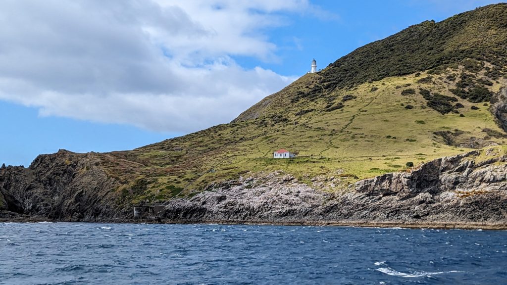
In the lower left you can see the pier where the supply boats would offload the lighthouse supplies. Donkeys were used to haul everything up the hill. The donkeys eventually got wise and ran off when they saw the boats arriving!
Finally we arrived at Hole in the Rock (Motu Kokako in Maori language). 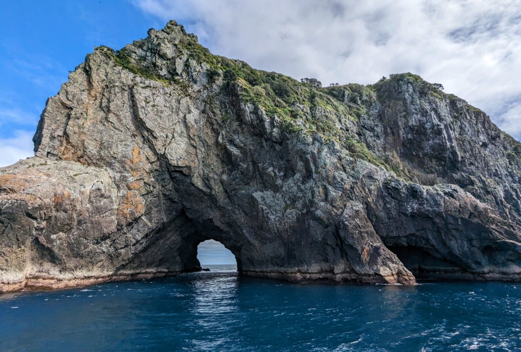
The guides gave us information about the Maori traditions and mythology of the rock, including the maiden looking out to sea, protecting all sailors! 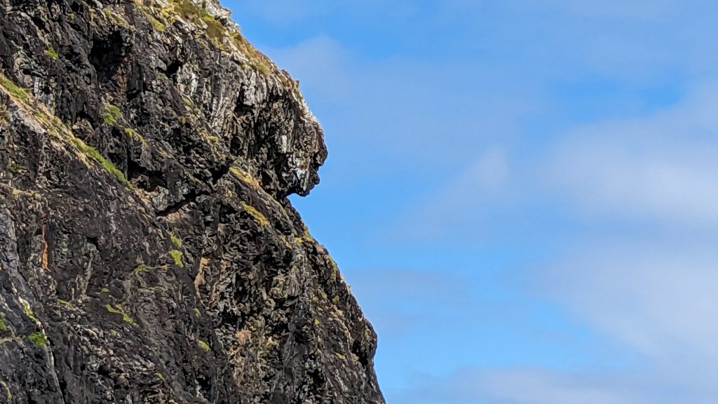 The sea was calm on one side, and rough on the other! We were able to motor through hole in the rock. It was surprisingly calm water through the passage, but the wind picked up when we emerged and it was a bumpy ride back into the Bay of Islands! Our last stop was in Otehei Bay on Orupukapuka island for lunch at the cafe (or bring your own, as we did).

The teal blue waters of Otehei bay looked appealing for swimming, but it’s still a little too cold!
The island is the largest in the Bay of Islands and Otehei Bay was Zane Grey’s fishing camp in the 1920’s and became a world famous resort as a consequence. Since 1979 the entire island is a Recreation Reserve managed by the Department of Conservation for recreation and conservation of native species. We had a relaxing lunch outside in the sunshine, and then enjoyed a glass of wine out of the wind in the cafe!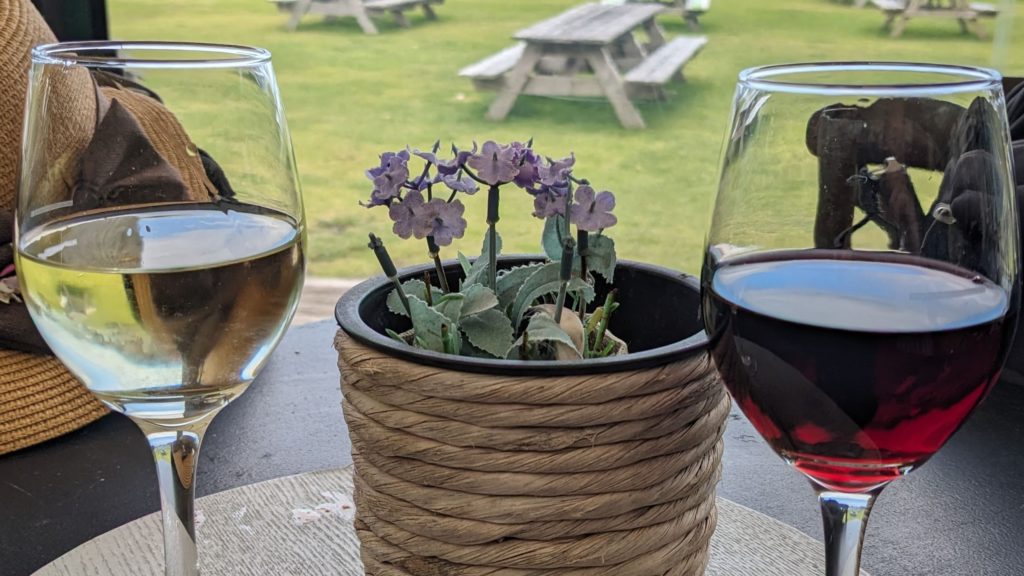 We returned from our cruise in the early afternoon and had time to relax, then grill the lamb steaks we bought yesterday!

Yummy!
October 11, 2023 Paihia (Day 14)

Another beautiful sunrise! With the bay at high tide.
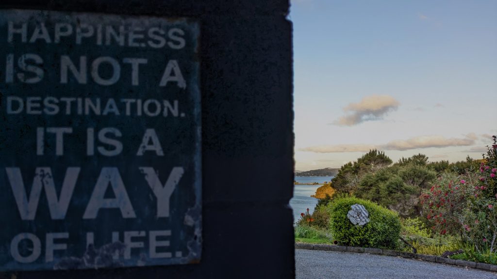
And a wonderful sentiment for life!
We stayed in town today, town being Paihia. Our Airbnb is in Haruru, a 7 minute, 4.7km drive away. We wandered around the little tourist section, checking out the amenities. We passed by one of the cruise ticket offices and got a deal on a cruise for tomorrow to visit some islands and head out to the tip of Cape Brett to see the Hole in the Rock. We found a great store/bar/restaurant tucked into a little shopping mall in the center of town.
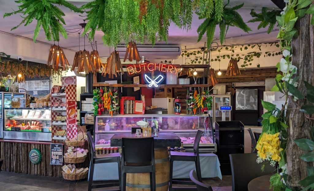
The butchery had fresh lamb! We got a few steaks to grill tomorrow.
For tonight though, we grilled fish that our hostess offered us. Her Dad is a renowned fisherman in the area and she was cleaning out her freezer, lucky us! I didn’t recognize the name of the fish, they use a lot of Maori names for things here, but she said it is a deep sea fish, and it was delicious with a little lemon pepper and olive oil!

October 10, 2023 Karikari Peninsula (Day 13)
Our goal today was to explore the Karikari Peninsula, particularly Maitai Bay, 116 km or 1 hour 35 min. away. On the recommendation of our hostess we took a detour on the way, on a loop to Matauri Bay. We were amazed at the views and the beaches we saw from the bluffs!

Our first view of Matauri Bay!
We figured out how to get down to the beach and also discovered that there is a Memorial to the Rainbow Warrior on the hill at the end of the beach. The Rainbow Warrior was the flagship of Greenpeace that was bombed and sunk by the French government in July, 1985 in a terror attack. Among their other protests against whaling, Greenpeace had the audacity to protest against nuclear testing being carried out in the south pacific by the French government! The ship was in Auckland harbour when it was bombed, the New Zealand government carried out an intensive investigation that revealed the perpetrators as French intelligence and military members. The ship was refloated for investigative reasons and was then scuttled just off this peninsula to act as a reef and a diving site.

The memorial to the Rainbow Warrior. It was windy at the top of the hill!

The hike up and back down the hill gave us views of this peaceful, beautiful bay!
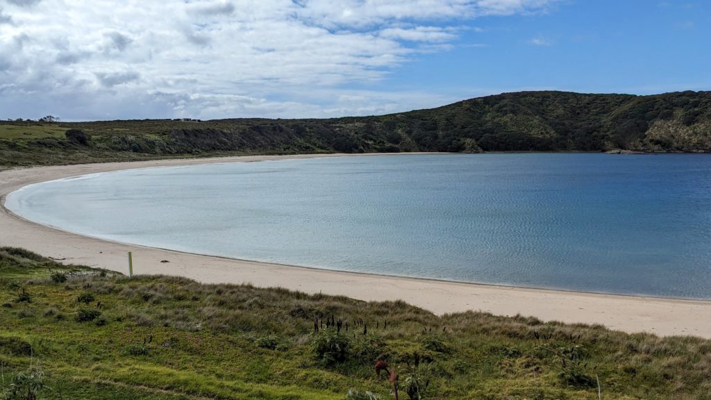
We continued on our way to the Karikari Peninsula which we discovered was much flatter and agricultural than we expected. We finally reached Maitai Bay on a gravel road, and it is magnificent!

The right side of the bay is rocky, with huge trees overlooking the water.
The left side stretches in an arc of soft sand that we walked in the breeze.

At the end of the beach we found a swing hanging from the huge branches of a tree. Of course we had a fun time swinging!
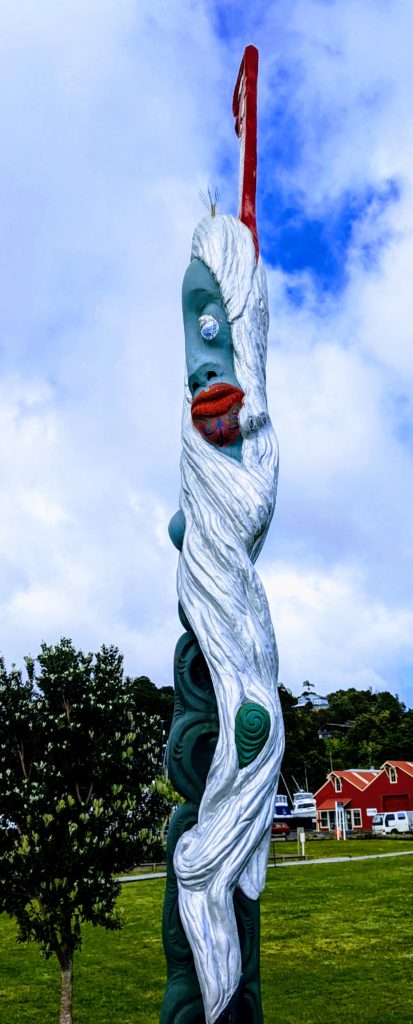
At the top of a hill between two bays we saw some carved, colorfully painted posts. We hiked up to see what they were.

They seem to represent a woman and a man. There were no explanatory signs and they were facing inland rather than out to sea. Notice what looks like tattoos on their faces.
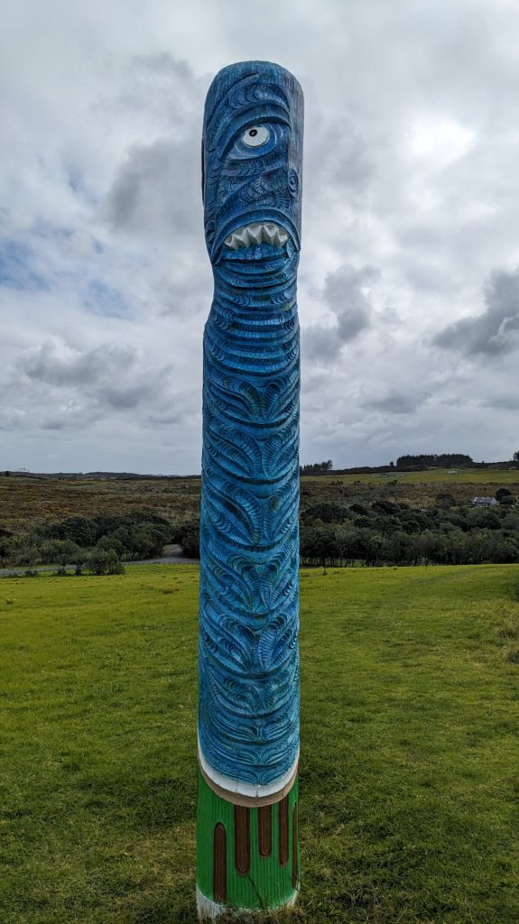
The backsides of the posts, looking out to sea, seemed to be scary sea monsters!
A little research explains that the posts are “Pou whenua“, a land post used by Maori to mark boundaries or places of significance, similar to totem poles in that they tell a story. These particular posts, “Traditionally carved Pou whenua, erected on the Pa site as symbolic protectors. They were placed here to mark the start of the Rahui which is still in place to allow the sea life to recover (Rahui currently ends Mar 2025)” (from https://lifeontheroadnz.com/rangiputa-maitai-bay-jewels-of-the-far-north/)
Then I had to look up ‘Rahui’; a form of tapu restricting access to, or use of, an area or resource by the kaitiakitanga of the area. Wikipedia
Then ‘tapu’; basically a taboo.
Then ‘kaitiakitanga’; Kaitiaki is a New Zealand Māori term used for the concept of guardianship, for the sky, the sea, and the land. A kaitiaki is a guardian, and the process and practices of protecting and looking after the environment are referred to as kaitiakitanga. Wikipedia
Whew! Long post!
October 9, 2023 Kauri Walk (Day 12)
We headed out to the forest today for a walk among the trees. The kauri tree is important in Maori mythology and we went to find some. We discovered that it’s not as easy we thought!

The entrance to the walkway to view kauri trees is very regulated! A disease is impacting the remnants of the kauri forest. We were instructed to brush and sanitize our shoes before entering the area!
We reached the observation deck to view the huge main tree after a short walk past tree-ferns and other large trees.

This is the mid-trunk, the whole tree wouldn’t fit in the camera frame!
We continued on another trail that called itself a ridge trail, but was constant up and down ridges, steep ridges! We gave up after about a half hour of thigh burning hikes up and down! Some unique sights were had though!

New Zealand is beset with introduced species that wreak havoc on native birds and plants!

I don’t know what would have caused this growth pattern except human intervention!

I called this a “weeping evergreen”, I have no idea what it is really labeled.
We drove the scenic route over the range into farmland and around back towards Opua and decided to try to finish the section of Coastal Walkway we got rained out of yesterday. We started down the walkway towards English Bay, got past the trailhead to the lookout, but then got distracted by a smaller trail heading up a creek to who knows where, so of course we went that way! We entered an enchanted forest! Filled with what looked like house plants gone wild! Huge ferns, trees, vines, a creek running through, a trail going up, down, around. Then small plaques with the names of the trees and plants, names like Rimu (red pine), Kiekie (“a scrambling climber related to pandanus”), Puriri (“of the verbena family, related to East Indian teak). None of which I recognized or could even tell which plants the plaques were referring to!

I think this is a Rimu, but I don’t know for sure!
One large root was labeled as belonging to a tree up on a ridge, the root traveled all the way down the creek to the bottom of the valley! We finally emerged up on a bluff above English Bay, we walked down along roads to English Bay and backtracked along the Coastal Walkway. We discovered that we had taken the trail through the Harrison Scenic Reserve, a trail set up by the local community as a trapline to trap invasive species to give the local birds, especially the kiwi, a chance to recover.
October 8, 2023 Coastal Walk (Day 11)
A beautiful sunrise greeted us, with mist from last nights rain hanging over the bay.
Today we ventured out despite predictions of rain to explore close to ‘home’. We drove the 10 km to Opua and found the much bigger harbour full of cabin cruisers and sailboats. 
We enjoyed cappuccinos as we walked around admiring the boats and the eclectic art scattered around the harbour.
More “Picasso-esque” art.
We also discovered the car ferry that will transport you and your car the short distance to the peninsula where Russell is located, a much shorter route than driving there, and the Coastal Walkway that connects Opua with Piahia in several sections.

The beginning (or ending) of the Coastal Walkway, the boardwalk along the edge of the bay in Opua.
We walked to English Bay and decided we would walk back, get the car, drive to the parking area at English Bay and walk the next section of the walkway. When we got there with the car, there were no parking spaces left, so we drove on to the next section parking area to walk back to English Bay. We started across a wooden walkway and bridge through a mangrove forest then headed up, up, up the trail, of course going further up to a lookout!

Up, up, up! My legs were burning!
The view was great, but a little hazy with the cloudy skies and moisture in the air.
On the way down from the lookout we were caught in the rain that finally arrived, and we never got to English Bay! But for a ‘rainy’ day we did a lot of sightseeing and walking!
