December 30, 2023 Flora & Mt. Arthur (Day 94)
A beautiful day weatherwise is predicted today. We’re going to explore close to home, at the edge of Kahurangi National Park, the 2nd largest New Zealand National Park! A 30 minute drive on country roads, then a gravel road up into the mountains got us to the Flora carpark and the trailhead for a loop track to 2 of the over 900 huts that comprise the best, most organized hiking shelter system in the world!
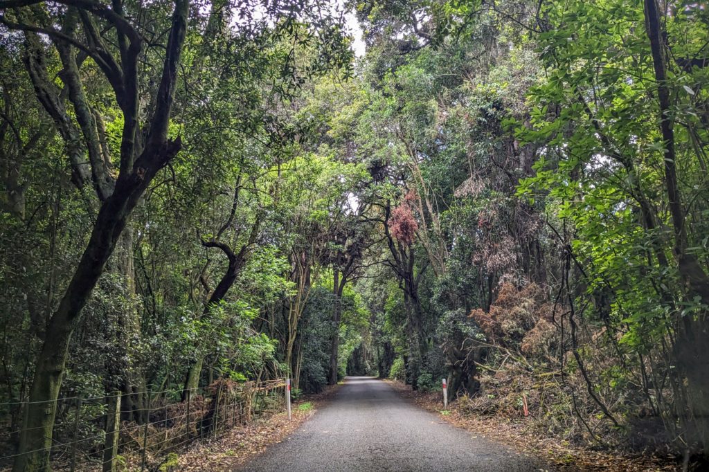
A country road from our B&B to the edge of the National Park.
We were glad we didn’t encounter any cars coming down the narrow gravel road as we drove uphill to the car park which was almost full! It is holiday season here and there were hikers of all ages returning and heading out! We got our daypacks organized and headed out on the track towards Flora hut which follows the Flora stream. It was an easy, wide gravel road through a beech forest, but it must be silver beech because there was no black sooty mould or hairy insect anal tubes on the tree trunks. There also was no scent, fragrant or otherwise, maybe because of the recent rain. We were heading downhill and encountered only one couple on the way up. We did encounter another couple, a bird couple down along the stream.

A pair of ducks were busy preening at the edge of the stream (bottom, middle of picture). They have light colored bills and dark plumage, are they the rare whio? The NZ blue duck?
We reached the Flora hut and found an information sign about the whio.

Yes, based on the habitat they are in and the light colored bills, they are probably one of the 5 pairs along the stream!
The hut itself is a well kept, well stocked with firewood, basic shelter. We met a couple having their lunch at the picnic table provided and had a conversation. They are locals and the man is traveling around measuring several huts that he then builds 1:20 scale models of! They showed us some photos on their phone of some of the models he has done, very realistic! He also explained that some of the huts were built to house hunters that were hired to cull the introduced deer species that were over-running the countryside, damaging crops and forest land, leading to erosion and decimation of native plants and animals. New Zealand Hut History-Hut2Hut explains the history and significance of the hut hiking system in Kiwi culture very well. The hut system was not officially organized under one entity until 1987 when several departments of the government were combined into the Department of Conservation.
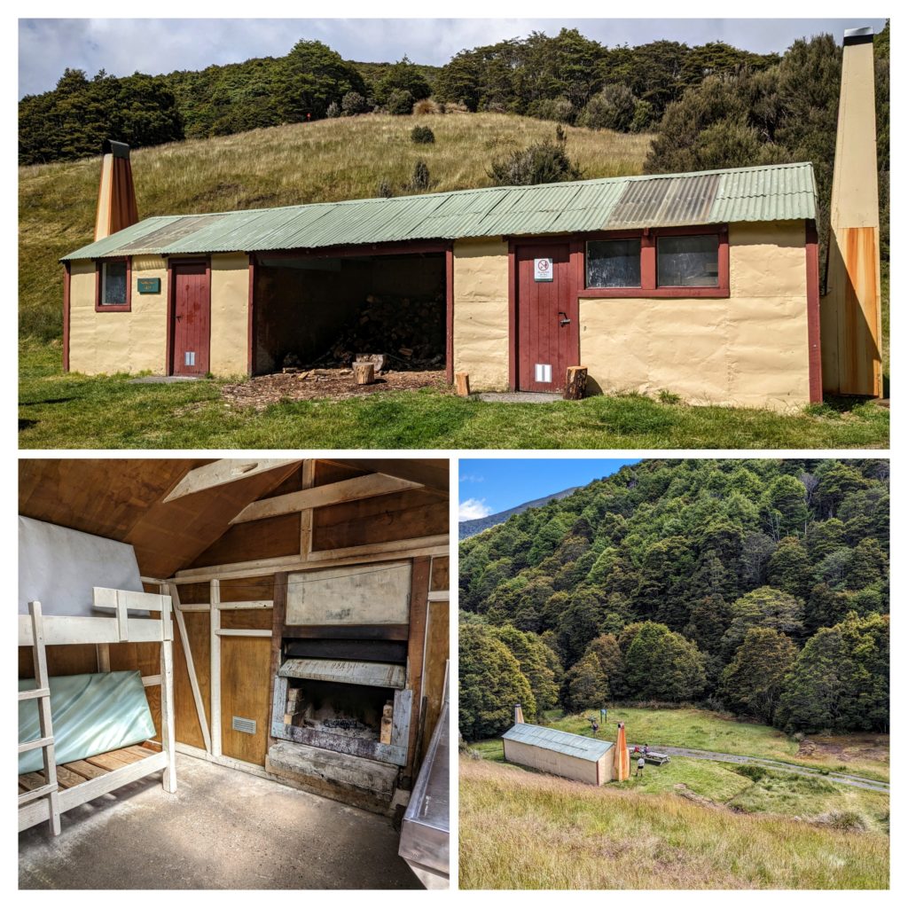
The Flora hut, outside, inside and from above as we continued our hike.
The trail to the Mt. Arthur hut went uphill from here, through the ‘old growth’ beech forest. This forest pretty much escaped the blow of the axe, saw and fire in the 1800-1900’s, mainly because the soil is unsuitable for agriculture, in other words, nobody could make money on exploiting the natural resources easily!

This old beech is well buttressed on the slope of the mountain.
As we reached what we thought would be the summit the vegetation changed from the beech forest to a more open tussock and stunted tree environment and this bird came down the trail to check me out!

This weka (in Maori, the English call it a woodhen) was curious about me, looking me up and down, then walking away to get a drink in a puddle and peck through the duff.
We now think that way back in October when we were in Russell and thought we saw kiwi at 9:30 in the morning, we actually saw weka, another flightless NZ bird species in the rail family, which have been reintroduced in the Russell area.
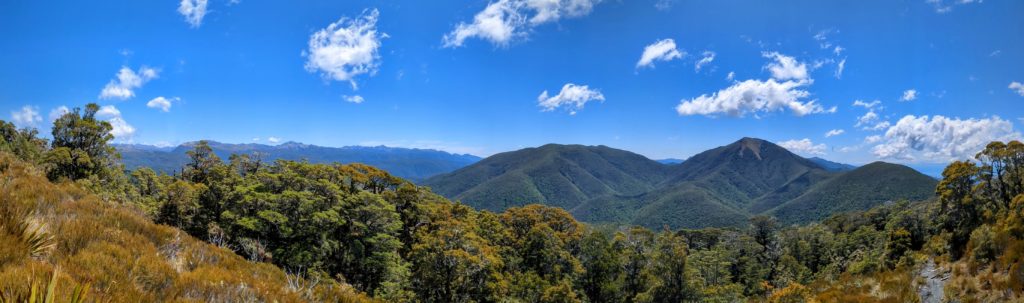
As we rounded a corner and emerged from the trees we got this fantastic view!
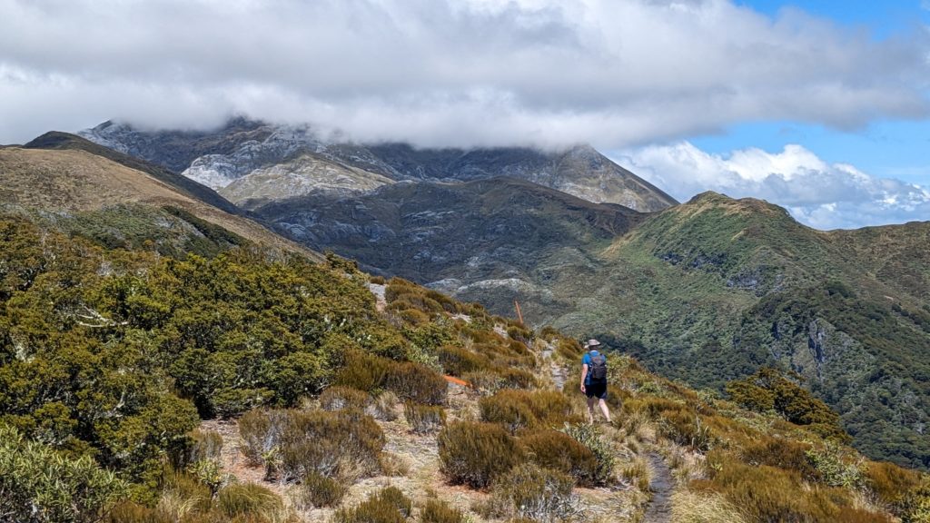
As we hiked around the ridge we glimpsed the true summit of Mt. Arthur, hidden in the cloud! A cold wind picked up, making us grateful for cooling the intensity of the sunshine!

We passed the trail leading up to the summit and headed to the Mt. Arthur hut, just a few hundred meters ahead. We also marveled that from up here we are looking out at Tasman Bay and the estuaries and farmland around Nelson!
The Mt. Arthur hut was crowded with hikers. Apparently the trail up to this hut from the carpark is a lot easier than the route we took past Flora hut! That’s okay, we were pretty much by ourselves out on the trail, here there were families from grandma to baby! We had an easier hike down the wide pathway and arrived at the carpark, even more full of cars than when we first arrived! We decided to head down the road to find a quieter place for our lunch.

And we found the perfect spot, at a ford on a tributary creek with clear, cold water to soak our tired feet and a scenic spot to put out our chairs and enjoy our lunch!
December 29, 2023 Nelson (Day 93)
After a night of rain and predictions of rain off and on today we decided to stay closer to home and not out on a trail! We drove into the town of Nelson, almost an hour away, but the biggest town nearby. We headed to the ‘old town’ area to see “New Zealand’s oldest fully preserved street”. South Street had it’s first building in 1861, twenty years after the official ‘founding’ of the settlement of Nelson by the New Zealand Company in 1841. By the 1970’s the street was considered a slum and plans were made for demolition of the small cottages that once housed immigrant laborers. Locals opposed the plans and a city council report described the street as “Unique in Nelson as a group of cottages which show the everyday style of accommodation of the period 1860-1900 as as such is an integral part of Nelson’s townscape today”. Revival and renewal of South Street commenced and the street is now a tourist attraction. It reminded me of Hannibal, Missouri where Mark Twain grew up, on a much smaller scale!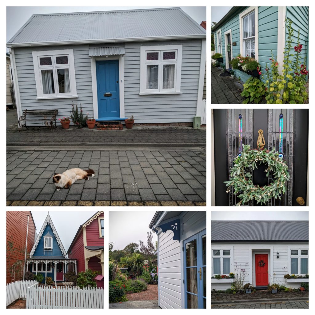 After strolling the short street we headed a few blocks to the downtown shopping area on Trafalgar Street. The street T’s into Church Hill where Christ Church Cathedral overlooks the downtown with an imposing tower. The gardens around the church are amazing!
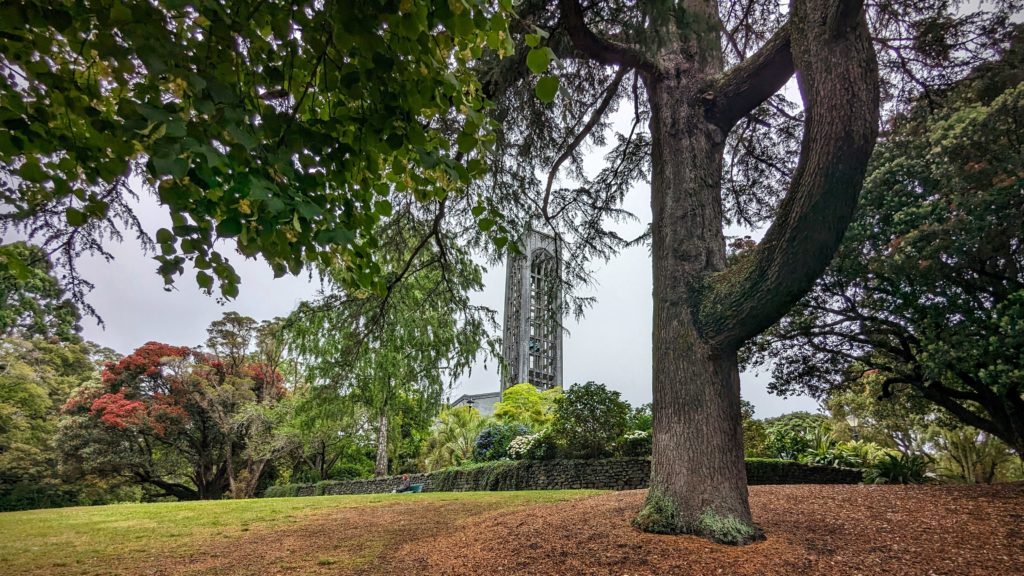
A huge pine competes with the bell tower!

A statue overlooks a planting of summer flowers while a blooming pohutukawa overlooks the statue!
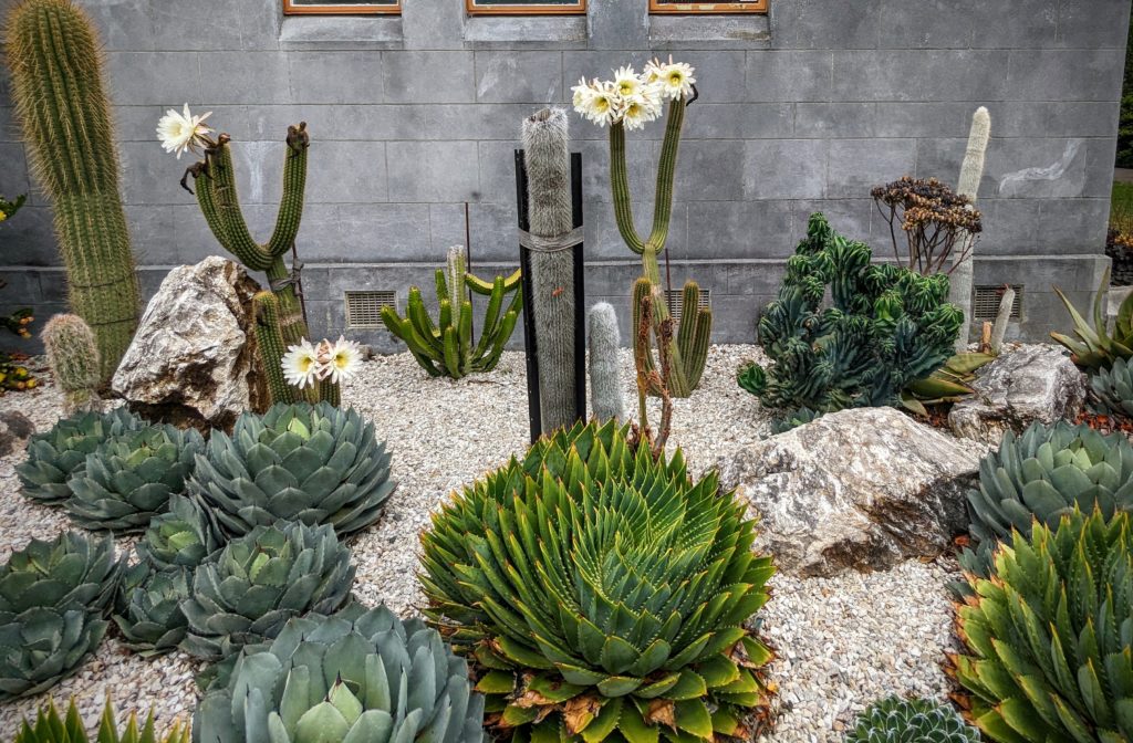
There’s even a planting of cactus against the wall of the bell tower, some blooming!
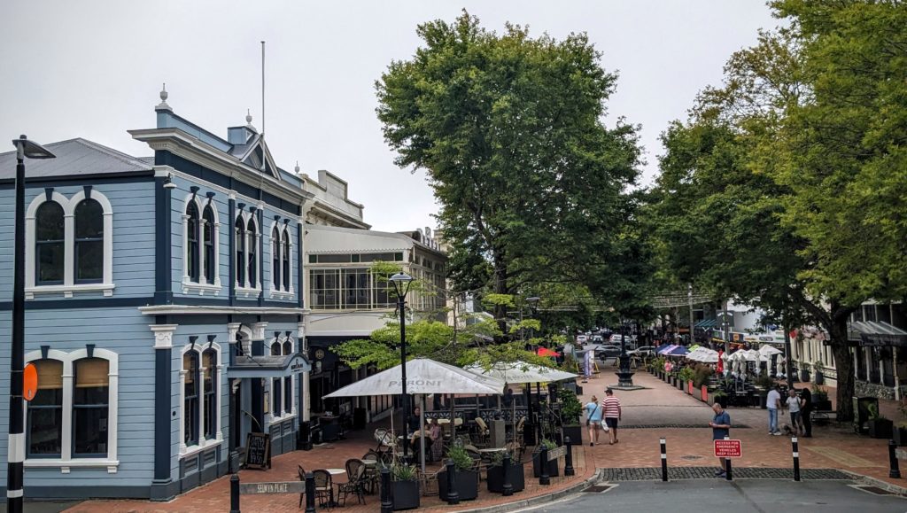
From the steps up to the Cathedral bell tower you can look at the downtown square.
After an hour strolling the Cathedral gardens and the shopping district we headed to Pic’s Peanut Butter World in the neighboring suburb of Stoke. Unfortunately they were closed for the day already. But we got to take pictures next to the giant peanut butter jar!
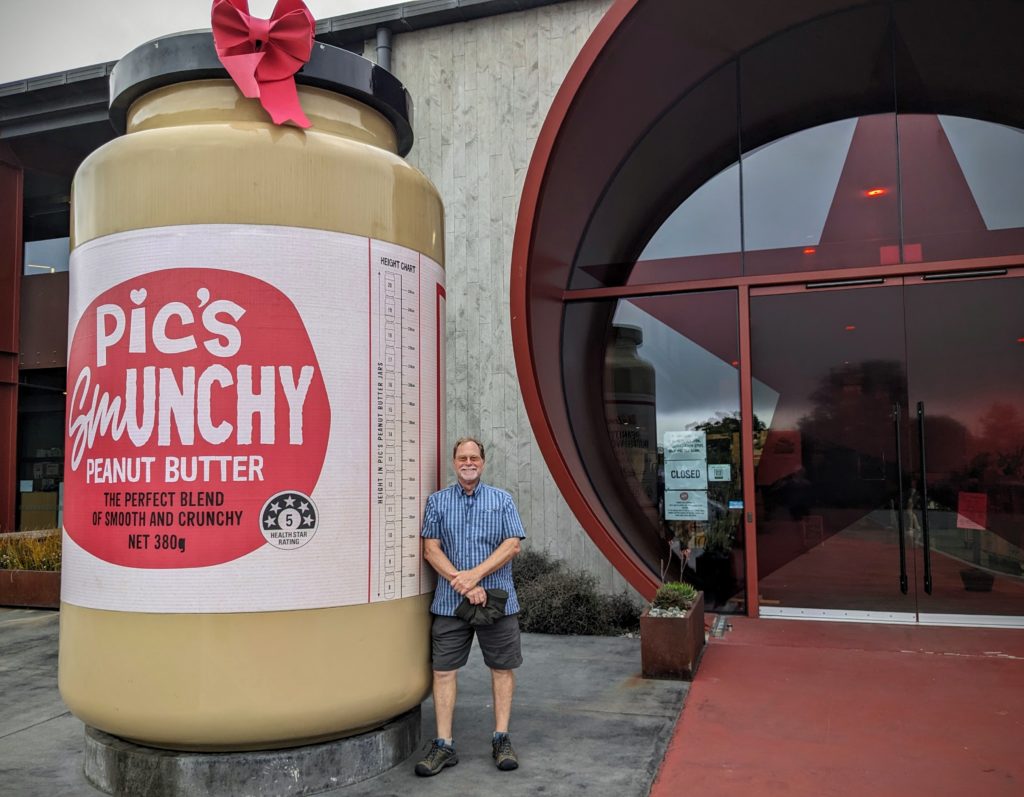
Smunchy!
December 28, 2023 Abel Tasman NP (Day 92)
We ventured north today to the smallest National Park in New Zealand, Abel Tasman N.P. Named for the Dutch explorer who anchored in Golden Bay, the northernmost area of the South Island on 16 December, 1642. Three hundred years later, to the day, 16 December, 1942, the Abel Tasman National Park was established! A two hour drive took us over Takaka hill and down into the Takaka river valley, through several small towns, to a trailhead to a waterfall.

Going up the Takaka hill grade, looking back at Tasman Bay where the port town of Nelson lies.
Don’t let the ‘hill’ of this grade fool you, Takaka Hill is a mountain pass from sea level to 2,595 ft. and back down to sea level! We stopped in the little town of Takaka for coffee and a pie, then continued to the coast of Golden Bay.

Our first stop, to eat our pie and drink coffee at Ligar Bay beach. The view is across the bay to Farewell Spit, a bird sanctuary from which the bar-tailed godwit migrates to and from Alaska every year. Over 18,000 miles, non-stop for 8 to 9 days without feeding!
As usual the bathroom here is well decorated, outside and inside!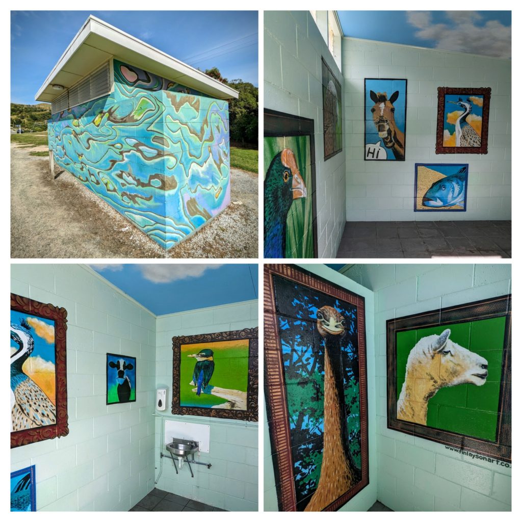 We continued up the road and stopped at the carpark for our hike to the waterfall, with a suspension bridge too!

The trail follows the Wainui river, crystal clear, flowing over huge boulders.

Our destination, Wainui Falls!
We returned via the same path and drove up to the end of the gravel road, at Wainui Bay carpark, to the end (or beginning) of the Abel Tasman Coast Track.

The beginning, with the colorful carving and the figurehead, or the end, plain, with hikers sitting on the benches after their 3 to 6 day trek!
Another 10km gravel road goes across the park to Totaranui Beach, one of the many golden sand beaches that Abel Tasman NP is known for. In fact, the Coast Track here is the most popular hiking trail in all of New Zealand! The most accessible, well serviced, less rugged, and goes to a lot of golden sand beaches!

From the gravel road, looking down onto Totaranui beach! The water looks inviting!
Being so popular of a National Park, with great walks, it was no surprise that the campground was full! We were amazed that everyone there had to come over the same gravel road, some with trailers full of camping gear, bikes, rafts, kayaks, etc.! No dogs or other pets allowed!

The beach is big enough to accommodate everyone!
We stopped in Takaka on our way home to stretch our legs and wander past the shopfronts. Our guide book describes Takaka as having “the highest concentration of yoga pants, dreadlocks and bare feet…”. The shops were selling lots of retro-hippie clothes and high end jewelry! We got some coffee to fuel our trip back over the slalom course of Takaka hill and made it home safely!
December 27, 2023 Different Island…(Day 91)
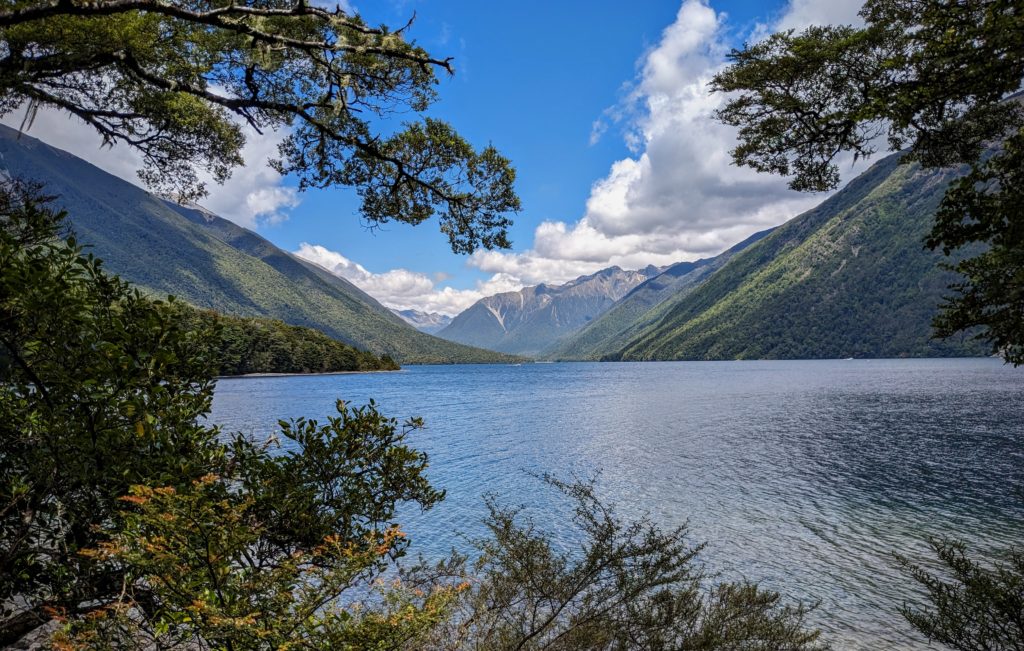
…Different Forest! We drove south today, through a valley bordered by rolling hills called Golden Downs. This is the fruit basket of New Zealand, lots of berry patches and farms. Also a hop growing region, hence an area of great craft breweries! Our destination was Nelson Lakes National Park, the northernmost portion of the Southern Alps, to the smaller of the 2 main glacially carved lakes, Lake Rotoiti (row-toe-ee-tee) meaning ‘small lake’. We reached the tiny town of St. Arnaud and took a quick walk around the visitors center before we headed down a short road and finally got to the lake edge!

We got vibes of British Columbia, Canada at the edge of the glacial lake!
The mountain peaks are above timberline and the forest is devoid of the iconic tree ferns that characterize the prehistoric-feeling forests of the North Island. The forest in this area that gets winter snows enough to host a ski area, are primarily beech trees. Beech forest tends to grow mainly on the drier, eastern side of the mountains, higher up, and in the cooler south.
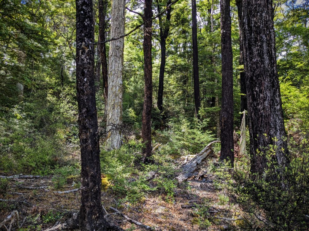
We started our hike on the lake circuit track through the beech forest.
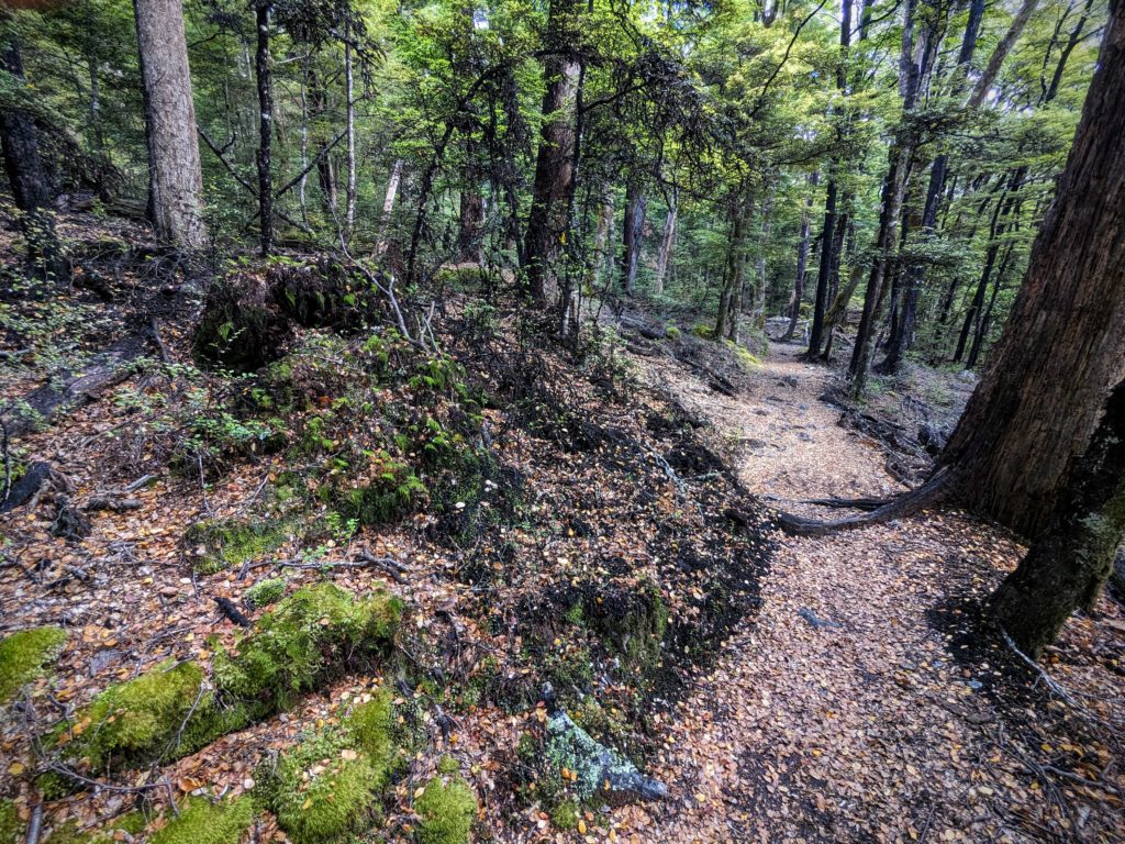
The track is lush, with lots of streams flowing across the trail carpeted with fallen leaves.
Some trees look burnt, covered with black mould that seems to flow down the trunks and over the ground. Many trees also look hairy, with small white hair-looking growths with tiny drops of moisture on the tips. We learned from information plaques (and a brief glance at information in the visitors center) that this is a unique ecosystem in the beech forests that many native animals are dependent on. A tiny insect burrows into the bark of particular species of beech trees to feed on the sap. It’s waste is excreted through long anal tubes that emerge from the tree bark, the tiny white ‘hairs’. The waste is a sweet honey-like fluid called honeydew that many native birds, bats, insects and even lizards feed on! The honeydew also feeds the black mould that flows down the tree and ground, creating habitat for other animals. The insect and the mould do not seem to harm the trees, however, an introduced wasp has become dominant in feeding on the honeydew and depriving the native animals of this necessary food source. The Rotoiti Nature Recovery Project is tackling the problem with a wasp control program. More information is HERE.

The ‘honeydew’ droplets on the tips of the anal tubes of the scale insect.
As we walked further up the track we got glimpses of the mountains surrounding the lake.
You can almost imagine mountain goats and grizzly bears on the mountain slopes, but you’re not in Canada! However, weather and some plants can kill you in New Zealand! The forest even has a different scent than the flowery, tropical scent of the forests we encountered on the North Island. Here, the scent is more spicy. I didn’t see an abundance of flowers, so maybe it’s the honeydew or the mould, but it seemed almost like caramelized sugar with an overlay of strong rosewater. Although there was lots of water on the trail and decomposing trees and leaves, there was no hint of the smell of decomposition. We reached our goal of 4 miles and returned on the same path. We ate our picnic lunch at the campground shelter and headed back through the fertile valley of hops and fruit to the old one room school house that marked our turn up the gravel road to our B&B.

The one room school house circa 1870’s.
The ‘scenic route’ back to our B&B!
December 26, 2023 Ferry Ride (Day 90)
We’re moving to the South Island! Very early morning for us, last minute packing, last minute cleaning and off we went at 6am to the ferry terminal in Wellington! We arrived early enough to be the 4th car in line to board the ferry. As we waited, getting a quick nap in the car, we saw a cruise ship being guided into port by tugboats!

A dramatic entrance into port under overcast skies!

Finally we entered the belly of the boat an hour before our scheduled departure. As we drove in we could see the Princess Cruise ship docked, and tour buses arriving to take the passengers for their adventures in Wellington.
We settled into our lounge chairs and enjoyed a buffet breakfast as the rest of the passengers boarded. Then we were off.

Fairly quickly we passed the Pencarrow lighthouses at the entrance to Wellington Harbour. We had ridden our bikes to the lighthouses on Dec. 14!

Soon we were out on Cook Strait with a warm breeze blowing and tiny whitecaps on the water. We were surprised at how warm it was and how sunny, looking back at the cloud covered headland! You can just make out a few of the many windmills on the hills.
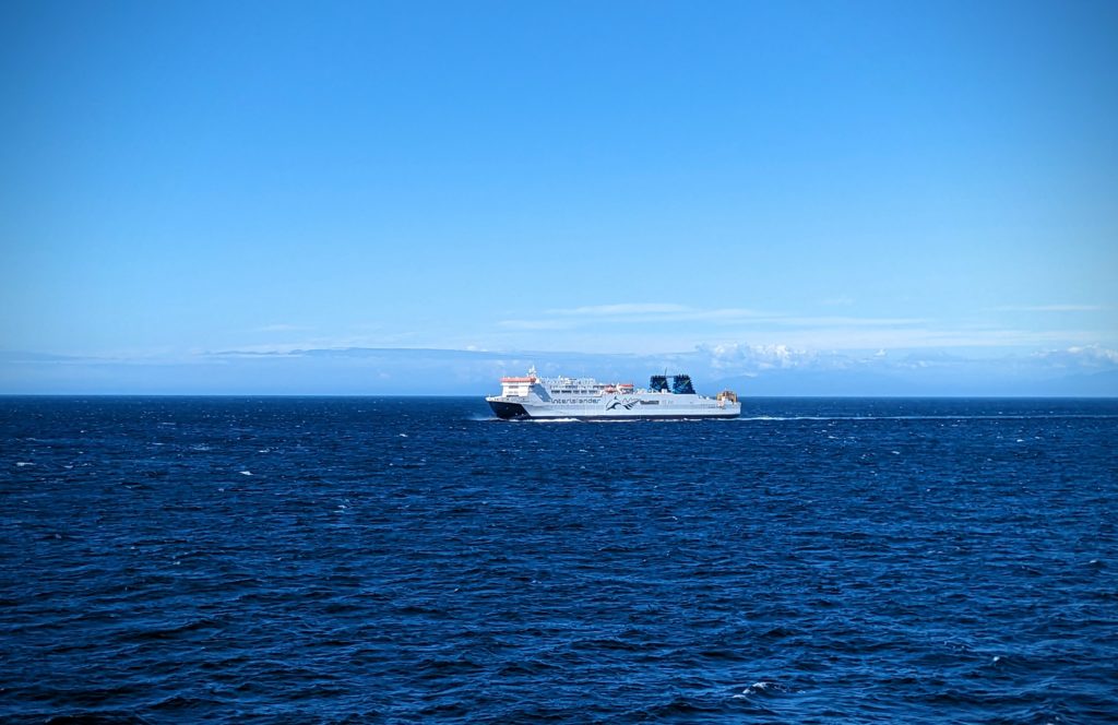
This must be what we look like! We passed a sister ship on it’s ride from the South Island to the North Island. We’ll be taking that ride in March!

Two hours into the ferry trip and we are entering the calm waters at the mouth of Queen Charlotte Sound on the South Island. But we have another hour to go as we thread our way deep into the jigsaw puzzle of islands and coves of peninsulas!
We reached our destination, the ferry terminal at the tiny town of Picton, disembarked and started our 3 hour drive to our B&B.

As we drove the narrow winding road to Nelson we looked back at the blue waters of the sound and the green hills rising above.
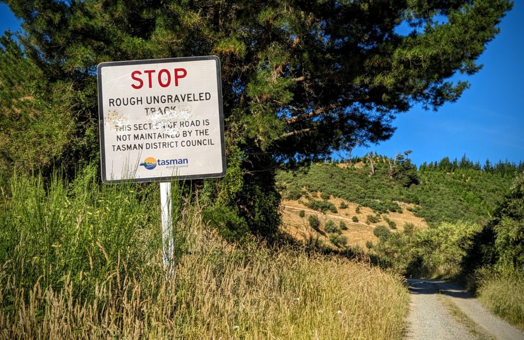
We stopped along the way at a park on the water. It was so warm out people were enjoying swimming and sunbathing on this holiday! We bumped into a German couple we had met on Thurs. December 21 when we hiked the rail trail! They are bike riding through New Zealand and they had taken the ferry to the South Island yesterday! Small world! We also stopped to do some grocery shopping and finally reached our B&B, a farm on a gravel road about 30 minutes from the town of Nelson.

We were greeted with a beautiful bouquet of flowers from their garden, a plate of chocolate chip muffins and a bottle of wine! A wonderful evening watching the moon rise!
