The Mine Shaft
On one of our walks looking for a geocache we discovered another old mine site. It’s not hard to do around here! Some mine shafts have been closed with heavy metal bars to protect people from exploring and possibly getting lost or hurt, also to protect habitat for bats who have moved into the mines for hibernation or roost sites. Some mine shafts are just fenced off, and we’re finding a lot of shafts that appear to have just been abandoned.

This shaft was unique in that it still had rails from the ore cart line descending into the darkness, and right next to them a ladder. Considering that this shaft may be 75 years old or more, we didn’t test the strength or safety of the wood ladder!

In this picture it appears the shaft is horizontal, but it is almost straight down. The sounds of a rock dropped into the mine shaft took a long time bouncing off the wood and rock walls to fade away!
Posted on February 12th, 2008 at 5:40 pm | Comments Off on The Mine Shaft
A Rare Rainy Day
Rain today, so we can stay inside and catch up on the website posts!
Posted on January 27th, 2008 at 5:18 pm | Comments Off on A Rare Rainy Day
Rock Art and a View
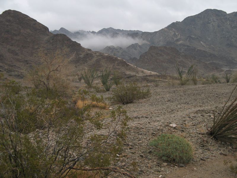
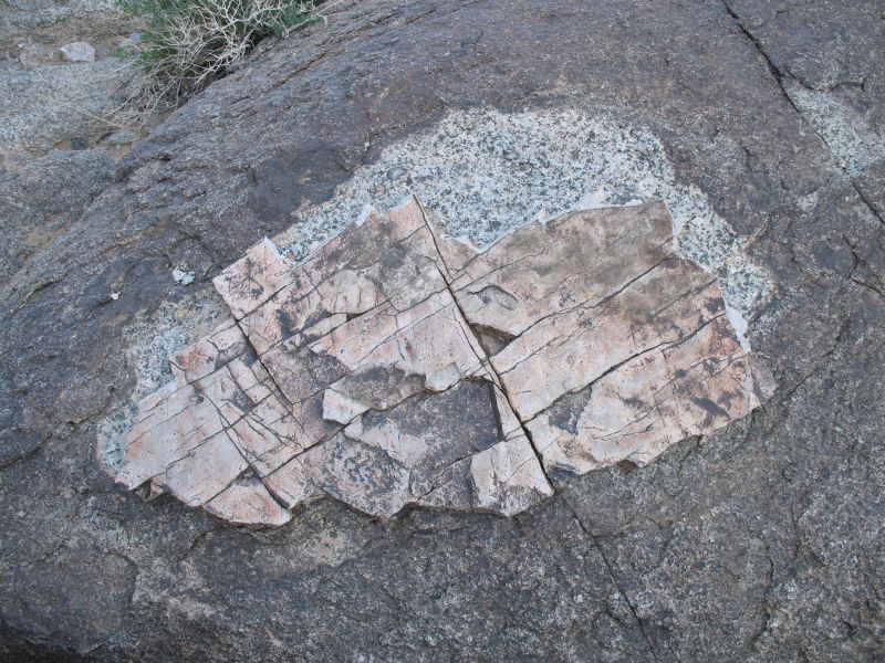
Another day of geocaching took us by motorcycle a few miles away, then up a mountainside. On the way up we went through a series of rock types and came across this boulder. A thin layer of rock that looked almost like a layer of plaster was wearing away and exposing the raw rock beneath, contrasting it with the desert varnish covering the majority of the rock face.
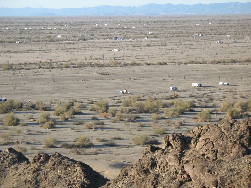
We reached the top, finally found the cache then took in the view. We had a great vista of the American Girl wash area. You can see all the ‘snowbirds’ dispersed over the valley.
A New Hobby!
After using the GPS to find Peter Kane’s waterhole, Robert discovered a new use for the electronic device besides a pedometer. He found Geocaching, a new hobby. Our first day out we had several caches within hiking distance marked on the GPS. We quickly found our first!
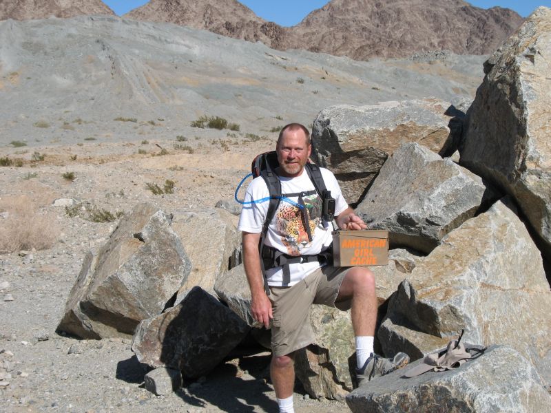
We continued our route and found our second cache within an hour. While we were inspecting the contents another group of ‘geocachers’ arrived (coincidentally from Oregon also). They didn’t have to look hard for the cache since we had it already! They gave us coordinates for another cache we didn’t have on our GPS and we decided to look for that one after we found our third goal. That last cache was a difficult one, we were right on top of the coordinates, but we never saw the container. All in all we hiked 9 miles, found 3 of 4 caches, learned more about the uses of the GPS and had a great time out in the sun.
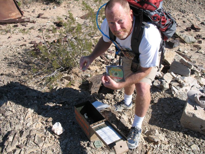
Robert inspecting the contents of a cache.
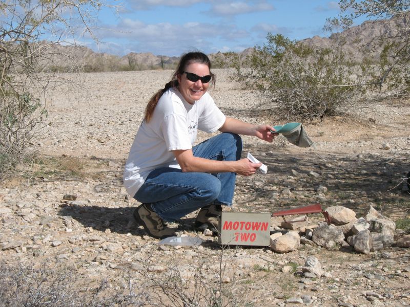
Mary Jo even got in on the fun!
Peter Kane Mine
Our friends Glen and Barb from British Columbia took us to a remote mine site created by Peter Kane in the 1920’s and 30’s. During the winters of two decades he worked at building a road to his site, carving small caves in the wall of a wash to live, cook and store supplies, and digging his mine. After his equipment was vandalized he gave up and died penniless in nearby Blythe, CA. His meticulous road has survived the decades since, through storm and sun, attesting to his determination and single handed hard work with pry bar and muscle only!
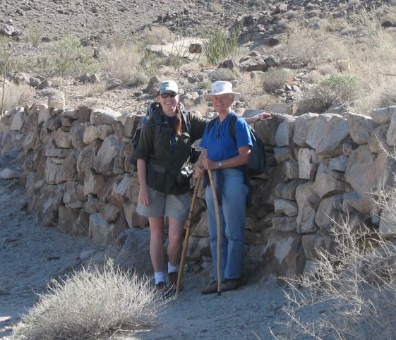
Barb and Mary Jo in front of one of the many retaining walls supporting the road.

Two of the three small caves carved into the wash. We finally found Peter Kane’s waterhole, with the help of the GPS. A modern addition to the waterhole is the pipe to a wildlife ‘guzzler’ probably installed by the fish and game department.
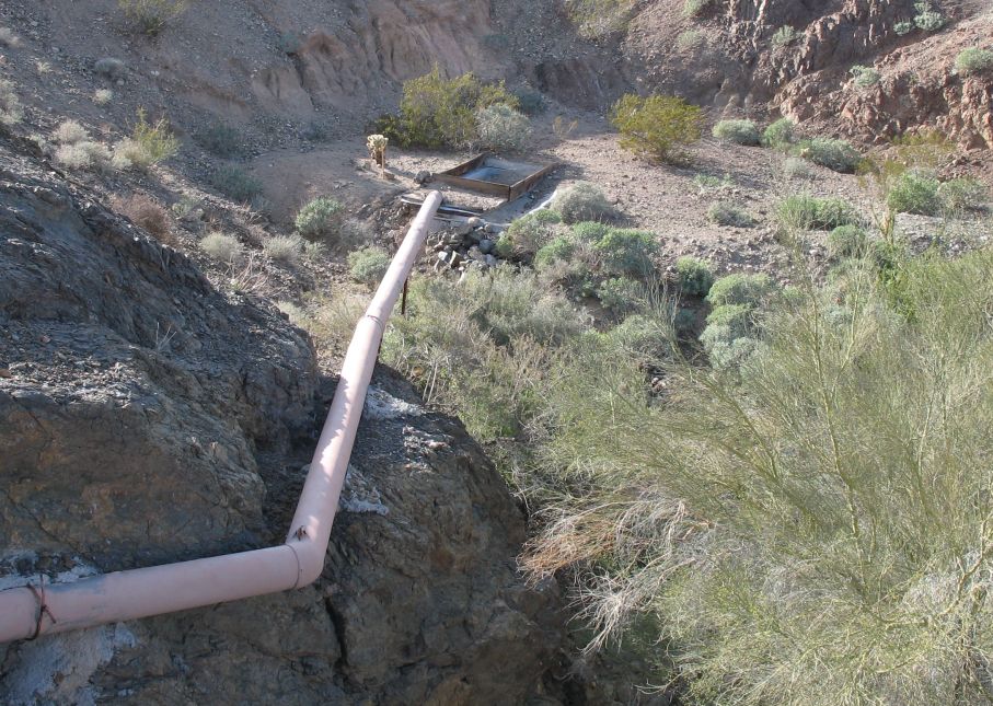
Below the cliff is the original waterhole, a mecca for wildlife and probably the reason Peter Kane sited his mining efforts nearby!

Posted on January 22nd, 2008 at 3:59 pm | Comments Off on Peter Kane Mine
