April 8 Penguin (Day 194)
We started the day (after breakfast of course) looking for gas and a car wash. Those gravel roads and the rain did a number on our little home on wheels! We found both across the street from each other near Launceston, the second largest city in Tasmania. Not to scare you, but THIS came crawling out of the hot water heater vent when we sprayed the motorhome down with water and started soaping it up!

A Huntsman spider, as big as any tarantula I’ve seen!
I know that Australia has lots of snakes, crocodiles, sharks, octopus, etc., even spiders, that can kill you, but this spider apparently is not one of them. However, I would not like to be bitten by it! I flicked it off the rig with a scrub brush and unfortunately it landed in a pool of soapy water that was probably toxic to it. I scooped it up and put it in a nearby box and hope that it recovers.
We continued on our way to the tiny town of Penguin on the northwest coast to resupply, dump and get water. We had an adventure trying to find an operating water spigot, then trying to find a water hose long enough to reach from said spigot to the rig!

The town of Penguin is decorated with all things penguin! Even the rubbish bins!

The town dates from 1861 as a timber town, supplying timber to Victoria, a state on the mainland of Australia that was experiencing a gold rush at the time.
All was figured out and we moved on to the free camp area just out of town, Midway Point. We explored the area on the walkway between the road, the railway and the diverse beaches.

The sandy beach is west of the grassy parking area site. The rocky ‘point’ is directly across the railroad tracks from the site.

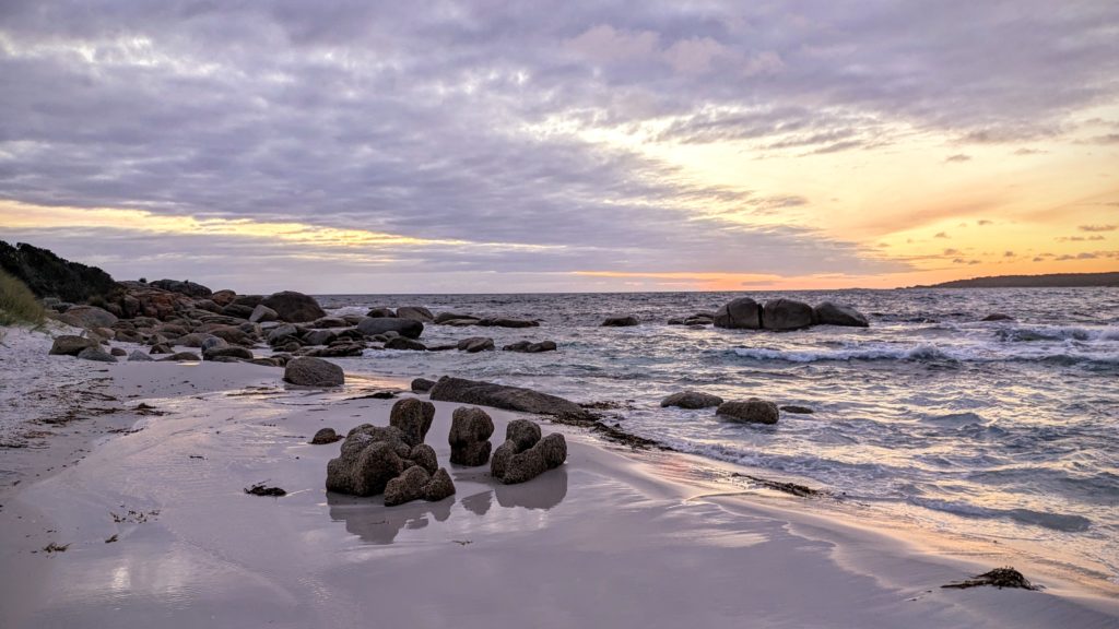
A little color from the sunset.
April 7 Eddystone to Lilydale (Day 193)
Last night at the pub we got some suggestions from the locals as to what to see around the area. One site recommended was the Eddystone Point Lighthouse, “hard to get to, but the most beautiful lighthouse in Australia” I think the words were! Yes, it was a washboard dirt road, but he was right! The wind was roaring and the waves crashing, a drizzle of rain off and on, and a rainbow!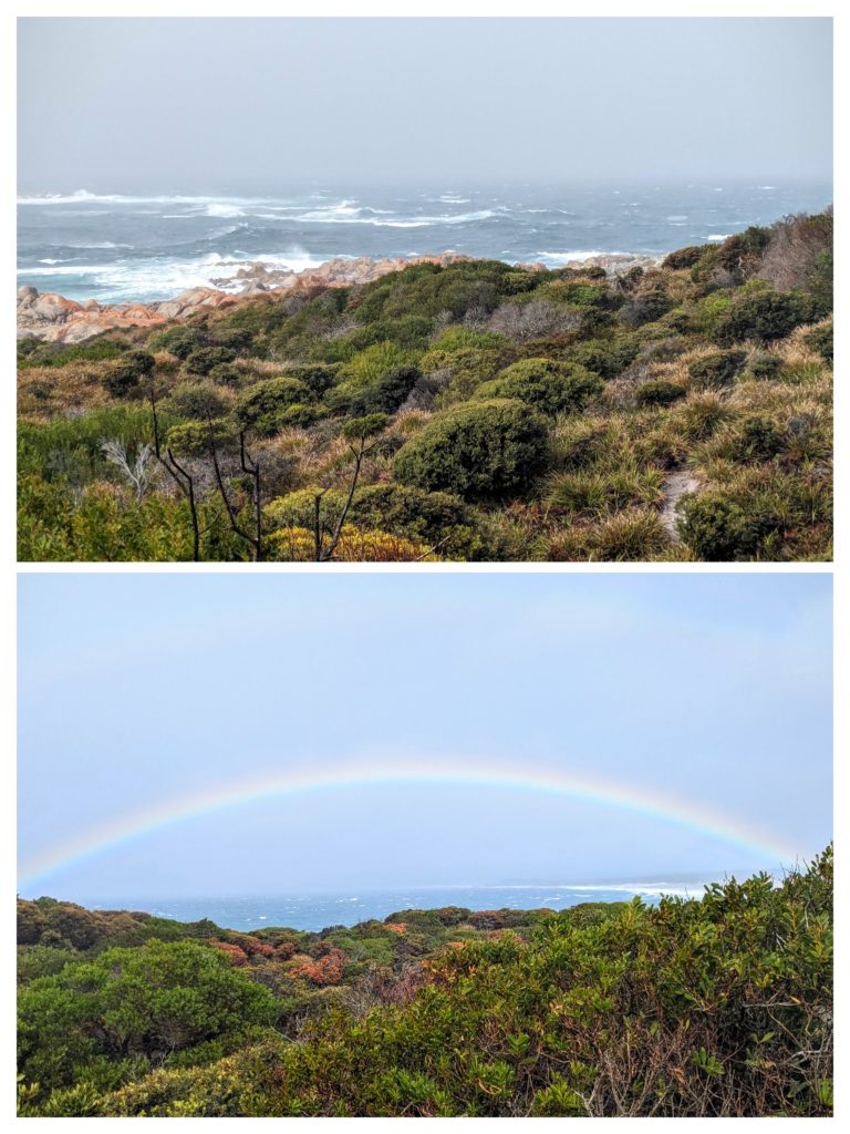

The lighthouse, built of the local granite is impressive, as are the 3 keepers houses built of the same stone.
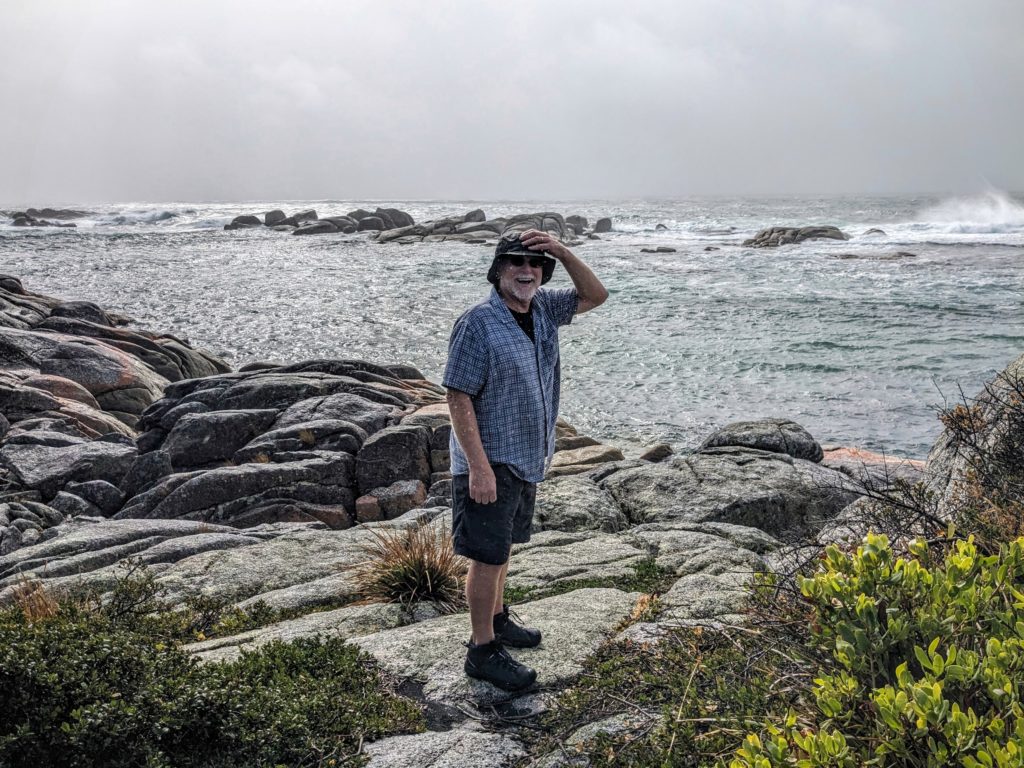
Hold onto your hat! We saw 2 little wallabies hopping through the brush on this short walk.
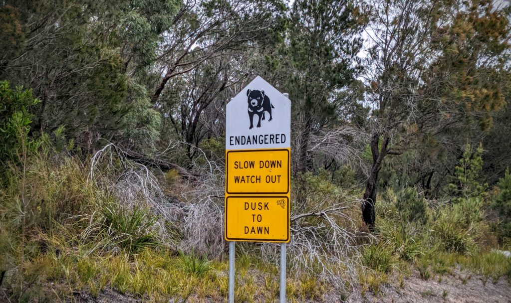
We’ve seen so much roadkill, but I don’t think we’ve seen any Tasmanian Devils.
We drove back through Gladstone, grateful to be on paved roads, and continued west and inland to another free campsite at Lilydale Falls Reserve.

The upper falls (upper picture) and lower falls (lower picture). In a green forested glen!
As we drive further north and west in Tasmania the vegetation is greening up, maybe due to the recent rain as well. The green here is more muted, less vibrant than the New Zealand green! The eucalyptus trees have more of an olive green color and more sparse leaves, but we were surprised to see tree ferns here! After our hike to the falls we found a defunct railway on a grade above and behind the camping area. We walked along that until it crossed the road, and returned to our campsite.

Railways always make me want to travel!
After dinner we relaxed and enjoyed a beautiful sunset.
April 6 On to Gladstone (Day 192)
We woke up to cloudy skies and went to the beach to try and catch the sunrise.
A muted sunrise on Jeanneret Beach.
We decided to head back to St. Helens, use the town wifi for an hour, then move on to new venues. We chose the unsealed road through the eucalyptus forest in the far north east of the island to experience the “off the beaten track” wilds. Logging activity is apparent, but it being Saturday we didn’t meet any logging trucks on the road. 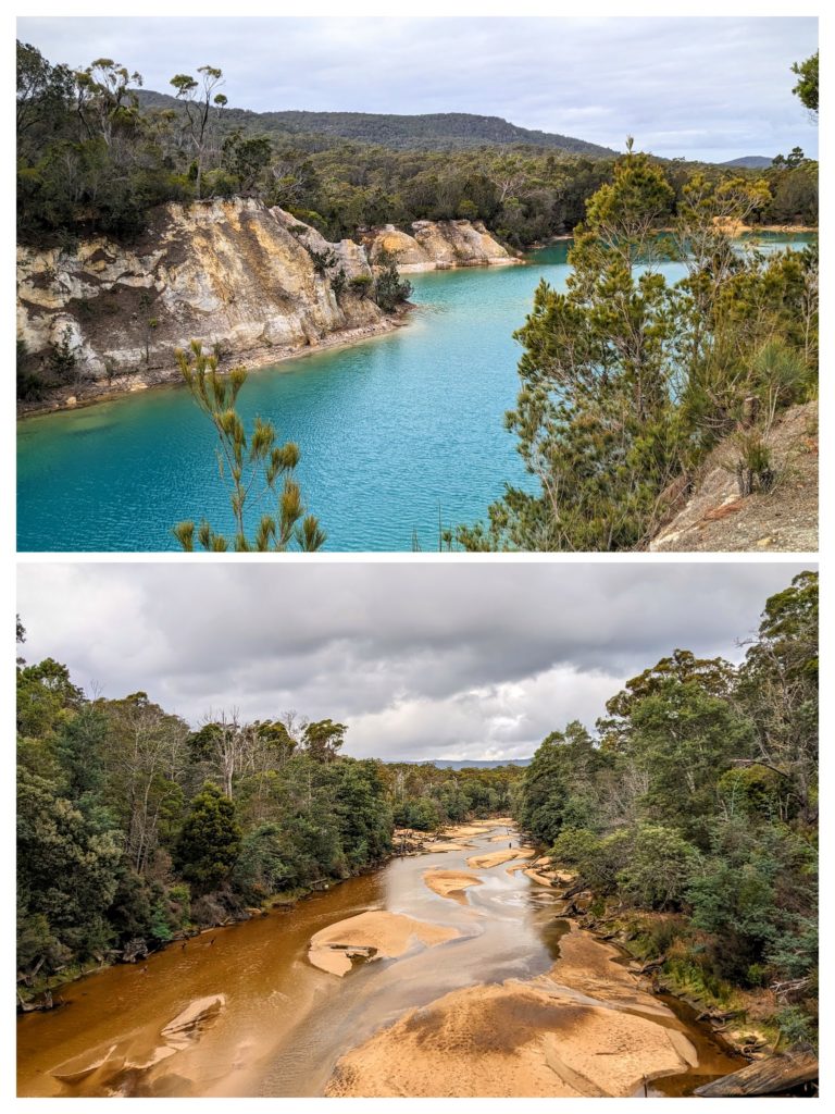 We crossed the Ringarooma River on it’s path to emptying into the Ringarooma Bay in Bass Strait, the body of water between the island-state of Tasmania and the mainland of Australia. Then as we approached the town of Gladstone we stopped at Little Blue Lake to admire it’s bright aqua-blue water, a little muted on this cloudy day. It looked suspiciously like an old quarry and I later found out that it was the site of a tin mine and the color comes from suspended clay and high levels of minerals in the water. We reached Gladstone and checked out the town’s free campsite next to the community center, with bathrooms available! We decided to stay for the night, set up quickly and took a walk around the 2 blocks of town. We found the cafe-tavern and stopped in for a few drinks. I chose Guinness while Robert had a glass of red wine. I think we were the talk of the locals who came and went, with me being the beer drinker and Robert being the wine drinker! It’s the first Aussie bar we’ve been in, and with the muddy utes (the local pick-up trucks) out front, filled with the carcasses of wallabies and cages with hunting dogs, we expected Crocodile Dundee to stroll in! The locals told us that the hunters go out to shoot the wallabies for sport, then use the carcasses for dog tucker (dog food).
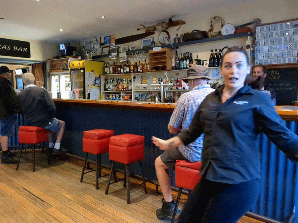
Not Crocodile Dundee, but a photo-bombing bar tender!! A fun evening at a local bar where a customer served us our drinks while the bar tender was serving folks in the cafe section!
April 5 Binalong Bay (Day 191)
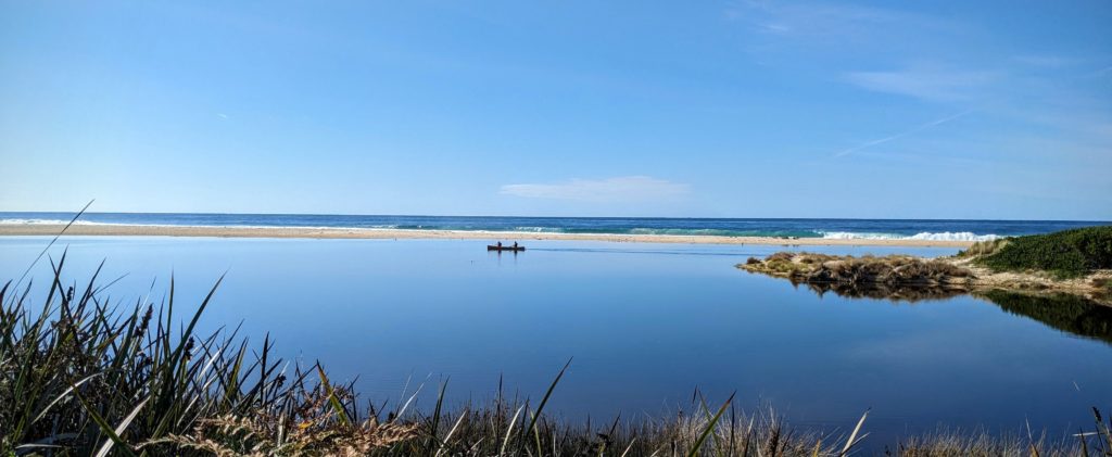
We had a beautiful sunrise, with a pair of black swans touching down on the lagoon where yesterday there was a canoe! 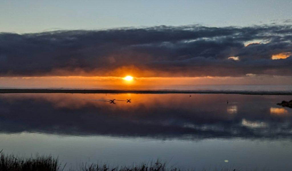
Unfortunately the sun couldn’t burn away the clouds and rain was threatening so we packed up to find better weather! Another day, another beach! Heading further north up the East Coast we stopped at St. Helens on Georges Bay for supplies and to replenish water, then drove around Grants Lagoon and to the beaches along Binalong Bay. Another free site courtesy of the Tasmania Conservation Department, this one with a ‘hybrid’ toilet that uses a micro-flush system. The sites were large and separated and we had a peek-a-boo view of the water!
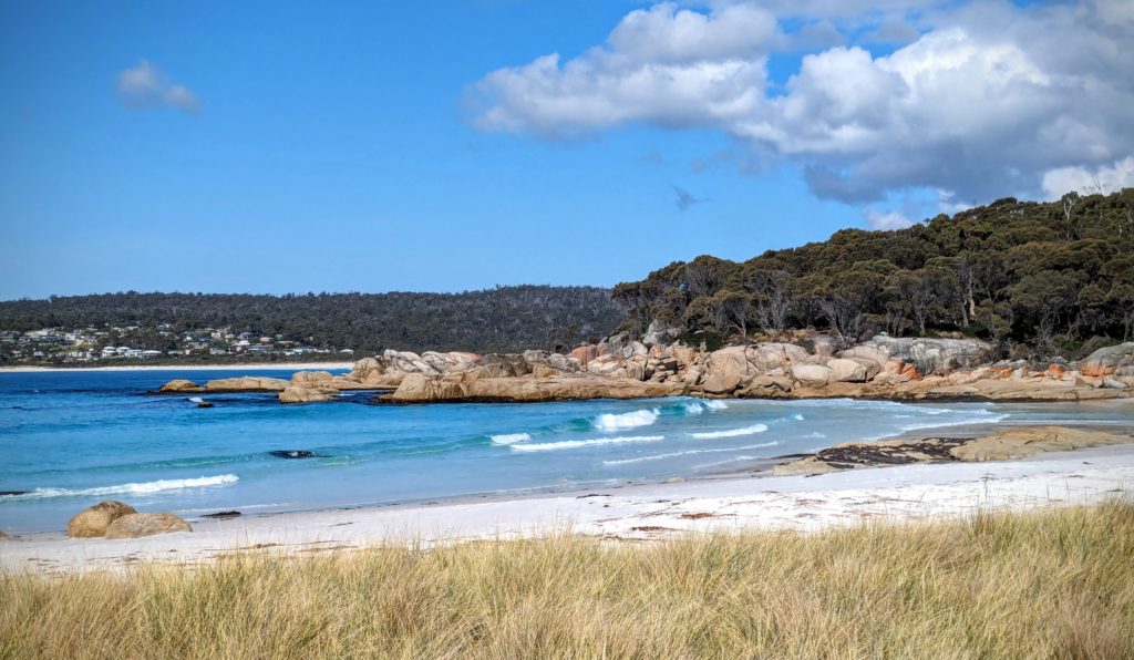
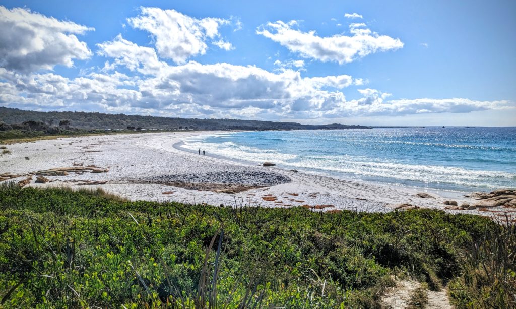
Jeanneret Beach, a tiny but gorgeous beach with sugar-white sand, clear baby-blue water and a nice slope for swimming!

The orange tinted rocks border the beach and are great for sunbathing and tide watching!
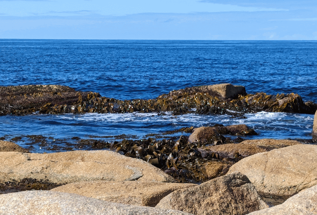
Watching the waves flow over the seaweed was mesmerizing.
This rocky headland separates this beach from the larger Swimcart beach that has a long camping area spread along it filled with campers.
Swimcart beach has rougher waters and a definite undertow, no swimming here!
We walked along Swimcart beach, and it was such a nice day, in the 70’s, we headed back to Jeanneret Beach and took a dip in the cool sea water!
April 4 Chain of Lagoons (Day 190)
We moved on this morning to another campsite, a free spot with a view of the ocean! It was a short drive of about 40 minutes and when we found our spot we were smitten!
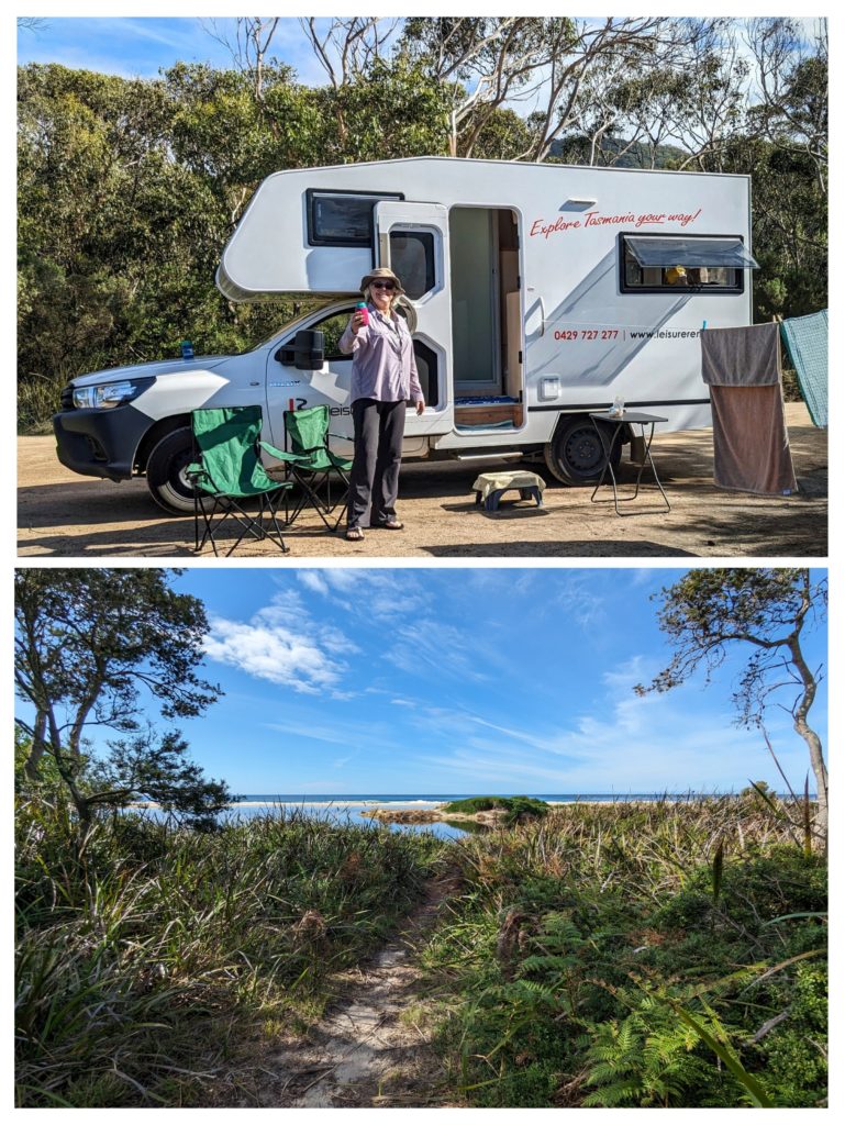
We quickly set up, even to the clothesline! As “Nick (Craig Nichols) would say “every hobocamp needs a clothesline”! Our setup and our view!
The end of the Lower March Creek lagoon separates us from the beach, but it is only a short walk away!

And finally we took a long walk on the beach and watched the incoming tide wash away our footprints in the sand!
