Lee’s Ferry -March 27
On a chilly, blustery day we continued our journey across Glen Canyon Dam into Page, Arizona where we re-supplied. From there we ascended Echo cliffs, then descended the other side to sunshine and warmth at Lee’s Ferry on the Colorado river. From 1870 to 1929 Lee’s Ferry was the only relatively safe place to cross the Colorado river for 600 miles! Now it’s part of Glen Canyon National Recreation Area and the launch point for raft trips on the Colorado river through the Grand Canyon.

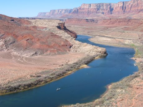
Looking down on the Colorado River from a steep trail. There were 3 different sites for the ferry, since they were flooded and washed away periodically.
 Looking left, or upstream, you can see the wagon road descending to the river at the site of 1 of the 3 ferry crossings.


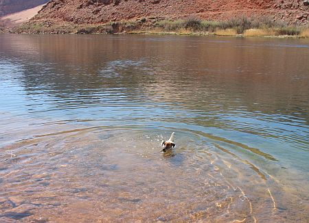
Looking across the Colorado from just below the campground. The milky colored water in the foreground is the silty Paria river flowing into the clear water of the Colorado. Glen Canyon Dam completely changed the quality of the Colorado river water, filtering out the massive amount of red silt collected from the huge watershed.

Sunset on “Lee’s Backbone”. Pioneers built an amazing wagon road on the face of the cliff to get to Lee’s Ferry.
Paria, Pahreah -March 25
We started down one of the dirt backroads to visit the Paria Movie Set in the Paria river canyon. The road was okay until the last 1/4 mile down a steep incline to the movie set site. We were just barely able to turn the truck around and head back uphill and park. We met some BLM workers on the way up the hill and suggested they move the “High-Clearance 4 Wheel Drive Needed” sign to a better turnaround spot! We walked down the hill to see the sites, unfortunately the movie set was burned down by arsonists in 2006, but the scenery was impressive enough. Further along the wide canyon floor was a cemetery, all that’s left of the town of Pahreah settled around 1873 and virtually abandoned in 1883.

The road ahead through the windshield.


That was a scary road, but worth the view!
Toadstools, March 25
We visited the nearby rock formations known as Toadstools. Mavrik had a fine time running through all the meandering washes and up and down the hills.


Wow, they really do look like that!

GSENM, March 23
That means Grand Staircase Escalante National Monument. Our next stop was a base from which to explore the south end of the massive Nat’l. Mon. in Utah. We eventually camped at Whitehouse Campground at the trailhead for the Paria River Trail. Unfortunately we were about a month too early to explore the dirt backroads (and just about every road is a dirt backroad out here!). There was still snow on a lot of the roads, and the rest were too rutted from bad-weather travel. We had a great day of sunshine and hiked around the campground.

Hiking into a small canyon at Whitehouse campground.

Interesting rock formations.

Looking down on the tiny campground from the rocks above.
Winsor Castle, March 22
No, we’re not in England, that would be Windsor Castle! We stopped at Pipe Spring National Monument in north-central Arizona on our way to Grand Staircase Escalante National Monument. We had an informative tour with a Paiute Indian guide, then were able to take Mavrik on the Ridge Trail in the background.

The building on the left is "Winsor Castle", built by the Mormon Church to sageguard the 1st ranch manager (Mr. Winsor) for the Church's "tithing herd" of cattle. Church members often gave their 10 percent tithe in the form of goods such as cattle.

Mavrik took a good long drink at the spring flowing from under the 'Castle'. The Mormons built the structure over the spring to ensure control of the land which had been used by Indians for thousands of years.
 Looking left, or upstream, you can see the wagon road descending to the river at the site of 1 of the 3 ferry crossings.


