November 27, 2023 Kiwi to Ohakune (Day 61)
We got up before the crack of dawn to see the full moon setting over the Bay of Plenty, behind Mt. Maunganui. Our last morning in the Bay View Bach.
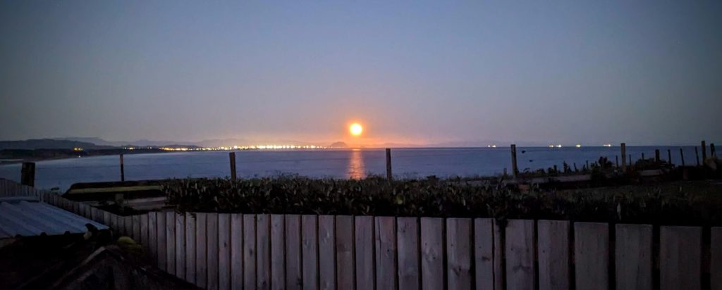
The lights on the horizon to the right of the moon are ships either leaving or entering the Port of Tauranga.
Yesterday, after our epic hike and packing and cleaning the bach, we went out for a few beers and a light dinner with some folks we had met a week ago. We had a wonderful time talking about our adventures and hearing about their life in Te Puke. Mark, the patriarch, is a kiwi farmer and he offered us a quick tour of his orchard the next morning. So we packed the car up and left at 7:15am to meet him at his orchard a 10 minute drive away. We had a great visit with him and learned about the NZ kiwifruit (formerly the Chinese gooseberry).
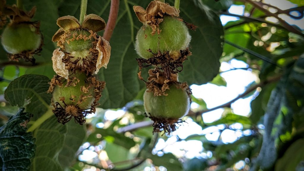
Baby kiwifruit. We don’t get the best of the crop in the US! The kiwifruit here in the local stores are twice as big!
After saying our goodbyes we continued on towards a hike we planned on our way south. Our destination was the Maramataha Bridge on the Timber Trail, a hiking & biking trail through the Pureroa Forest Park.

The longest and highest suspension bridge on the Timber Trail!
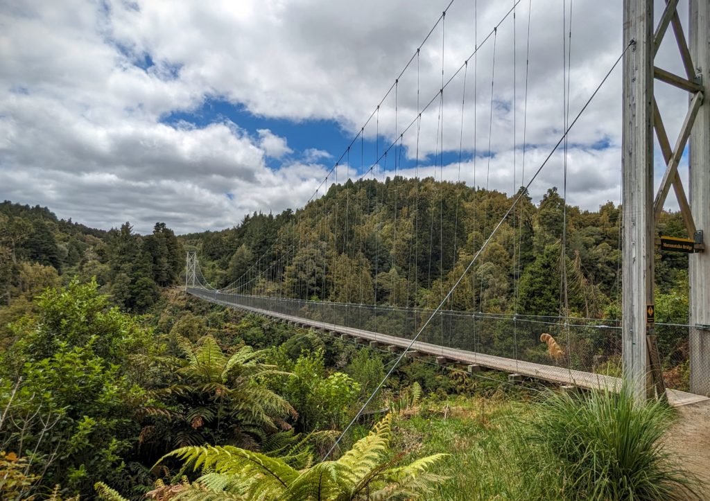
It crosses the Maramataha River, home to the whio or blue duck, a critically endangered NZ native bird. The bridge allows for bikers and hikers to pass over the river without disturbing the critical habitat of the ducks.
After our almost 2 hour walk through the regenerating forest we continued towards our night’s stay in Ohakune. Our friends in the pub last night said that it’s a great little ski town. I was thinking maybe bunny hills, I was not prepared for a huge snow capped active volcano!
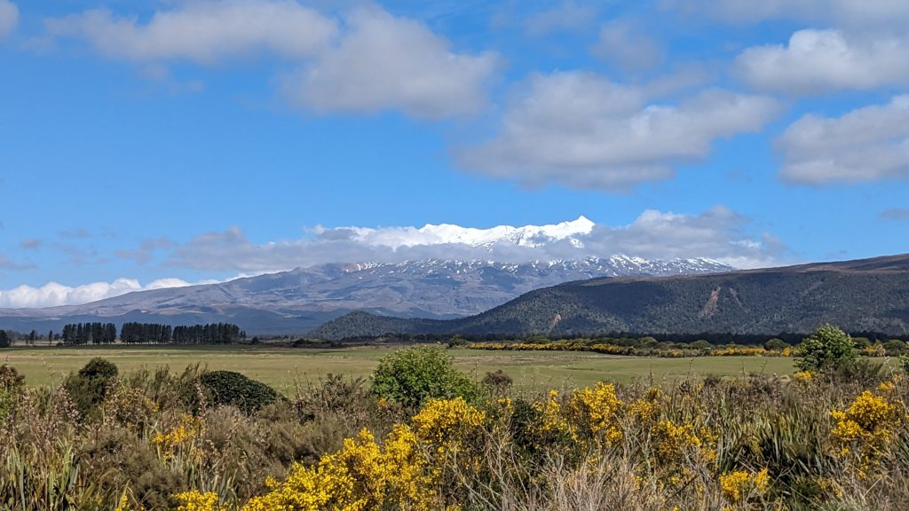
Our first view of Mt. Ruapehu, one of NZ’s most active volcanos!

As we got closer the clouds dissipated and we had a clear view!
The quaint town of Ohakune reminded us of a smaller version of Bend. A skiable volcano nearby, a river running through it, the Mangawhero River, and a newspaper named The Bulletin!
One of the businesses that caters to the winter visitors!
Ohakune has wound down it’s ski season and the summer traffic has not yet begun. We had a leisurely stroll around town during shoulder season, something Bend no longer has!
November 26, 2023 Point Hike (Day 60)
We had a beautiful day and headed out for a hike before we got down to business packing to move. We decided to head to the road to Newdick’s Beach, a private road we thought was closed but learned that for a small fee we could drive or hike there. Since it’s walking distance we decided to hike! After paying our $2 NZ to walk the private road, it was a 15 minute stroll down a lane until we saw the water, and a rope swing!

Of course if there’s a swing, I must swing!
To the right was a sandy beach that headed towards the Holiday Park opposite Pukahina Beach.We looked to the left, towards the cobble beach and Okurei Point.

What’s around the point? We decided to explore.

Beautiful expansive vistas out to sea, and tiny masterpieces of nature on shore.
We made it around the point, carefully stepping across the cobble beach.

The rounded tip of Okurei Point.
On the other side of the point we decided we might as well hike all the way to Maketu beach, we could see it in the distance, but how many obstacles would be in our way?

As we hiked, carefully watching our steps over rocks and trees, we looked up to see a sea lion climbing up on a rock close to shore. It was totally oblivious to us! We watched for a little while, then continued on our way.

We could see the beach stretching to the Maketu Beachside Cafe, a welcome sight after our careful trek over the cobbles!
We are very lucky that it was low tide! We saw the marks on the cliff wall that if the tide was up, it would be impassable!

Our route around the point! What an adventure! Over 4 miles round trip from the bach and back.
November 25, Bach Beauties (Day 59)
We went into Te Puke to do some errands in preparation for our next move. Our time in Bay of Plenty is winding down and we’re getting ready to move down to Wellington for our next adventures. While we have been here at Bay View Bach for the past 26 days we’ve seen the flowers budding and now blooming!

Indigo?

Mandevilla?

Blue hibiscus?
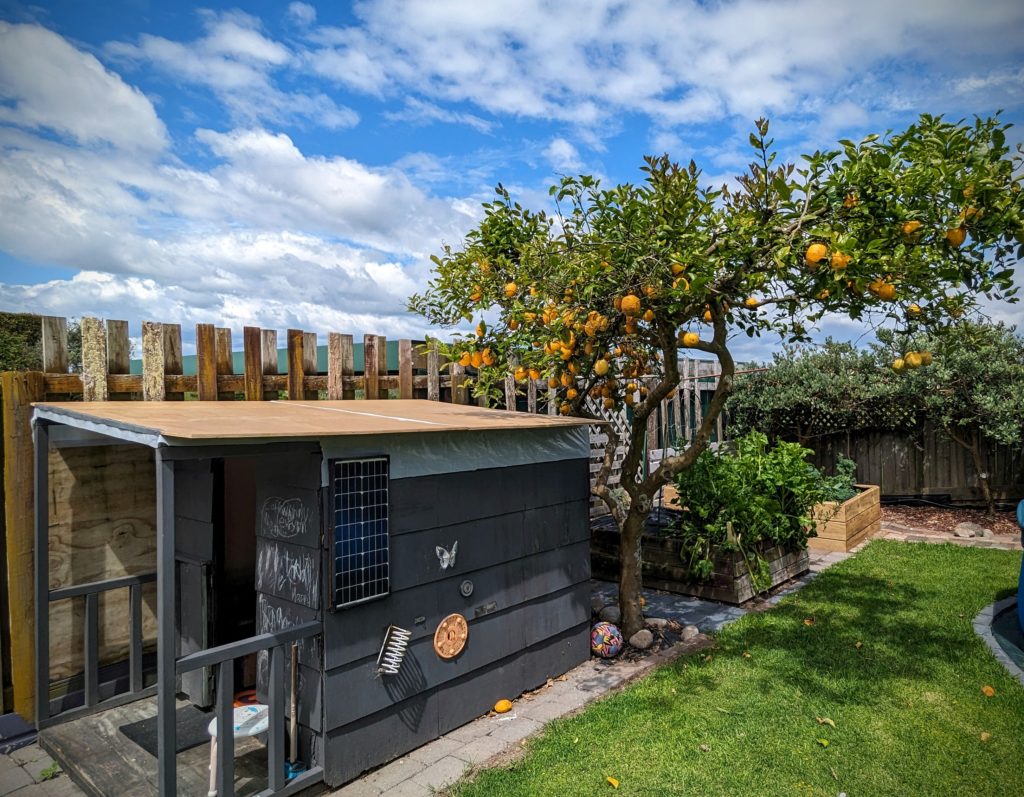
And the prolific lemon tree! Overlooking the cutest play house! I used many lemons on the grilled fish and found out that grilled lemon is delicious!
November 24, 2023 Lunch at the Beach (Day 58)
This morning we took our walk down to town with a slight detour towards Okurei Point. We found another marker with more information about Historic Maketu “One Community, Two Histories” (Maori and Pakeha-European). This point of land was settled by Maori between 700 and 1000 years ago and was a prominent village with fortifications and cultivated fields of kumara (sweet potato), taro, uwhi (yam) and hue (bottle gourd). When Capt. Cook sailed by in 1796 he noticed the large village above the cliff and named it Town Point.

An aerial view of Okurei Point. The red arrow points to our Bach, the blue arrow points to Maketu Beach.
We headed to Maketu Beach to the Maketu Beachside Cafe & Restaurant for lunch.

Literally beachside!

Robert ordered the pan-fried fish & chips, with a great cabbage salad. I had the fish burger with the salad on it!
We heard the patter of feet and looked up to see a gull walking on the semi transparent roof!

His/her webbed feet!
November 23, 2023 A GORGEous Day (Day 57)
We left our B&B after a quick granola breakfast to head down the east side of the Coromandel peninsula. Our first stop was Hot Water Beach, where at low tide you can feel hot sand under your feet, dig a hole in the sand and let it fill with the hot water that is rising from 2 hot springs. It has become a very popular spot and was already filled with people.

The 2 hot springs are in a tiny area at the end of the rocky point, so everyone was gathered there. It will be inaccessible in and hour when the tide comes in!
Since we had no shovel, no swimsuits and didn’t want to pay the $25 (NZ) parking fee we took a loop road to Hahei Beach nearby. We were rewarded with a beautiful empty beach near Cathedral Cove (which unfortunately is closed due to storm damage from the February cyclone Gabrielle).
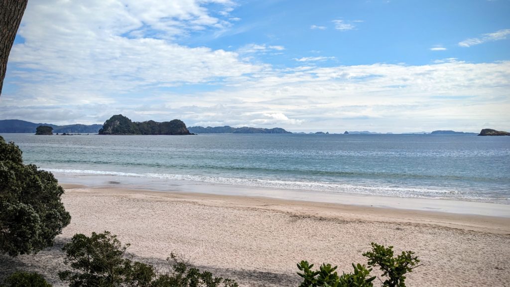
A beautiful sandy beach with picturesque islands in the distance.
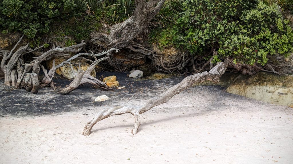
The roots of this pohutuwaka tree seem to be clutching the sand!
Walking into the little village we spotted this huge fig tree in the yard of “The Lawnmower’s Son Art Space“.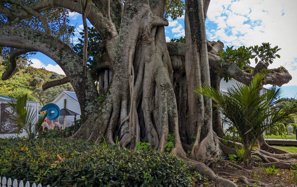 We continued south through the beautiful countryside and returned through Karangahake Gorge to explore it more. The gorge is only 20km (about 12.5 miles) long but is full of history and beauty. It was a major gold mining area in the 1870’s. The local Maori (the Hauraki tribes) were opposed to the mining of their lands, but were persuaded through various unscrupulous methods to sign away their mining rights by 1875 and the Ohinemuri field was officially opened to prospectors. The Ohinemuri river cuts through the Karangahake Gorge. Placer mining proved unprofitable, but new methods first in the world to be field tested here, using the Crown Battery to crush the gold ore and the cyanide process to extract the trace gold from the rock, were begun in 1889. History HERE. Lots of infrastructure was built, huge stamp mills, train routes, tunnels, bridges, etc. Most is all gone now and the river is slowly recovering from the devastating pollution. The railway operates a portion of the line as a scenic train. The gorge now has a walkway/bikeway on the rail route through tunnels and along the river. As we approached the historic walkway we detoured slightly for a view.
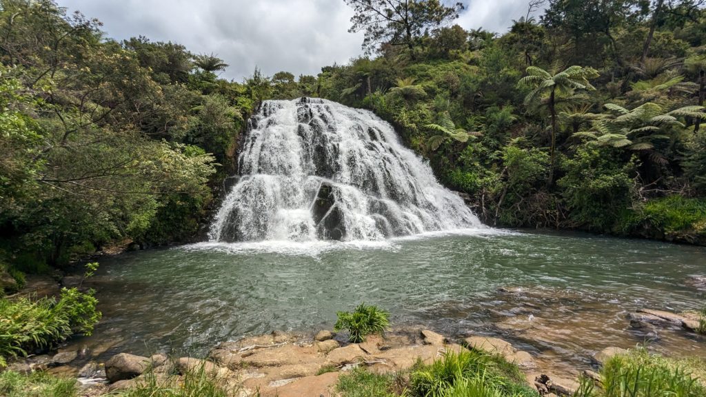
Owharoa Falls, just a short walk from the walkway/bikeway in the gorge!
We drove to another section of the walkway to try the Rail Tunnel Loop hike.

From the parking area you cross Highway 2 and the Ohinemuri river on the old rail/road trestle and enter the 1km long tunnel! The tiny dot above Robert’s head is the other side of the tunnel!
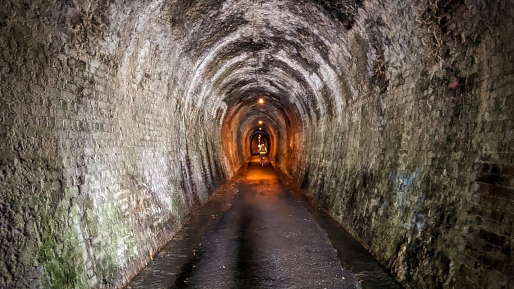
The tunnel is lighted! Bicycles and a few walkers passed us.
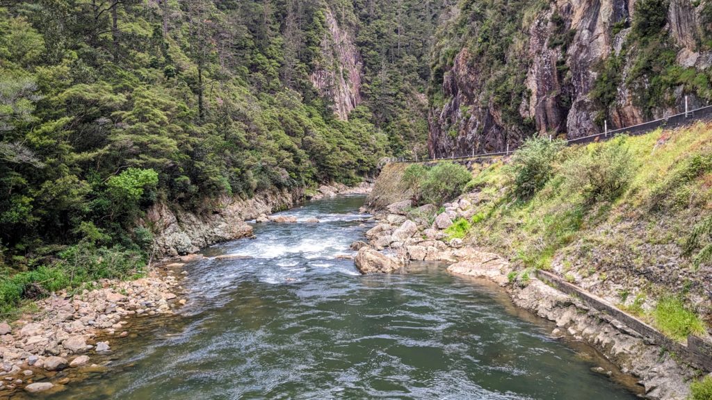
At the other end you emerge and cross under Highway 2 and over the river. A great view of the gorge from the bridge.

A map of the tunnel route. Unfortunately cyclone Gabrielle damaged the trail so the loop walk to and through the other tunnel (with windows overlooking the river) was closed.
We headed home to the Bach and had a great grilled fish dinner and a beautiful sunset!
