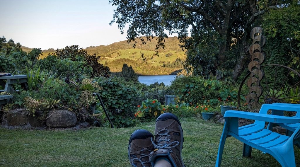
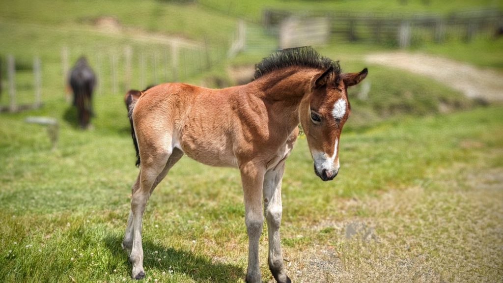
November 17, 2023 Work Out (Day 51)
Another day with projected rain that never showed up! We finally headed out for a walk to take advantage of the sunshine despite the wind! We headed down the hill to town and chanced on a couple of vintage cars in the parking lot of the local restaurant.
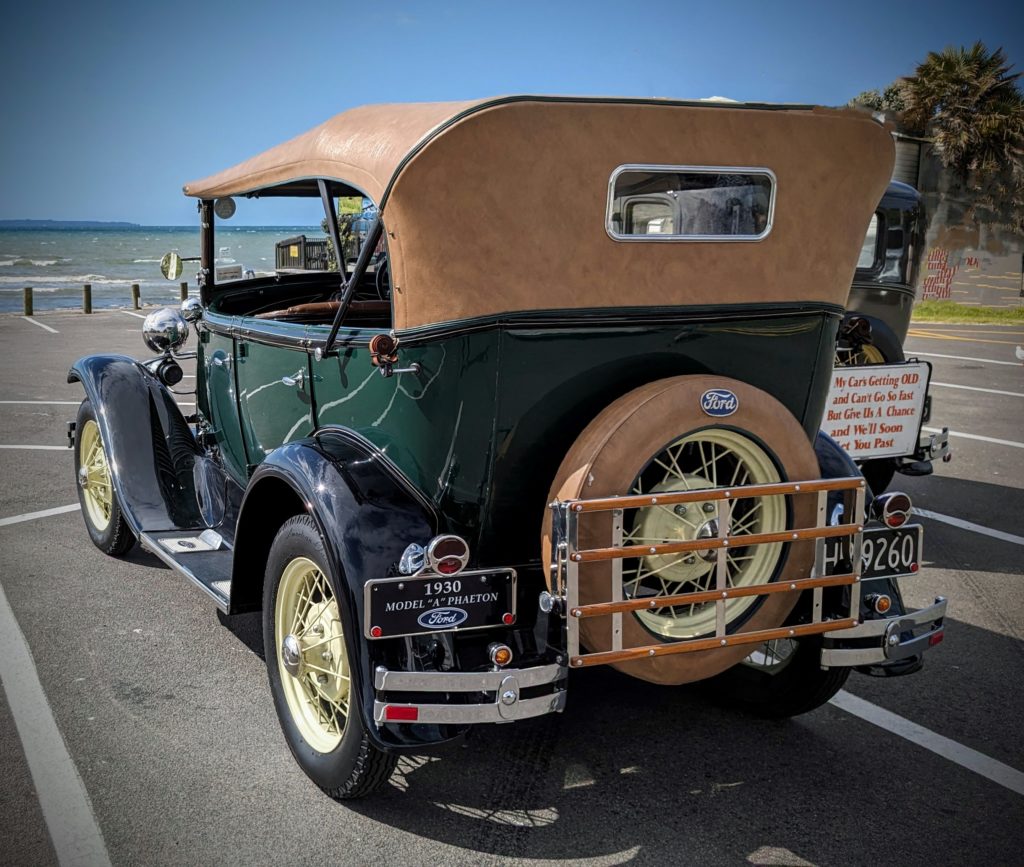
Model A’s , gorgeously restored!
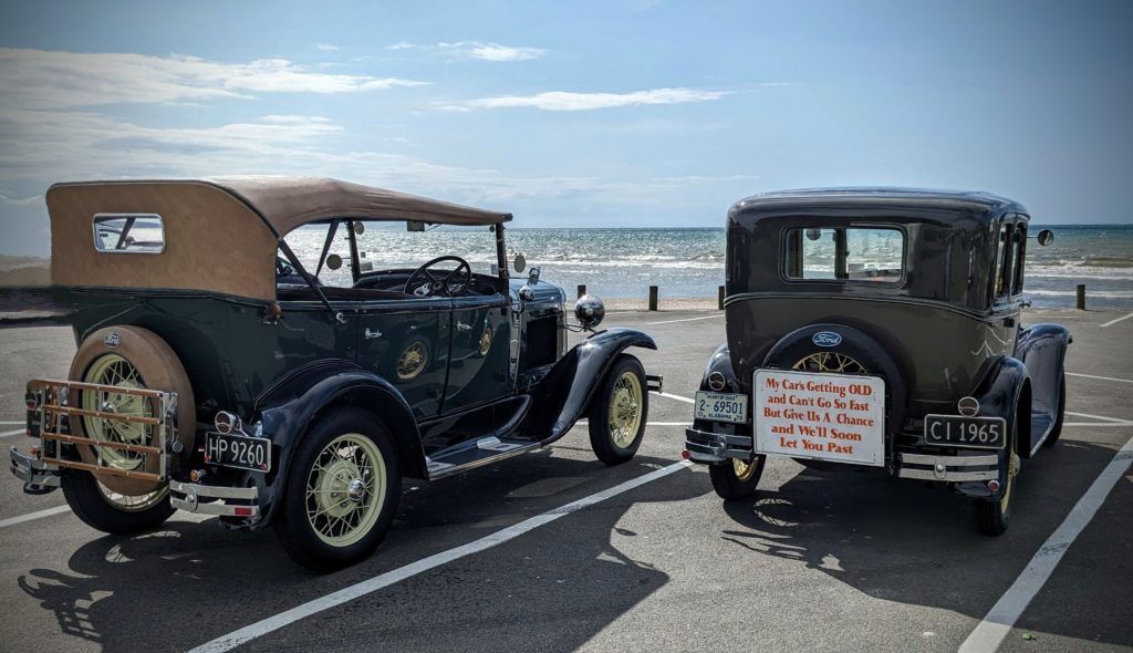
It takes you back to what we think of as a simpler time.
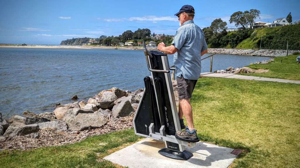
Walking on we came to the free workout stations on the waterfront. The ocean wind was much appreciated as we tried out all the stations and worked up a sweat in the humidity!
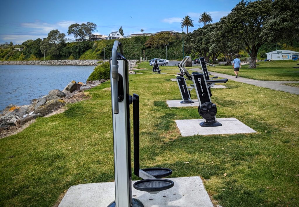
I tried all except what I thought was a sit-up station. It looked like a back killer!
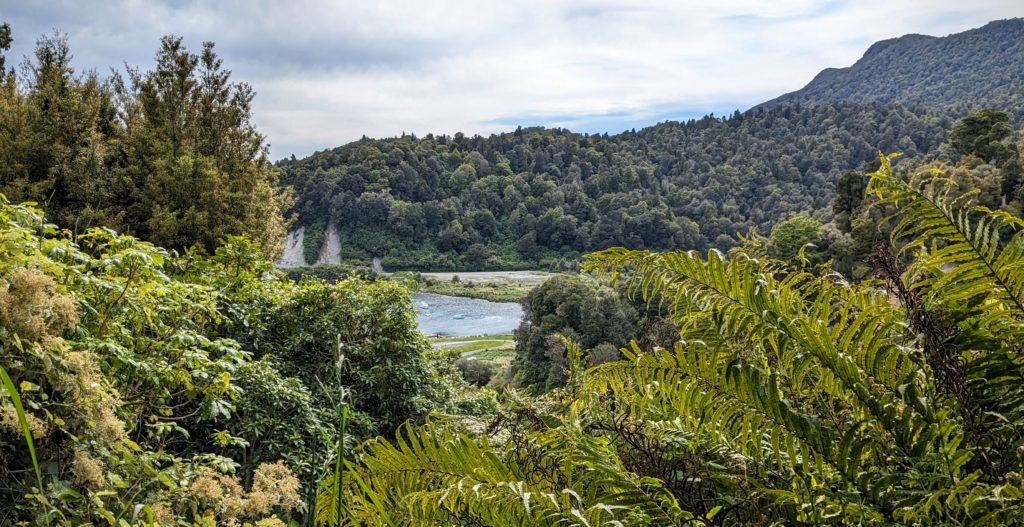
We walked back to the Bach via the Gully walk, welcoming the shade. We have a few blocks to walk and we have a view over another gully filled with what looks like native vegetation, to distant paddocks and a peek-a-boo of the ocean.
November 16, 2023 Raparapahoe Falls (Day 50)
We had some errands to do in Te Puke (te-pock-eh); shopping, having some documents printed out and getting our necessary capuccino & chai latte! Since it was a nice day we decided to explore the area a little more. We found a nearby waterfall to hike to, Raparapahoe Falls, and after having our picnic lunch in the parking area we headed down the trail, and I mean down!
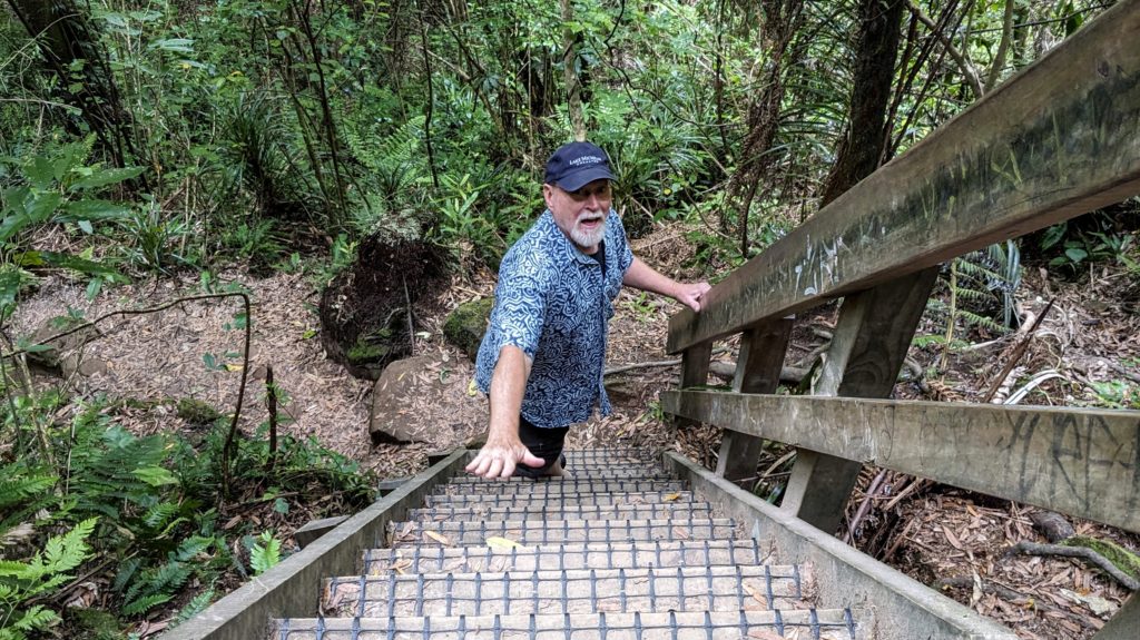
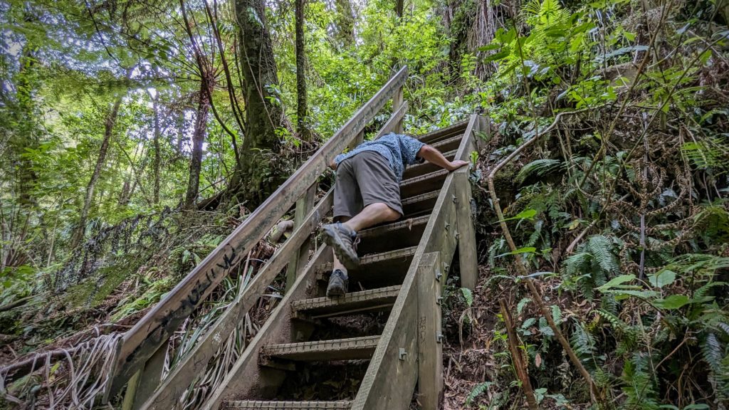
The steepest of many stairways on the trail!
We met a couple coming up the trail, huffing and puffing, then a group of young people coming up in swimsuits with towels. It was a great hike down through the woods then along a stream bank where the trail had washed out in a few places, to a steep walled bowl where the small falls spilled into a beautiful emerald green swimming hole!
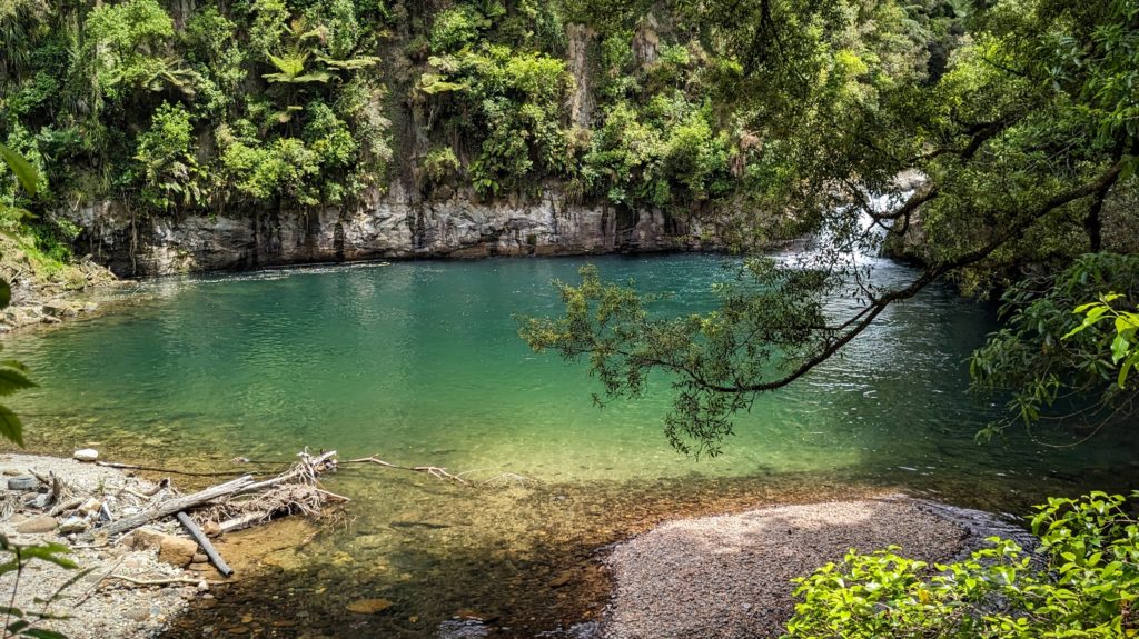
Approaching the falls. I took the high road, climbing up through the trees, Robert took the low road, climbing over rocks on the edge of the stream flowing out of the pool.
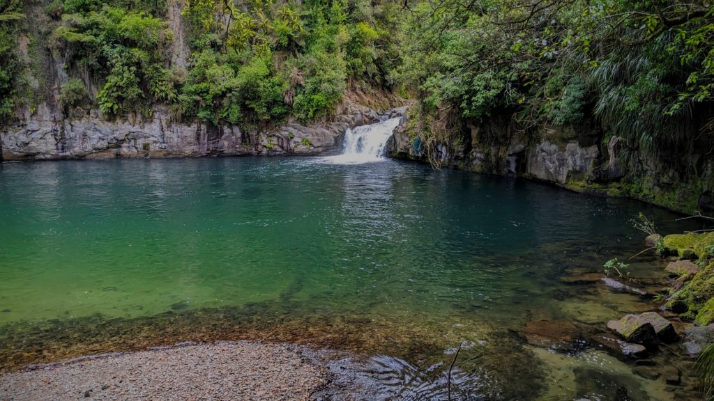
We both met at a spot we could view the falls. We would have to get our feet wet to get any closer, and we were not prepared to go swimming unfortunately, it was hot and humid enough though!
As we hiked back the way we came, we could see the steep walls of the canyon on the other side of the river.
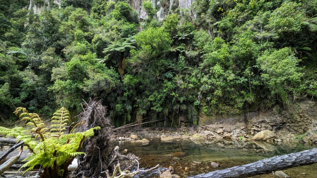
Covered with tree ferns and tropical looking vegetation, the steep walls were well disguised.
The steep hike back up! A good heart-pumping workout!
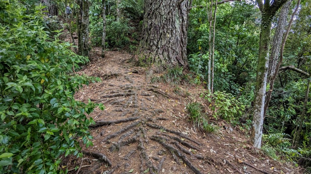
We knew we were close to the end when we came to the trail paved with the roots of this huge tree!
November 15, 2023 Day of Rest (Day 49)
Today we enjoyed a slow, sunny, beautiful day here at Bay View Bach in Maketu. A ‘Bach’ is a traditional Kiwi Holiday home, usually a simple cabin at the beach or in the mountains where families gather for school holidays. Here’s a short history of the iconic Kiwi Bach. Of course in the age of AirBnB and VRBO you can find grander designs than a simple cabin! We are very comfortable, with all we need at our bach!

The living room and deck of the Bach, with the fabulous view!
We are located in the small town of Maketu, and have finally learned the proper pronunciation (I hope) as ‘mac-eh-two’. Also, we have been schooled in the pronunciation of the nearby larger town (and Kiwifruit capital of the world) Te Puke as ‘te-pock-eh’.
November 14, 2023 Water & Forest (Day 48)
We started out after a hearty breakfast into a chilly very windy day. The sun would break out of the clouds briefly, but it felt like rain was threatening. We were taking highway 38, most of which is gravel, through the heart of Te Urewera (literally “the burnt penis”, why? I couldn’t find out, this is as far as I got! Another reason to come back!).
Our first view of Lake Waikaremoana, “sea of rippling waters”, at the south end of Te Urewera. It was so windy there were whitecaps on the lake!
We stopped at the visitor center at Aniwaniwa, but it was closed and has been since this sign from February 12!

Highlights are mine. Translations: Papatuanuku=’The Earth Mother’; manuhiri=’visitor, guest’; kaimahi=’worker, staff, employee.
Luckily the store/office of the Lake Waikaremoana Holiday Park was open and we could get our hot coffee & tea! At the suggestion of the gentleman behind the counter we should take the road to the right before we cross the bridge to see a great waterfall and swimming hole. So of course we did! After driving down a smaller gravel road to the end we parked and walked the trail to emerge to this!

Papakorito Falls!
Returning to the main road we crossed it and parked at another parking area to follow a trail towards the sound of a waterfall. After walking up and around a forested hill we descended to the next waterfall.

Aniwaniwa Falls, I learned later!
We clambered down a steep slope to the base.

If you look closely you can spot a black swan in the lower right, calmly swimming around. We tried not to disturb it.

Robert is the happiest Birthday Boy! Nature is delivering great presents!

Hiking back up on what turned out to be a loop trail back to the car, we encountered a third waterfall with a tranquil swimming hole. Too bad it was too cold to swim!
All the signage for the falls was apparently destroyed in the cyclone because tho we saw posts, there were no signs. We left the falls area and continued on the winding and narrow road, ascending along a ledge above Lake Waikaremoana and descending through lush forest, opening to valley meadows in the interior at small towns.

The views of the lake were fantastic. The lush native forest grows right to the edge!
Robert had to keep his eyes on the road!

Glad we didn’t meet anyone coming the other way!

Signs we are approaching a town!

A Marae being repaired/restored.
We reached the town of Ruatahuna – The Heart of Te Urewera. There was a health fair going on, we didn’t stop, except for the traffic on the road!

“Wandering Stock” as the signs said!
“I’m ready for my closeup!”
We stopped at a picturesque park just out of town hoping to have some lunch, but it was too windy!

We stretched our legs a bit, then continued on to another less picture worthy spot, but less windy too!
We could tell when we left Te Urewera because the forest changed from lush diversity to monoculture pine trees (can’t really call it a forest), planted in rows.

Looking back at the lush forests of Te Urewera on our way back home.
What we took away from our 3 day adventure is the peace and beauty of the area and the generosity and resiliency of the people who call it home. What disturbed us was the difference between the lush forests of the interior and the barren, blistered, overgrazed looking pastures around Gisborne and towards Wairoa. The areas where the cattle and sheep graze had gashes of tan earth where sections of the hillsides seem to be sliding down. I don’t know if it was the impact of Cyclone Gabrielle, or 150 years of forest elimination and intensive agriculture or a combination of both that create that circumstance. I can’t claim I’m not partly responsible, I do like a glass of chardonnay with my lamb chop!
November 13, 2023 From Sea to Mountains (Day 47)
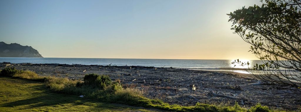
Sunrise on Tokomaru Bay.
We started out our day with a great breakfast and lattes delivered to us by our host! Made with fresh milk from the cows he milked this morning! We shared a great conversation sitting outside in the sunshine, then we packed up and continued down the east coast. The mid February cyclone Gabrielle severely impacted the whole east coast and cut the access between Tokomaru Bay and the town of Tolaga Bay, where we were heading, when forestry slash crashed into this bridge!
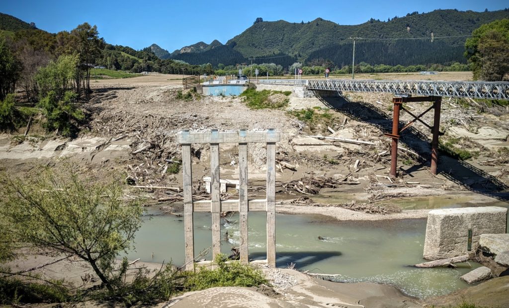
The bridge that was wiped out in the storm in Feb. with the temporary bridge to the right. It was a little scary on the bridge as it creaked and clacked as we drove over!
We reached Tolaga Bay and looked for the Tolaga Bay Wharf that it is famous for.
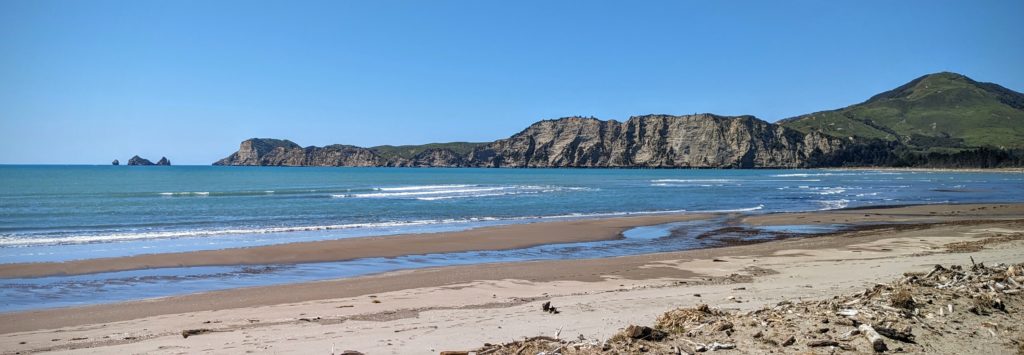
It’s a beautiful bay and a site of one of the first landings in 1769 by Captain Cook in New Zealand.
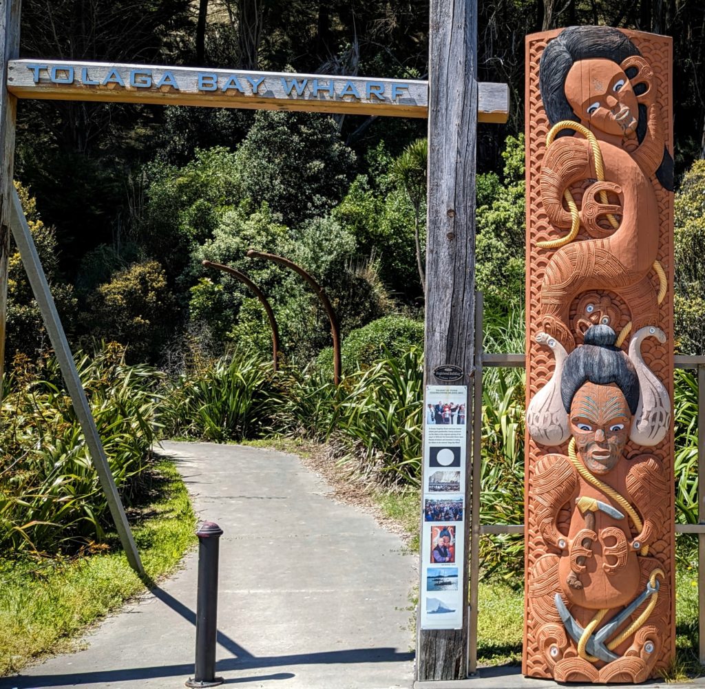
We found the wharf and the beautiful carved entrance way. Unfortunately the storm Gabrielle caused damage and the wharf is no longer safe to walk out on.
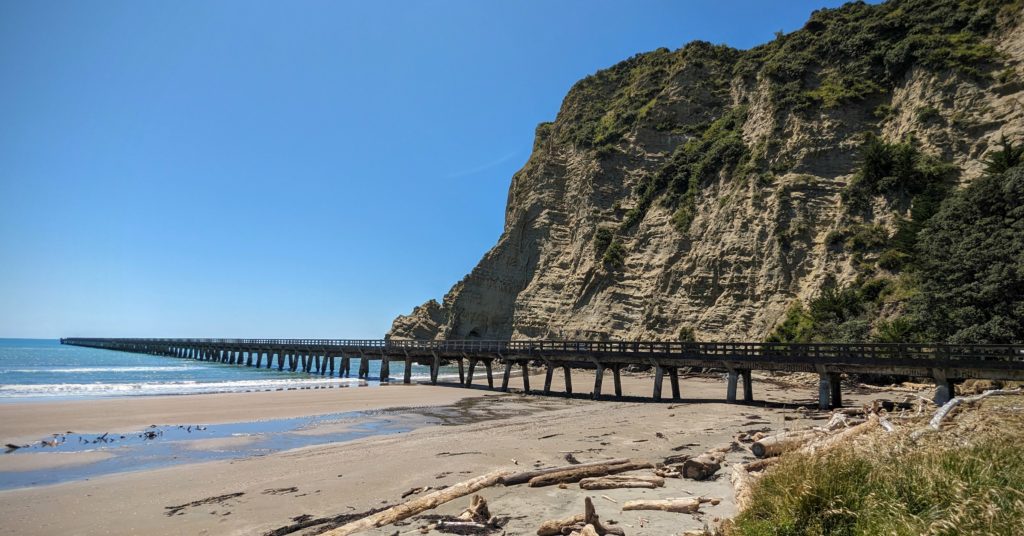
From the beach you can see the length of the wharf. It was a popular place to fish from.
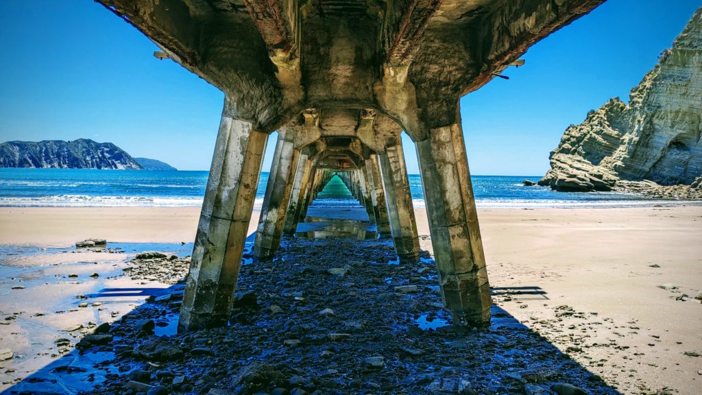
Walking the beach to get underneath the wharf you can see the damage, and the beautiful green sea water!
Since we couldn’t walk the wharf we continued on our way, looking for a site to have our lunch. We brought along our gas grill to grill some venison sausage we picked up in Tokomaru Bay!
We found a free campsite on Opoutama Beach on the way to the small Mahia peninsula with a picnic table and a great view.
After our lunch we continued through Gisborne, the largest town in the region, and one steeped in history, both Maori and Pakeha. We will have to return some day to learn all that history, we still had 2 hours to our destination! At Wairoa we started heading inland towards Te Urewera, the largest most pristine rainforest on the North Island. “In 2014, a world-first law brought an end to government ownership of Te Urewera National Park and recognised the rainforest as its own legal entity and the Tūhoe people as its legal guardians. It also gave the forest the same legal rights as a person.” We will explore tomorrow. For tonight we will relax at our AirBnB overlooking the forest and a small lake, surrounded by an orchard.