April 11 Tarkine Loop (Day 197)
We woke to a sunnier day and had breakfast then headed out to explore the 2 trails that lead out from the campground. The Sinkhole Trail is a loop into the forest supposedly past sinkholes, but we never could identify any, maybe because they are filled with vegetation!
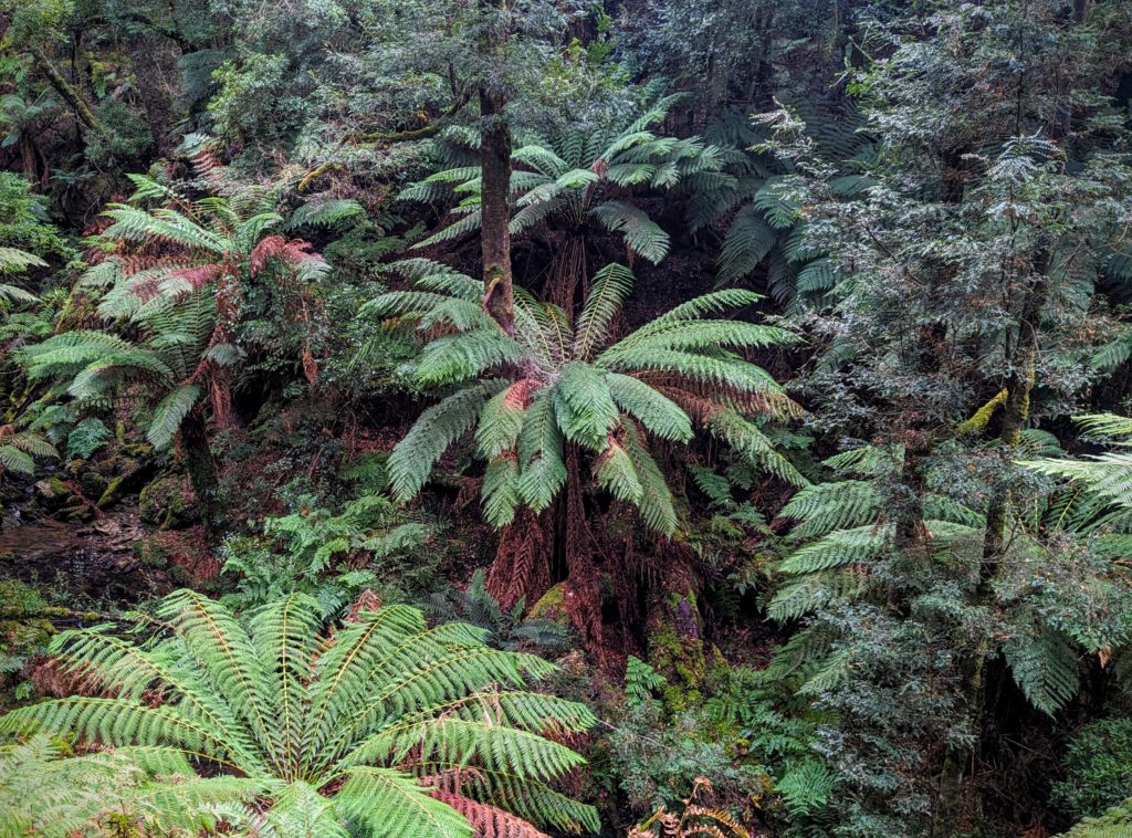
There are tree ferns in Tasmania! Not the same species as New Zealand though.
Besides the Eucalyptus trees, another dominant tree in the rainforest is the Myrtle tree (Nothofagus cunninghamii), not to be confused with the Oregon myrtle (Umbellularia californica). Those common names for species are very confusing!
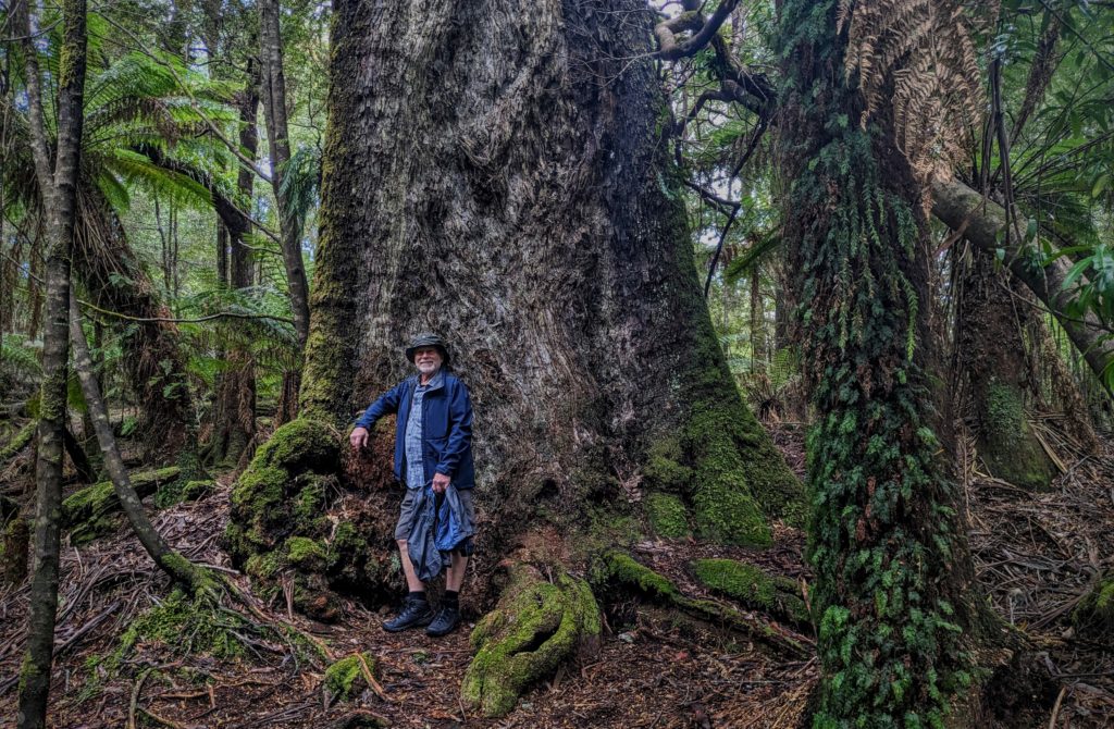
The huge buttressed trunk of the Tasmanian Myrtle on the Julius River Trail cannot be confused with the Oregon myrtle!

The tiny fungi and mosses are just as important as the huge canopy trees!
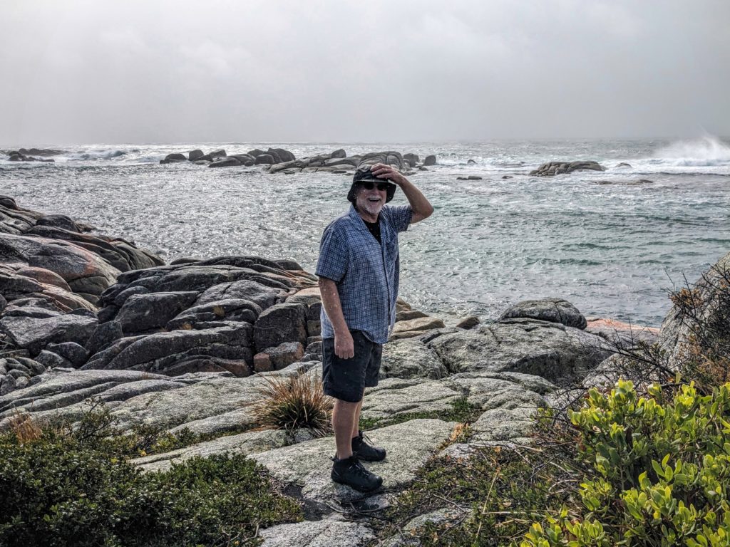
We returned from our hikes and packed up to continue the tour on the Tarkine Loop Road to the next turnoff at Chisholm Lake, a sinkhole that is filled with water!
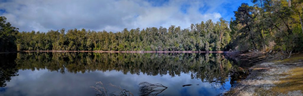
It’s a large lake and we heard frogs croaking around the banks!
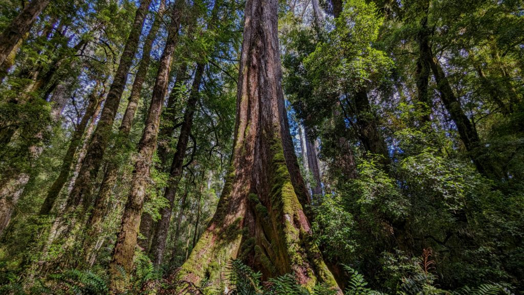
The huge Eucalyptus have buttressed trunks also!
Our last stop was the Trowutta Arch, another sinkhole filled with water and covered with green algae or duckweed deep in a beautiful rainforest grove.
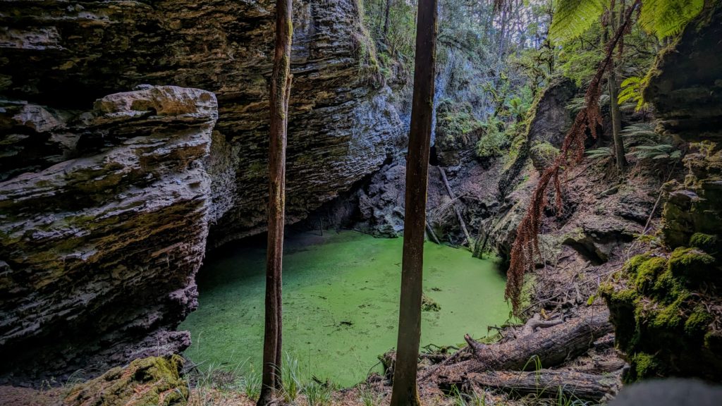
The water filled sinkhole was encircled by steep walls of corrugated rock.
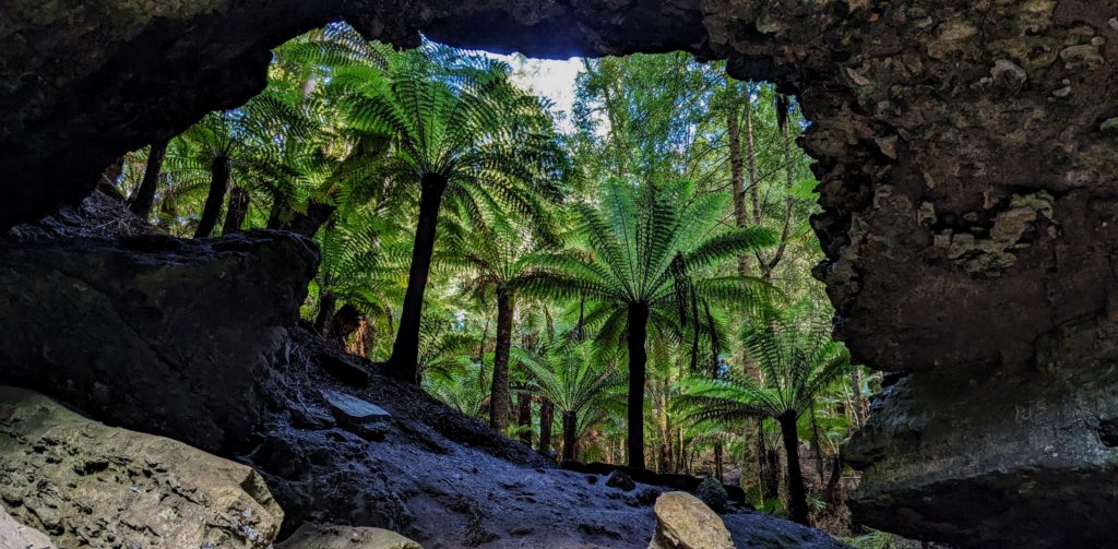
The arch of rock framed beautiful ferns, the common name here is ‘Manfern’.
We finished our loop tour and returned to the town of Smithton near the north coast to spend the night at the free campsite at Tall Timbers, a resort that accommodates campers with a grassy parking area.
April 10 Tarkine Forest (Day 196)
We woke to mixed weather, sunny and beautiful then cloudy and misty! A morning highlight was the moving of the cows. The local dairyman moved his cows to new pasture, right next to the campsite!
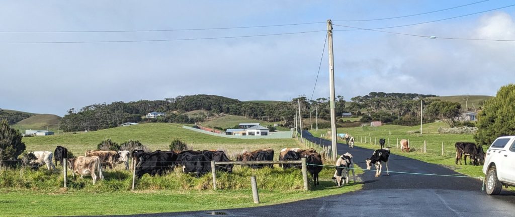
He used rope tied to his truck bumper as a fence to guide the cows around the corner and into their new paddock.
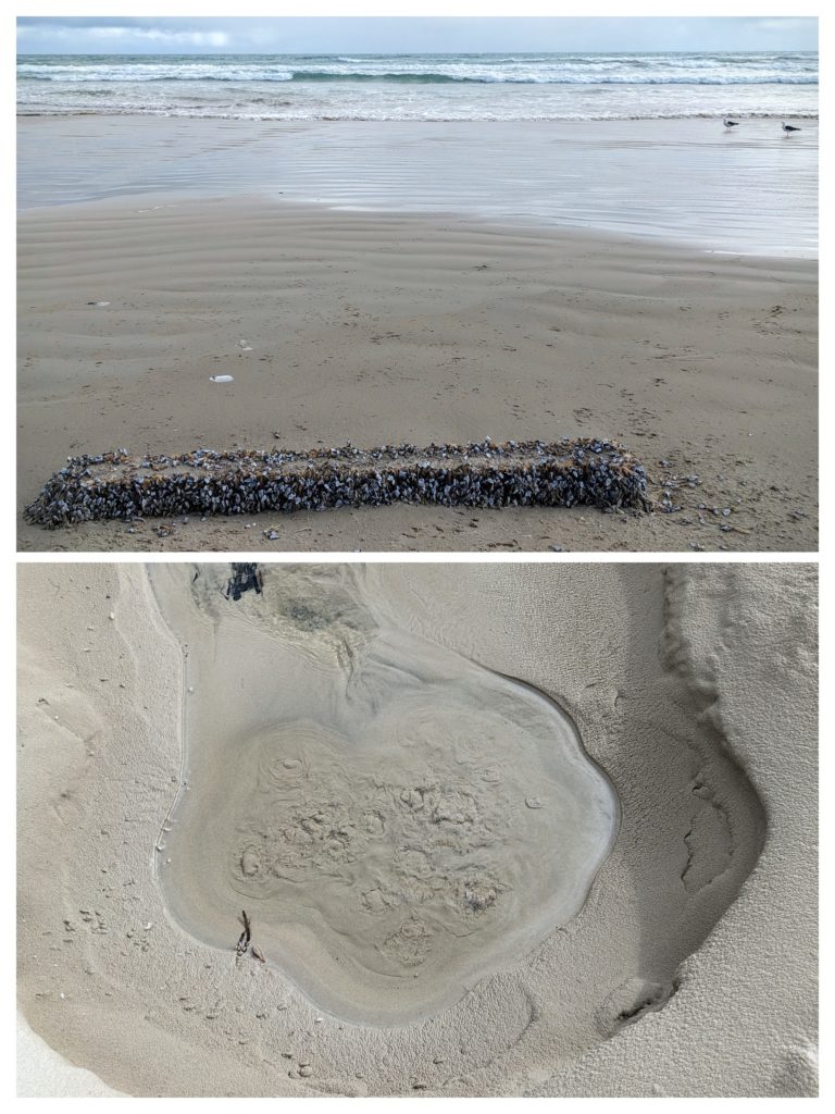
A last walk on the beach in the wind revealed some interesting sights. A bubbling cold water spring and barnacle encrusted flotsam.
We packed up to head out to the Tarkine Forest, the temperate rainforest on the west coast of Tasmania. The first part of the Tarkine Loop follows the west coast south past the “Edge of the World Viewing Platform” looking out at the Roaring 40’s of the Great Southern Ocean! It was roaring today, with sideways rain, so no pictures were taken! Video will be posted to the YouTube channel soon. We turned inland and entered the rainforest, quite a difference from the scrub-grass and rocky landscape along the wild west coast.
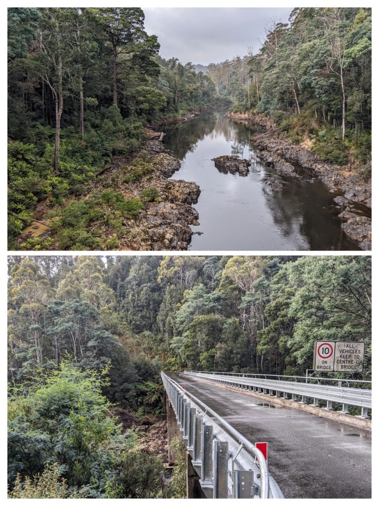
We crossed a river and saw the rainforest in the mist!
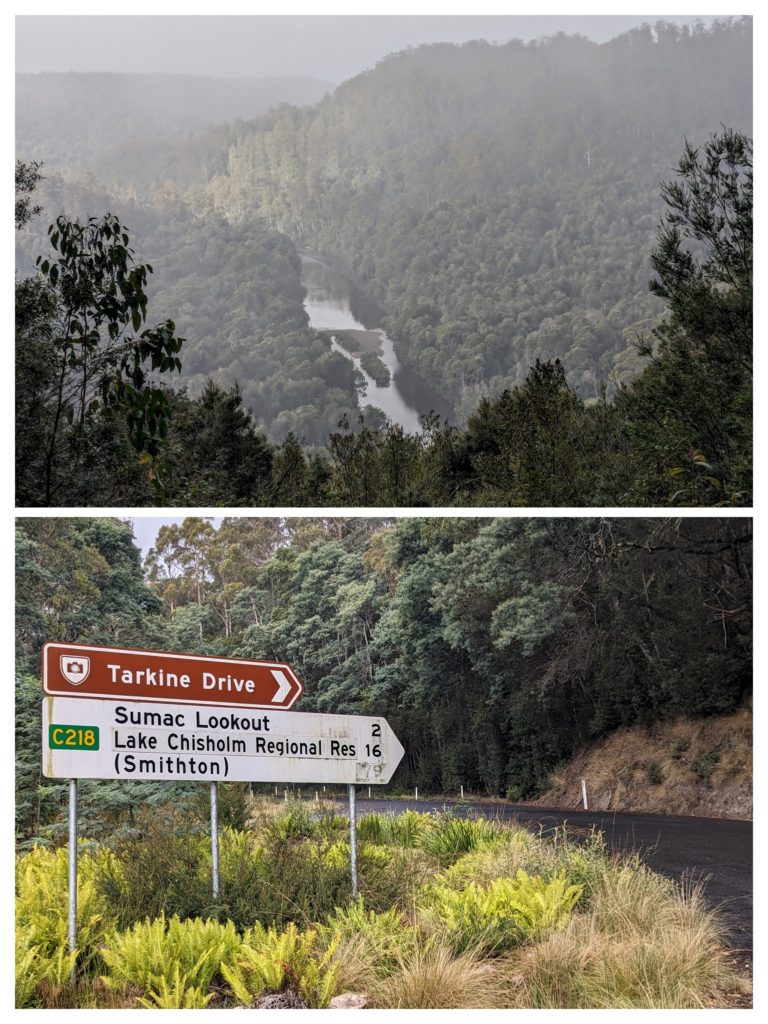
We headed up to Sumac Lookout on the Tarkine Drive. The mist was dense, almost fog, but gave the forest the wash and hue of ‘rainforest’!
We reached our campsite for the night, Julius River, and joined the one other camper to spend the dark night under the canopy of rainforest trees.
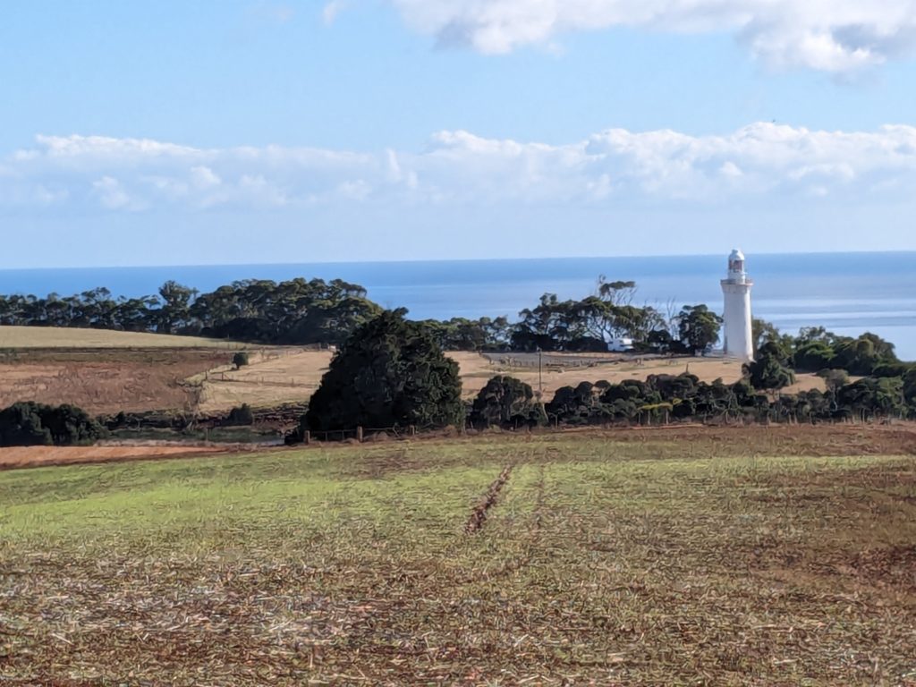
April 9 Table Cape Lighthouse (Day 195)
We headed out early this morning, our destination; a free campsite on the west coast near Marrawah. The route is mostly along the north coast and we will pass three capes jutting out into Bass Strait. We decided to visit the lighthouse at Table Cape, the first cape on the route, and visible as a large flat butte just past the large working port town of Wynyard. As we approached the top of the butte through farmland and turned onto the gravel road the last few km we were enchanted with a beautiful stand of summer flowers leading to the lighthouse!
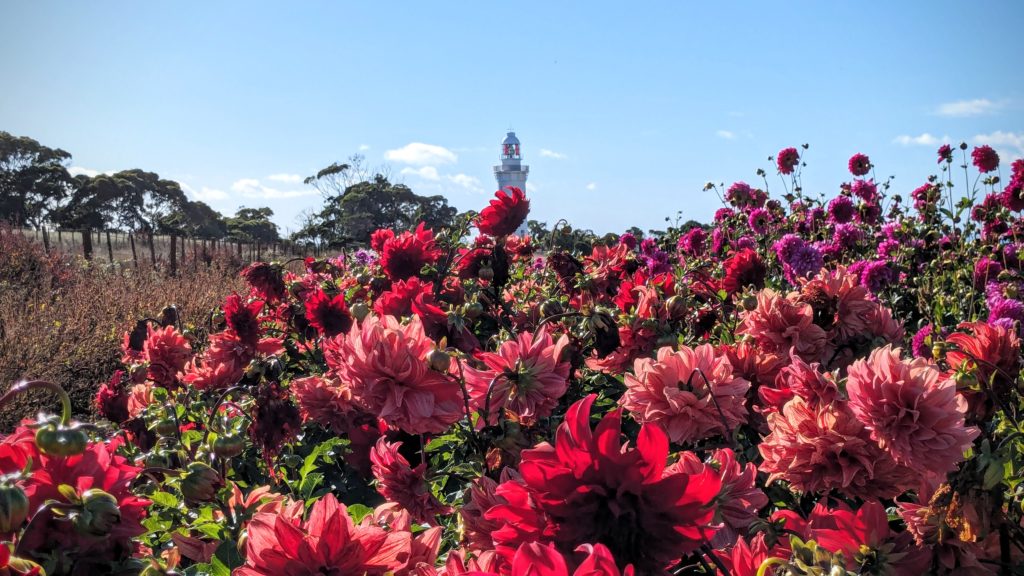
I had to get out and walk among the dahlias!
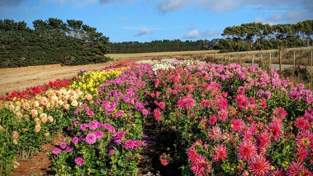
The long rows of colorful flowers overlooked farmland.
A walk along the high cliffs of Table Cape led to a lookout with a view back towards the lighthouse.

A reader board gives info on the volcanic origin of Table Cape. The farmland on the cape must be beautiful in spring with tulips blooming!
We moved on down the highway and passed the second cape, Rocky Cape, the gravel road to that lighthouse would probably undo the cleaning we just did yesterday! We did stop at a viewpoint however.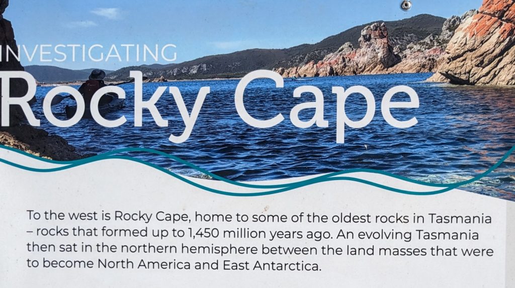

The long peninsula in the distance is Rocky Cape.
We passed the third cape, North Point (no lighthouse) then moved inland to cut across the pointy northwest tip of Tasmania to reach our destination, Green Point Beach. The one hour, 65 km trip from North Point to our campsite was enough distance for the weather to change from the partly cloudy warm north coast to the windy, grey skies and intermittent rain of the west coast!
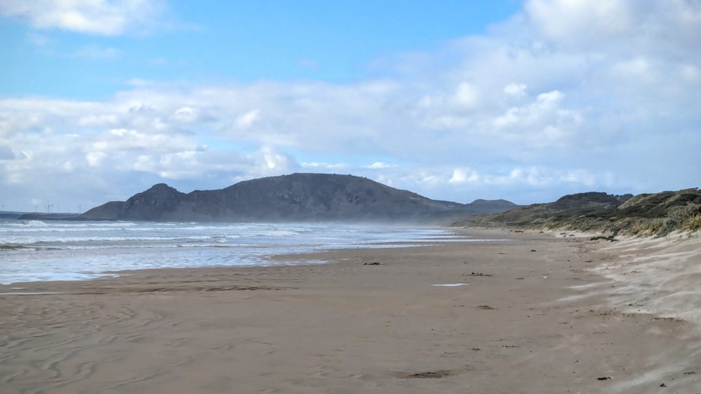
Green Point Beach. Not much green from this view, but enough wind to keep the windmills way on the distant left point of land turning!
April 8 Penguin (Day 194)
We started the day (after breakfast of course) looking for gas and a car wash. Those gravel roads and the rain did a number on our little home on wheels! We found both across the street from each other near Launceston, the second largest city in Tasmania. Not to scare you, but THIS came crawling out of the hot water heater vent when we sprayed the motorhome down with water and started soaping it up!

A Huntsman spider, as big as any tarantula I’ve seen!
I know that Australia has lots of snakes, crocodiles, sharks, octopus, etc., even spiders, that can kill you, but this spider apparently is not one of them. However, I would not like to be bitten by it! I flicked it off the rig with a scrub brush and unfortunately it landed in a pool of soapy water that was probably toxic to it. I scooped it up and put it in a nearby box and hope that it recovers.
We continued on our way to the tiny town of Penguin on the northwest coast to resupply, dump and get water. We had an adventure trying to find an operating water spigot, then trying to find a water hose long enough to reach from said spigot to the rig!

The town of Penguin is decorated with all things penguin! Even the rubbish bins!

The town dates from 1861 as a timber town, supplying timber to Victoria, a state on the mainland of Australia that was experiencing a gold rush at the time.
All was figured out and we moved on to the free camp area just out of town, Midway Point. We explored the area on the walkway between the road, the railway and the diverse beaches.

The sandy beach is west of the grassy parking area site. The rocky ‘point’ is directly across the railroad tracks from the site.

A little color from the sunset.
April 7 Eddystone to Lilydale (Day 193)
Last night at the pub we got some suggestions from the locals as to what to see around the area. One site recommended was the Eddystone Point Lighthouse, “hard to get to, but the most beautiful lighthouse in Australia” I think the words were! Yes, it was a washboard dirt road, but he was right! The wind was roaring and the waves crashing, a drizzle of rain off and on, and a rainbow!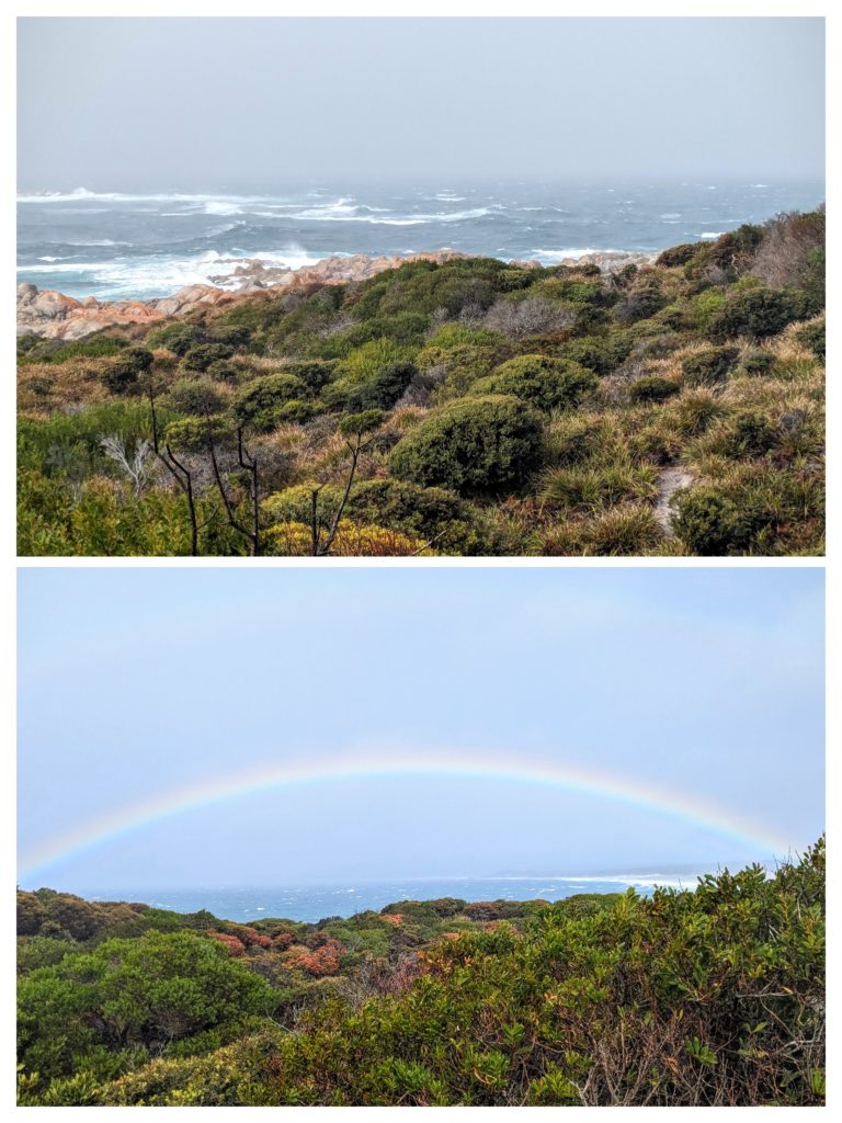

The lighthouse, built of the local granite is impressive, as are the 3 keepers houses built of the same stone.
Hold onto your hat! We saw 2 little wallabies hopping through the brush on this short walk.
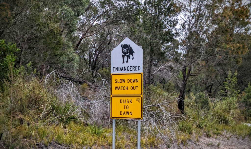
We’ve seen so much roadkill, but I don’t think we’ve seen any Tasmanian Devils.
We drove back through Gladstone, grateful to be on paved roads, and continued west and inland to another free campsite at Lilydale Falls Reserve.

The upper falls (upper picture) and lower falls (lower picture). In a green forested glen!
As we drive further north and west in Tasmania the vegetation is greening up, maybe due to the recent rain as well. The green here is more muted, less vibrant than the New Zealand green! The eucalyptus trees have more of an olive green color and more sparse leaves, but we were surprised to see tree ferns here! After our hike to the falls we found a defunct railway on a grade above and behind the camping area. We walked along that until it crossed the road, and returned to our campsite.

Railways always make me want to travel!
After dinner we relaxed and enjoyed a beautiful sunset.
